photo sharing and upload picture albums photo forums search pictures popular photos photography help login
Dave Beedon | profile | all galleries >> Places >> Utah >> Moab (environs) >> Shafer Trail tree view | thumbnails | slideshow

4922 Plateau | Arches National Park | Canyonlands National Park | Castle Valley (introduction) | Castle Valley: Round Mountain | Castle Valley: Castleton Tower | Corona Arch | Corona Arch Domes | Day Canyon | Dead Horse Point State Park | The Goose Neck | Ida Gulch | Jackson-Kane plateau | Jeep Arch | Monitor and Merrimac Buttes | Negro Bill Canyon ("NBC") | Other Moab Environs | Poison Spider Mesa: Loop Through the Fins | Poison Spider Mesa: Return to the Maw | Potash Area | Sand Flats | Shafer Trail | Tombstone Plateau | White Rim Trail | Moab: Tilted Hunter-Gatherer Plateau

Shafer Trail


"Shafer Trail' is the name given unofficially to varying portions of a rough dirt road near Moab and Potash. That same road is sometimes called "Potash Road." Both appelations are erroneous. The road in question has the official designation of "San Juan County Route 142." However, in 2015 there was only one inconspicuous sign identifying that name, and people I've talked to in Moab are generally unaware of that name. "Shafer Trail," though, is a name widely known in the area and among bicyclists and four-wheel-drive enthusiasts, so I'm using that name for the gallery.

San Juan County Route 142 (SJC 142) runs from the county line just south of the Potash boat ramp to Canyonlands National Park. Along the way it passes the huge blue evaporation ponds of Intrepid Potash and later encounters Fossil Point (better known as "Thelma and Louise Point" after the movie whose finale was filmed there). Near Fossil Point it passes under Dead Horse Point, then reaches a glorious view of the Colorado River opposite the Goose Neck, a formation inside a bend in the river. Not far beyond the viewpoint the road enters Canyonlands National Park (no gate, just a small sign) and ascends to a junction with the White Rim Trail (another rough dirt road). From that junction SJC 142 continues uphill in Shafer Canyon, running though some spooky turns called the Shafer Switchbacks. At the top of the switchbacks the road levels out for a while and ends at the paved road that provides access to the Island in the Sky portion of Canyonlands National Park.

Signs recommend traveling here with high-clearance four-wheel-drive vehicles. Condition of the road varies due to the natural environment and the frequency of grading by the county. It is wise to expect to encounter bumps, ruts, sharp stones, and dust. I have driven the eastern two-thirds of the road with my Toyota Sienna but can do so only if the roughest spots have been filled in by grading. My maximum speed is about 10 miles per hour. Often I go slower to avoid obstructions and sharp stones.

I use SJC 142 as an access route for hiking.

Shafer Trail: First Visit
:: Shafer Trail: First Visit 
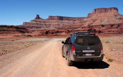
::
Shafer Trail: Second Visit
:: Shafer Trail: Second Visit 
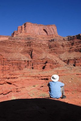
::
Shafer Trail: Goose Neck Viewpoint
:: Shafer Trail: Goose Neck Viewpoint 
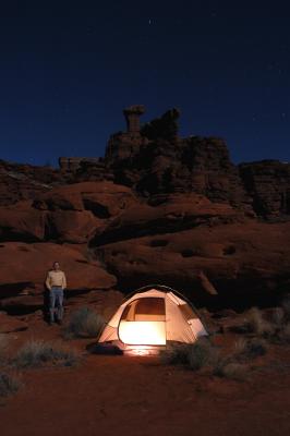
::
Shafer Trail: Shafer Camp
:: Shafer Trail: Shafer Camp 
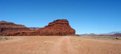
::
Shafer Trail: Thelma and Louise Plateau
:: Shafer Trail: Thelma and Louise Plateau 
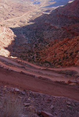
::
Shafer Trail: Cross-Country Descent to the Colorado River
:: Shafer Trail: Cross-Country Descent to the Colorado River ::
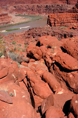
Five levels (I was standing on the first level)
Ridge of Unknowns
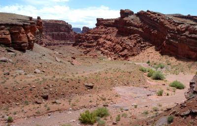
:: Ridge of Unknowns ::