photo sharing and upload picture albums photo forums search pictures popular photos photography help login
Dave Beedon | profile | all galleries >> Places >> Utah >> Dead Horse Point State Park tree view | thumbnails | slideshow

Arches National Park | Bingham Canyon Copper Mine | Blue Castle Canyon | Dead Horse Point State Park | Dewey Bridge | Utah: I-70 | Lakeside | Lucin | Utah: Miscellaneous Photos | Moab (town) | Moab (environs) | Salt Lake City (miscellaneous) | Salt Lake City (Red Butte Garden) | San Rafael Reef | Spiral Jetty | Sun Tunnels (Celestial Art in the Utah Desert) | Timpie: Abandoned Truck Stop | US 6 Corridor | Valley of the Gods | Wendover Area

Dead Horse Point State Park


(SCROLL DOWN TO SEE THUMBNAIL IMAGES THAT LEAD TO PHOTO GALLERIES)

From Dead Horse Point State Park people get a mind-boggling view of the landscape created bythe Colorado River. It is located about 28 miles (driving distance) southwest of Moab, at the end of a dead-end road on a plateau. Most of the park is boring grassland punctuated by the occasional bush or short tree: it is this unexciting terrain that greets the visitor when approaching and entering the park. Only the distant presence of the La Sal Mountains sparks any interest. But as one gets closer to the visitor center, one gets hints of the beauty to come.

At the visitor center one gets the first look at the beautiful scenery, but the view is somewhat limited compared to what lies ahead. The overlook at the end of the road sits at the edge of an airy cliff that plunges hundreds of feet straight down to lower slopes. All around is a landscape that pays homage to the power of nature: a deep river canyon, mesas, buttes, valleys, and ridges, all created by the peacefully-flowing Colorado River, 2000 vertical feet below. A gentle trail that follows the rim expands on the view. The scenery can only be described by words like awesome, grand, mind-boggling, and fantastic.

The scenery visible from the park reminds me of that at the Grand Canyon, but on a smaller, more intimate, scale. Unlike the Grand Canyon, this area is more easily explored on foot because of the presence of some rough dirt roads.

All of this landscape is composed of layer upon layer of sandstone in shades of red, orange, and purple. In some places the layers are tilted or curved due to an upwelling of salt formations deep underground. That salt---and potash---are mined at nearby Potash; the mine's tiered blue evaporation ponds are visible east of the park.

My first trip to the park was a one-hour stop during a whirlwind drive home from the East Coast. The pictures I had seen on the Web had not prepared me for the reality of the place. As I gazed with dropped jaw upon the canyons and mesas, I heard that familiar voice of the landscape calling me to return for explorations on foot. In particular, the most-photographed portion, a formation called the Goose Neck, captured my imagination. A trip four years later provided me with my Goose Neck fix.

The overlook area of the park is at the center of this WikiMapia aerial view.

Driving to Dead Horse Point State Park
:: Driving to Dead Horse Point State Park 
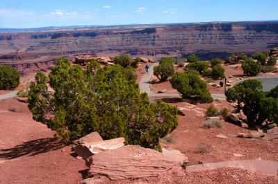
::
Facilities at the Overlook of Dead Horse Point State Park
:: Facilities at the Overlook of Dead Horse Point State Park 
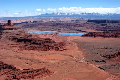
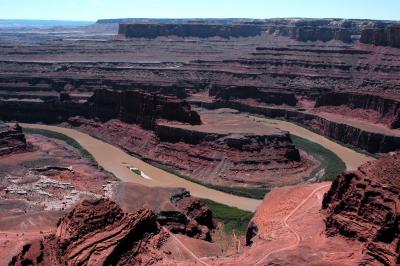
::
Dead Horse Point State Park: eastern views
:: Dead Horse Point State Park: eastern views ::
Dead Horse Point State Park: western views
:: Dead Horse Point State Park: western views 
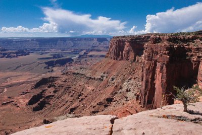
::
Dead Horse Point State Park: Rim hike
:: Dead Horse Point State Park: Rim hike ::