photo sharing and upload picture albums photo forums search pictures popular photos photography help login
Don | profile | all galleries >> # more Australian landscapes # >> # Great South-West Road Trip # >> # Cape Leeuwin # tree view | thumbnails | slideshow

# Gawler Range # | # Head of Bight # | # Nullarbor Plain # | # Eyre Bird Observatory # | # Mt Ragged # | # Alexander Bay # | # Cape Le Grand # | # Esperance coast # | # Peak Charles # | # Stokes Inlet # | # Fitzgerald River National Park # | # Stirling Range landscapes # | # Stirling Range wildflowers # | # Porongorup Range # | # Waychinicup landscapes # | # Waychinicup wildflowers # | # Valley of the Giants # | # Mt Frankland # | # D'Entrecasteaux # | # Shannon National Park # | #Pemberton district# | # Cape Leeuwin # | # Leeuwin-Naturaliste landscapes # | # Leeuwin-Naturaliste wildflowers # | # Dryandra Woodland reserve #

# Cape Leeuwin #

The south-western corner, very literally, of the Australian continent, where the Southern and Indian Oceans meet.
After travelling along the oceanic but relatively sheltered coast of the Great Australian Bight, this was our first encounter with the Indian Ocean and exposure to its prevailing westerly winds.
Indian Ocean
Indian Ocean
Indian Ocean
Indian Ocean
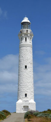
Cape Leeuwin lighthouse
Cape Leeuwin
Cape Leeuwin
Cape Leeuwin pano
Cape Leeuwin pano
view from Cape Leeuwin
Indian Ocean rollers
Indian Ocean breakers
Pink Rice-flower (Pimelea ferruginea)
rock formation
rock formation