


|
|
|
|
|
|
| Steve Bloomfield | profile | all galleries >> Grand Teton National Park September 2006 >> Tracks and elevation profiles | tree view | thumbnails | slideshow |
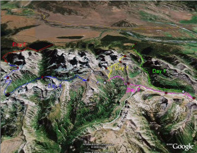 Google Maps over view of all 5 days (Looking West) |
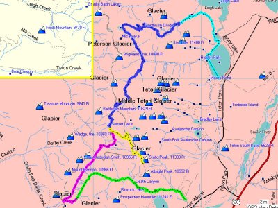 Garmin Mapsource Map overview |
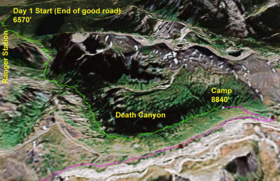 Day 1 Google Earth Map (Looking West) |
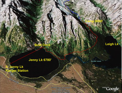
 Day 2 Google Earth Map (Looking East) |
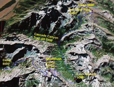
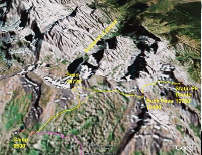 Day 3 Google Earth Map (Looking West) |
 Day 4 Google Earth Map (Looking South) |
 Day 5 Google Earth Map (Looking East) |
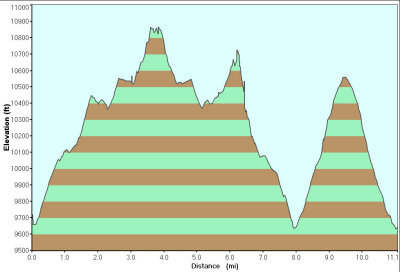
 Elevation Profile for Day 1 |
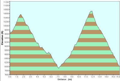
 Elevation Profile for Day 2 |
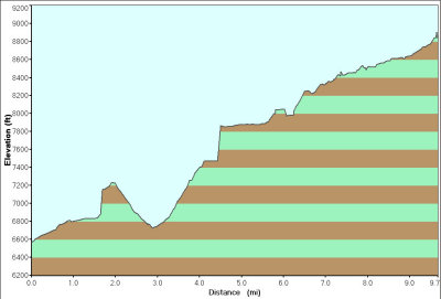
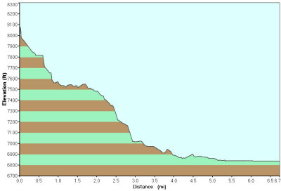
 Elevation Profile for Day 3 |
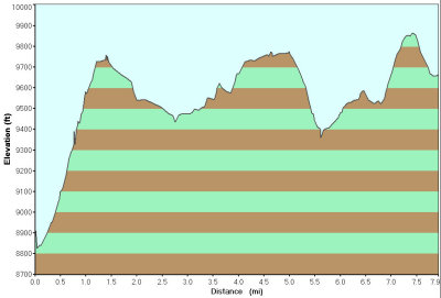
 Elevation Profile for Day 4 |
 Elevation Profile for Day 5 |
| comment | share |