


|
|
|
|
|
|
| Pekka Leppanen | profile | all galleries >> 2004-2025 >> 2004 >> work >> GPS M: Display, track & navigate | tree view | thumbnails | slideshow |
GPS M is an app for displaying and collecting location information on iPhones, iPads and iWatches, and delivering Apple Maps routing directions to smart glasses.
The app provides location information in your preferred units for speed, course and altitude. Additionally, the phone app calculates and maintains derived information such as distance travelled, maximum and average speeds, highest and lowest altitudes and ascent and descent. The data, and Apple Maps routing directions, are also available in ActiveLook based smart glasses.
The collected data is visible in real time in the watch. The watch app can be also used to remotely connect the phone: start or stop the trace, reset or pause both devices.
The location data can be saved to a GPX trace: you can follow your current position, active trace or stored traces on the map.
Check out the user's guide: User's Guide
Get the app from Apple App Store: search for 'GPS M' or through browser: GPS M
New in version 1.1
Usability
- Map View track points are color coded show speed or altitude in each location as an octile from black through blue, green and yellow to red.
- The �background location indicator� is shown on the phone screen when the app is running while the location updates are not paused.
- Ascent and descent values in the Map View summary.
- Reset command in both phone Data View and watch Remote Command View resets all derived values
- Phone Data View controls are grouped to Information, Control, Track and Close.
Corrections
- Negative min/max altitudes are now shown. Note: due to vertical [lack of] accuracy negative values are likely close to, but above sea level.
- GPX track logs are checked for at least one track points.
- Map View current location pin remains set to initial coordinates when panning the map.
New in version 1.2
- Added Compass View to phone. Changing between pages through swiping the screen vertically or horizontally. NOTE: YOU NEED TO CALIBRATE THE COMPASS: see user's guide page 6 for the instructions.
- Watch synchronisation to compass only when watch is active
Version 1.2.1:
Error corrections:
- Compass direction was always magnetic (�M), now based on the selection (�M or �T)
- Storing user�s unit preferences on watch occasionally failed, now addressed
Watch connection optimization: data sent to watch is not buffered and send only when the watch app is reachable. Once the watch app has been found, sending data is attempted once per second.
New in version 1.3.0: Smart Glasses

The phone app supports ActiveLook ( https://www.activelook.net/) smart glasses, such as Engo-1 and 2, Jumbo EVAD-1 and Cosmo Vision, as a display device.
The smart glasses have two modes: Directions and Data.
� Directions: when a destination is set in the phone app, direction and distance of the next turn is displayed, followed by current speed. If you're off track the bearing to the step end and and the turn needed is displayed.
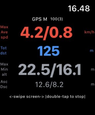
� Data: displays current travel data (speed, distance travelled, max and average speeds) on the first page and statistics (minimum and maximum, altitude and ascent and descent ) on the next page.
The last page is always empty, showing only remaining battery capacity. If you have selected power save mode, after the set delay the display is turned off and gestures are disabled.
Advance the page by tapping the icon, or swiping your hand in front of the glasses if you have enabled the gestures. Tapping the icon in power save state re-enables gestures (if you have enabled this in the preferences) and displays the first page.
The smart glasses require the iPhone app to be started when using it. When the phone is locked or the app runs on background glasses 'change page' function is disabled.
The directions are only available for iPhones with English or Finnish (!) as primary language. You can easily change phone's primary language to English and back, or add your language's navigation phrases to the app. Leave a (private) comment through the link below if you need help. I'll be happy to add the support for your language to the next releases! See the user's guide for more information and examples.
Data & Privacy
GPS M collects no data outside the temporary diagnostics log and optional GPX logs stored in phones app folder ("GPS M").
Comments are welcome!
Links to other apps: PhotoM, Display 0183M & Photo Distributor M
GPS, GPX, geolocation, trace, track, compass, smart glasses, ActiveLook, directions, navigation, Apple Maps
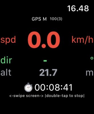
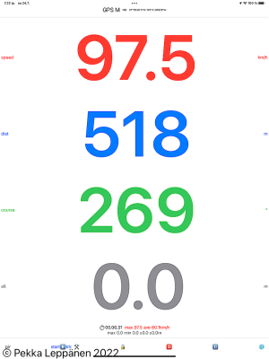 Data view on iPhone or iPad |
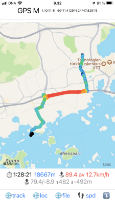 Trace highlighting speed |
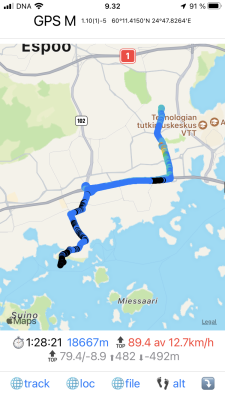 Trace highlighting altitude |
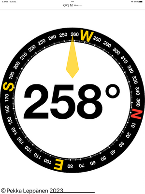 Compass view |
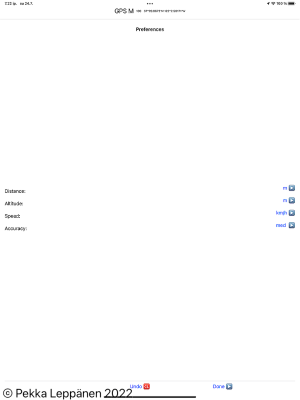 Settings |
 iWatch Data View |
 iWatch Remote Data View to iPhone collected aggregate data |
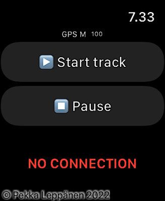 iWatch Remote Commands view, with no connection to iPhone App |
 v100.001.png |
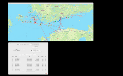 MacOS: Settings and map with waypoints, routes and tracks |
 MacOS: Routes |
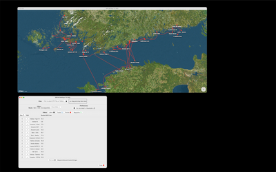
 MacOS: editing a OpenStreetMap route with OpenSeaMap overlay |
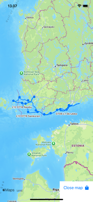 iOS: Map with tracks only |
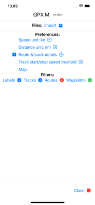 iOS: Settings |
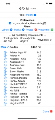 iOS: Settings with routes' details |
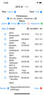 iOS: Settings with tracks' details |
 iOS: only one track selected |
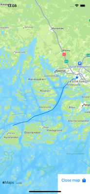
 iOS: Map in image mode, with one track's detail |
 GPX M |
| comment | share |