


|
|
|
|
|
|
| John Scurlock | profile | all galleries >> Galleries >> In Box | tree view | thumbnails | slideshow | map |
Last Update November 6, 2017

This gallery contains recently uploaded images, with older images seen first
and newer images last. Note that images appearing here also appear elsewhere in their
respective local galleries.
To see a list of all galleries & sub-galleries, click
Here.
THE IMAGES PRESENTED HERE HAVE BEEN DOWN-SIZED FROM THE ORIGINAL DIGITAL FILES.
Full-resolution color prints are available by request.
____________________________________________________________________________________________________
All Images Copyright 2002/2020, John Scurlock, Photographer & Pilot.
| previous page | pages 1 2 3 4 5 6 7 8 9 10 11 12 13 14 15 16 17 18 19 20 21 22 23 24 25 26 27 ALL | next page |
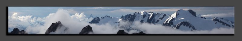
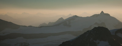
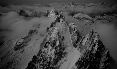
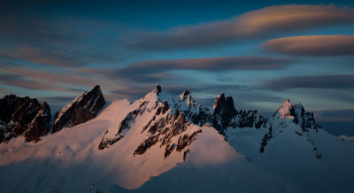
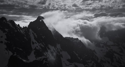
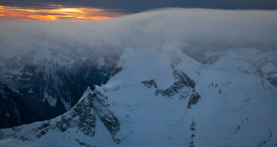
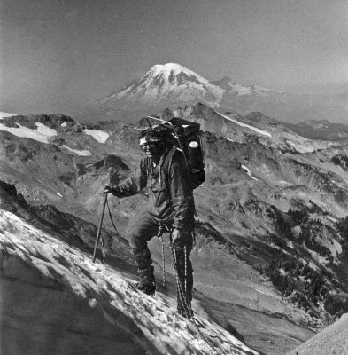
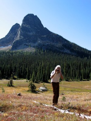 A Great Photographer In His Element: Austin Post At Washington Pass Meadow |
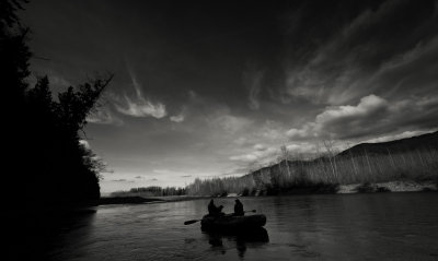
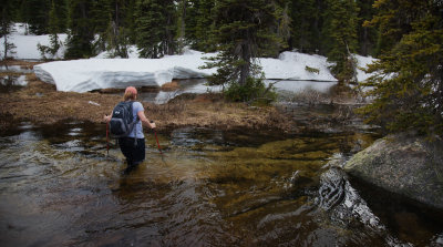
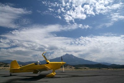 On The Ground At Weed, California (Weed082907-_4.jpg) |
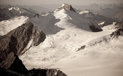
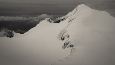
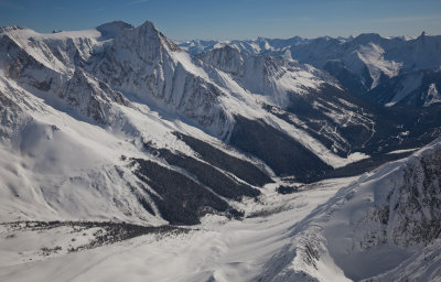
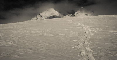
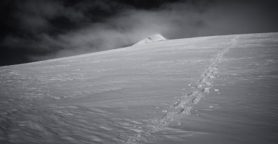
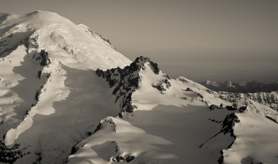
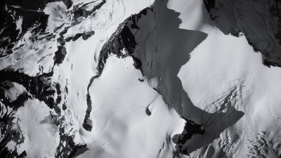
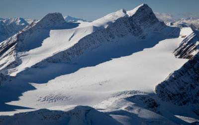
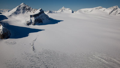
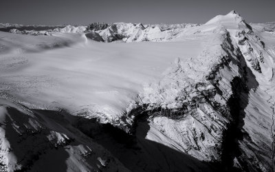
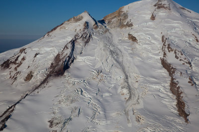
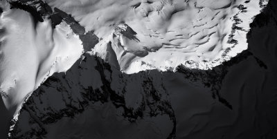
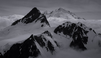
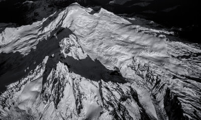
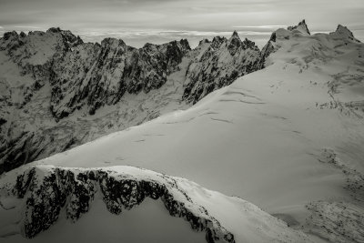
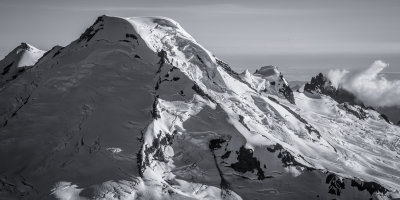
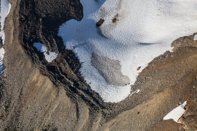
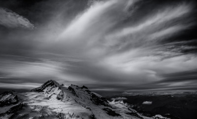
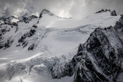
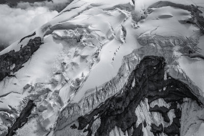
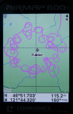 GPS Track: Mt. Rainier Glaciers (GPSRainier092407-_1.jpg) |
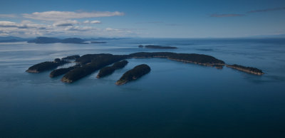
 The San Juan Islands (MtBaker121111-278-3.jpg) |
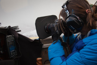
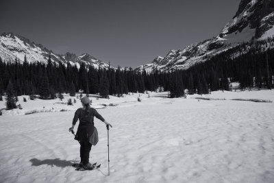
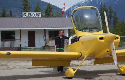 Photographer/Copilot Steph Abegg Awaits Departure Into The Rockies (Valemount_J_051412_021-1.jpg) |
Five Feet Off The Water? (Seafair_080512_189-10.jpg) |
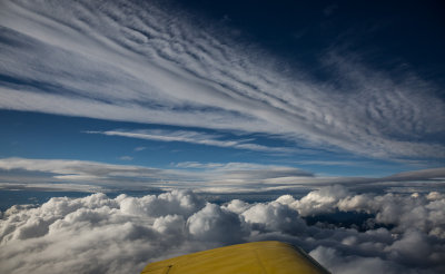
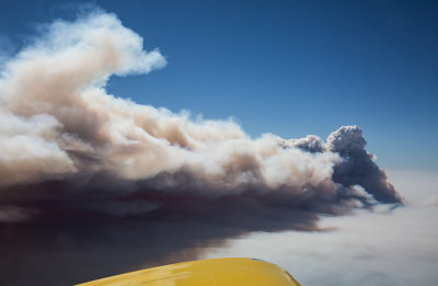
 Forest Fire Smoke & The Eastern North Cascades (MF_091912-125-2.jpg)* |
 Mt. Quanstrom From The North (Quanstrom_092712_022-1.jpg) |
 Vixen Peak, Looking To The South (VixenPk_092712_010-2.jpg) |
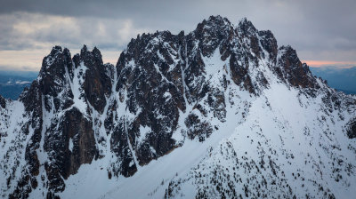
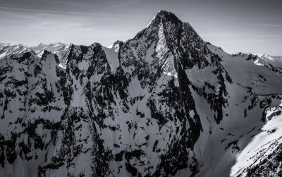
 Triplehead Peak (Triplehead_092712_002-3.jpg) |
 Mount Lunn From The Southeast (Lunn_2_092712_015-4.jpg) |
 Roberts Peak And The Lunn Icefield (Roberts_092712_001-5.jpg) |
 Erie Peak From The Northeast (EriePk_092712_004-6.jpg) |
 Mts. Beaman & Exmoor From The North (BeamanExmoor_092712_002-7.jpg) |
 Pivot Peak & The Pivot Glacier (Pivot_092712_001-8.jpg) |
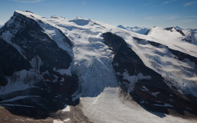
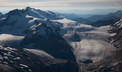
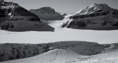
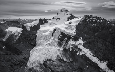
 Mt. Mackenzie King (L), Mt. Sir John Abbott (R), & North Canoe Glacier (NorthCanoeGlacier_092712_007-9.jpg) |
 The North Face Of Mt. Zillmer (Zillmer_NF_092712_001-4.jpg) |
 Mt. Goodall From The Southwest (Goodall_092712_001-1.jpg) |
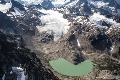
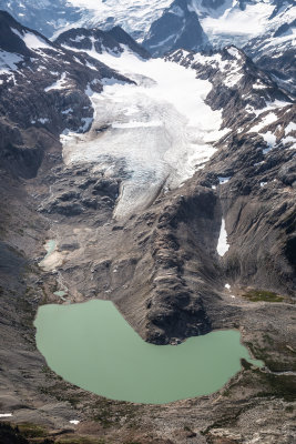
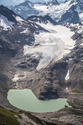
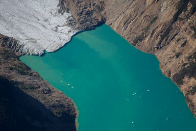 'Kiwa' Lake (JohnAbbottKiwa_092712_022-2.jpg) |
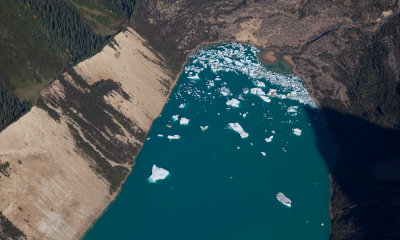 'Kiwa' Lake (JohnAbbottKiwa_092712_020-1.jpg) |
 Hallam Peak From The Southwest (HallamPk_092812_001-1.jpg) |
 Hallam Peak From The South (HallamPk_092812_016-2.jpg) |
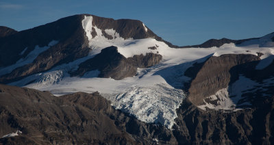
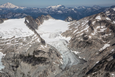
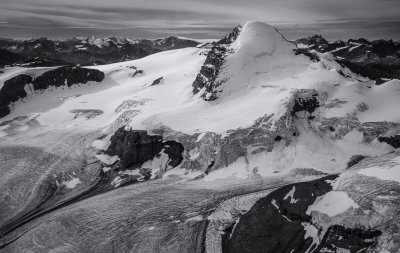
 Kiwa Glacier (JohnAbbottKiwa_092712_026-1.jpg) |
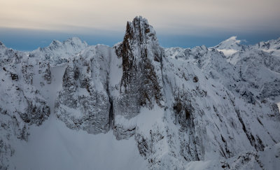
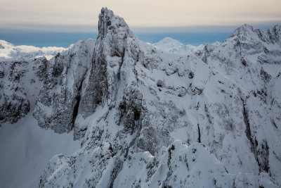
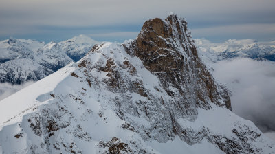
 Sir John Thompson From The Southwest (SirJohnThompson_092712_001-2.jpg) |
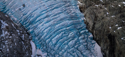
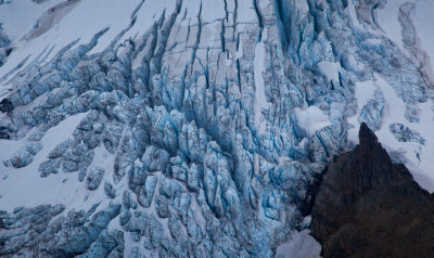
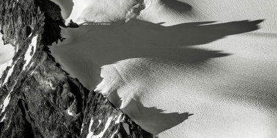
 North Canoe Glacier: Crevasses & Seracs (NCanoeGl_092712_016-3.jpg) |
 North Canoe Glacier: Crevasses & Seracs (NCanoeGl_092712_022-4.jpg) |
 Unnamed Peaks & Glaciers Above The Azure River (BraithwaiteAzure_092712_011-5.jpg) |
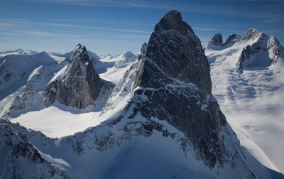
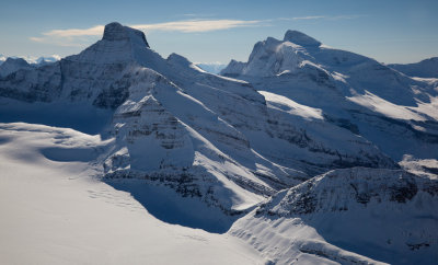
 Sir Sandford From The South (SirSandford_092612_020-1.jpg) |
 Sir Sandford From The Northwest (SirSandford_092612_080-2.jpg) |
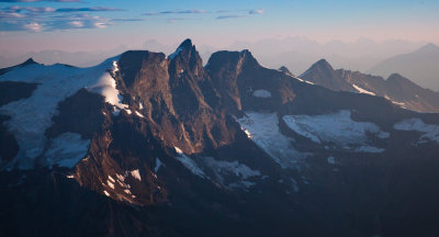
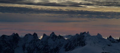
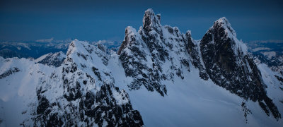
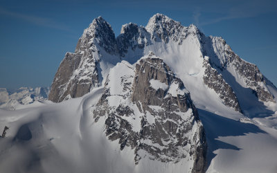
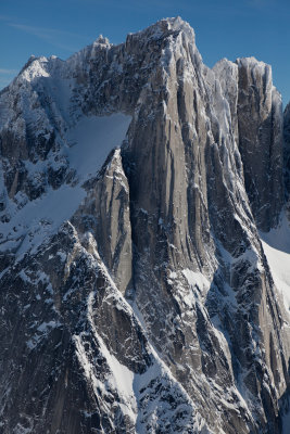
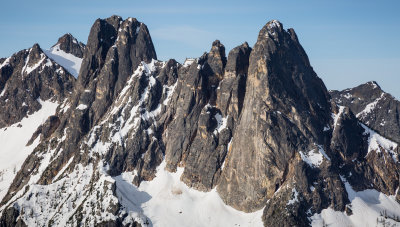
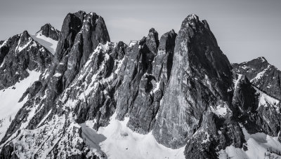
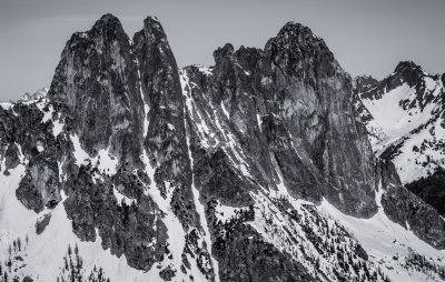
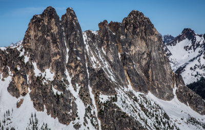
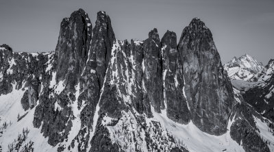
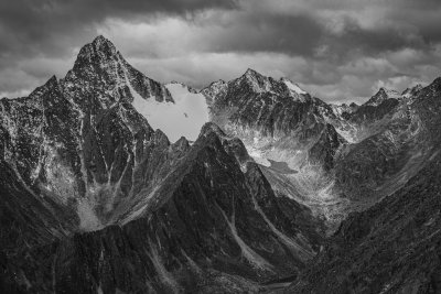
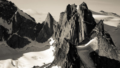 Stickle (Center) & The Gothics From The Southeast (Adamants_092612_044-3.jpg) |
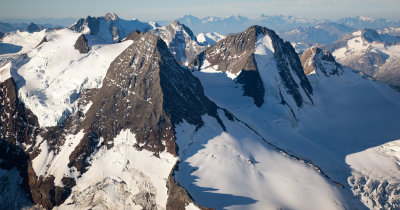
 L to R: Gothics, Stickle, Adamant, Turret (Adamants_092612_053-4.jpg) |
 MtFlightCd1pt5_092612_59-5.jpg |
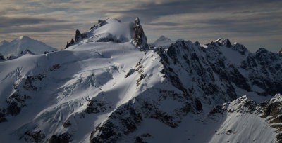
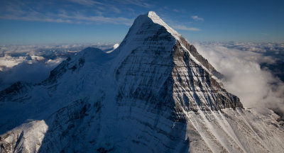
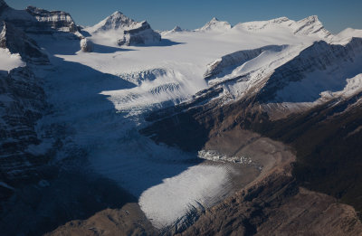
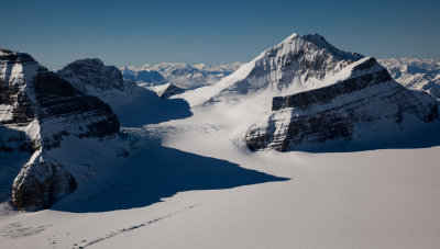
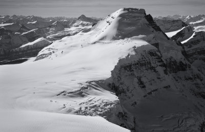
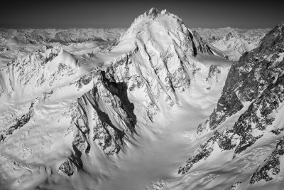
 Mt. Robson: Upper Emperor Face & Ridge (Robson_092612_017-6.jpg) |
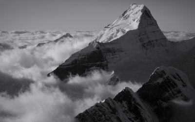
 Mt. Robson From The Southwest (Robson_092612_031-7.jpg) |
 Mt. Robson From The South (Robson_092612_041-8.jpg) |
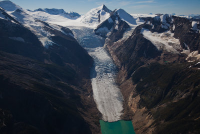
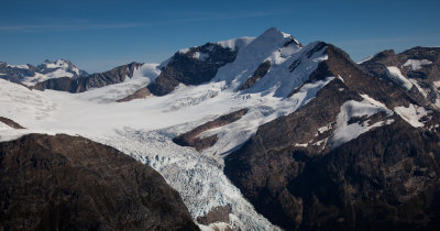
 Conrad Glacier (Bugaboos_092812_031-12.jpg) |
 South Howser Tower From The Southwest (Bugaboos_092812_044-13.jpg) |
 Sir Sandford From The Southeast (SirSandford_092812_016-9.jpg) |
 Sir Sandford From The East (SirSandford_092812_028-10.jpg) |
 Sir Sandford From The North (SirSandford_092812_043-11.jpg) |
 Downie Peak From The Southeast (Downie_092612_005-1.jpg) |
 Schrund Peak From The Northeast (SchrundPkN_092612_005-1.jpg) |
 Sir Donald & The Upper Illecillewaet Glacier From The South (SirDonald_092812_012-2.jpg) |
 Mt. Duncan & Beaver Mountain From The Northeast (PurcellsRogersS_092812_028-3.jpg) |
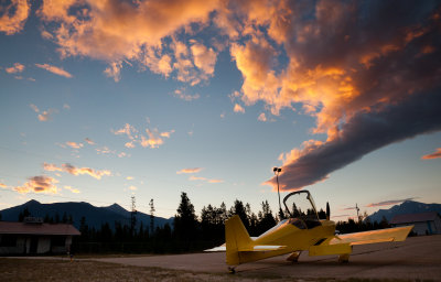 Sunrise At Departure (Valemount_092812_013-1.jpg) |
 Grand Mountain From The Northeast (PurcellsRogersS_092812_012-1.jpg) |
 The East Face Of Mount Wheeler (PurcellsRogersS_092812_019-2.jpg) |
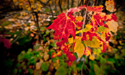
 Fall Color, Northern Michigan (ThomasRock_101012_008-2.jpg) |
 Fall Color, Northern Michigan (ThomasRock_101012_038-4.jpg) |
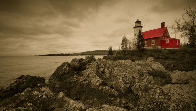 Eagle Harbor Lighthouse (Keweenaw_101312_116-5.jpg) |
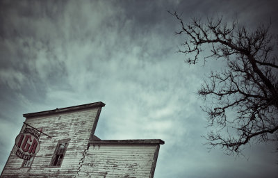 Super IGA Market (Watson_101712_022-1.jpg) |
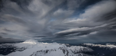
 Lenticular Clouds Above Jack Mountain (MF_092812-42-3.jpg)* |
 Shuksan, Looking To The Southwest (Shuksan110212_101-1.jpg) |
 Shuksan From The Northwest (Shuksan110212_143-2.jpg) |
 Fury, E Peak, SW Face (NPickets110512_053-1.jpg) |
 Fury, E Peak, Looking To The SW (NPickets110512_077-2.jpg) |
 Challenger, Looking West (NPickets110512_083-3.jpg)* |
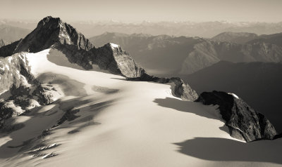
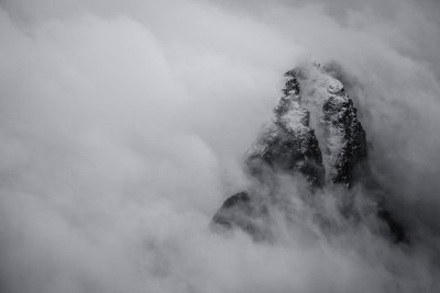
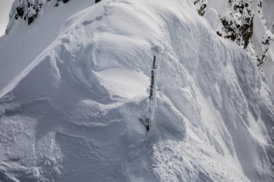
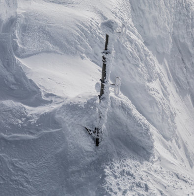
 Challenger Glacier Detail (NPickets110512_113-4.jpg)* |
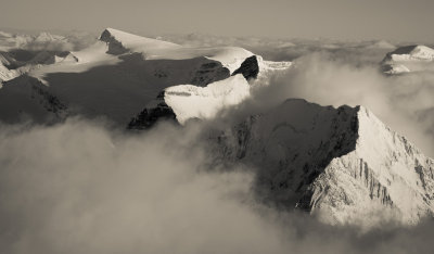
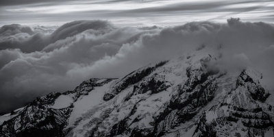
 The Northern Picket Range (NPickets_2_110512_002-10.jpg)* |
 Redoubt From The Northeast (Redoubt110512_008-12.jpg)* |
 Lincoln Peak (MtBaker_110712_173-1.jpg) |
 Lincoln Peak, Mount Baker, Glory (MtBaker_110712_056-1.jpg) |
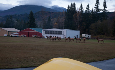 Who's Gonna Win This Race?? (Elk_110712_014-3.jpg) |
 Lemolo Mox From The East (MoxSpickard_111012_056-3.jpg) |
 Castle Peak From The Southwest (Castle_111012_004-4.jpg) |
 Hozomeen Mountain South Peak From The South (Hozomeen_111012_061-5.jpg) |
 The Northern Picket Range: Spectre To Challenger (NPickets_111012_032-6.jpg) |
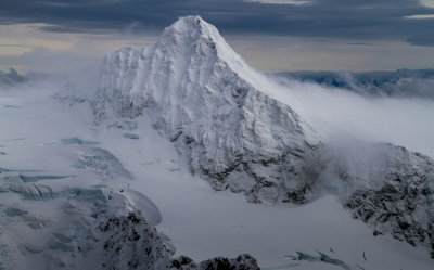
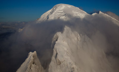
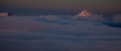
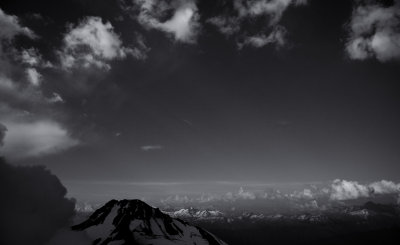
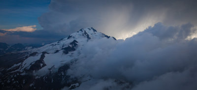
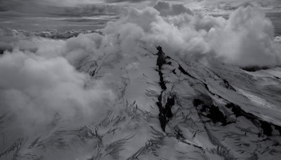
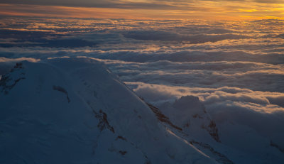
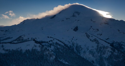
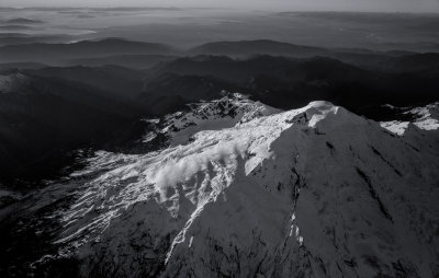
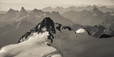
 Three Volcanoes: Glacier Peak, Mt. Rainier, & Mt. St. Helens (GlacierPk_111512-62-1.jpg) |
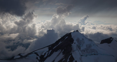
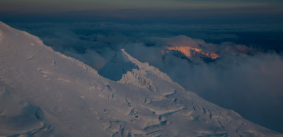
 Glacier Peak, Looking To The Southeast (GlacierPk_111512-92-2.jpg) |
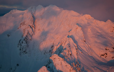
 Glacier Peak, Looking To The Northeast (GlacierPk_111512-109-3.jpg) |
 GlacierPk_112412_194-1.jpg |
 Sulphide Glacier (L), Crystal Glacier (Center/Right), & Nooksack Tower (Shuksan_112412_035-2.jpg)* |
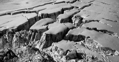
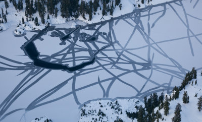
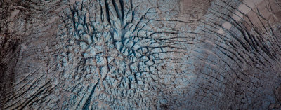
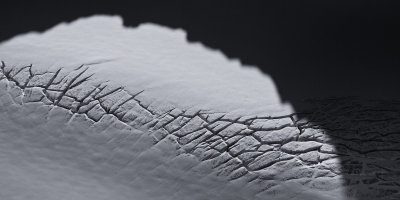
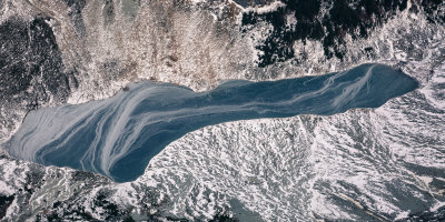
 Watson Lake: Ice Fracture Pattern (WatsonLk_112612_010-1.jpg)* |
 The North Face Of Whatcom Peak (WhatcomPk_112612_001-4.jpg) |
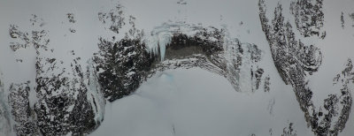 Icicles, Mt Redoubt's N Slopes (Redoubt_112612_037-2.jpg) |
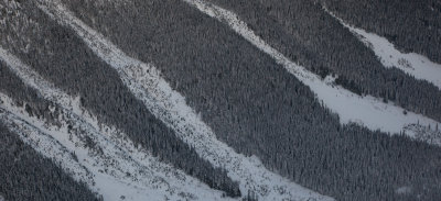 Snow & Trees, Perry Creek (PerryCr_112612_005-3.jpg) |
 Southeast Mox Peak & Lemolo Mox From The Southeast (MoxPks_112612_028-2.jpg) |
 Watson Lake (WatsonLk_112612_004-1.jpg) |
 Devil's Tongue, Devil's Toothpick, & Silver Lake From The South (Spickard_112612_007-1.jpg) |
 White Chuck Mountain, Summit Detail (Whitechuck_120512_016-1.jpg) |
 White Chuck Mountain, Looking To The Southeast (Whitechuck_120512_037-2.jpg)* |
 Fueling Flight With Storm Approaching (MFlt_120812-70-1.jpg) |
 Eldorado Peak From The West (Eldorado_121312_010-3.jpg) |
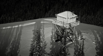
 Hidden Lake Lookout (HiddenLake_121312_008-4.jpg) |
 Tillie's Towers From The Northwest (KlawattiTill_121312_007-1.jpg) |
 Klawatti Peak From The West (KlawattiTill_121312_014-2.jpg) |
 Sahale (L) & Boston Peaks From The Southeast (SahaleBoston_121312_007-2.jpg) |
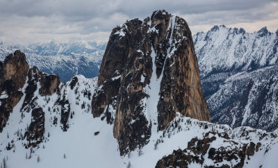
 Silver Star & Wine Spires From The Southwest (SilverStar120109-15.jpg) |
 Buckner102910-04-1.jpg |
 Mt. Triumph From The South (Triumph_122112_023.jpg) |
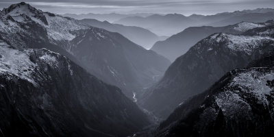
 Skagit River Gorge Looking Northeast (SkagitGorge_122112_003-1.jpg) |
 Fog Signal Hut: East Point Saturna Island, British Columbia (212_0286-1.jpg) |
 Afternoon At East Point: Saturna Island, British Columbia (Saturna_122212_0332-1.jpg) |
 South Twin Sister From The East (Sisters_010113_080-1.jpg)* |
 Chimney Rock & North Chimney Rock From The Southeast (OvercoatChimney_010113_112-2.jpg) |
 Sunset At Mt. Index (Index_010113_005-3.jpg)* |
 Whitehorse Mountain Looking To The Southwest |
 Ballard & Azurite, Looking To The South (Ballard_010313_023-1.jpg) |
 Azurite Peak, South Face (Azurite_010313_014-2.jpg) |
 Three Fingers East Face (ThreeFingers_010313_041-3.jpg) |
 Three Fingers From The North (ThreeFingers_010313_116-4.jpg) |
 Snow Dome From The Northwest (Olympics_123012_134-1.jpg) |
 Circe (Foreground), Upper Hoh Glacier, & Olympus E Peak From The East (Olympics_123012_217-2.jpg) |
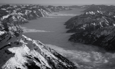
 Valhalla Group From The Northeast (Olympics2_123012_41-3.jpg) |
 Mt. Carrie From The Southeast (Olympics2_123012_100-1.jpg) |
 Snowfield Peak From The East (Snowfield_011113_013-1.jpg)* |
 Crater Mountain (Foreground) & Jack Mountain, Looking Northwest (Crater_011113_013-2.jpg)* |
 Mt. Prophet, Looking To The Northwest (Prophet_011113_002-3.jpg) |
 Mt. Prophet At Sunrise (Prophet_011113_052-7.jpg) |
 Jack Mountain Summit Ridge, Looking East (Jack_011113_058-6.jpg) |
 Triumph Sees Its Shadow (Triumph_011113_003-8.jpg) |
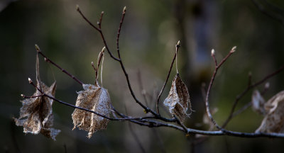
 Snowy Alders (Concrete_011113_020-9.jpg) |
 |
 Mt. Adams From The South (Adams_011913_076-1.jpg) |
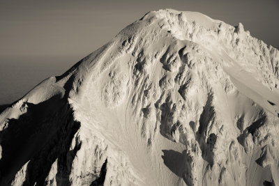
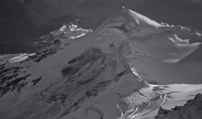
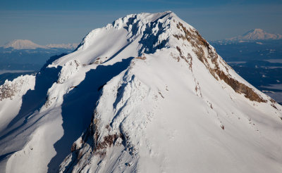 Mt. Hood, Summit Detail From The South (Hood_011913_080-2.jpg) |
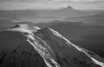
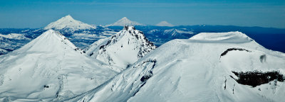 Seven Volcanoes (ThreeSisters_011913_13-3.jpg) |
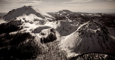
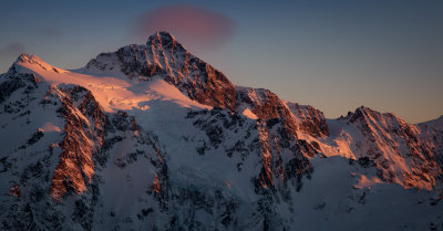
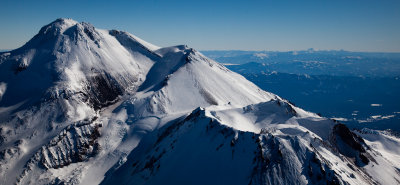 Shasta, Shastina, & Lassen From The Northwest (Shasta_011913_035-4.jpg) |
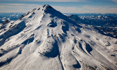 The Northeast Face Of Mt. Shasta (Shasta_011913_131-5.jpg) |
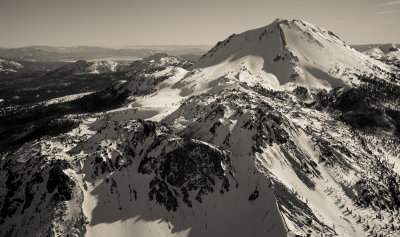
 Lassen Peak & Chaos Crags From The North (Lassen_011913_004-6.jpg) |
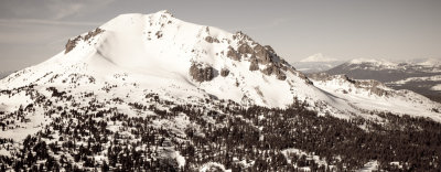
 The North Face Of Lassen Peak (Lassen_011913_016-7.jpg) |
 Lassen Peak From The Southeast (Lassen_011913_070-8.jpg) |
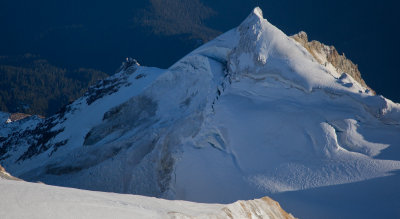
 Mt. Hood, Detail Of The Upper Sandy Headwall (Hood_011913_127-9.jpg) |
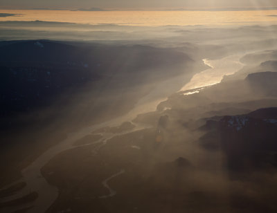 The Columbia River, Looking To The Southwest (ColumbiaRiver_011913_022-10.jpg) |
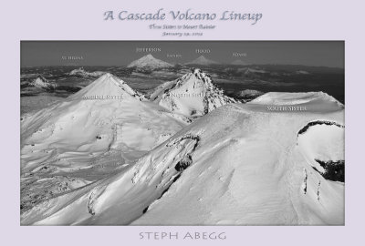 Cascade Volcano Lineup Poster |
 Mt. Redoubt & Mox Peaks From The Southeast (Redoubt_012513_004-1.jpg)* |
 Hozomeen N Peak, Zorro Face (Hozomeen_012513_026-2.jpg)* |
 Hozomeen Mountain, Looking To The East (Hozomeen_012513_044-3.jpg) |
 Desolation Fire Lookout (Desolation_012513_027-4.jpg) |
 Sourdough Lookout (Sourdough_012513_002-6.jpg) |
 Sourdough Lookout (Sourdough_012513_035-7.jpg)* |
 Jack Mountain Summit Detail, Looking East (Jack_012513_059-5.jpg) |
 Mount Baker Volcano Research Center Web Site Nears The 200,000 Hits Milestone |
 Ptarmigan Peak From The Southeast (Ptarmigan_020213_012-1.jpg) |
 Osceola (R), Carru, & Lago From The Northwest (OsceolaCarruLago_020213_042-2.jpg) |
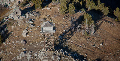
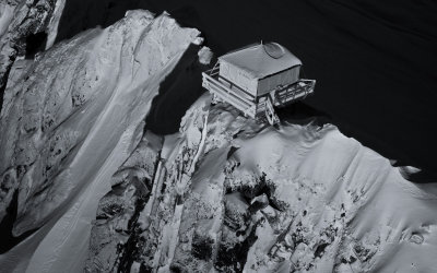
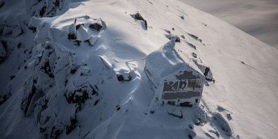
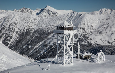
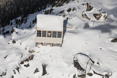
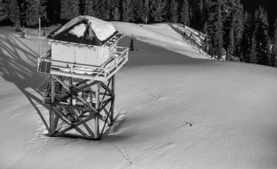
 Mebee Pass Fire Lookout (Mebee_020213_004-3.jpg) |
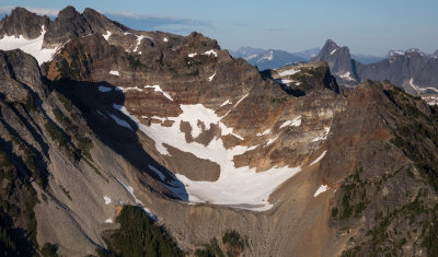
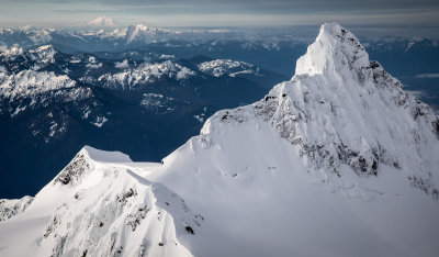
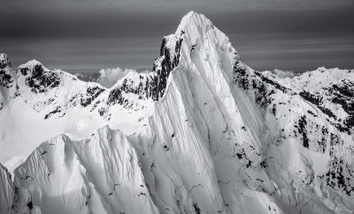
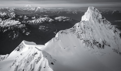
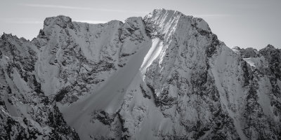
 Logan (L) & Goode, Looking SE (Logan_020213_012-4.jpg) |
 Afternoon On The Nooksack River (NooksackRiver_021013_421-10.jpg)* |
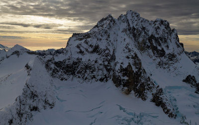
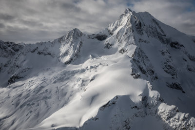
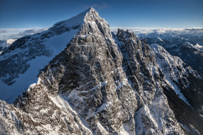
 The Upper Northeast Face Of Johannesburg (Johannesburg_021513_040-1.jpg) |
 Forbidden Peak From The East (Forbidden_021513_007-2.jpg) |
 Silver Star From The Southwest (SilverStar_021513_010-1.jpg) |
 The Wine Spires From The West (SilverStar_021513_073-2.jpg) |
 Oval Peak From The South (Oval_021513_038-3.jpg)* |
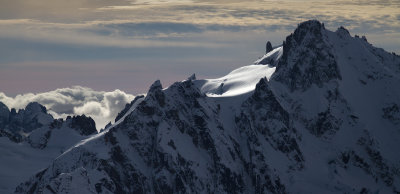
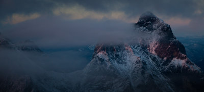
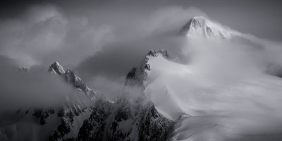
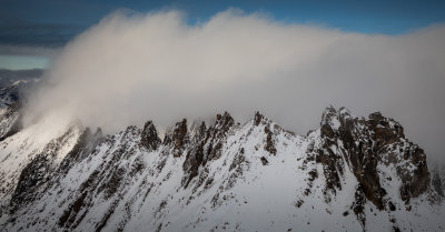
 Lenticulars Clouds & Alpenglow, Mt. Challenger (Pickets_021513_050-4.jpg) |
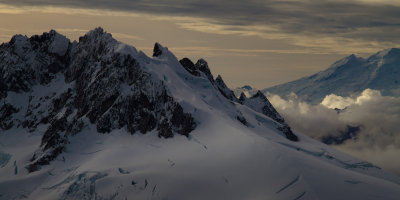
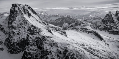
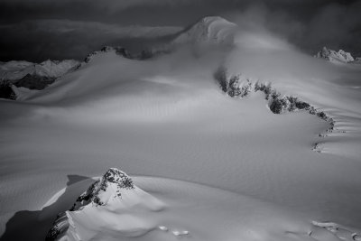
 The Northern Picket Range From The Southwest (Pickets_021513_077-5.jpg) |
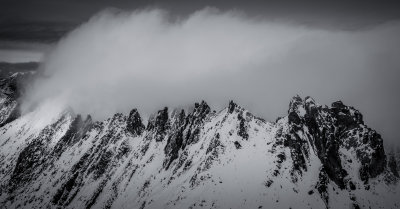
 Lenticular Clouds And The Southern Picket Range (Pickets_021513_131-6.jpg)* |
 Sunset, Mount Baker & Mt Shuksan (MtBaker_021513_005-7.jpg) |
 Alpenglow & The Northern Picket Range (Pickets_021513_146-8.jpg) |
 Afternoon At Beard's Hollow (SWWA_021913_044-1.jpg) |
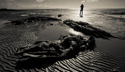 Ghost Tree Remnants At Low Tide (SWWA_021913_120-2.jpg) |
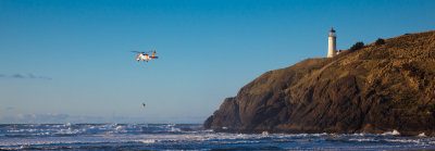 USCG Air Station Astoria MH-60T Jayhawk Helicopter In Action (SWWA_021913_262-1.jpg) |
 SWWA_021913_009-1.jpg |
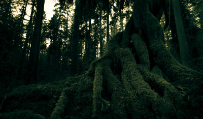 Moss & Green (RockportSP_022213-4-1.jpg)* |
 Eldorado From The East (Eldorado_022713_016-1.jpg) |
 Mt. Goode From The East (Goode_022713_034-3.jpg) |
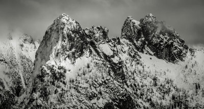
 Mt. Baring From The North (Baring_010113_002-1.jpg) |
 Mt. Baring From The North, Version II (Baring_010113_002-3.jpg) |
 Mt. Baring From The Northwest (Baring_010113_020-2.jpg) |
 North & South Twin Sisters (Sisters_030313_013-1.jpg)* |
 Upper N & NE Face (MtBaker_030313_050-2.jpg) |
 Glacier Peak From The Northeast (GlacierPk_030313_019-3.jpg) |
 Dorado Needle, Looking Northwest (Eldorado_030813_017-1.jpg) |
 Dorado Needle & Eldorado, Looking To The Southeast (Eldorado_030813_031-2.jpg)* |
 Forbidden Peak, North Ridge & Northwest Face (Forbidden_030813_023-3.jpg) |
 Whitehorse, Upper N Face Detail (Whitehorse_030813_011-4.jpg) |
 Eldorado_030813_017-5.jpg* |
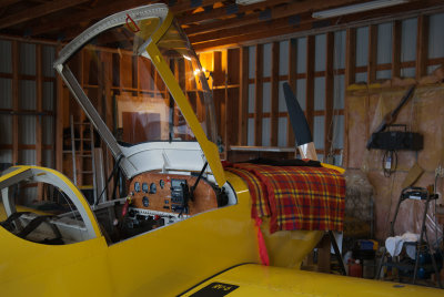 Warming The Engine Prior To Departure (Concrete_030913_001-1.jpg) |
 Kelowna: Cleared Customs, Refueled, Bugaboos Await! (Kelowna_030913_001-2.jpg) |
 Pigeon Spire & The Howser Towers (Bugaboos_030913_211-3.jpg) |
 Bugaboo Spire (Bugaboos_030913_249-4.jpg) |
 North Howser Tower From The Northwest (Bugaboos_030913_280-5.jpg) |
 Conrad & Conrad Glacier From The North (Conrad_030913_064-6.jpg) |
 The Howser Towers From The West (Bugaboos_030913_356-7.jpg) |
 Jumbo Valley (Jumbo_030913_050-8.jpg) |
 The Northeast Face Of Gimli (Valhallas_030913_017-9.jpg) |
 Mt. Dag From The North (Valhallas_030913_048-10.jpg) |
 Ebey's Landing State Park (Coupeville_Ebey_031113-38-1.jpg) |
 Ebey's Landing State Park (Coupeville_Ebey_031113-43-2.jpg) |
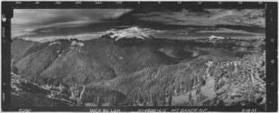 Mount Baker From The Dock Butte Fire Lookout, 1935 (6582compDR-1.jpg) |
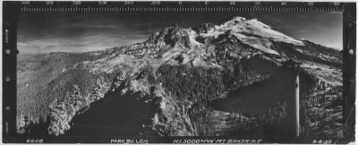 Mount Baker From Atop The Park Butte Fire Lookout, 1935 (6608compDR-2.jpg) |
 Mount Baker From The Northwest (MtBaker_031813_098-1.jpg) |
 Lincoln, Colfax, Baker (MtBaker_031813_118-2.jpg) |
 Shuksan From The South (Shuksan_031813_203-3.jpg) |
 Mt Shuksan, Looking Northeast (Shuksan_031813_310-4.jpg) |
 SPickets_031913_014-1.jpg |
 BostonSahaleBuckner_031913_002-2.jpg |
 Johannesburg_031913_007-3.jpg |
 Diablo Lake At Dawn (Diablo_032113_149-1.jpg) |
 Eldorado, Dorado Needle, Snowfield, Looking North (Eldorado_032213_062-5.jpg)* |
 Ripsaw Ridge & Buckner, Looking NE (Buckner_032213_010-2.jpg) |
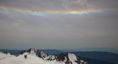
 Vertical Rainbow: The Right Half Of A Sun-Dog (MF_032213-444-1.jpg) |
 Spire To Dome (DomeSpire_032713_008-2.jpg) |
 Ross Pass (MtFlight_032713-133-1.jpg) |
 Sauk City Moonset (Moonset_032813_003-1.jpg) |
 Sauk Mountain At Dawn (Moonset_032813_006-2.jpg) |
 Bannock Mountain From The Northwest (Bannock_032713_002-5.jpg) |
 Cashmere Mountain From The South (Cashmere_032713_008-1.jpg) |
 Needle Peak From The East (DarkNeedle_032713_005-4.jpg) |
 Napeequa Mountain From The North (Napeequa_032713_008-3.jpg) |
 Prusik Peak From The South (S_E_040113_035-1.jpg) |
 Abernathy Peak From The North (Aber_040113_028-1.jpg) |
 Hoodoo Peak From The North (Hoodoo_040113_024-2.jpg) |
 Martin Peak, West Face (MS_040113_006-3.jpg) |
 Cheops, Martin, Switchback From The Southwest (MS_040113_015-4.jpg) |
 Cashmere Mountain From The Northeast (SE_040113_007-5.jpg) |
 Dragontail Peak From The Northwest (SE_040113_031-6.jpg) |
 Enchantment Peak From The West (SE_040113_070-7.jpg) |
 Argonaut Peak From The North (SE_040113_081-1.jpg) |
 Mt. Stuart From The Northwest (SE_040113_085-2.jpg) |
 Argonaut Peak From The South (SE_040113_095-3.jpg) |
 Little Annapurna From The Southwest (SE_040113_097-4.jpg) |
 Little Annapurna From The South (SE_040113_105-5.jpg) |
 Dragontail Plateau From The East (SE_040113_132-6.jpg) |
 Pond On Thunder Knob (ThunderKnob_040813-13-1.jpg) |
 The North Face Of Colonial Peak (ThunderKnob_040813-109-2.jpg) |
 Early Spring Vine Maple (ThunderKnob_040813-140-3.jpg) |
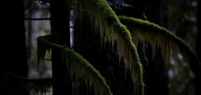 Moss & Dark Trees (ThunderKnob_040813-177-4.jpg) |
 Sucia Island (SalishSea_041113_107-3.jpg) |
 Amphitheater Mountain From The East (C_A_041613_038-1.jpg) |
 Mt Lago & Ptarmigan Peak, Looking North (LagoPtarmigan_041613_005-4.jpg) |
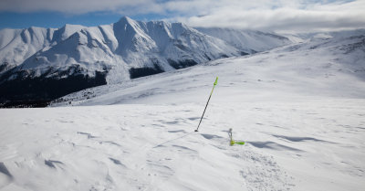
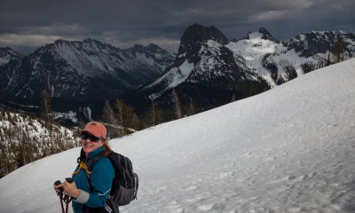
 Steph Abegg Photographing Windy Peak (SA_041613_004-2.jpg) |
 Windy Peak From The North (Windy_041613_026-3.jpg) |
 Triumph From The North (Triumph_041613_008-5.jpg) |
 Grazing... Watching... (Canada1_041813_196-2.jpg) |
 Canada1_041813_8-1.jpg |
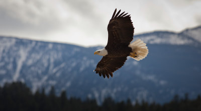 Bald Eagle Fly-By (Canada1_041813_253-1.jpg) |
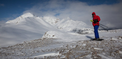 Moi, Snowshoeing Parker Ridge (Canada2_042113_17-2.jpg) |
 Parker Ridge, Looking Towards Mt Castleguard & Columbia Icefield (Canada1_042113_1282-2.jpg) |
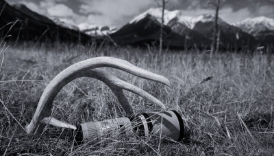 Antler & Steph's 400mm Lens (Canada1_042013_903-1.jpg) |
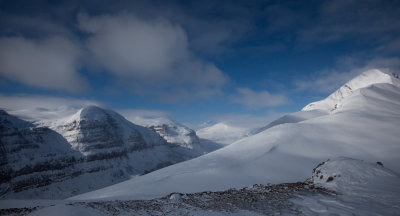
 Mt Athabasca (R) & Parker Ridge (Canada2_042113_130-1.jpg) |
 Parker Ridge, Looking East (Canada2_042113_138-2.jpg) |
 Parker Ridge (Canada2_042113_163-2.jpg) |
 Ice Otter (Canada1_042013_852-1.jpg) |
 Rainier & Little Tahoma (Rainer_050113_007-1.jpg) |
 Little Tahoma (Rainer_050113_019-2.jpg) |
 Little Tahoma & Mt Saint Helens (Rainer_050113_064-3.jpg) |
 Redoubt From The North (Redoubt_050113_029-4.jpg) |
 Bear Mountain, Upper North Face/The Diamond (Bear_050113_011-5.jpg) |
 Mt Rahm & Silver Lake (Custer_050113_001-6.jpg) |
 Twin Needles & The Thread Of Ice (SPickets_050113_001-7.jpg) |
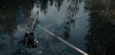
 Gorge Lake: Partially Submerged Tree Stump (GorgeLk_050613-151-1.jpg) |
 Mt Chaval, Looking To The West (Chaval_052013_038-1.jpg) |
 Johannesburg's Upper N Face, Looking East (Johannesburg_052013_038-2.jpg) |
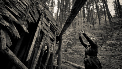 Canyon Creek: Photographing The Old Guard Station Horse Barn (MRF_051713-187-1.jpg) |
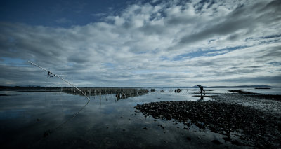 Chuckanut Drive: Taylor Shellfish Company (MRF_051813-208-2.jpg) |
 The Southern Picket Range, Crescent Creek Spires To Mt. Terror (SPickets_060313_063-1.jpg) |
 Northern Slopes Of Mt Despair (Despair_060313_010-2.jpg) |
 Ruth Crossing Canyon Creek (MRF_051713-82-1.jpg) |
 Vine Maple Along The Thunder Knob Trail (MRF_051913-530-2.jpg) |
 Circumhorizon Arc Above The Twin Sisters Range (NooksackMidFkCd2_061513-28-1.jpg) |
 Shuksan & Baker From The East (MtBaker_071413_061-3.jpg) |
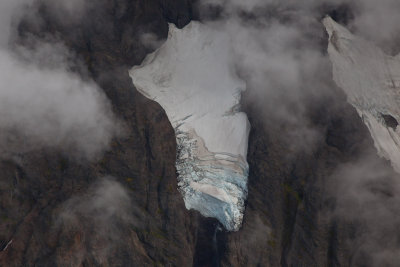
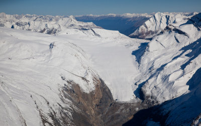
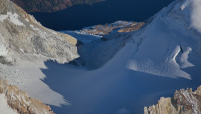
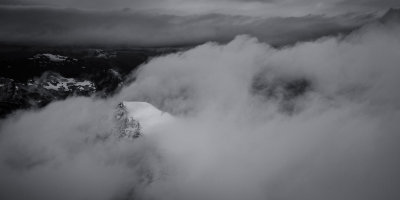
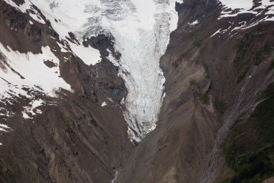
 Mt Challenger & Challenger Glacier (NPickets_071413_039-4.jpg) |
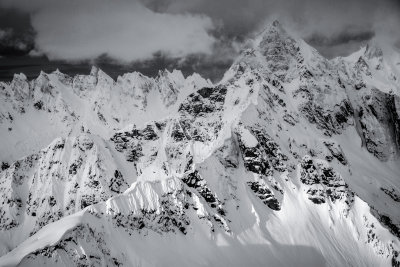
 McMillan Spires To Degenhardt: The Southern Picket Range (SPickets_071413_010-5.jpg) |
 Shuksan From 13,000' (Shuksan_071413_018-2.jpg) |
 Looking To The Northeast Across Glacier Peak's Summit (GlacierPk_081013-19-1.jpg) |
 Glacier Peak's Summit, Looking West (GlacierPk_081013-142-2.jpg) |
 Crevasses & Seracs, Dusty Glacier (GlacierPk_081013-321-3.jpg) |
 Glacier Peak From The North (GlacierPk_081013-340-4.jpg) |
 Lincoln Peak's Pocket Glacier (MtBaker_082813-205-3.jpg) |
 Roosevelt Glacier Crevasses (MtBaker_082813-187-2.jpg) |
 Mount Baker From The Northeast (MtBaker_082813-167-1.jpg) |
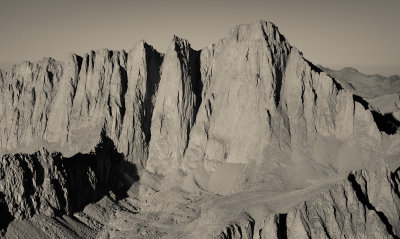 The East Face Of Mt. Whitney (IMG_1640-1.jpg) |
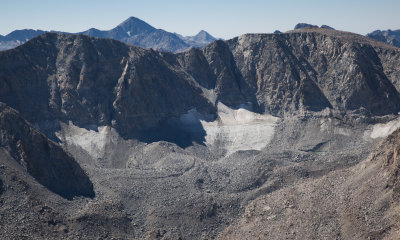
 Middle Palisade Glacier (IMG_2176-1.jpg) |
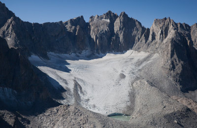 Palisade Glacier (IMG_2203-2.jpg) |
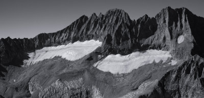
 Mt Goethe's North Face & Goethe Glacier (IMG_2551-3.jpg) |
 Mt Humphreys East Face (IMG_2650-4.jpg) |
 Green Creek Moraines (IMG_3283-1.jpg) |
 Green Creek Moraines (IMG_3294-2.jpg) |
 Mount Maclure & Maclure Glacier (IMG_3111-1.jpg) |
 Early Fall In The Southern Picket Range (SPickets_100813_11-1.jpg) |
 Mount Ritter (Center) & Banner Peak (R) From The East (IMG_2958-1.jpg) |
 Banner Peak From The Northeast (IMG_2977-2.jpg) |
 Banner Peak From The Northwest (IMG_3009-3.jpg) |
 Spire Point From The Northeast (DomeSpire_101313_056-1.jpg) |
 Spire Point, Looking Northwest (DomeSpire_101313_095-2.jpg) |
 Mt Torment (Foreground), Looking To The South (Forbidden_101313_032-3.jpg) |
 Forbidden Peak, East Ridge (Forbidden_101313_058-4.jpg) |
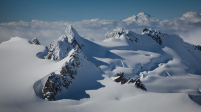
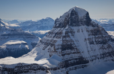
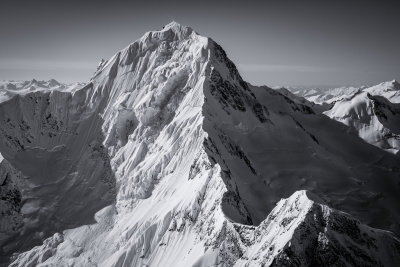
 Mt. Robson From The Northwest |
 Robson From The Southeast (Robson_101613_053-1.jpg) |
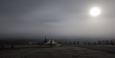 Valemount Airport, Moonlight & Fog (Valemount_101813_005-1.jpg) |
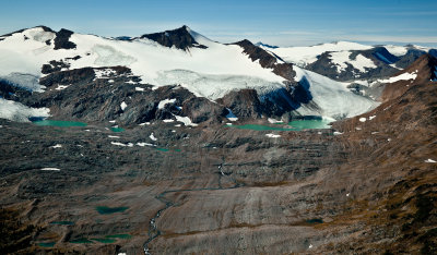
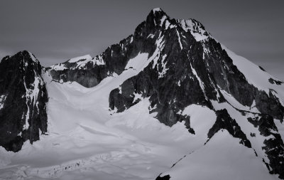
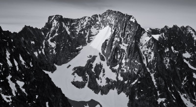
 Mt Chown & Chown Glacier (ResthavenIcefield_101713_022-2.jpg) |
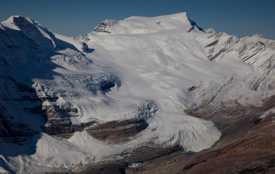
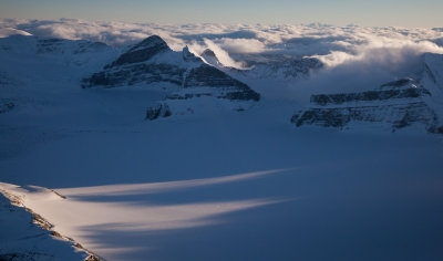
 Resthaven Icefield (ResthavenIcefield_101713_079-3.jpg) |
 Lynx Mountain & Reef Icefield, Looking South (ReefIcefield_101713_08-3.jpg) |
 Resthaven Icefield At Sunset, Looking South (ResthavenIcefield_101613_03-1.jpg) |
 Evening At The Resthaven Icefield, Lookout Southeast (ResthavenIcefield_101613_13-2.jpg) |
 Mt Monashee (Center), Mt Lempriere (L), & Upper Serpentine Neve (Monashees_101813_85-1.jpg) |
 Hallam Peak & Foster Glacier From The West (Monashees_101813_133-2.jpg) |
 Hallam Peak & Upper Hallam Glacier (Monashees_101813_215-3.jpg) |
 Rockback Peak & The Northern Lunn Icefield (Cariboos_101713_042-1.jpg) |
 Tarkin (L) & Endrock Peaks, Looking Southwest (Cariboos_101713_081-2.jpg) |
 Mt Lunn & The Lunn Icefield From The Southwest (Cariboos_101713_134-3.jpg) |
 Mt Albreda From The Northeast (Monashees_101813_32-4.jpg) |
 CalumetSwoda_101713_016-3.jpg |
 Swoda Mountain From The Northeast (CalumetSwoda_101713_038-4.jpg) |
 Robson, Detail Of The Summit Pyramid South Face (Robson_101613_201-2.jpg) |
 Kelowna Airport: Awaiting Departure For Valemount (Kelowna_101613_01-1.jpg) |
 Swoda Mountain From The Northwest (CalumetSwoda_101713_080-1.jpg) |
 Barricade Mountain & The Resthaven Icefield (ResthavenIcefield_101713_123-2.jpg) |
 Resthaven Icefield, Looking Northwest (ResthavenIcefield_101713_150-3.jpg) |
 Barricade Mountain (Left Center) & Resthaven Icefield (ResthavenIcefield_101713_155-4.jpg) |
 Swiftcurrent Glacier, Looking North (SwiftcurrentLongstaff_101713_006-1.jpg) |
 Reel Peak From The Southeast (ReelPk_101713_04-5.jpg) |
 The Wine Spires & The North Cascades, Looking Southwest (SilverStar_102613_040-1.jpg) |
 NorthTwentyMileLO_102613_014-1.jpg |
 Tiffany_102613_001-2.jpg |
 MtBaker_102813_004-1.jpg |
 MtBaker_102813_007-2.jpg |
 MtBaker_102813_010-3.jpg |
 MtBaker_102813_022-4.jpg |
 MtBaker_102913_019-1.jpg |
 MtBaker_102913_040-2.jpg |
 MtBaker_102913_068-3.jpg |
 MtBaker_102913_075-4.jpg |
 Mt Alberta From The Northeast (BCcard3a092011-217-1.jpg) |
 Mt Columbia From The East (BCcard3a092011-284-2.jpg) |
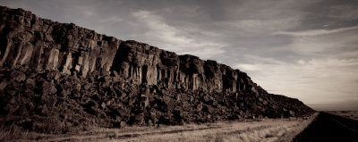
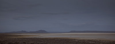 The Alvord Desert At Dusk (Oregon_111013-95-1.jpg) |
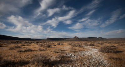
 Near Page Springs (Oregon_111113-107-2.jpg) |
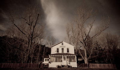 The Frenchglen Hotel |
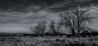
 North Of Frenchglen, Oregon (Oregon_111113-133-4.jpg) |
 Caliche, North Of Frenchglen, Oregon (Oregon_111113-152-5.jpg) |
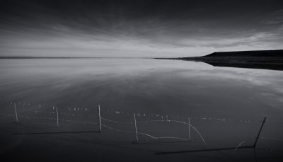 Malheur Lake (Oregon_111113-191-6.jpg) |
 Sunset At Mount Baker (MtBaker_111913_053-1.jpg) |
 Sherman Peak From The Northwest (MtBaker_111913_082-2.jpg) |
 Bacon Peak From The Southwest (BaconPk_111913_022-3.jpg) |
 Boston, Sahale, & Glacier Peak (BostonSahale_112713_005-1.jpg) |
 Looking North Along The Phantom Crest To Challenger (NPickets_120713_023-1.jpg) |
 Sourdough Lookout (SourdoughLO_120713_032-2.jpg) |
 Sourdough Lookout At Sunset, Looking Northeast (SourdoughLO_120713_033-3.jpg) |
 Mt Pilchuck Fire Lookout (Pilchuck_120813_011-1.jpg) |
 Miners Ridge Fire Lookout (MinersRidge_120813_007-2.jpg) |
 Glacier Peak From The Northeast (GlacierPk_120813_007-3.jpg) |
 Green Mountain Fire Lookout (GreenMountain_120813_008-4.jpg) |
 Mt Shuksan From The Northwest (Shuksan_120813_001-5.jpg) |
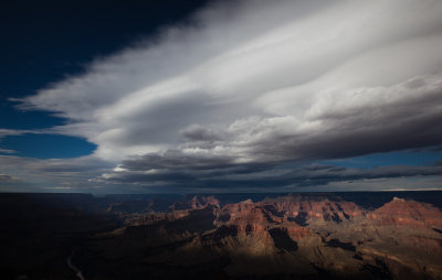 The Grand Canyon From Maricopa Point (GCNP_120313_1092-1.jpg) |
 Sunset At Dome Peak (DomeSpire_121113-19-1.jpg) |
 Neve Glacier: Shadows & Blowing Snow (Snowfield_122413_064-1.jpg) |
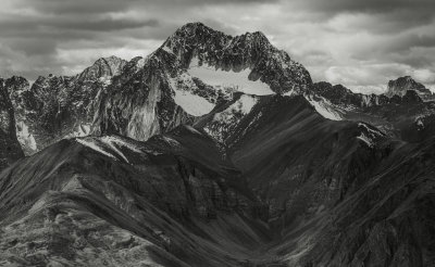
 Formidable From The Southwest (Formidable_122413_004-2.jpg) |
 Mt Blum From The South (Blum_122413_019-3.jpg) |
 Spider Mountain From The Southeast (Spider_011714_014-1.jpg) |
 Sourdough Lookout (SourdoughLO_012014_015-1.jpg) |
 RAF At Jones Beach (RAF_010814-310-1.jpg) |
 RAF & Tanta Sheila (NYC_010814-30-2.jpg) |
 Snowfield Peak & Neve Glacier From The Northeast (Snowfield_012114_040-1.jpg) |
 Sentinal & Leconte Peaks From The Northwest (SentinalLeconte_012114_026-2.jpg) |
 Spire Point (R) & Dome Peak (L Background) From The West (DomeSpire_012114_032-3.jpg) |
 Sahale Peak (L) & Boston Peak From 14,000' (SahaleBoston_012414_019-1.jpg) |
 Looking Southeast Down Lake Chelan (LakeChelan2_012414_025-2.jpg) |
 On The Inspiration Glacier, East Of Eldorado (Eldorado_012414_004-3.jpg) |
 Inspiration Glacier, Southwest Margin ( Eldorado_012414_074-4.jpg) |
 Challenger Glacier & Mt Challenger's Western Peaks (NPickets_020314_010-1.jpg) |
 Cat's Ear Spire (L) & Horseman, Horseman's Pack, & Pack Train (Snowfield_020314_005-3.jpg) |
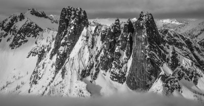
 West McMillan Spire From The Southwest (SPickets_020314_019-2.jpg) |
 RossLake_031114_010-1.jpg |
 Desolation_031114_012-2.jpg |
 Mt Triumph (Center Distance) & E McMillan Spire (R), Looking West (MF_031114-309-3.jpg) |
 Table Mountain From The East (MBSA_032114-339-1.jpg) |
 Table Mountain From The Northwest (MBSA_032114-345-2.jpg) |
 Mt Herman From The East (MBSA_032114-368-1.jpg) |
 Mt Whitney, Mt Russell, & Tulainyo Lake, Looking South (IMG_1681-9.jpg) |
 The Southern Pickets: Crescent Creek Spires To Mt. Terror (SPickets_041914_009-1.jpg) |
 SPickets011212-169-1.jpg |
 SPickets_030712_064-1.jpg |
 SPickets112511-044-1.jpg |
 SPickets112511-172-2.jpg |
 Davis Peak From The Northwest (Davis_051214_016-5.jpg) |
 Mt Triumph From The Northeast (Triumph_051214_023-2.jpg) |
 Ruth Fremson At Washington Pass Meadow (WaPass_052014-62-1.jpg) |
 The Southern Pickets From Above Picket Pass (SPickets_053014_082-6.jpg) |
 Degenhardt, Terror, Blob, & Twin Needles From The North (SPickets_053014_067-5.jpg) |
 SPickets_053014_046-1.jpg |
 WaPass_060114-87-1.jpg |
 WaPass_060114-121-2.jpg |
 Shadow & Crevasses, Upright Peak's Northeast Glacier (Upright_101713_028-10.jpg) |
 Bonanza Peak From The Northeast (Bonanza_060714_046-1.jpg) |
 Mt. Fernow's North Face (MF7FJ_060714_004-2.jpg) |
 Mt. Shuksan From The Northeast (Shuksan_070314_101-1.jpg) |
 Avalanche Debris Fan, Nooksack Cirque (Shuksan_070314_119-2.jpg) |
 Climbers On The Coleman Glacier (MtBaker_070314_061-3.jpg) |
 Liberty Bell, East Face (LibBell_020512_029-1.jpg) |
 Liberty Bell, East Face (LibBell_020512_035-2.jpg) |
 Mt. Washington From The Southeast (Washington_011913_34-1.jpg) |
 Mt. Washington From The North (Washington_011913_01-1.jpg) |
 Sinister, Gunsight, & Agnes Peaks From The Southwest (SinisterDome_081014_025-13.jpg) |
 Glacier Peak From The Southwest (GlacierPeak_081014_008-12.jpg) |
 Horse Armor Detail (NYC_081814-292-1.jpg) |
 Mount Baker From The East (MtBaker_082814_037-1.jpg) |
 Shuksan & Nooksack Tower From The South (Shuksan_082814_007-2.jpg) |
 Eldorado (R) & Early Morning Spire (L) From The South (Eldorado_082814_050-1.jpg) |
 Early Morning Spire From The Southwest (Eldorado_082814_092-2.jpg) |
 Late Summer Evening At Snow King (Snowking_082814_007-3.jpg) |
 Mount Baker From The South, At Sunset (MtBaker_090614_068-1.jpg) |
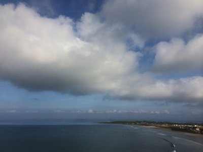 Donegal Bay From Rossnowlagh |
 Glacier Peak, Looking To The East (GlacierPeak_101914_032-1.jpg) |
 Mt. Goode From The West (Goode_101914_121-2.jpg) |
 Eldorado's Summit From The Southeast (Eldorado_101914_078-3.jpg) |
 Mount Baker Under A Cloud Pile (MtBaker_101914_028-1.jpg) |
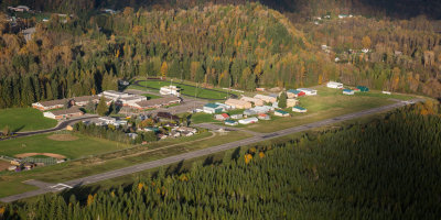 Concrete Municipal Airport (ConcreteMunicipalAirport_101914_021-2.jpg) |
 JS_GoatRocks_c1977__001-1.jpg |
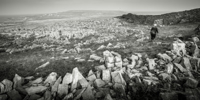 Leaving Dun Aengus (0F5A1965-2-10.jpg) |
 Mt Rainer, Looking To The Northeast (Rainier_111314_200-1.jpg) |
 Mount Rainier From The Northwest (Rainier_111314_499-2.jpg) |
 The Southern Picket Range From 17,500' (Pickets_111614_067-1.jpg) |
 The Northern Picket Range From 17,500' (Pickets_111614_070-2.jpg) |
 Mt Shuksan From 17,500' (Shuksan_111614_023-3.jpg) |
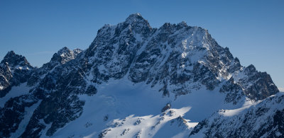
 Mt Shuksan From 17,500' (Shuksan_111614_035-4.jpg) |
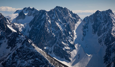
 Mt. Shuksan From 17,500', Labeled (Shuksan_111614_035-4_Labeled.jpg) |
 Mt Shuksan From 17,500' (Shuksan_111614_062-5.jpg) |
 Mount Baker From 17,500' (MtBaker_111614_021-6.jpg) |
 Mount Baker From 17,500' (MtBaker_111614_076-7.jpg) |
 Mount Baker From 17,500' (MtBaker_111614_226-8.jpg) |
 Wild Lake (CrowderLake_111914_021-1.jpg) |
 Luna Peak, Glacier Peak, & McMillan Spires (Pickets_111914_093-2.jpg) |
 Challenger Glacier, Mt Challenger, & The Northern Picket Range (Pickets_111914_109-3.jpg) |
 The Baker River Valley (BakerRiver_111914_008-4.jpg) |
 Adams, Hood, Jefferson, & Three Sisters From The North (Adams_012515_365-1.jpg) |
 Jack Mountain From The Northeast (Jack_012815_103-1.jpg) |
 The Southern Picket Range, Looking South (Pickets_021315_049-4.jpg) |
 Central Park Near West 77th Street (NYC_022515_563) |
 The North Face Of Buck Mountain (Buck_030315_018-1.jpg) |
 Whatcom Peak From The Northwest (Whatcom_031615_031-1.jpg) |
 Copper Lookout (CopperLO_031615_026-2.jpg) |
 Mt. Hagan From The Northwest (Hagan_031615_008-3.jpg) |
 Bacon Peak From The Northwest (Bacon_031615_003-4.jpg) |
 Sherman Peak From The Southeast (MtBaker_031615_006-1.jpg) |
 Summit Plateau, Looking Northeast (MtBaker_040315_119-1.jpg) |
 Triumph From The Northeast (Triumph_040315_038-2.jpg) |
 Mt. Torment (R Foreground), Looking Southeast (Torment2_040315_008-3.jpg) |
 Avalanches Below Johannesburg (Johannesburg_040315_071-4.jpg) |
 Eldorado From The South (Eldorado_040315_032-5.jpg) |
 Eldorado, Looking Northwest (Eldorado_040315_072-6.jpg) |
 Hidden Lake Lookout (HiddenLakeLO_040315_009-7.jpg) |
 South Early Winter Spire, Looking To The Northeast (EarlyWinterSpire_041015_002-3.jpg) |
 Silver Star From The West (SilverStar_041015_058-1.jpg) |
 Golden Horn From The North (GoldenHorn_020815_014-1.jpg) |
 Golden Horn From The Northwest (GoldenHorn_020815_021-2.jpg) |
 Golden Horn From The East (GoldenHorn_020815_084-3.jpg) |
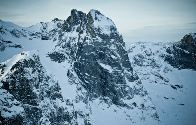
 The North Face Of Stanley Peak (Stanley090808-_62-10.jpg) |
 Kates Needle From The East (Stikine042809--_374-2.jpg) |
 Kates Needle From The Southeast (Stikine042809--_367-1.jpg) |
 Forbidden Peak From The Northwest (Forbidden_052715_001-1.jpg) |
 Mount Baker From The Northeast (MtBaker_062115_013-1.jpg) |
 Shuksan's Summit Pyramid From The South (Shuksan_062115_025-2.jpg) |
 Sulphide Glacier Shadows (Shuksan_062115_074-3.jpg) |
 Glacial Cirque Southwest Of Hagan Mountain (Hagan_062115_062-5.jpg) |
 Detail, Glacial Cirque Southwest Of Hagan Mountain (Hagan_062115_027-4.jpg) |
 Lower Rainbow Glacier (Rainbow_062415_017-1.jpg) |
 Lower Bastille Glacier (Bastille_062415_024-2.jpg) |
 Castle Peak From The Northeast (Castle_080815_065-2.jpg) |
 The North Face Of Castle Peak (Castle_080815_073-3.jpg) |
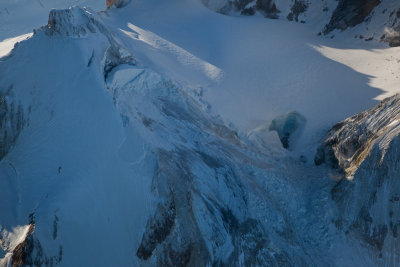
 Crevasses On The Challenger Glacier (Challenger_080815_035-5.jpg) |
 The East Face Of Southeast Mox Peak (SE_Mox_080815_011-4.jpg) |
 The Saint (Peak 7185) From The Northeast (Saint_080815_2-1.jpg) |
 Three Aunts, Freezeout, & Full Moon Rising, Looking Northwest (Castle_080815_017-1.jpg) |
 Wolverine_081015_72-1.jpg |
 Wolverine_081015_167-2.jpg |
 Wolverine_081015_204-3.jpg |
 Glacier Peak From The Northeast (GlacierPk_081015_034-1.jpg) |
 Wildfires_Wa_082015_205-2.jpg |
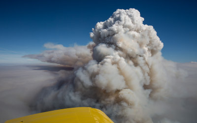 Wildfires_Wa_082015_247-3.jpg |
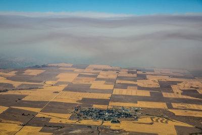 Waterville & Smoke (Wildfires_Wa_082015_386-1.jpg) |
 MtFlight_082015_470-4.jpg |
 Mesahchie (L) & Katsuk Peaks, Looking South (MesahchieKatsuk_082015_005-5.jpg) |
 Sahale Glacier (BostonSahale_100815_015-1.jpg) |
 Forbidden Glacier (Forbidden_100815_037-2.jpg) |
 Klawatti Glacier (Klawatti_100815_020-3.jpg) |
 Glacier Peak, Looking To The Northwest (GlacierPeak_101115_323-1.jpg) |
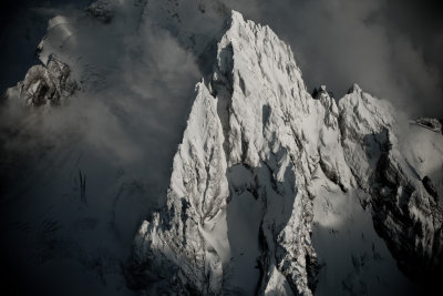
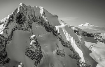
 Challenger's Summit Tower From The Northeast (Challenger_110315_074-1.jpg) |
 Mt Hardy's Northeast Face (Hardy_112015_017-3.jpg) |
 Golden Horn From The North (GoldenHorn_112015_024-2.jpg) |
 Mesahchie Peak, Looking To The South (MesahchieKatsuk_112015_023-4.jpg) |
 Cutthroat_112015_032-2.jpg |
 LibertyBell_112015_023-1.jpg |
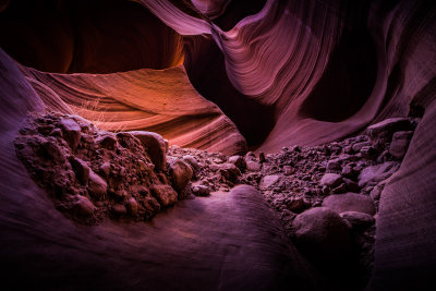 Antelope Canyon (PhoenixRAF_112415_696-1.jpg) |
 Sillouette (L) & Daemon (R), Looking To The Southeast (DaemonSillouette_113015_007-1.jpg) |
 Carru's North Face (OsceolaCarruLago_113015_072-2.jpg) |
 Osceola, Looking To The Northwest (OsceolaCarruLago_113015_015-1.jpg) |
 Sitting Bull Mountain, Northeast Face (SittingBull_113015_017-1.jpg) |
 Heather Ridge, Looking South (HeatherRidge_113015_021-1.jpg) |
 Booker, Northeast Buttress (Booker_113015_007-1.jpg) |
 The Northeast Face Of Bannock Mountain (Bannock_113015_030-2.jpg) |
 L to R: Agnes, Gunsight, Sinister, Dome, Looking To The South (AgnesDome_113015_019-3.jpg) |
 Spire Point From The South (Dome_Spire_121115_023-5.jpg) |
 Spire Point & Glacier Peak (Dome_Spire_121115_041-6.jpg) |
 The Northwest Face Of Forbidden Peak (Forbidden_121115_004-2.jpg) |
 Forbidden Peak, Upper Northwest Face (Forbidden_121115_084-3.jpg) |
 Sentinal Peak's West Face (SentinalLeconte_121115_008-4.jpg) |
 Glacier Peak From The Northeast (GlacierPeak_122615_093-1.jpg) |
 Glacier Peak From The Northeast (GlacierPeak_122615_236-1.jpg) |
 Sunlight & Shadow, North Guardian/Chocolate Glacier Divide (GlacierPeak_122615_251-1.jpg) |
 Ten Peak Mountain & Glacier Peak From The Southeast (GlacierPeak_122615_395-2.jpg) |
 Liberty Bell & Early Winter Spires From The North (LibertyBell_010616_103-1.jpg) |
 Mount Adams From The Northeast (Adams_011416_123-1.jpg) |
 Mount St Helens From The Northeast (MtStHelens_011416_030-2.jpg) |
 Mount St Helens From The North (MtStHelens_011416_071-3.jpg) |
 Mt Rainier From The West (Rainier_011416_054-4.jpg) |
 Silver Star Mountain, West Face (SilverStar_010616_023-1.jpg) |
 Spider Mountain, South Face (Spider_121115_003-1.jpg) |
 McMillan Spires, Looking To The West (SPickets_012516_070-1.jpg) |
 Dome Peak From The South (DomeSpire_020616_065-2.jpg) |
 Sloan Peak From The South (Sloan_020616_060-1.jpg) |
 Three Fingers Lookout (ThreeFingers_020616_045-1.jpg) |
 Winthrop Mountain From The South (WinthropMt_032616_021-1.jpg) |
 Three Fools, Looking Southwest (ThreeFools_032616_001-2.jpg) |
 Castle Peak From The Southeast (Castle_032616_049-1.jpg) |
 Castle Peak, Looking To The Northwest (Castle_032616_063-2.jpg) |
 Powder Mountain's West/Northwest Face (PowderMountain_032616_006-3.jpg) |
 Fire To A Ridge, West Of Powder Mountain (PowderMountainFire_032616_012-4.jpg) |
 Castle Peak From The West (Castle_032616_011-1.jpg) |
 Blizzard Peak From The North (BlizzardPeak_032616_003-3.jpg) |
 Meadow At Frosty Lake (FrostyCreek_032616_004-2.jpg) |
 Downie_042016_045-1.jpg |
 LibertyBell_053016_048-1.jpg |
 LibertyBell_053016_048-2.jpg |
 LibertyBell_053016_053-3.jpg |
 LibertyBell_053016_015-1.jpg |
 LibertyBell_053016_015-2.jpg |
 LibertyBell_053016_016-3.jpg |
 Goode_053016_044-1.jpg |
 The North Face Of Mt. Bell (Bell_J_20120324_074-2.jpg) |
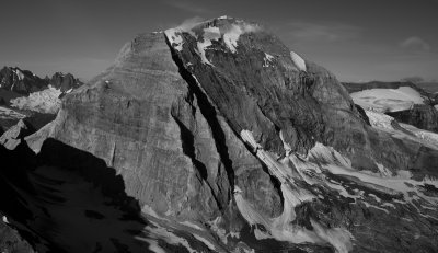
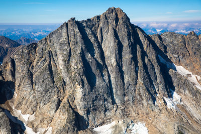
 Waddington's Northeast Face (Waddington_J_20120324_231-1.jpg) |
 Zion_063016_136-1.jpg |
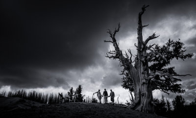 Great Basin Bristlecone Pine At Spectra Point (CedarBreaks_070116_113-1.jpg) |
 CedarBreaks_070116_86-1.jpg |
 The Castle (EscalanteCapitolReef_070316_095-1.jpg) |
 Cold Meadows Airstrip (Idaho_072716_357-1.jpg) |
 Blackfoot Glacier & Blackfoot Mountain (GNP_091516_1085-1.jpg) |
 Snowfield Peak & Neve Glacier From The North (Snowfield_092016_005-1.jpg) |
 Vasiliki_061116_019-1.jpg |
 Vasiliki_061116_019-2.jpg |
 Liberty Bell From The Northwest (LibertyBell_061116_058-4.jpg) |
 Stikine Icefield, Looking To The South (Stikine042809--_151-1.jpg) |
 South Sawyer Glacier, Looking South (StikinePM042909--_067-2.jpg) |
 South Sawyer Glacier, Melting Freshwater Ice (StikinePM042909--_076-3.jpg) |
 Vasiliki Ridge From The West (Vasiliki_061116_019-2.jpg) |
 Baker & Shuksan, Looking To The Southwest (MtBaker_220117_022-1.jpg) |
 SlatePeak_012617_009-2.jpg |
 Bonanza_013117_046-4.jpg |
 HiddenLakeLO_013117_015-5.jpg |
 HiddenLakeLO_013117_015-6.jpg |
 Gunsight, Looking To The Northeast (Gunsight_013117_013-4.jpg) |
 Agnes From The East (Agnes_013117_004-2.jpg) |
 Bonanza, NE Face (Bonanza_013117_025-1.jpg) |
 McGregor_033117_020-1.jpg |
 McGregor_033117_020-2.jpg |
 NorthCascadesInstitute_041917_019-1.jpg |
 Luna Peak From The Northeast (NPickets_041917_033-2.jpg) |
 Luna Peak From The Northwest (NPickets_041917_055-3.jpg) |
 McMillan Spires From the Southeast (SPickets_041917_040-1.jpg) |
 The Southern Picket Range From The East (SPickets_041917_151-4.jpg) |
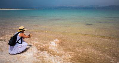 Photographing Salt Formations, Israel's Dead Sea (DeadSea_040817_021-1.jpg) |
 Israel's Dead Sea (DeadSea_040817_122-2.jpg) |
 Cathedral, Looking Northwest (Cathedral_042117_041-1.jpg) |
 Cathedral, Looking Northwest (Cathedral_042117_041-2.jpg) |
 Blum_042917_030-4.jpg |
 Shuksan_042917_213-1.jpg |
 Triumph_042917_048-3.jpg |
 Mount Shuksan's Summit Pyramid From The North (Shuksan_042917_213-2.jpg) |
 Hozomeen_012513_026-1.jpg |
 Hozomeen Mountain's South Peak From the North (Hozomeen_111012_019-4.jpg) |
 Southeast Mox Peak, East Face (MoxSpickard_111012_050-1.jpg) |
 Southeast Mox Peak, East Face (MoxSpickard_111012_056-2.jpg) |
 Southeast Mox Peak, East Face (MoxSpickard_111012_056-3.jpg) |
 Hozomeen Mountain, North Peak, Zorro Face (Hozomeen_111012_034-2.jpg) |
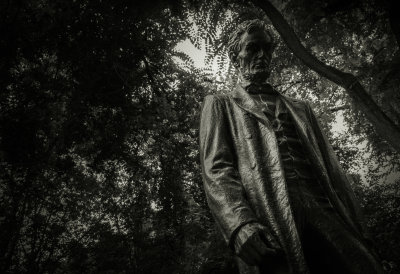 Abraham Lincoln (PortlandOR_070717_001-1.jpg) |
 Chief Mountain (GNP_071417_054-2.jpg) |
 Sue Lake & Pyramid Peak (GNP_071417_097-3.jpg) |
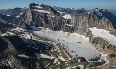 Grinnell Glacier (GNP_071417_225-4.jpg) |
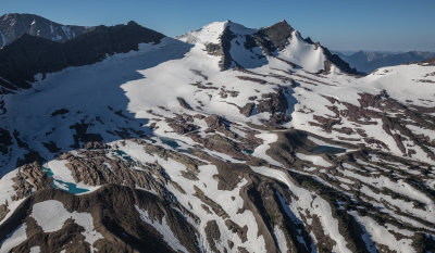 Sperry Glacier (GNP_071417_323-5.jpg) |
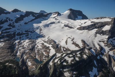 Blackfoot Glacier (GNP_071417_363-6.jpg) |
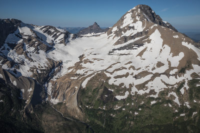 Jackson Glacier (GNP_071417_376-7.jpg) |
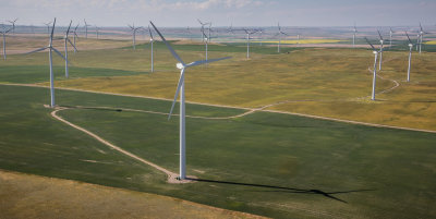 Wind Farm West Of Shelby, Montana (ShelbyMT_071217_083-1.jpg) |
 Mount Baker's North Ridge (MtBaker_081517_048-1.jpg) |
 Upper Chocolate Creek & Dust Clouds (GlacierPeak_082417_071-2.jpg) |
 Tiedemann Group From The Southwest (Waddington_081616_032-1.jpg) |
 Waddington & The Scimitar Glacier (Waddington_081616_102-2.jpg) |
 The East Face Of Mt. Monarch (Monarch_081616_017-3.jpg) |
 Glacier Peak From The East (GlacierPeak_082417_058-1.jpg) |
 Glacier Peak, Looking To The Southwest (GlacierPeak_082417_102-3.jpg) |
 LloydGeorgeIcefield_091517_013-1.jpg |
 LloydGeorgeIcefield_091517_026-2.jpg |
 LloydGeorgeIcefield_091517_055-3.jpg |
 LloydGeorgeIcefield_091517_076-4.jpg |
 LloydGeorgeIcefield_091517_097-5.jpg |
 LloydGeorgeIcefield_091517_126-6.jpg |
 StPatrick_091517_004-1.jpg |
 Ulysses_091517_160-2.jpg |
 Bryce_102717_002-3.jpg |
 Athabasca, North Face (Athabasca_102717_010-4.jpg) |
 Ripsaw Ridge & Boston Glacier (RipsawRidge_110617_008-1.jpg) |
 Klawatti Peak From The East (TepehKlawatti2_110617_027-4.jpg) |
 The Tepeh Towers, Looking To The Southeast (TepehTwrsKlawatti_110617_012-3.jpg) |
 The Torment-Forbidden Traverse (TormentForbidden_110617_101-2.jpg) |
 Valhalla Mountain (Stikine042809--_013-1.jpg) |
 Iceweb Peak From The Northwest (Stikine042809--_065-1.jpg) |
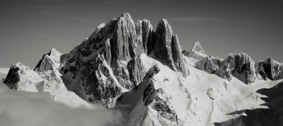
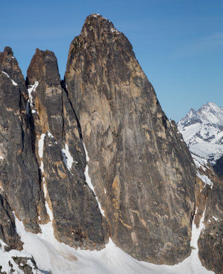
 The Gothics From The North (Adamants_042016_055-2.jpg) |
 WaddingtonFredBeckeyMovie_081516_514-1.jpg |
 Swoda Peak From The Northwest (CalumetSwoda_101713_079-3.jpg) |
 Brig Peak From The West (WMantle1-050908-_0216-5.jpg) |
 Heyburn Mountain, North Face (Sawtooth-061707-468-4.jpg) |
 Horstmann Peak, North Face (Sawtooth-061707-454-3.jpg) |
 Sherpa Peak, Northeast Face (StuartEnchantments_120717_110-3.jpg) |
 Little Annapurna, South Face (StuartEnchantments_120717_147-4.jpg) |
 Dragontail Plateau, Looking Northwest (StuartEnchantments_120717_172-5.jpg) |
 Argonaut, North Face (StuartEnchantments_120717_212-7.jpg) |
 Stuart, North Face (StuartEnchantments_120717_232-3.jpg) |
 SilverStar_050417_048-2.jpg |
 SilverStar_050417_048-1.jpg |
 Redboubt From The East (Redoubt_122117_002-2.jpg) |
 Copper Peak, Looking South (MF7FJ_011418_120-2.jpg) |
 Agnes Peak From The East (Agnes_011418_026-1.jpg) |
 Miners Ridge Fire Lookout (MinersRidgeLO_011418_012-1.jpg) |
 The North Face Of Mt. Fernow (MF7FJ_032018_080-1.jpg) |
 Liberty Bell From The East (LibertyBell_050417_039-3.jpg) |
 Bonanza, North Face (Bonanza_032018_261-1.jpg) |
 The Bugaboos From The Northwest (Bugaboos_102817_075-1.jpg) |
 Reliance Mountain From The North (RelianceHomath051407-_33-1.jpg) |
 Klawatti_100815_0401.jpg |
 NorthKlawatti_082616_0181.jpg |
 NorthKlawatti_082616_0262.jpg |
 SouthCascade_082616_0023.jpg |
 SouthCascade_082616_0084.jpg |
 SouthCascade_082616_0245.jpg |
 SouthCascade_082616_0386.jpg |
 SouthCascade_082616_0577.jpg |
 Tsar, Northwest Face (BCcard2092011341.jpg) |
 Cirque Of The Unclimbables (LoganMountains_090519_3641.jpg) |
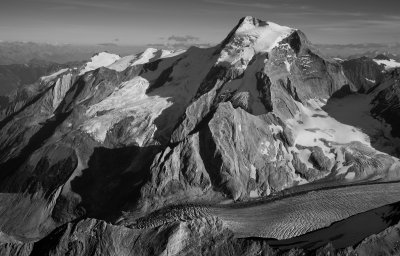
 The North Face Of Mt. Forbes (Forbes_090619_0222.jpg) |
 Mount Brazeau From The North (Brazeau_090619_0531.jpg) |
 Wolf Fang Peak, Northeast Face (LoganMountains_090519_1151.jpg) |
 Hole In The Wall Peak From The Northeast (LoganMountains_090519_1501.jpg) |
 Mount Sir Sandford From The South (SirSandford_092812_0121.jpg) |
 Mount Ida From The North (Ida_091517_0611.JPG) |
 Mount Hardy From The East (Hardy_112015_021.JPG) |
 Dorado Needle, Eldorado, and McAllister Glacier From The North (DoradoNeedle_112015_002.JPG) |
 The Golden Horn From The North (GoldenHorn_112015_023.JPG) |
 Mount Saint Nicholas From The North (GNP_021222_120-18.JPG) |
| previous page | pages 1 2 3 4 5 6 7 8 9 10 11 12 13 14 15 16 17 18 19 20 21 22 23 24 25 26 27 ALL | next page |