|
|
|
|
|
|
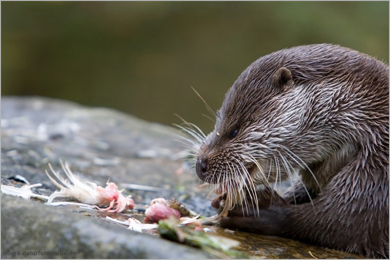
| Michael Feistel | profile | all galleries >> Activities >> OTTER TRAIL | tree view | thumbnails | slideshow |
 This gallery is dedicated to the beauty of my second native country, South Africa. Unfortunately it does not refer to the Otter Trail in America as many of you, dear visitors, would have subconsciously assigned it to.
Otter Trail Reservations:
Telephone: +27 12 426 5111
Fax: +27 12 343 0905
E-mail | General Info | Download Map | Tariffs
This gallery is dedicated to the beauty of my second native country, South Africa. Unfortunately it does not refer to the Otter Trail in America as many of you, dear visitors, would have subconsciously assigned it to.
Otter Trail Reservations:
Telephone: +27 12 426 5111
Fax: +27 12 343 0905
E-mail | General Info | Download Map | Tariffs
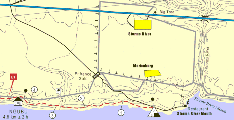
Start to Ngubu4,6km - 3 hours On the first day, the trial winding through thick undergrowth and raising up to a nice and refreshing stream pool, the hiker bridges a 4.6km distance between the start at the Storms River Rest Camp and the first overnight stop, the Ngubu hut. This leg is rather easy walking with little difficulties for some of you overcoming the rocky profile just before the tracks lead to a cave.
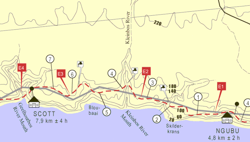
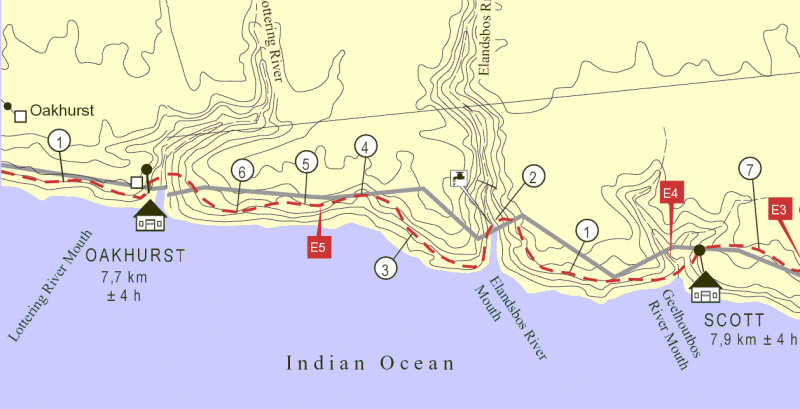
Ngubu to Scott7,9km - 6 hours On day two, hikers have to cover a distance of about 7.9 km (as the crow flies as figured out later) between Ngubu- and Scott hut. This leg is a bit more strenuous, since it cuts several times 50m altitude profile lines. Now it will proof if you have choosen the right shoes and the approriate weight for your backpack. In exchange for the effort, hikers get rewarded with a peacefull rest at Blou Baai, which is actually the highlight of the day after crossing the Kleinbos River. This leg of the trail is to be considered as the highlight of the whole trip with regards to beautiful scenery and diversity of the terrain walked through.