Dave Beedon
|
all galleries
>>
Places
>>
Utah
>>
Moab (environs)
>>
4922 Plateau
> Topography
previous
|
next
01-MAY-2015
Topography
view map
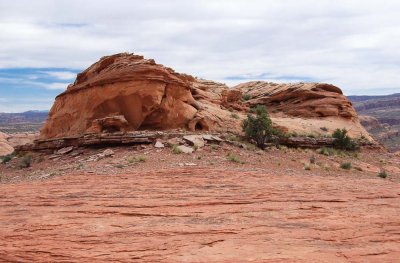
The tree is about ten feet (3 m) tall.
My vantage point was at the center of
this WikiMapia aerial view
and I was looking south.
Nikon D80
1/800s f/5.6 at 26.0mm iso200
full exif
other sizes:
small
medium
large
original
auto
previous
|
next
All images are copyright 1966 - 2023 by Dave Beedon (davebeedon AT comcast DOT net).
share
Type your message and click Add Comment
It is best to
login
or
register
first but you may post as a guest.
Enter an optional name and contact email address.
Name
Name
Email
help
private comment
Type your message and click Add Comment
It is best to
login
or
register
first but you may post as a guest.
Enter an optional name and contact email address.
Name
Name
Email
help
private comment