photo sharing and upload picture albums photo forums search pictures popular photos photography help login
Dave Beedon | all galleries >> Places >> Utah >> Moab (environs) >> Ida Gulch >> Ida Gulch---from Castle Valley Road to south ridge > Porcupine Rim
previous | next
10 Jul 2004 Dave Beedon

Porcupine Rim

Castle Valley, Utah

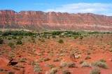
Looking southwest at Porcupine Rim. My car is barely visible as a small spot in the center of the image.


other sizes: small medium large auto
share
sam boyd12-Jun-2006 22:24
enjoyed visiting your galleries again, dave. currently i am shooting in the high arctic, at 75 degrees north, which too is a desert. best, p/s
Dave Beedon02-Jan-2006 06:20
Follow-up to my previous comment: possibly an "average" number of layers.
Dave Beedon09-Dec-2005 08:08
Dan, how many layers of meaning are in their songs?
Guest 09-Dec-2005 07:52
I have several cd's by the "Thick White Band"
Dave Beedon06-Dec-2005 22:11
John, the thick white band is probably White Rim sandstone, one of four strata that make up the Cutler group of sandstones. A geology book of the area lists the names of all the the rock strata found in the Moab area (more than are shown in this photo). They are, from top to bottom: GreenRiver, Wasatch, Mesa Verde, Mancos, Ferron, Mancos (another one), Dakota, Cedar Mountain, Morrison, Entrada, Navajo, Kayenta, Wingate, Chinle, Moenkopi, Cutler (composed of White Rim, Organ Rock, Cedar Mesa, and Lower Cutler), Upper Hermosa, and Paradox Salt (an intrusion of salt far below the surface).
John Cooper06-Dec-2005 10:27
Dave, Do you have any information regarding the strata in the rocks.
Especially the thick white band.
Type your message and click Add Comment
It is best to login or register first but you may post as a guest.
Enter an optional name and contact email address. Name
Name Email
help private comment