


|
|
|
|
|
|
| |
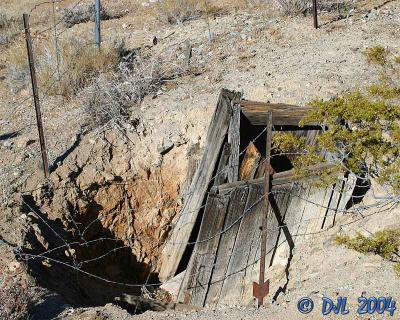
An unknown mine in the desert of the Ridgecrest Ca area. By unknown I mean it does not have a name on my topographical maps. I am sure someone knows what it was. This mine had a coule of vertical shafts, neither very deep. They look like they may have been deeper at one time, but have been filled in for some reason. Overhead imagery of the area of the mine can be found here http://terraserver.homeadvisor.msn.com/image.aspx?t=1&s=10&x=2180&y=19650&z=11&w=2
Copyright DJL 2003, 2004, 2005. All Rights Reserved. Copying and reproducing are strictly forbidden without explicit consent.
| comment | |