photo sharing and upload picture albums photo forums search pictures popular photos photography help login
Type your message and click Add Comment
It is best to login or register first but you may post as a guest.
Enter an optional name and contact email address. Name
Name Email
help private comment
Christopher Schardt | profile | all galleries >> Events >> Antlerville >> Maps tree view | thumbnails | slideshow

Maps

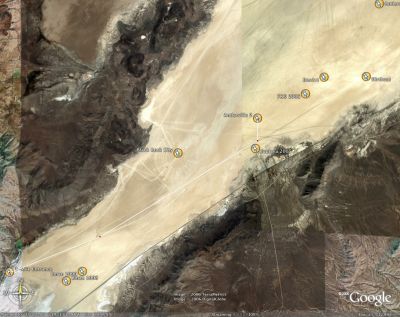
This J4, there was a huge lake in the middle of the playa. Going to Noman's normal location off the 12-mile road was impossible. Fortunately, modern technology along with the kind help of Danger Ranger, Bill Carson, Dodger, and Metric helped us find a new location off the 3-mile road that the RVs and newbies in our group would have no trouble reaching.
Aerial Photo 6/18 1.JPG
Aerial Photo 6/18 2.JPG
Satellite Photo 6/26.jpg
Satellite Photo 6/29.jpg
Map from Dodger.jpg
Map from Dodger.jpg
PathToAntlerville.jpg