photo sharing and upload picture albums photo forums search pictures popular photos photography help login
Christopher Schardt | profile | all galleries >> Events >> Antlerville >> Maps tree view | thumbnails | slideshow

Maps

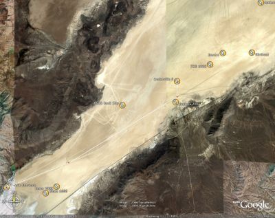
This J4, there was a huge lake in the middle of the playa. Going to Noman's normal location off the 12-mile road was impossible. Fortunately, modern technology along with the kind help of Danger Ranger, Bill Carson, Dodger, and Metric helped us find a new location off the 3-mile road that the RVs and newbies in our group would have no trouble reaching.
Aerial Photo 6/18 1.JPG
Aerial Photo 6/18 2.JPG
Satellite Photo 6/26.jpg
Satellite Photo 6/29.jpg
Map from Dodger.jpg
Map from Dodger.jpg
PathToAntlerville.jpg