photo sharing and upload picture albums photo forums search pictures popular photos photography help login
ravenoaks | profile | all galleries >> Galleries >> CAPE BRETON ISLAND-JEWEL OF THE NORTH ALANTIC COAST tree view | thumbnails | slideshow

CAPE BRETON ISLAND-JEWEL OF THE NORTH ALANTIC COAST

https://pbase.com/ravenoaks/cape_breton

All pictures and text on this site are copyrighted by Donald L Schultz


Voted #2 of the top world destinations by National Geographic Traveler’s Magazine, Cape Breton Island, Canada is breath taking. Out ranked only by the Norwegian Fjords and more popular to world travelers than places like South Island, New Zealand and the Hawaiian Islands, Cape Breton was high on our list of places to visit in Canada. Adding to its appeal was its day time average temperature of 75 F while the States sweltered in one of the hottest summers on record.

Sara and I have spent the past three weeks in this amazing place where the sea and sand have combined to create a land of indescribable beauty and fascinating history and culture. Normally we make a base camp at each new area by choosing an RV resort centrally located with such amenities as 50 amp electrical service, sewer hookup, cell phone and internet service, nearby food stores and gas stations and hopefully a pool. For Cape Breton we chose Cabot Trail Campgrounds located near the tiny community of Baddeck, Nova Scotia and on the shores of the famous Bras d’Or Lakes (fr. Arms of Gold) and we were not disappointed. We have a huge site nestled among fragrant pines overlooking the lake and a view of the western horizon. Oh those sunsets…………………and with Internet wireless service in the RV, one could hardly ask for more.

Visiting Cape Breton Island has several “must sees” including a Ceilidh (kay-lee), a puffin or whale watch, a lobster dinner, a tour of the Fortress of Louisbourg National Historic Site, a visit to the Sydney coal mines, eagle watching on the shores of Bras d’Ors, investigating the Acadian community of Cheticamp and the most popular, traveling world famous CabotTrail.

Conveniently divided into five scenic trips, a traveler to the island can be assured of a complete visit by just following the signs. Sara and I did all five trails. It is one of the luxuries of Rving, time. Let us share them with you. You can find each trail on the map which is the first picture of this gallery.

THE CEILIDH TRAIL

The Ceilidh Trail runs from the city of Port Hastings where one enters the island and follows the western coast north to the Acadian town of Cheticamp. Known by the locals as the Sunset Side of the Island, it is a place for sailing, kayaking, and scuba diving and unforgettable sunsets. This region has a decidedly Scottish flair and is famous the many Ceilidhs held nightly. A Ceilidh is a night of music, step dancing and story telling. We have attended several and they are the best show in town. The trail is dotted with many schools that teach the Gaelic language, Scottish dancing and fiddle playing. Probably the most famous is the Ceilidh Trail School of Music located near Inverness, but there are countless others that dot the trail specializing in step dancing, fiddle playing, piping, guitar and piano. No doubt the popularity of the River Dance phenomenon has added to the interest in these school. And they are not cheap. $500 to a $1000 buys you a week of lessons. And that does not include food, lodging or transportation.

While on the Ceilidh Trail a stop at a Scottish resturant allows you to indulge in a traditional codfish supper of salt cod with potatoes, curds, bacon and green tomato chow, topped off with fresh tea biscuits, oatcakes and ginger snaps.

No trip up the Ceilidh Trail would be complete without a visit to the world famous Glendora Distillery, home of the only single malt whiskey (it is really scotch but can’t be called that because it is not made in Scotland) made in all of Canada. Nestled in a valley among towering hills and along a babbling brook (it actually babbled) the gleaming white walls of the distillery and adjacent inn were striking. Single malt means that the only ingredients are barley, yeast and water and the final result is golden amber in color, with a nose of heather, butterscotch, ginger and honey, and a taste of cream, almond, with a flow of wood and carmel. Sounds great until you realize that the cheapest bottle for this 10 year old hooch is $79 a bottle and well over a $100 for the really good stuff. Too rich for our blood, but we did enjoy the tour and lovely grounds. The Ceilidh Trail is a must for the music lover and lover of good scotch if one can afford it.

THE CABOT TRAIL

The Cabot Trail is by far the most popular of all the trails on Cape Breton Island and one visit would tell you why. Named after the Italian explorer Jon Cabot, this 185 mile loop surrounds Cape Breton Highland National Park and has been described as one of the world’s most beautiful scenic drives. It begins at Cheticamp, rising to the most northern point on the Island and the highest in the park. The trail then crosses the park to the eastern shore thru Ingonish, a whale watching center and back to Baddeck on the north shore of the Bras d’Ors lake system where we have made our base camp. For the really adventurous, a side trip to the most northern point of the Island, Meat Cove, is a must.

If you have ever driven US Highway 1 up the western coast of California, north of LA , you have some idea of the beauty of this area. Sara and I had the joy of driving the trail in our little white convertible. The road often appears destined to be swallowed up by the ocean below. The sky above and the ocean below combine into a continuous aqua blue backdrop only to suddenly be divided by pure white breakers as they crash against the rock shores. Traveling the trail one sees every shade of green, broken often by waterfalls that are just off the roadway, with some visible only by an inland hike. Words simply don’t do justice to the experience.

We, of course, just had to visit Meat Cove. Its name refers to a practice of early inhabitants to drive caribou off the shear cliff into the ocean below to be harvested by kayaks. Meat Cove boasts a tiny campground for those brave souls willing to haul their RV or tents to the end of a twisting, gravel road which crosses several rickety, wooden bridges. It was not even considered by us at 22,000 lbs and over 50 ft, truck and RV combined. There are tables at the end overlooking the sea for $2 a picnic, a tiny restaurant that was mysteriously closed at noon and would not open for an hour, an ice cream shop and of all things, an Internet Café with a high speed connection. Of all the places to get on line. We were incredulous and sent several e-mails all free of charge with some of the best ice cream in the universe dripping down our arms, much to the chagrin of the attendant. We made a generous donation in the box in the bathroom for toilet paper and cleaning supplies as suggested and in another on the way out.

The Cabot Trail Loop winds its way down the eastern side of the Island with more breath taking views as it dips in and out of the park, through the towns of Dingwall, Ingonish and Wreck Cove, ending with a short ferry ride back to the Trans Canada Highway 105 to Baddeck, location of our base camp. This is the one tour every visitor can’t miss or why go to the Island.

THE MARCONI TRAIL

This is shortest of all the trails on Cape Breton Island at 37 miles, but it contains some of richest history of the area. Beginning in Sydney, the largest city on the island at 26,000, the Marconi Trail travels west to the historic town of Louisbourg, then north along the cape through Glace Bay, Reserve Mines and back to Sidney.

Sidney was established in 1785 and has a rich and varied history. Near by Table Head was the site where inventor Guglielmo Marconi sent the first trans-Atlantic wireless message. The Sidney Coal Mine Museum includes a guided tour of the Ocean Deeps Colliery, an underground coal mine. Retired coal miners accompany you on this 20 minute excursion into a 1932 "room & pillar" mine, where you will experience first hand what it was like to extract coal by the sweat of your brow. Sara and I took a rain check on the mine tour as Sara’s naturally curly hair was deemed “incompatible” with a “cave” as she described it, and wearing the wig was not an option due to an unwillingness to “contaminate” her hair piece (used to prevent “convertible frizz”) with coal dust. The mines closed at the turn of the century and the Canadian Government decided to spend over 25 million dollars and put the thousands of displaced coal miners to work restoring the famous Fortress of Louisbourg on the south eastern coast of the island. Next to Cape Breton National Park, no visit to the island is complete without a day long tour of this incredible fort. From the moment you enter the gates until you take your leave, you are transported back to the 1700’s with hundreds of occupants all in full costume and character ready to make you “feel” what it was like to live at Forteresse de Louisbourg. Construction of the Fortress began in 1719 and was only finished on the eve of the first British siege in 1745.

The cost of the construction was so exorbitant for the time that King Louis XV was reported to muse to his minister that one day he should be able to see Louisbourg rising over the western horizon from his palace at Versailles. The fortress changed hands between the French and the British once in 1745 and again in 1785 after which it was returned to the French by treaty in 1748.
The British did, however, steal the famous Louisbourg Cross that hung in the fortress chapel. Found later at Harvard University Archives in Boston, the cross is now on permanent loan to the fort. Following the surrender of Louisbourg, British forces and engineers set about methodically destroying the fortress with explosives, ensuring the fortress could not return to French possession a second time in the eventual peace treaty. By 1760 the entire fortress was left as mounds of rubble.

After a short bus ride to the site, you first enter a typical cod fishermen’s house outside the walls. In front of a roaring fire, you are greeted by the residents in costume and in character explaining the importance of cod fishing to the success of the fortress and the reason for its existence. Cod ruled and we saw a fish boat, nets, hand lines, drying rack and Sara’s favorite, the sod roof with wild flowers growing like a colorful veil. Upon entering the fortress gate, a stern guard asks for the password and warns not to fraternize with the British prisoners or we too will end up in the brig. The password posed the biggest problem but we tried “MasterCard” and it worked, much to the snickering of the guard and crowds gathered. At the entrance there were the guard’s quarters with bunks, gun racks and two different toilets. One was in a hole in the fortress wall and the other in a quaint little room over hanging the sea wall. Don tried both seats and preferred the “flush “ model due to its lack of odor, but was secretly concerned when looking down the hole to see the sea below. It kind of made a meal of fresh cod fish less appealing.

The fortress boasts over 50 points of interest including barracks, power magazines, bakery, forge, tavern, period hotel and inn, stables, chapel, Governor and officer’s quarters, gardens, a typical home for the nobility and the commoners and even a lime kiln. The fortress walls and ramparts boasted 18, 24 and 36 pound cannons, all original. Each area had “locals” who loved to strike up a conversation and would answer questions.

We saw a lace maker, witnessed a musket and cannon firing demonstration, purchased local bread, went to confession at the chapel and experienced the punishment horse outside the King’s Bastion, the largest structure in the compound. In the basement of the Bastions were displays that showed the pain staking attention to detail and authenticity that was given to the reconstruction. Original artifacts recovered from the site were cataloged, photographed and measured to reproduce every aspect of the reconstruction. Many of the original items are present in each of the exhibits. Countless hours were spent in France documenting the original printed plans of the complex.

After over 5 hours we left the Fortress of Louisbourg feeling we had for a brief time been transported to 17 the century New France. It is by far the highlight of the Marconi Trail and not to be missed.

THE BRAS D’ORS SCENIC LAKE DRIVE

Located in the south center area of Cape Breton Island is a chain of large lakes, the Bras d’Ors (bra doors) or Arms of Gold. Sara and I camped on one of the many inlets for our three week stay on the Island with a clear view of the water from our back picture window The Bras d’Ors Lake Scenic Drive circles the lake along the shoreline with views of farms, villages, woodlands and fields. Most visitors to the Bras d’Ors are surprised to find that the water contains salt but at a lower level than the surrounding sea. The lakes have several outlets to the sea and have been a safe haven for sailors for centuries.

The Bras d’Ors contains oysters, herring, mackerel, cod and flounder and lobster. However, in 1999 the lobster population suddenly plummeted for some unknown reason and has never fully recovered. The lobster fishery in the surround ocean remains strong. The region is a major nesting area for the bald eagle and we saw several of these majestic birds soaring over the water. A distinctive white speck in the vivid green backdrop that lines the lake was a telltale sign of an eagle perched over the lake. Sara and I would get out the spotting scope and marvel at Haliaeetus leucocephalus (halo-sea, aeetos-eagle, leukos, white head) with its hooked beak and yellow eye as it would glare back at us as if to say,” Not one step closer.” We spent hours watching and were able to find nests, immature eagles and watch those famous plunge dives for fish.

The Bras d’Ors are the ancient homeland of the Mi’Kmag aboriginal peoples (Canadian term for Indians or what we call Native Americans) whose language and culture is still evident in four First Nation Reserves (what we call reservations) on its shores. The traditional clothing of these proud people appears more to be South American with colorful vests, skirts and capes. Present day Reserves at Whycocomagh and St. Peters unfortunately show the signs of poverty and despair with tax free cigarette stands and drug abuse centers so common to their counterparts in the US. Still any visit to Cape Breton Island would not be complete without exploring the winding shores of the Bras d’Ors Lake.

THE FLEUR DE LIS TRAIL

The Fleur de lis Trail “The Road to the Isles” is the last of the five trails Sara and I explored during our visit to Cape Breton Island. It is 164 miles long and begins at the Canso Causeway which is the deepest causeway in the world. This tiny ribbon of land physically connects the Island with the mainland of Nova Scotia or New Scotland. Over 10 million tons of rocks were dumped into the inlet to create this bridge. The Canso Causeway is over 700 ft wide at its base in almost 1000 ft of water, and only 70 ft wide at the top. The causeway is wide enough for two lanes of traffic and a train road bed and was completed in 1995 at a cost of over 22 million dollars. As we crept across its S shaped roadway with the truck and RV, Sara and I secretly hoped it wouldn’t collapse. It didn’t.

The Fleur de lis Trail takes you along the southern coast, then north on the eastern edge of the island. The coastline is picturesque with many secluded inlets and coves and is the home of some of the oldest Acadian communities in the area. Arichat, Petit de Grat, and D’Esmusse are all worth a visit for their authentic Acadian food, music and culture. Arichat (pop.886) has strong business ties with Jersey in the Channel Islands off England. At the LeNoir Forge Museum we watched horse shoes made at the black smith shop. Petit-de-Grat (pop.454) is probably the most picturesque fishing village on the island with weather beaten shacks, lobster traps and nets. It is truly a photographer’s paradise and the site of the Le Festival Acadien de Petit-de-Grat held each August. The Fleur De Lis Trail explores some of the oldest settlements on Cape Breton Island and is a real must for the history buff or photographer.

Before leaving the Cape Breton Island, Sara and I had to see the famous puffins, often referred to as “the clowns of the sea.” Now for a non birdwatcher, the thought of spending over $100 just to see one little bird must seem ridiculous, but keep in mind that on the boat ride we met a math professor and his wife who had flown in from Austin ,Texas expressly for the purpose of viewing one of these ten inch clowns of the bird world. In fact, while on the puffin tour, we were told that an African Reef Crane had been blown off course and was spotted near Sidney. Birders from as far away as Europe and Australia reportly had made the trip to Cape Briton to see this rare bird. Crazy, Huh????.The puffin tour was led by the Puffin Lady, Donelda MacAskill, who with her husband were lobster fishermen for two months and tour guides the rest of the year. The trip out to the Sea Islands, where the puffins nest, took about 40 minutes during which bald eagles would swoop over the boat to retrieve fish tossed in the air by the captain. Donelda was a wonderful tour guide and knew her sea life with the confidence of a seasoned naturalist.

Puffins are only about 10 inches tall and weigh about the same as a can of soda, she explained. Their beaks are only colorful during the mating season. The puffins mate in a small cave in the rocks and only one egg is laid. A toilet or “guano pit” is constructed in the first bend of the burrow and used by the baby puffin so as not to soil its feathers. The toilet is moved closer to the entrance as the baby puffin matures, and when it leaves the nest, it follows its parents to the open sea where it will remain for up to three years before returning to the same island. The puffins’ greatest natural enemy is the giant black backed gull that will catch them in mid air and rip them to shreds for a meal, an event we sadly witnessed during our trip. We also saw kittiwakes, razor bills, great and crested cormorants and the black guillemot, just to name a few.
Sara’s bird list swelled to over 110 different types as did her pride as a bird watcher.

Regardless of whether you are at Cape Breton to hike, bike, bird watch or explore the five trails of the Island, a visit to this captivating part of Canada is well worth the time and effort.


previous pagepages 1 2 3 4 5 6 7 ALL next page
THE TRAILS OF CAPE BRETON ISLAND MAP
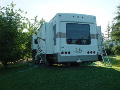
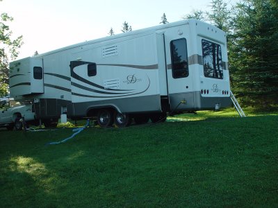
WE HAVE A HUGE SITE OVERLOOKING THE BRAS d'ORS LAKE CHAIN
OUR PICTURE WINDOW FACED THE LAKE
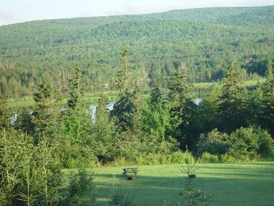
WHAT A WONDERFUL VIEW
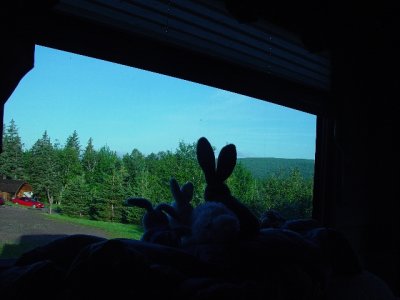
SARA'S RABBITS WAIT FOR THE SUNSET
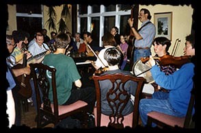
THIS IS ONE OF THE MANY MUSIC SCHOOLS ON THE CEILIDH TRAIL
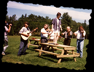
A QUICK LESSON IN STEP DANCING ON A PICNIC TABLE
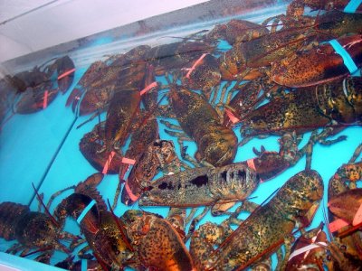
LOBSTERS CAN BE HAD AT MOST COASTAL TOWNS BUT AT $10 A LBS IT IS STILL AN EXPENSIVE MEAL
THE ACADIANS HAVE A STRANGE WAY OF SPELLING LAUNDROMAT
THERE ARE MANY CHURCHES ON THE CABOT TRAIL
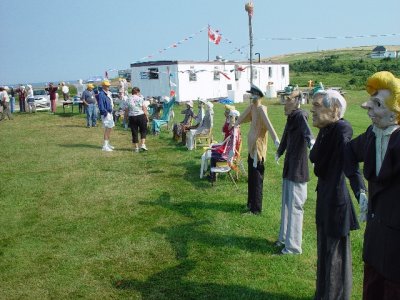
THIS IS THE FAMOUS ACADIAN SCARECROW PARK OUTSIDE OF CHETICAMP AND IT IS FREE
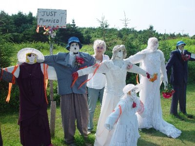
SARA WAS THE MOTHER OF THE BRIDE FINALLY
previous pagepages 1 2 3 4 5 6 7 ALL next page