


|
|
|
|
|
|
| |
| 18-FEB-2007 | |
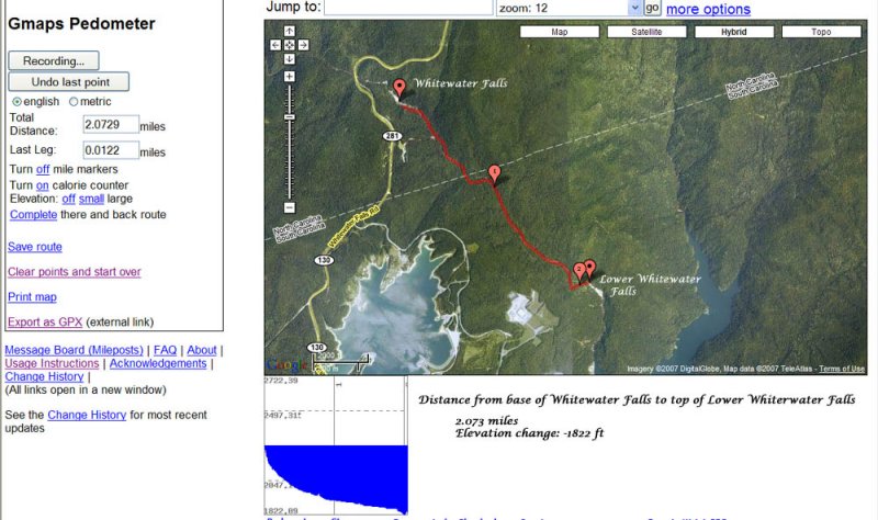
Using Gmaps Pedometer I traced the distance from
the base of Whitewater Falls to the top of Lower
Whitewater Falls in SC. The elevation drop was
calculated to be over 1800 ft in just over 2 miles.
http://www.gmap-pedometer.com/
Unless otherwise noted all images are Copyrighted: © 2009 Kelvin Taylor. Most images are available for license.
| comment | |