


|
|
|
|
|
|
| John Scurlock | profile | all galleries >> Galleries >> The Canadian Rockies | tree view | thumbnails | slideshow | map |

THE IMAGES PRESENTED HERE HAVE BEEN DOWN-SIZED FROM THE ORIGINAL DIGITAL FILES.
Full-resolution 8x10, 11x14, and 13x19 color prints are available by request.
____________________________________________________________________________________________________
All Images Copyright 2004/2020, John Scurlock, Photographer & Pilot.
| previous page | pages 1 2 3 4 5 6 7 8 9 10 11 12 ALL | next page |
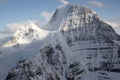
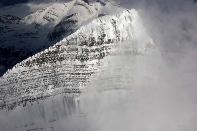
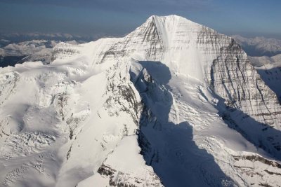
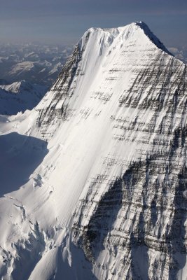
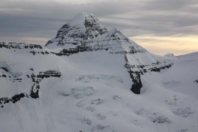
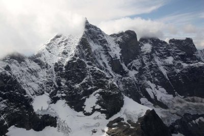
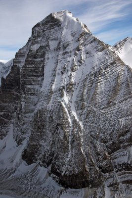
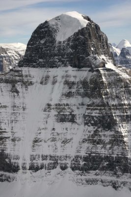
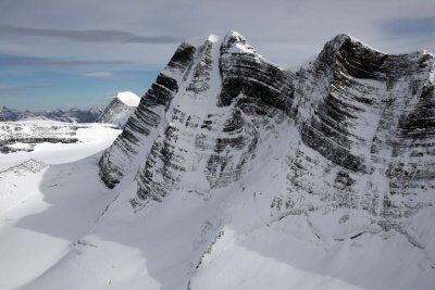
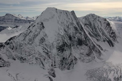
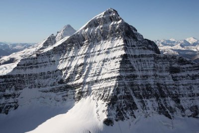
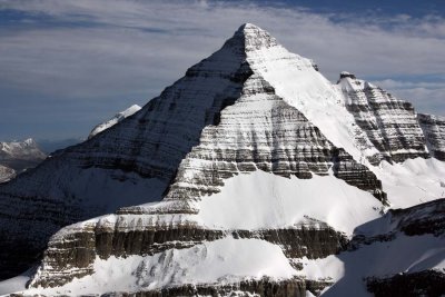
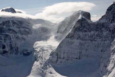
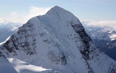
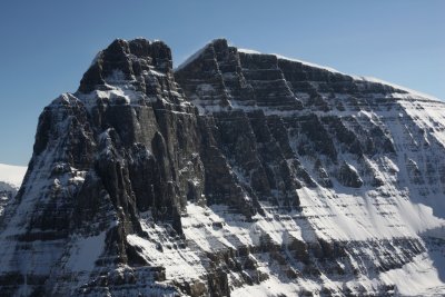
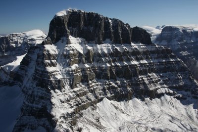
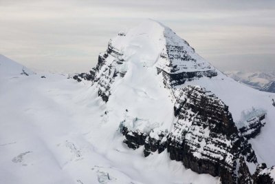
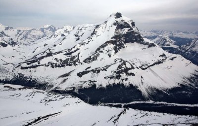
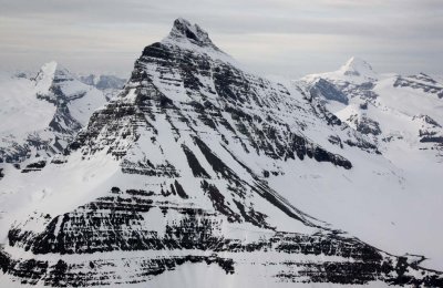
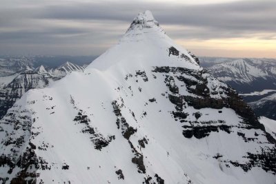
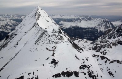
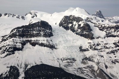
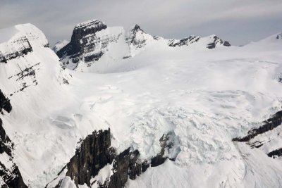
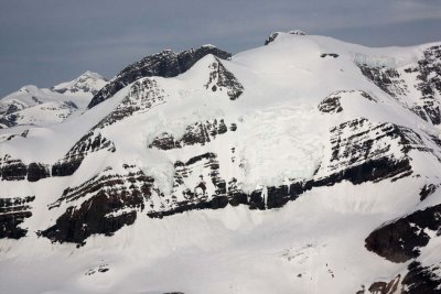
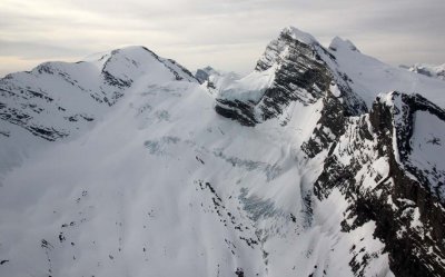
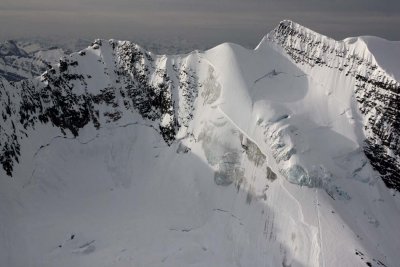
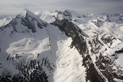
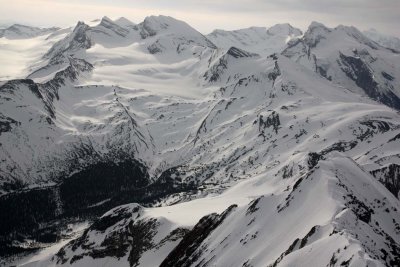
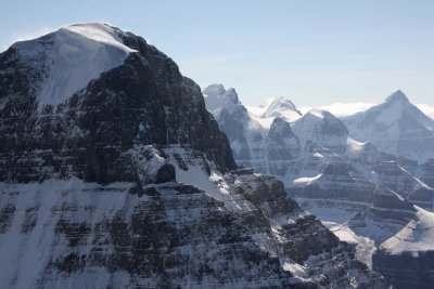
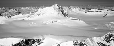
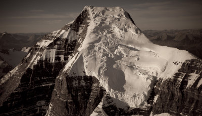
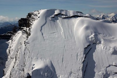
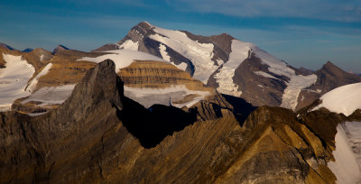
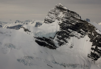
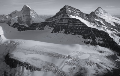
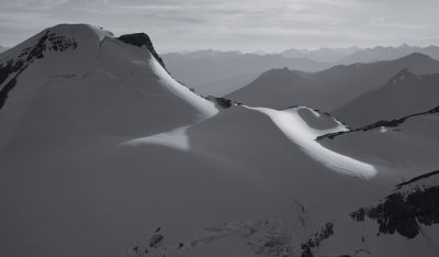
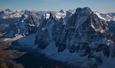
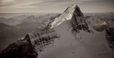
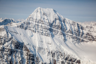
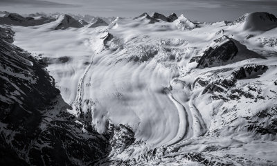
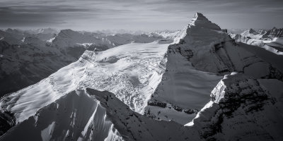
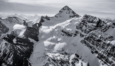
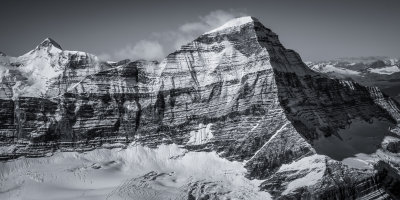
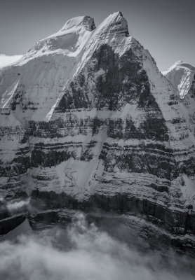
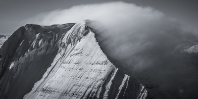
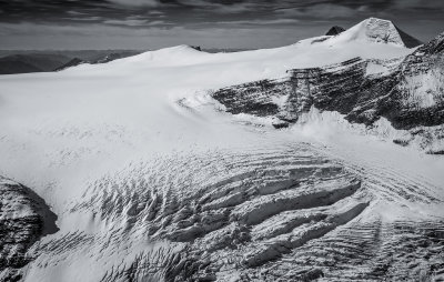
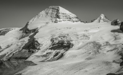
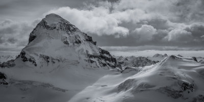
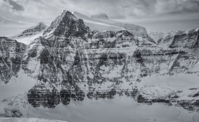
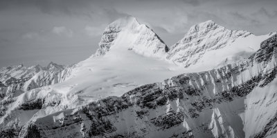
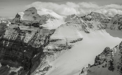
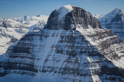
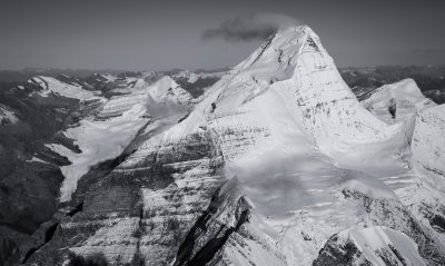
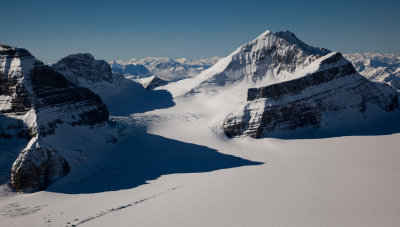
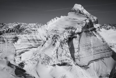
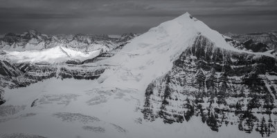
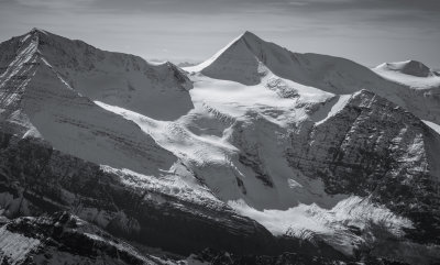
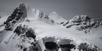
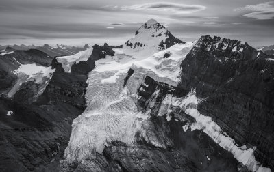
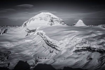
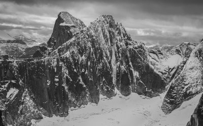
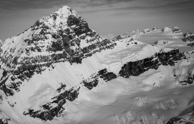
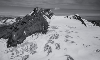
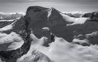
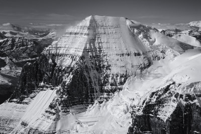
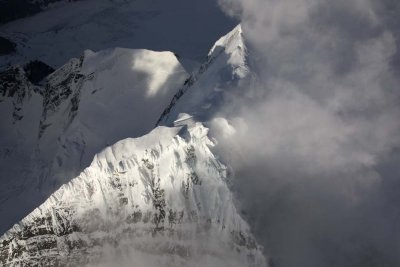 Robson: Summit Detail, View NE (Robson051508-_702.jpg) |
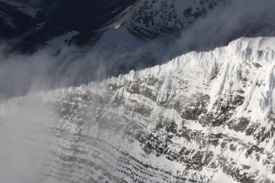
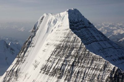
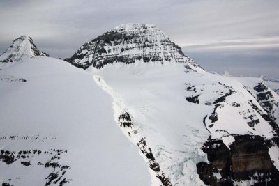
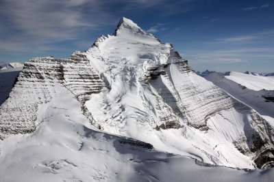
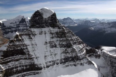
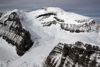
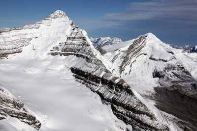
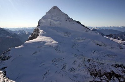
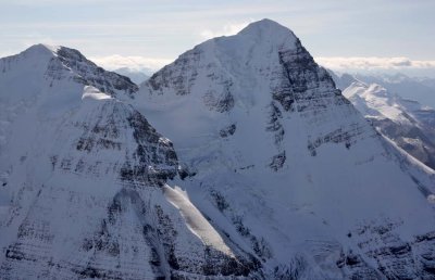
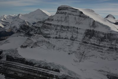
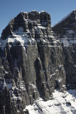
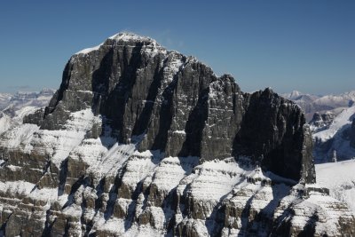
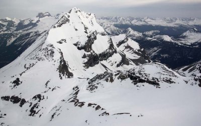
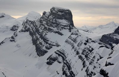
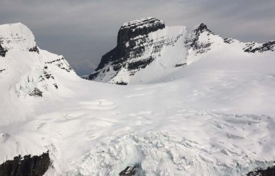
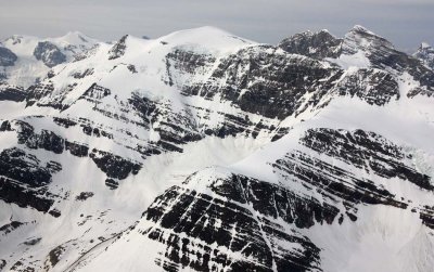
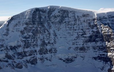
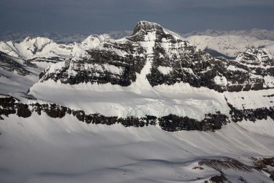
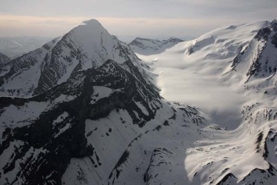
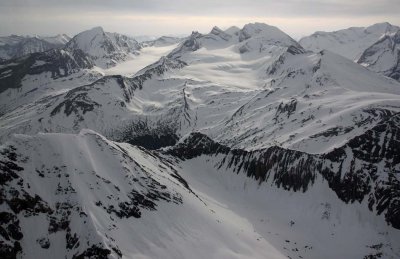
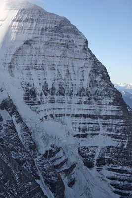
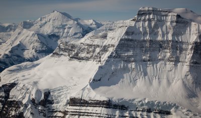
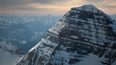
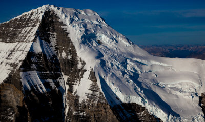
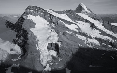
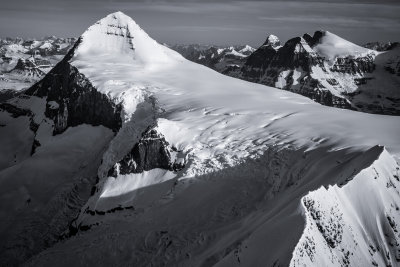
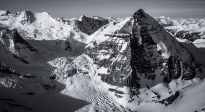
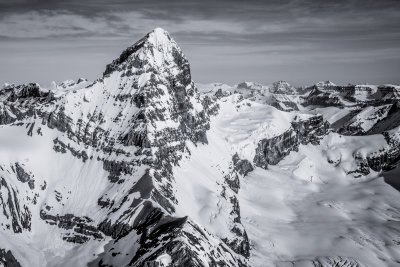
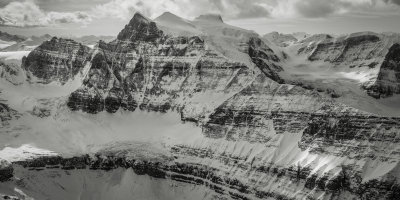
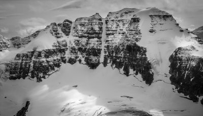
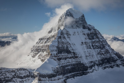
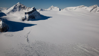
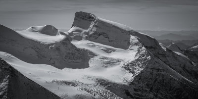
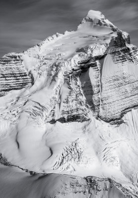
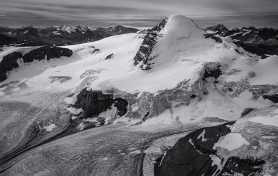
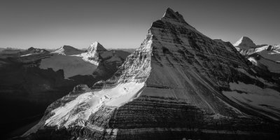
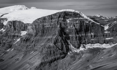
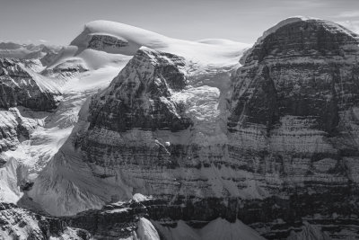
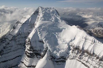 Robson Upper S/SE Face (Robson051508-_068.jpg) |
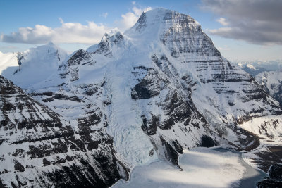
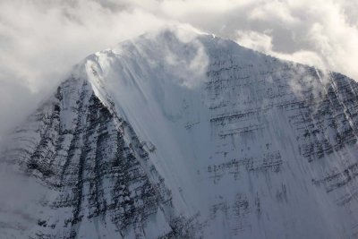
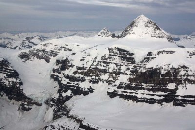
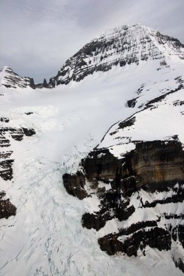
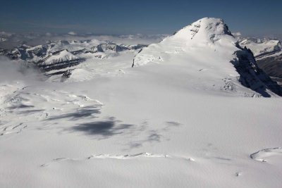
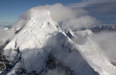
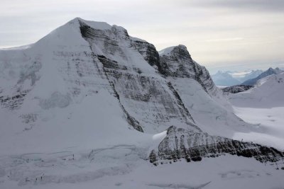
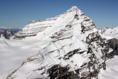
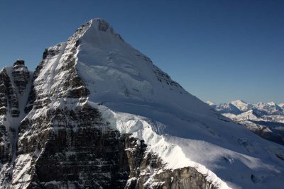
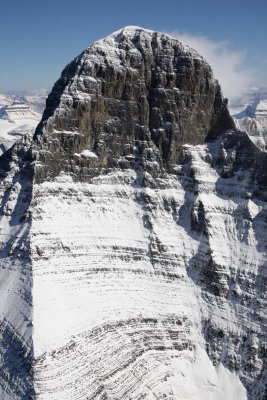
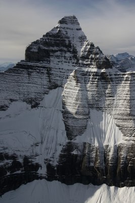
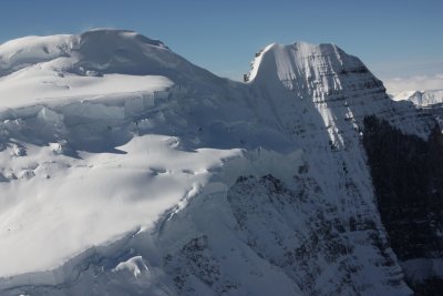
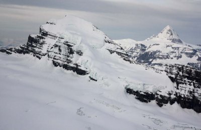
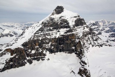
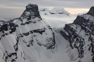
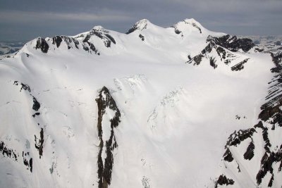
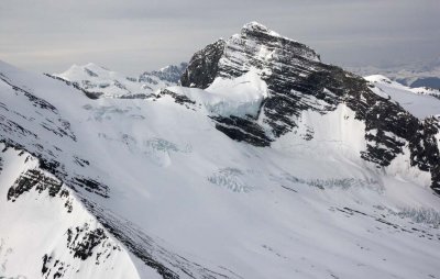
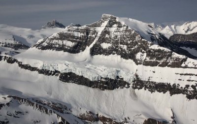
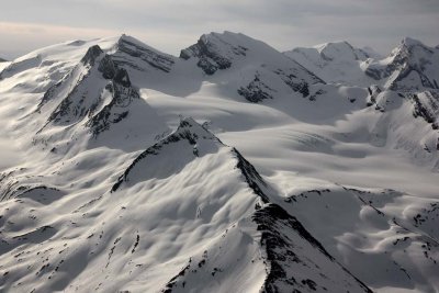
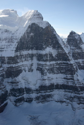
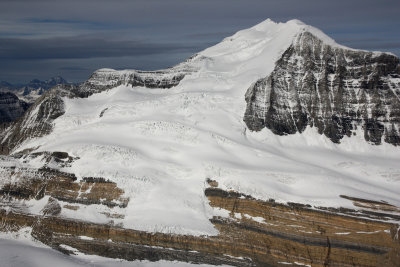
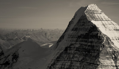
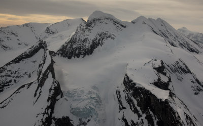
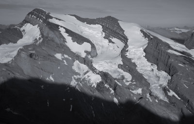
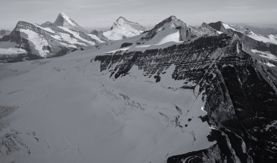
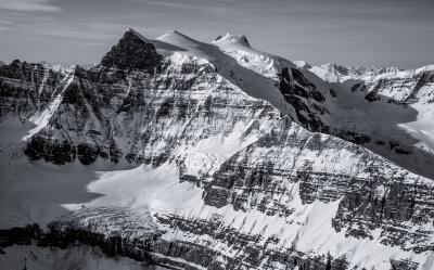
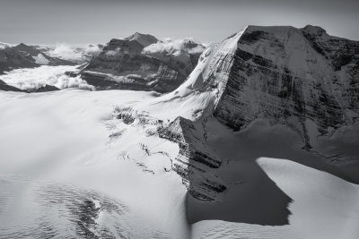
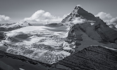
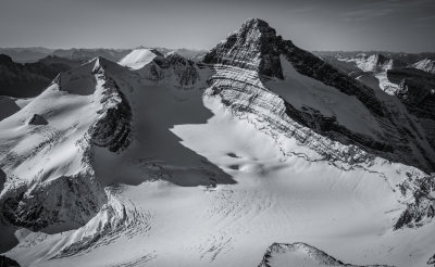
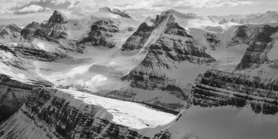
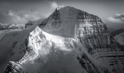
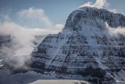
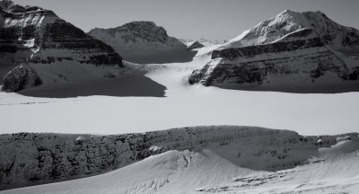
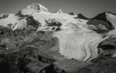
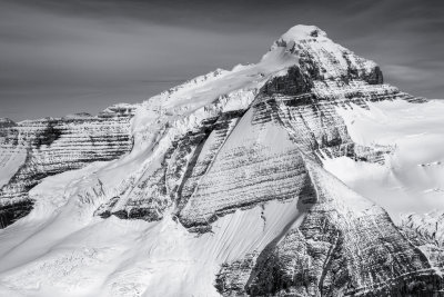
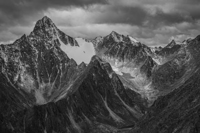
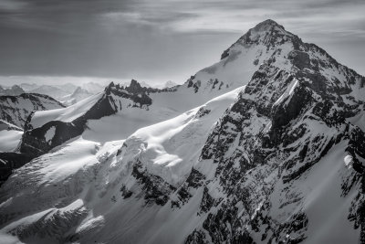
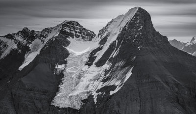
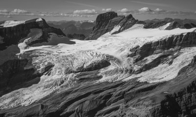
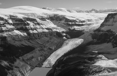
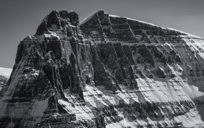
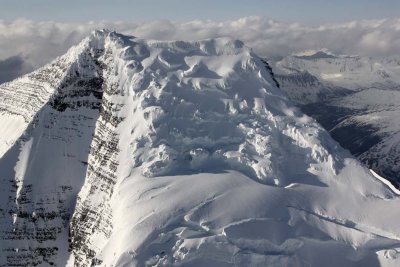 Robson Upper SE/Summit Glacier, View N (Robson051508-_140.jpg) |
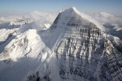
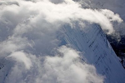
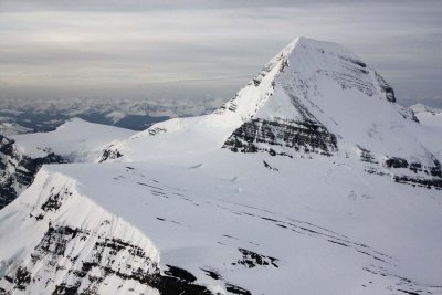
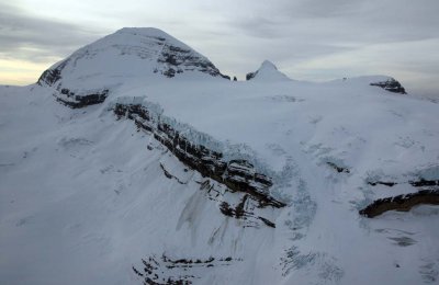
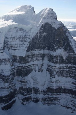
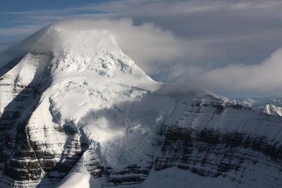
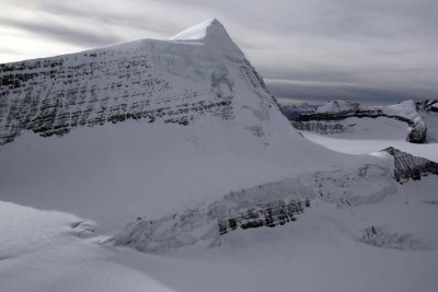
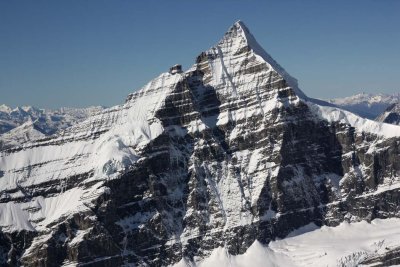
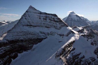
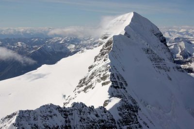
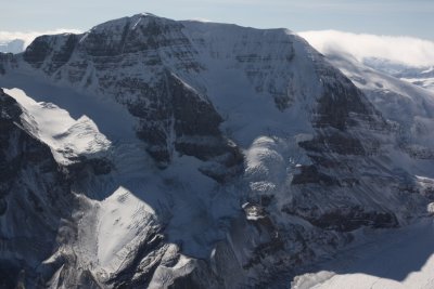
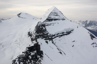
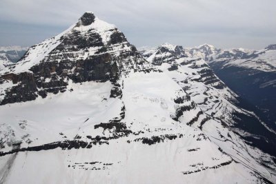
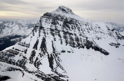
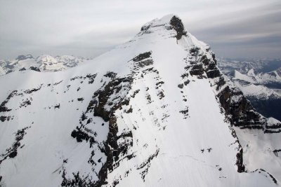
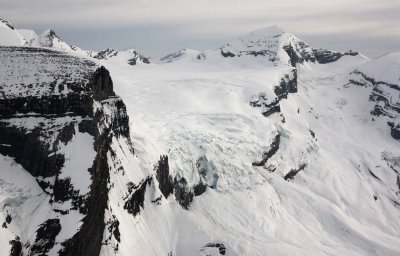
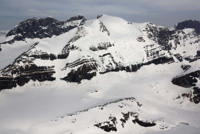
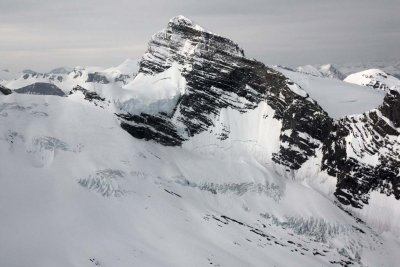
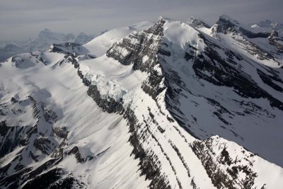
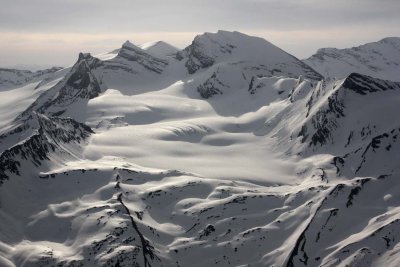
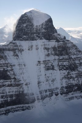
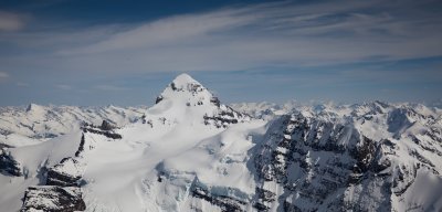
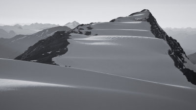
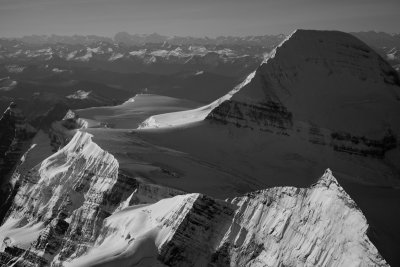
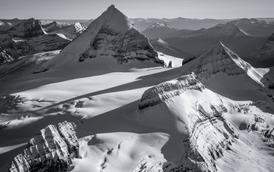
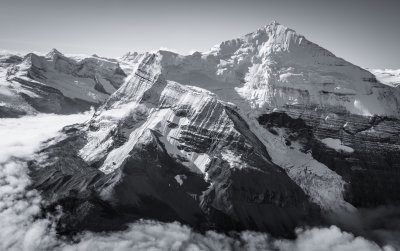
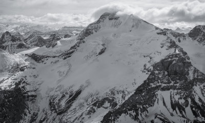
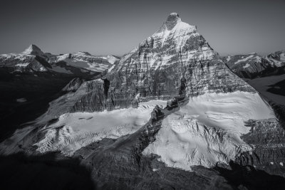
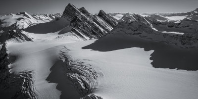
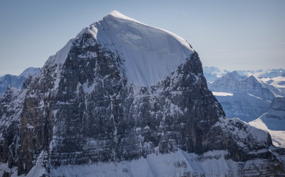
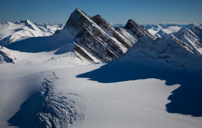
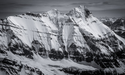
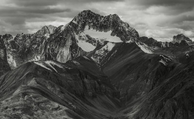
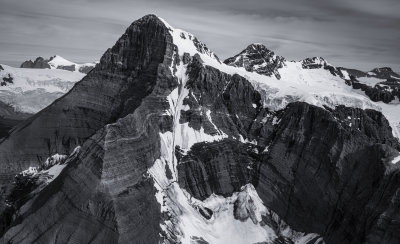
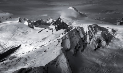
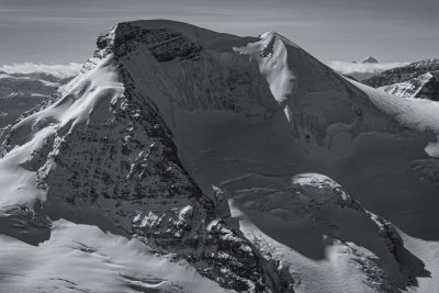
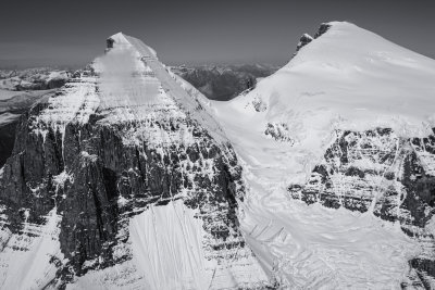
 Robson, View NW (Robson051508-_168.jpg) |
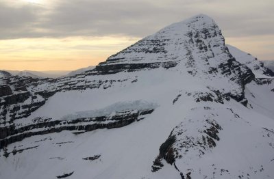
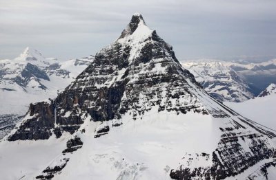
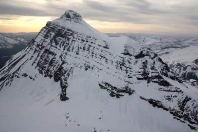
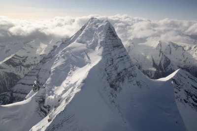 Robson, View NW (Robson051508-_075.jpg) |
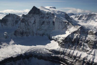
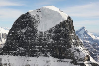
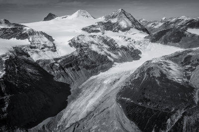
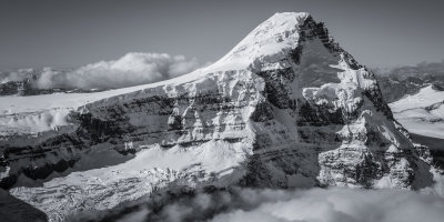
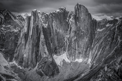
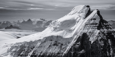
 Robson, Emperor Face (Robson051508-_360.jpg) |
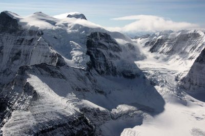
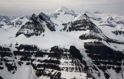
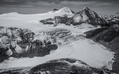
 Robson, N Face (Center) & Upper Emperor Face (Robson051508-_257.jpg) |
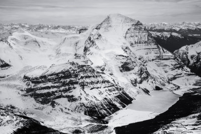
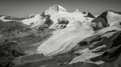
 Robson & Berg Lake (Robson051508-_421.jpg) |
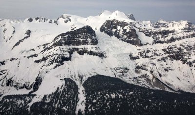
 Berg Glacier & Berg Lake (Robson051508-_404.jpg) |
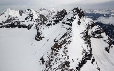
 Robson, Upper SW Face & Emperor Ridge (Robson051508-_616.jpg) |
 Robson, Emperor Ridge & Gargoyle Detail (Robson051508-_815.jpg) |
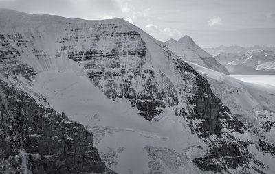
 Robson, Upper N Face (Robson051508-_674.jpg) |
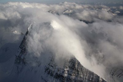
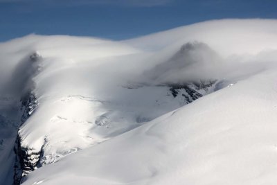
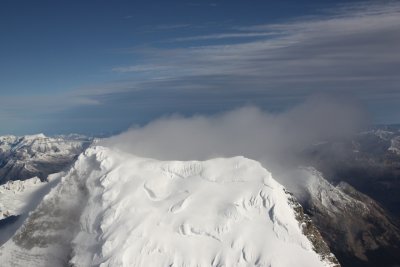
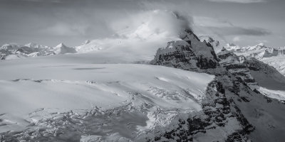
 Robson, Upper N Face & Wind-Driven Cloud (Robson051508-_714.jpg) |
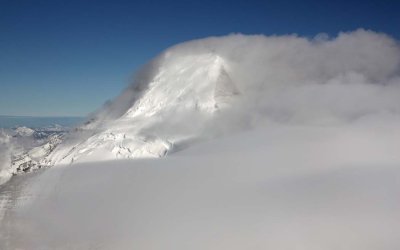
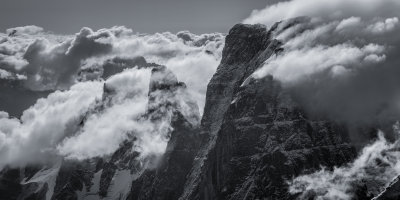
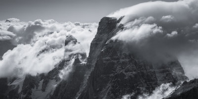
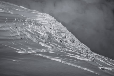
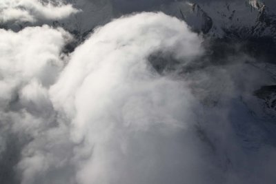 Robson: Wind-Driven Summit Clouds (Robson051508-_781.jpg) |
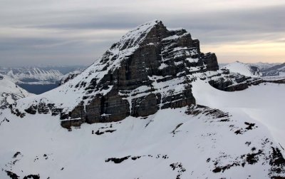
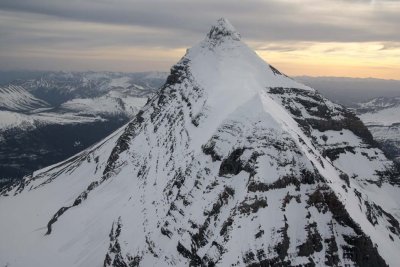
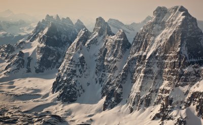
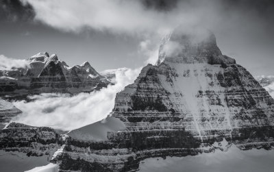
 Robson, View SE (Robson051508-_745.jpg) |
 Robson, View S/SW (Robson051608-_070.jpg) |
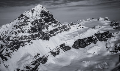
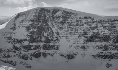
 Robson N Face (Robson051608-_086.jpg) |
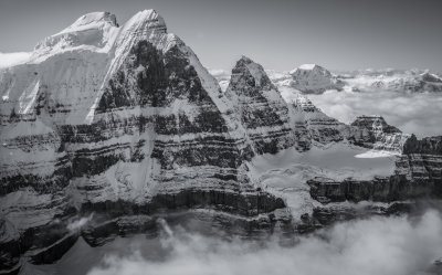
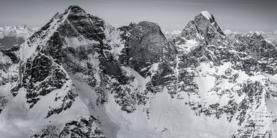
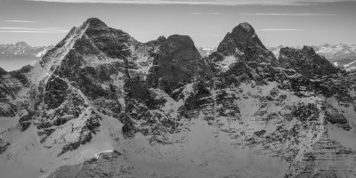
 Robson N (Center) & Emperor Faces (R) (Robson051608-_115.jpg) |
 Robson, Upper Emperor Ridge (Robson051608-_124.jpg) |
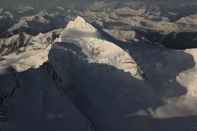
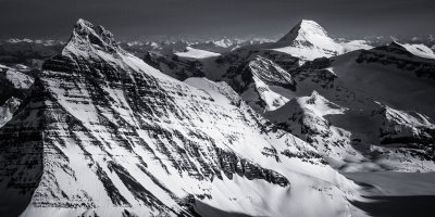
 Sir Alexander, View SW (SirAlex051708-_016.jpg) |
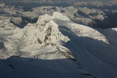
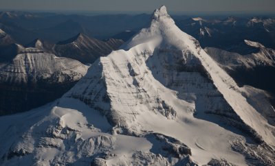
 Sir Alexander, N/NW Face (SirAlex051708-_038.jpg) |
 Sir Alexander, SW Face (SirAlex051708-_112.jpg) |
 Sir Alexander, S/SE Face (SirAlex051708-_127.jpg) |
 Sir Alexander, S/SE Face (SirAlex051708-_139.jpg) |
 Sir Alexander, NW Face (SirAlex051708-_234.jpg) |
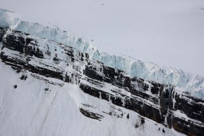 Sir Alexander, Ice Cliff Detail (SirAlex051708-_194.jpg) |
 Stormy Weather At Lloyd George Icefield (LdGeo051608-_47adj.jpg) |
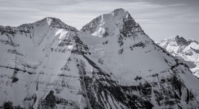
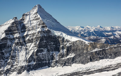
 Resplendent, N Face (Robson051608-_031.jpg) |
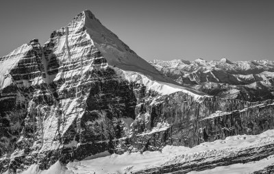
 Resplendent E (L) & N Faces (Robson051608-_011.jpg) |
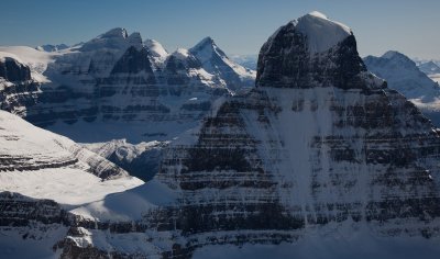
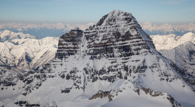
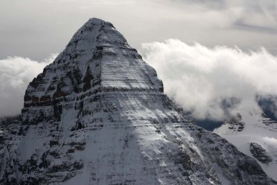 Assiniboine, Upper E (L) & N Faces (Assiniboine090808-_053.jpg) |
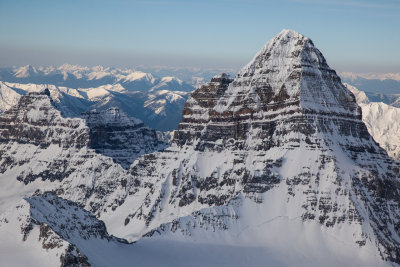
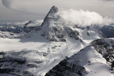 Assiniboine N Face (Assiniboine090808-_134.jpg) |
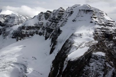
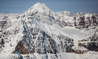
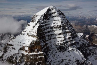 Assiniboine, Upper S/SE Face (Assiniboine090808-_026.jpg) |
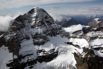 Assiniboine, E/SE Face (Assiniboine090808-_101.jpg) |
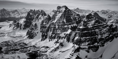
 The Goodsirs, View NW (GoodsirGp_48.jpg) |
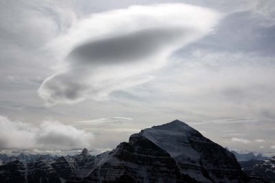 Temple, Upper N Face & Lenticular Cloud (TenPkTemple090808-_32.jpg) |
 Quadra, Upper N Face (TenPkTemple090808-_68.jpg) |
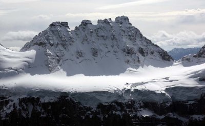
 Stanley, NE & N Faces (Stanley090808-_68.jpg) |
 ClemenceauIcefld-1-092808-_359.jpg |
 ClemenceauIcefld-1-092808-_350.jpg |
 ClemenceauIcefld-1-092808-_353.jpg |
 ClemenceauIcefld-1-092808-_348.jpg |
 Tusk Mountain N Face (ClemenceauIcefld-1-092808-_143.jpg) |
 Tsar, NW Face (ClemenceauIcefld-1-092808-_288.jpg) |
 Columbia, View NW (ColumbiaIcefld-1-092808-_126.jpg) |
 N Twin (L) & Twins Tower, N Face (ColumbiaIcefld-1-092808-_316.jpg) |
 Alberta, N Face (ColumbIcefld-2-092808-_02.jpg) |
 Alberta, N Face (ColumbIcefld-2-092808-_17.jpg) |
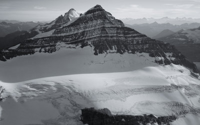
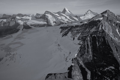
 Robson, Upper SE Face (Robson092908-_28.jpg) |
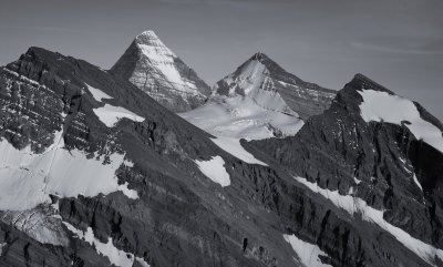
 Robson, Upper S/SE Face (Robson092908-_45.jpg) |
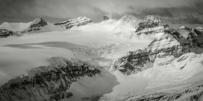
 Hooker, N Face (HookerIcefld-1-092808-_104.jpg) |
 Hooker, S Face (HookerIcefld-1-092808-_119.jpg) |
 Hooker, NE (L) & N Faces (HookerIcefld-1-092808-_142.jpg) |
 Hooker NE Face (HookerIcefld-1-092808-_137.jpg) |
 Serenity, N Face (HookerIcefld-1-092808-_059.jpg) |
 Whitehorn (L) & Phillips, S Faces (Robson2-092908-_316.jpg) |
 Whitehorn, S (L) & E Faces (Robson2-092908-_331.jpg) |
 Whitehorn E Face (Robson2-092908-_352.jpg) |
 Phillips, NE/N Faces (Robson2-092908-_363.jpg) |
 Whitehorn, N Face (Robson2-092908-_433.jpg) |
 Whitehorn, Upper N Face (Robson2-092908-_412.jpg) |
 Whitehorn, W Face (Robson2-092908-_439.jpg) |
 Whitehorn, View NE (Robson2-092908-_457.jpg) |
 Lyell, View NE (Lyell-Alexandra-092808-_019.jpg) |
 Lyell, N Face (Lyell-Alexandra-092808-_076.jpg) |
 Lyell (L) & Alexandra Glacier (Lyell-Alexandra-092808-_083.jpg) |
 Lyell (L) & Farbus, View S (Lyell-Alexandra-092808-_104.jpg) |
 Bryce, N Face (Bryce-092808-_041.jpg) |
 Bryce, W Face (Bryce-092808-_056.jpg) |
 Bryce, View SW Along NE Ridge (Bryce-092808-_105.jpg) |
 Bryce, Upper N Face (Bryce-092808-_117.jpg) |
 Bras Croche, N Face (ClemenceauIcefld-1-092808-_008.jpg) |
 Tsar N Face (ClemenceauIcefld-1-092808-_319.jpg) |
 Andromeda N Face (ColumbiaIcefld-1-092808-_207.jpg) |
 Twins Tower (L) & N Twin, W Faces (ColumbiaIcefld-1-092808-_261.jpg) |
 N Twin & Twins Tower, Upper N Faces (ColumbiaIcefld-1-092808-_302.jpg) |
 Twins Tower, Upper W Face (ColumbiaIcefld-1-092808-_346.jpg) |
 Alberta E Face (ColumbiaIcefld-1-092808-_369.jpg) |
 Alberta W Face (ColumbiaIcefld-1-092808-_407.jpg) |
 Alberta W Face (ColumbiaIcefld-1-092808-_421.jpg) |
 Alberta, Upper N Face (ColumbIcefld-2-092808-_32.jpg) |
 St. Patrick, NE Face (Kakwa051708-_028.jpg) |
 St. Patrick, NE (L) & NW Faces (Kakwa051708-_041.jpg) |
 St. Patrick (R) & St. George, View SE (Kakwa051708-_043.jpg) |
 St. Patrick, NW/W Face (Kakwa051708-_054.jpg) |
 St. Patrick, S Face (Kakwa051708-_065.jpg) |
 Ida, View NW (Kakwa051708-_075.jpg) |
 Ida, E (L) & NE Faces (Kakwa051708-_092.jpg) |
 Ida, NE Face & N Ridge (Kakwa051708-_097.jpg) |
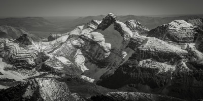
 Ida, View S (Kakwa051708-_105.jpg) |
 Ida, W Face, View S (Kakwa051708-_114.jpg) |
 Ida, W Face, View SE (Kakwa051708-_121.jpg) |
 Ida, W Face (Kakwa051708-_129.jpg) |
 Ida, SW Face (Kakwa051708-_142.jpg) |
 Ida, View NE (Kakwa051708-_147.jpg) |
 Ida S Face (Kakwa051708-_163.jpg) |
 Ida, E (Center) & NE Faces (Kakwa051708-_179.jpg) |
 Koona (L) & Awasis, View S (Kakwa051708-_194.jpg) |
 L To R: Ida (Distance), Koona, Awasis, Walrus, View SE (Kakwa051708-_207.jpg) |
 Walrus, W Face (Kakwa051708-_217.jpg) |
 Walrus W Face (Kakwa051708-_225.jpg) |
 Awasis (Center) & Koona, View NE (Kakwa051708-_228.jpg) |
 Walrus, S Ridge, View N (Kakwa051708-_229.jpg) |
 Walrus, S Ridge & E Face (Kakwa051708-_237.jpg) |
 R To L: Koona, Awasis, Walrus, View NW (Kakwa051708-_245.jpg) |
 Kisano Group From The N (Kakwa051708-_248.jpg) |
 Kisano Group From The North (Kakwa051708-_254.jpg) |
 Dimsdale, NW Face (Kakwa051708-_358.jpg) |
 Dimsdale (L) & Kisano, View NE (Kakwa051708-_375.jpg) |
 Kisano SW Face (Kakwa051708-_392.jpg) |
 Dimsdale, View N (Kakwa051708-_399.jpg) |
 Dimsdale, View NW (Kakwa051708-_403.jpg) |
 Kisano NW Face (Kakwa051708-_419.jpg) |
 Petrie NE Face, View NW (Kakwa051708-_494.jpg) |
 Petrie NE Face (Kakwa051708-_497.jpg) |
 Petrie N Face (Kakwa051708-_509.jpg) |
 Ovington NE Face (Kakwa051708-_520.jpg) |
 Ovington NE Face (Kakwa051708-_523.jpg) |
 Petrie (L), Ovington, Plaskett, View SE (Kakwa051708-_541.jpg) |
 Kitchener N Face (ColumbiaIcefld-1-092808-_221.jpg) |
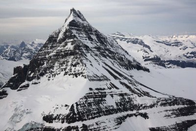
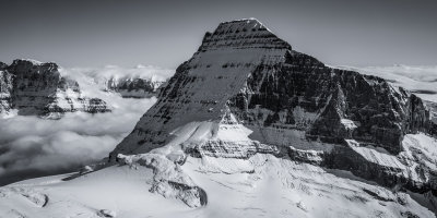
 Robson, View NW (Robson092908-_19.jpg) |
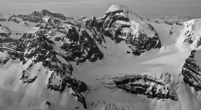
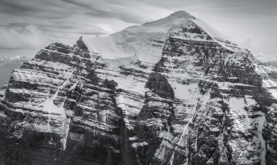
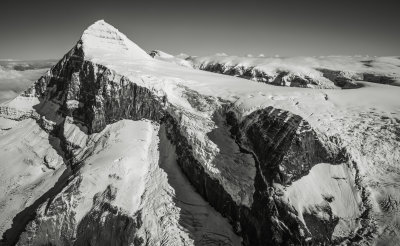
 Robson, Upper SW Face & Summit (Robson2-092908-_115.jpg) |
 Nechamus W Pk, N Face (Kakwa051708-_725.jpg) |
 Pearson, NE Face (Kakwa051708-_753.jpg) |
 Pearson NE Face (Kakwa051708-_776.jpg) |
 Pearson NW Ridge (Kakwa051708-_799.jpg) |
 Pearson NW Face (Kakwa051708-_824.jpg) |
 Pearson, W Face & Unnamed Glacier (Kakwa051708-_856.jpg) |
 Pearson Group, Southern Peaks, W/NW Faces (Kakwa051708-_862.jpg) |
 Pearson Group, Southern Peaks, W Slopes (Kakwa051708-_893.jpg) |
 Pearson Group, Southern Peaks, View E (Kakwa051708-_969.jpg) |
 Pearson Pk (L) & The Pearson Group, View NE (Kakwa051708-_987.jpg) |
 Twins Tower N Face (ColumbiaIcefld-1-092808-_245.jpg) |
 Alberta N Face (ColumbiaIcefld-1-092808-_460adj.jpg) |
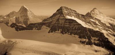
 L To R: Alberta, N Twin, S Twin, Columbia (ColumbiaIcefld-1-092808-_469.jpg) |
 Robson, Emperor Face (Robson2-092908-_273FR.jpg) |
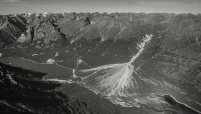
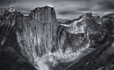
 The South Face Of Mt. Clemenceau |
 The Ramparts, Looking To The Southeast (TonquinValley_J_051412_143-1.jpg) |
 Mt. Hooker From The East (Hooker_J_051412_003-2.jpg) |
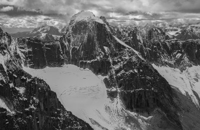
 Bras Croche (R) & Clemenceau, North Faces (BrasCroche_J_051412_029-3.jpg) |
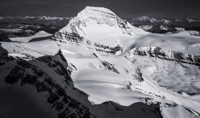
 Mt. Forbes From The Northwest (Forbes_J_051412_027-4.jpg) |
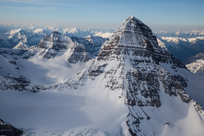
 Assiniboine From The West At Daybreak (Assiniboine_J_051512_090-5.jpg) |
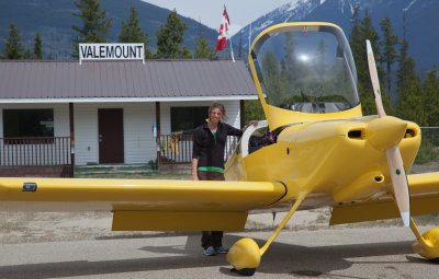 Photographer/Copilot Steph Abegg Awaits Departure Into The Rockies (Valemount_J_051412_021-1.jpg) |
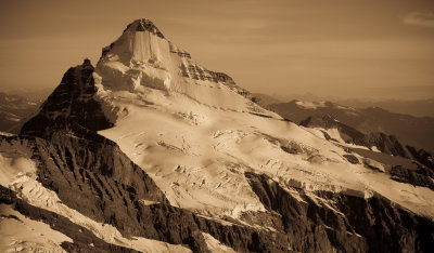
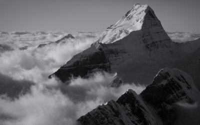
 Mt. Robson From The South (Robson_092612_041-8.jpg) |
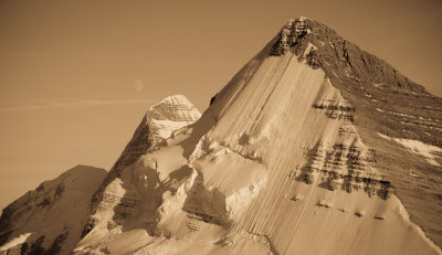
 Mt. Robson From The Southwest (Robson_092612_031-7.jpg) |
 Mt. Robson: Upper Emperor Face & Ridge (Robson_092612_017-6.jpg) |
 Lyell-Alexandra-092808-_177.jpg |
 The North Face Of Mount Phillips (PhillipsWhitehorn_092612_004-1.jpg) |
 The North Face Of Whitehorn Mountain (PhillipsWhitehorn_092612_007-2.jpg) |
 Moon, Robson, Whitehorn (PhillipsWhitehorn_092612_043-3.jpg) |
 PhillipsWhitehorn_092612_089-4.jpg |
 Mt. Petrie (R) & Mt. Ovington From The South (Kakwa051708-_462-1.jpg) |
 Jarvis Creek, Looking West (Kakwa051708-_465-2.jpg) |
 Mt Ovington (L) & Mt Petrie (R) From The Southeast (Kakwa051708-_483-3.jpg) |
 Ovington N/NE Face (Kakwa051708-_530-1.jpg) |
 Ovington, West Face (Kakwa051708-_561-2.jpg) |
 Nechamus Mountain, North Face (Kakwa051708-_572-3.jpg) |
 Phillips From The North (MFCd1pt5_092612_238-1.jpg) |
 Phillips From The Northwest (MFCd1pt5_092612_241-2.jpg) |
 Phillips, Northwest & West Slopes (MFCd1pt5_092612_253-3.jpg) |
 Phillips West Face (MFCd1pt5_092612_262-4.jpg) |
 Longstaff, Upper SE Face (MFCd2_092612_1-5.jpg) |
 Longstaff, Upper E & N Slopes From The Northeast (MFCd2_092612_4-6.jpg) |
 Longstaff, North & Northwest Slopes (MFCd2_092612_7-7.jpg) |
 Longstaff From The Northwest (MFCd2_092612_15-8.jpg) |
 Longstaff (L), Robson, Whitehorn, Looking Southeast (MFCd2_092612_16-9.jpg) |
 Mt. Geikie & The Ramparts, Looking South (BCcard3a092011-95-1.jpg) |
 The North Face Of Mt. Alberta (BCcard3a092011-224-1.jpg) |
 Sir Alexander, Looking To The South/Southwest (BCcard1092011-545-1.jpg) |
 Mount Ida, South Face (BCcard1092011-533-1.jpg) |
 Mt. Robson: Kain Face (Robson_092612_061-1.jpg) |
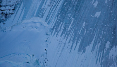 Robson North Face Ice Detail (Robson_092612_139-2.jpg) |
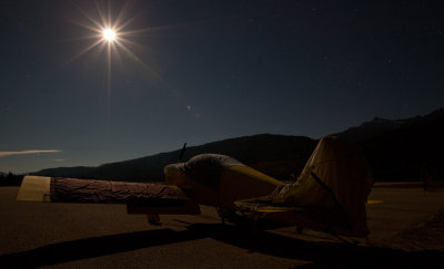 Airplane By Moonlight: Valemount, British Columbia (VmtNight_092612_69-1.jpg) |
 The North Face Of Stanley Peak (Stanley090808-_62-10.jpg) |
 Assiniboine_J_051512_001-3.jpg |
 Assiniboine_J_051512_031-4.jpg |
 Assiniboine_J_051512_045-5.jpg |
 Edith Cavell From The Northeast (EdithCavell_J_051412_023-1.jpg) |
 Edith Cavell, North Face (EdithCavell_J_051412_033-2.jpg) |
 BrasCroche_041916_004-2.jpg* |
 Columbia, Looking To The North (Columbia_041916_026-5.jpg) |
 Forbes_041916_077-6.jpg |
 Freshfield_041916_023-7.jpg |
 Ida_041816_001-1.jpg |
 Ramparts_041916_025-1.jpg |
 SirAlexander_041816_019-2.jpg |
 Tsar_041916_044-4.jpg |
 Tusk Mountain From The East (Tusk_041916_016-3.jpg) |
 Robson_041816_82-2.jpg |
 Bryce_041916_026-1.jpg |
 Forbes_041916_003-3.jpg |
 Forbes_041916_057-4.jpg |
 LyellAlexandra_041916_006-2.jpg |
 Sir Alexander From The South (BCcard1092011-557-1.jpg) |
 BrasCroche_091417_023-1.jpg |
 Clemenceau_091417_018-2.jpg |
 Columbia_091417_004-3.jpg |
 Alberta_091417_030-1.jpg |
 NTwinTower_091417_016-1.jpg |
 Geikie_091417_121-1.jpg |
 Hooker_091417_079-1.jpg |
 NTwinTower_091417_004-2.jpg |
 Robson_091417_278-1.jpg |
 Tsar_091417_015-2.jpg |
 L to R: Glendower, Lloyd George, Criccieth From The South (LloydGeorgeIcefield_091517_169-1.jpg) |
 Lloyd George Icefield & Lloyd George Glacier From The East (LloydGeorgeIcefield_091517_175-1.jpg) |
 Mt Lloyd George & Lloyd George Icefield From The East (LloydGeorgeIcefield_091517_296-1.jpg) |
 Joplin Creek & Tuchodi River, Looking Northwest (Muskwa_091517_023-2.jpg) |
 Mt Ulysses From The North (Ulysses_091517_090-1.jpg) |
 Mt Columbia From The North (Columbia_091417_078-1.jpg) |
 Sir Alexander From The West (SirAlexander2_091517_029-1.jpg) |
 SirAlexander2_091517_034-2.jpg |
 Geikie_091417_102-1.jpg |
 Goodsir_J_051512_024-2.jpg |
 Mt Forbes, North Face (Forbes_102717_033-1.jpg) |
 Andromeda, North Face (Andromeda_102717_010-2.jpg) |
 Columbia From The East (Columbia_102717_053-2.jpg) |
 Kitchener, North Face (Kitchener_102717_019-3.jpg) |
 Lyell, Northeast Face (Lyell_102717_060-2.jpg) |
 Lyell, Northeast Face (Lyell_102717_074-3.jpg) |
 Looking South To The Lyell Icefield (Lyell2_102717_002-4.jpg) |
 Athabasca, North Face (Athabasca_102717_010-4.jpg) |
 Bryce_102717_002-3.jpg |
 The East Face Of Mt. Ida (Ida_091517_034-2.jpg) |
 Ulysses2_091517_009-2.jpg |
 Mt Temple, North Face (TenPkTemple090808-_46-1.jpg) |
 Mt Ball From The Northwest (Stanley090808-_49-2.jpg) |
 Stanley090808-_58-3.jpg |
 Robson051508-_287-2.jpg |
 Swoda Peak From The Northwest (CalumetSwoda_101713_079-3.jpg) |
 BCcard3a092011-252-1.jpg |
 Alberta_091417_028-1.jpg |
 Alberta_091417_065-2.jpg |
 BCcard3a092011-265-1.jpg |
 Robson_091417_0862.jpg |
 Columbia_091417_0325.jpg |
 Columbia_091417_0154.jpg |
 Swiftcurrent Glacier, Looking North (SwiftcurrentLongstaff_101713_006-1.jpg) |
 Barricade Mountain (Left Center) & Resthaven Icefield (ResthavenIcefield_101713_155-4.jpg) |
 Resthaven Icefield, Looking Northwest (ResthavenIcefield_101713_150-3.jpg) |
 Barricade Mountain & The Resthaven Icefield (ResthavenIcefield_101713_123-2.jpg) |
 Swoda Mountain From The Northwest (CalumetSwoda_101713_080-1.jpg) |
 Tsar, Northwest Face (BCcard2092011341.jpg) |
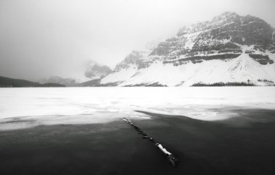 Bow Lake (C052110-0136adjBW.jpg) |
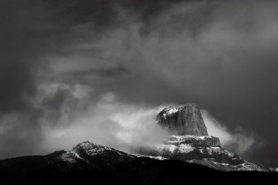 Roche Miette (C052210-0743adjBW.jpg) |
 Robson From The Southeast (Robson_101613_053-1.jpg) |
 Evening At The Resthaven Icefield, Lookout Southeast (ResthavenIcefield_101613_13-2.jpg) |
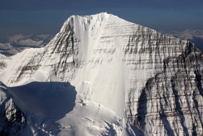
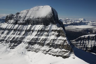
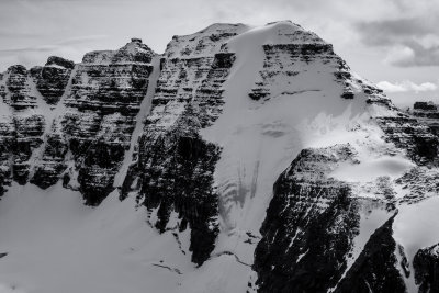
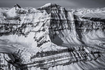
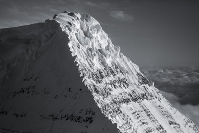
 Robson, Detail Of The Summit Pyramid South Face (Robson_101613_201-2.jpg) |
 Mt Columbia From The East (BCcard3a092011-284-2.jpg) |
 Ida_041816_010-1.jpg |
 The West/Southwest Face Of Clemenceau (Clemenceau_102817_013-2.jpg) |
 Goodsirs, East Face (Goodsirs_102817_008-3.jpg) |
 Mount Lyell From The East (Lyell_102717_024-2.jpg) |
 Robson_101613_164-4.jpg |
 LloydGeorgeIcefield_091517_013-3.jpg |
 Mount Glendower's Northeast Face (LloydGeorgeIcefield_091517_019-4.jpg) |
 Sir Alexander From The Northwest (SirAlexander2_091517_016-5.jpg) |
 Bryce_J_051412_0191.jpg |
 Bryce_J_051412_0531.jpg |
 ClemenceauIcefld1092808_2961.jpg |
 ClemenceauIcefld1092808_3002.jpg |
 Cirque Of The Unclimbables (LoganMountains_090519_3641.jpg) |
 The North Face Of Mt. Forbes (Forbes_090619_0222.jpg) |
 Mount Brazeau From The North (Brazeau_090619_0531.jpg) |
 Wolf Fang Peak, Northeast Face (LoganMountains_090519_1151.jpg) |
 Hole In The Wall Peak From The Northeast (LoganMountains_090519_1501.jpg) |
 SirAlexander_041816_107-4.jpg |
 Mt Forbes, N Face (CRockies_041916_1168-1-1.jpg) |
 Mt. Proboscis, Southeast Face (LoganMountains_090519_1861.jpg) |
 LoganMountains_090519_3051.jpg |
 LoganMountains_090519_3172.jpg |
 Mount Ida From The North (Ida_091517_0611.JPG) |
 Bryce, North Face (Bryce_090619_0061.JPG) |
 The Southeast Face Of Mount Bryce (Bryce_090619_0191.JPG) |
 Forbes, East Face (CRockies_041916_12291.JPG) |
 Mount Dimsdale From The East (Kakwa_091517_0361.JPG) |
 Mt. Columbia From The Southeast (Columbia_101818_070.jpg) |
 TwinsTowers_090619_026-1.jpg |
 Mount King Edward From The Southeast (KingEdward_090619_036-2.JPG) |
 Stutfield Peak From The North (Stutfield_1_090619_009-1.JPG) |
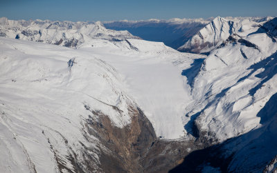
 The Columbia Glacier & Columbia Icefield (ColumbiaIcefld-1-092808-_063-1.JPG) |
 Athabasca, North Face (ColumbiaIcefld-1-092808-_194-2.JPG) |
 Athabasca, North Face (ColumbiaIcefld-1-092808-_200-3.JPG) |
 Stutfield, West Face (ColumbiaIcefld-1-092808-_235-4.JPG) |
 The West & South Twins From The Southwest (ColumbiaIcefld-1-092808-_261-5.JPG) |
 The South Twin (L) & North Twin From The East (ColumbiaIcefld-1-092808-_277-6.JPG) |
 South Twin, North Face (ColumbiaIcefld-1-092808-_287-7.JPG) |
 Robson2-092908-_357-11.JPG |
 Robson2-092908-_357-12.JPG |
| previous page | pages 1 2 3 4 5 6 7 8 9 10 11 12 ALL | next page |