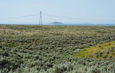
Looking south from I-84 in south-central Idaho. The subject of the photo is the hill in the distance: Cinder Cone Butte. This view caused me to alter my driving plans.
On my first road trip to Utah I was cruising down I-84, bored with the scenery in this part of Idaho. Then something caught my eye: a lone hill in the distance. It had communications towers on it, meaning a road led there. Its solitary presence in a huge plain meant that the view from its summit must be nice. My curiosity took over. I got off the freeway at the next exit (Exit 74, signed "Simco Road").
The butte turned out to be ten miles (16 km) away, much farther than I had thought upon seeing it. The drive to the butte included a stop for train pictures at a grade crossing. Eventually I found the butte's access road amid farming fields and drove right up to the top and took in the view. It was a nice change of pace from the dreadfully boring freeway corridor.
Geotagging is approximate.
|