I posted this in an attempt to eliminate---or at least significantly reduce---the bothersome inquiries I'm getting about a certain topographic feature in the domes above Corona Arch.
For months I have been inundated with PBase mail messages, e-mail messages, and telephone calls, asking me to provide a photo taken from the downhill end of a gently-sloping "mesa" near Moab, Utah. It all started when I posted a photo taken from the gentle pass at right. It's baffling that so many people would make such requests, but who am I to question the motivation of the masses?
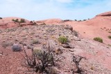
The photo above was shot from the downhill end of the mesa, where the mesa abuts a rock outcrop, and looks northwest toward the pass at right. Behind the pass is more gentle terrain---the route I took to get here. The mesa is at the center of this WikiMapia aerial view.
The weird colors are my own fault---for this day-long hike my camera's white balance was set to "fluorescent," which made all the images blue-pink. I tried to correct that problem, with limited success.
|