


|
|
|
|
|
|
| lrh | profile | all galleries >> Jasper ARK Pictures >> Jasper 2018 (J6) >> "Temp" gallery I created for our friends the Thurstons around Apr-May 2018 for their Branson trip | tree view | thumbnails | slideshow |
Notes I Took 2018 Spots She Was Interested in Devil's Den (think swimming not allowed) https://goo.gl/GQLKnl Bull Shoals Lake (towards Harrison) Tea Tables Rock https://goo.gl/SsNioR America's Best Value Inn Prescott ARK 33.8102941, -93.4196562 Barn off of Benton spot N 34.61201, W 92.73925 Accuracy: 10 m https://maps.google.com/maps?q=34.612%2C-92.7392 Old house near ArK 10 United States N 34.88149, W 92.7735 Accuracy: 5 m https://maps.google.com/maps?q=34.8815%2C-92.7735 Lake Sylvia N 34.86715, W 92.82243 Accuracy: 11 m https://maps.google.com/maps?q=34.8672%2C-92.8224 Dam at Sylvia N 34.87096, W 92.82099 Accuracy: 11 m https://maps.google.com/maps?q=34.871%2C-92.821 Cold Spring He Mentioned https://www.fs.usda.gov/recarea/ouachita/recarea/?recid=10717 Other Bradley 36�00'31.0"N 93�11'25.0"W https://goo.gl/maps/B11zre8uDPs 23rd Barn shot (111021) United States N 36.25026, W 92.76435 Accuracy: 10 m https://maps.google.com/maps?q=36.2503%2C-92.7643 Intersection in Indian Rock (hiking) N 36.09005, W 92.57058 Accuracy: 20 m https://maps.google.com/maps?q=36.09%2C-92.5706 Barn after Rush United States N 36.12534, W 92.64965 Accuracy: 11 m https://maps.google.com/maps?q=36.1253%2C-92.6496 Trailer 40,000 United States N 35.90489, W 93.18727 Accuracy: 14 m https://maps.google.com/maps?q=35.9049%2C-93.1873 8707410066 Gas ARK 7 N 35.78348, W 93.1134 Accuracy: 16 m https://maps.google.com/maps?q=35.7835%2C-93.1134 Barn shot after falling water N 35.72614, W 93.01742 Accuracy: 10 m https://maps.google.com/maps?q=35.7261%2C-93.0174 THE Barn Shot 74 United States N 36.00985, W 93.30054 Accuracy: 13 m https://maps.google.com/maps?q=36.0099%2C-93.3005 36.00962,-93.30073 I am here: 36.00970�N 93.30064�W http://maps.google.com/maps?q=36.00971%2C-93.30064 Wed Barn shots detour I am here: 36.09830�N 93.14678�W http://maps.google.com/maps?q=36.0983%2C-93.14679 Barn 43 N 36.00142, W 93.38753 Accuracy: 26 m https://maps.google.com/maps?q=36.0014%2C-93.3875 Magnolia Wilderness Access Sign N 35.86282, W 93.38512 Accuracy: 27 m https://maps.google.com/maps?q=35.8628%2C-93.3851 Thur Hammerschmidt p 60 https://goo.gl/gikgeh Park (gravel right side by pond) N 36.01868, W 93.28971 Accuracy: 12 m https://maps.google.com/maps?q=36.0187%2C-93.2897 Turn left at wilderness sign N 36.02098, W 93.28788 Accuracy: 20 m https://maps.google.com/maps?q=36.021%2C-93.2879 Fri Barn Mt Judea N 35.95052, W 93.06508 Accuracy: 13 m https://maps.google.com/maps?q=35.9505%2C-93.0651 Barn Shot where mattress flew N 34.6118, W 92.73879 Accuracy: 23 m https://maps.google.com/maps?q=34.6118%2C-92.7388
| previous page | pages 1 2 ALL | next page |
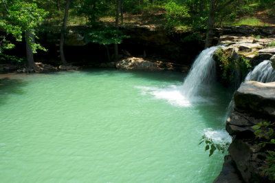
 Blue Hole |
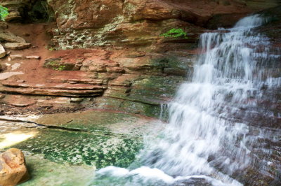
 *Scenic Shot, Falling Water Waterfalls |
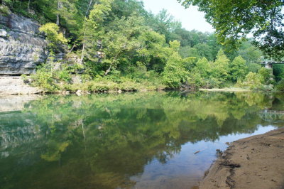 *Scenic Shot, Pruitt, "Upper" |
 *Scenic Shot, Lost Trail Waterfalls (Not Eden Falls) |
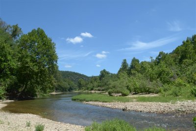
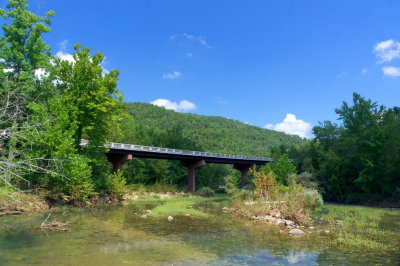 *Scenic Shot, Ponca Access |
| previous page | pages 1 2 ALL | next page |
| comment | share |