photo sharing and upload picture albums photo forums search pictures popular photos photography help login
Jerry Pillarelli | profile | all galleries >> Travel and Nature >> US Travel; by Trip, by State >> Alaska National Parks Trip - Summer 2015 >> Denali National Park – Alaska >> Mount McKinley, Denali National Park – Alaska tree view | thumbnails | slideshow

Mount McKinley, Denali National Park – Alaska

Images of Mount McKinley from the air in Denali National Park – Central Alaska, taken in July 2015.

At 20,320 feet Mount McKinley holds the distinction of having the largest vertical rise from bottom to top of any mountain in the world. It is massive, an incredible site to behold from the ground, and even more awe inspiring from the air.

I was in Talkeetna Alaska for my K2 Aviation flight to “the high one” anticipating an experience that would rock my world. Little did I know that I would be rocked even before I boarded the plane. The pilot was discussing the passenger load with another K2 employee when the earth began to move, only for a few seconds, just enough to make me worry. Then it happened again! I looked at the two of them and the employee said to the pilot ‘I’m going to say it was a 5.0, how about you?’ He replied, ‘I’ll say 4.8”. ‘Great’ she said, ‘I’ll start the pool sheet’. Apparently this happens often enough that everyone here simply bets on the strength of the tremors, winner takes the pool! Turns out the epicenter was only 25 miles from Talkeetna, the first tremor was a 4.9, followed by a 5.1. I’m not sure who won the pool but I simply marked it down as another interesting Alaskan travel experience…

The flight to the mountain was spectacular! I had talked with the pilot to see if he would let me ride up front and he had no problem with it. Someone would have to sit there, it might as well be me and since the mountain would be in front of us as we made our way to it, it was the best seat in the house. It was beautiful watching Mount McKinley get closer but the real fun began when we started weaving our way around the mountain. It’s a completely different experience when you’re flying and looking up at peaks and cliffs! Then, as if that was not enough, we land at the 5,500 foot level on the Ruth Amphitheater on Mount McKinley and spend 30 minutes just marveling at the scenery. It was amazing and, because of the clouds, we never even got to see the mountain top. Maybe next time…
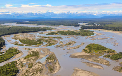
Flying toward the Alaska Range over the Chulitna River from Talkeetna
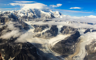
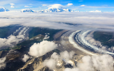
Mount McKinley with the Tokositna and Ruth Glaciers in the foreground
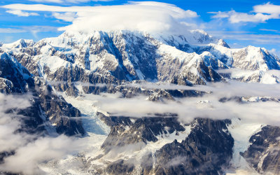
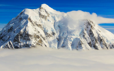
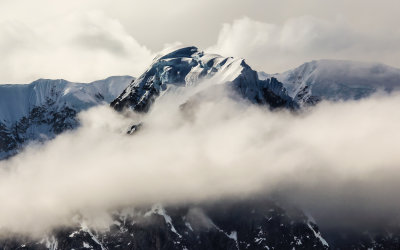
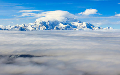
Mount McKinley above the clouds
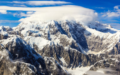
Mount McKinley with the summit obscured by clouds
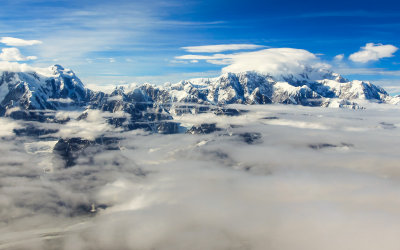
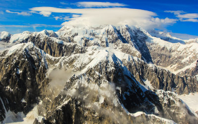
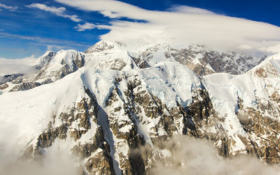
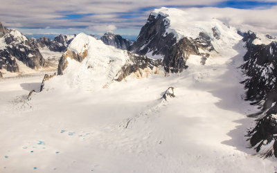
Mount McKinley with glaciers in the foreground
Mount McKinley from the southwest
Mount McKinley from the west
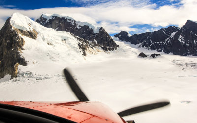
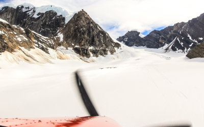
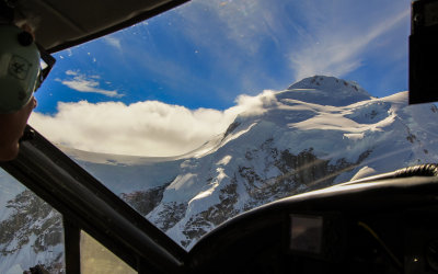
View from the copilot seat as we move through the mountainous areas around Mount McKinley
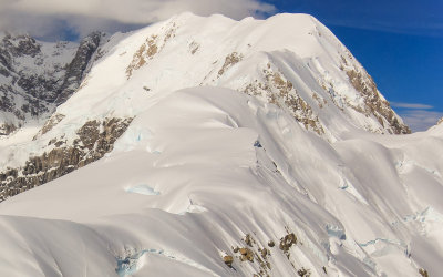
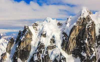
The flank of Mount McKinley
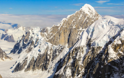
A snow covered peak with Mount Huntington on the right
Flying past snow covered peaks
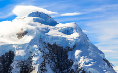
Mount Foraker summit above the clouds
A windswept peak west of McKinley
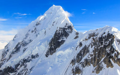
Mount Huntington southwest of McKinley
View of Mount Huntington
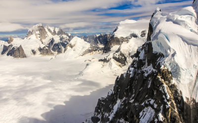
Snow clings to the top of a ridge
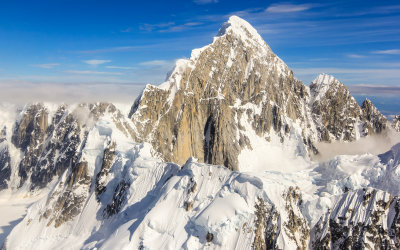
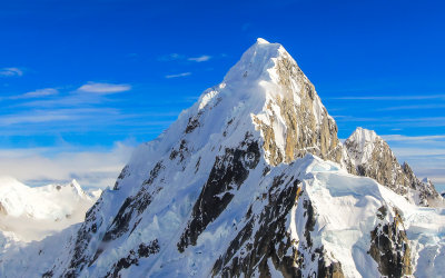
The peak of Mount Huntington
Flying by the peak of Mount Huntington
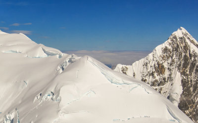
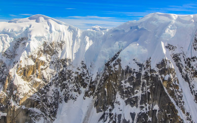
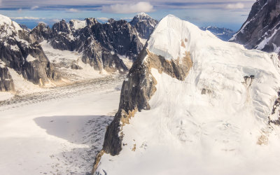
Snowcapped peaks on the flank of Mount McKinley
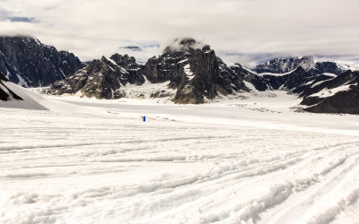
Looking toward our landing zone on the Ruth Amphitheater
Flying over our landing zone on the Ruth Amphitheater (see planes, center)
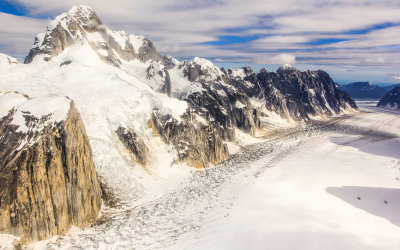
The Ruth Glacier passing through the Great Gorge
Mooses Tooth Peak on the edge of the Great Gorge and the Ruth Glacier
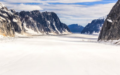
Ruth Glacier and the Great Gorge on Mount McKinley
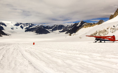
Final approach to our landing on the Ruth Amphitheater
Seconds from touchdown on the Ruth Amphitheater on Mount McKinley
Windswept mountain peak on Mount McKinley
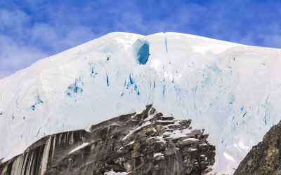
A wind cave high on a peak above the Ruth Amphitheater
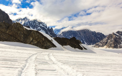
Mountainous area surrounding the Ruth Amphitheater
Explorers Peak on the edge of the Ruth Amphitheater on Mount McKinley
Mount Dan Beard near the Ruth Amphitheater on Mount McKinley
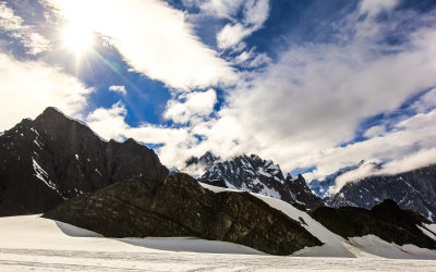
The sun through the clouds from the Ruth Amphitheater on Mount McKinley
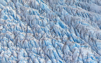
Ruth Glacier on Mount McKinley from the air
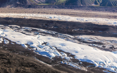
Flying over Ruth Glacier as it passes through the Tokosha Mountains south of Mount McKinley