photo sharing and upload picture albums photo forums search pictures popular photos photography help login
Dave Beedon | all galleries >> Places >> Utah >> US 6 Corridor > Kurves at Kyune
previous | next
30-OCT-2008 20081030_1561

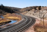
Kurves at Kyune

Kyune, Utah view map


Kyune is a railroad site southeast of Soldier Summit and north of Castle Gate. This view looks west from the Emma Park Road bridge over the tracks. (PBase's aerial imagery labels the road as "Kyune Pass Road.") The red thing above and beyond the tracks is not colorful vegetation, but a tractor-trailer rig on US 6. At left is the Price River.

The road I'm on connects to US 6 out of view to the left. That intersection is something I saw every time I drove by on previous trips. On this drive from Moab to Lakeside (via Salt Lake City) my curiosity about the road prompted me to turn onto it for a short exploration. I'm glad I did.

I left Moab at 11:15 a.m., took this picture at 2:12 p.m.,
and arrived at Lakeside at 6:20 p.m.

Nikon D80
1/400s f/14.0 at 44.0mm iso400 full exif

other sizes: small medium large original auto
share
Dave Beedon26-Dec-2013 02:21
Thanks 1moremile, exzim, and fotabug.
1moremile25-Dec-2013 23:35
Great scene and very well photographed. V.
exzim24-Dec-2013 03:18
A finw pic Dave, hope to see more now you're back
fotabug18-Dec-2013 16:58
A fine composition!
Type your message and click Add Comment
It is best to login or register first but you may post as a guest.
Enter an optional name and contact email address. Name
Name Email
help private comment