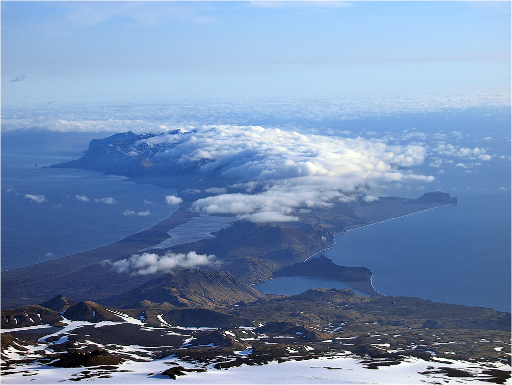
SW view over SÝr-Jan (southern Jan Mayen).
The lake to the left is SÝrlaguna, a shallow lagoon that totally evaporates during the first half of July.
In the lower right foreground lies the Hochstetter crater/138m, and behind it Nordlaguna and the Dome/136m.
Nordlaguna is 1,5 km≤/37m deep and holds freshwater, supposedly divided from the sea for some 1500-4000 years, just by a narrow gravel-bank merely 2m high.
It's housing nice arctic char by the way, and maybe other still undetected endemic species...
To the right BrielletŚrnet (Brielle tower), and behind it Hvalrossbukta (Walrus bay, from where we would leave Jan Mayen a few days later).
Far out in the center clouds you can just see Rudolftoppen/769m, the highest peak on SÝr-Jan.
The very dark and jagged crown by the glacier edge in the lower left corner is the Palffy crater/637m.
In the sea, outside the far-off point to the left, stands FyrtŚrnet (the Lighthouse), a characteristic rock pillar that has never been climbed yet.