photo sharing and upload picture albums photo forums search pictures popular photos photography help login
Type your message and click Add Comment
It is best to login or register first but you may post as a guest.
Enter an optional name and contact email address. Name
Name Email
help private comment
Brian Dickson | all galleries >> California 2019 >> 5_cottonwood_to_whitney > Map of the hike
previous | next
06-Oct-2019

Map of the hike

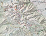
This map is located west of the town of Lone Pine in California and includes our ascent of Mt Whitney (the highest point in the contiguous USA) and some beautiful cross country hiking over Crabtree Pass.
We left our car near Lone Pine and hitch hiked to the start point at Cottonwood Lakes and on the return from Whitney portal trailhead.


other sizes: small medium large original auto
previous | next
comment | share