Type your message and click Add Comment
It is best to
login
or
register
first but you may post as a guest.
Enter an optional name and contact email address.
Name
Name
Email
help
private comment
Alan Hartmann |
profile
|
all galleries
>>
Covered Bridges
>>
Covered Bridges of Vermont
>> 45-12-18 Washington County, Robbins Nest CB
tree view
| thumbnails |
slideshow
|
map
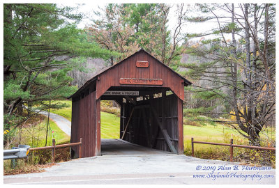
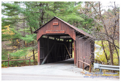
45-12-18 Washington County, Robbins Nest CB
This bridge is privately owned and on private property. It's visible from Rt 302 / East Barre Rd., apx 2.5 miles south east of the intersection of 302 & 62 in Barre VT.
Spans a Branch of Stevens Brook
GPS 44.1787, -72.4708
PBase Maps
SKY25856.jpg
SKY25860.jpg
comment
|
share
Type your message and click Add Comment
It is best to
login
or
register
first but you may post as a guest.
Enter an optional name and contact email address.
Name
Name
Email
help
private comment
click on thumbnails for full image