photo sharing and upload picture albums photo forums search pictures popular photos photography help login
Type your message and click Add Comment
It is best to login or register first but you may post as a guest.
Enter an optional name and contact email address. Name
Name Email
help private comment
Alan Hartmann | profile | all galleries >> Covered Bridges >> Covered Bridges of Pennsylvania >> 38-09-08 Bucks County, Uhlerstown Bridge tree view | thumbnails | slideshow | map

38-09-08 Bucks County, Uhlerstown Bridge

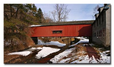
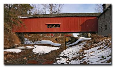
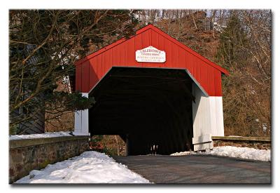
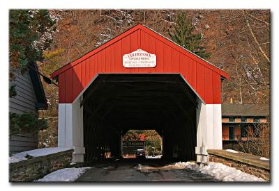
On Uhlerstown Rd, Uhlerstown / Tinicum Township. , 0.3 mile west of Rt 32, just south of the Frenchtown Bridge. The bridge is located immediately to the east of a high ridge that will block sunlight from early afternoon on, and there’s a house adjacent to the eastern end, blocking morning light. Noon would be the best time for photographing this bridge, at least its southern exposure. The canal path provides some vantage points to the north.
N40 31.526 W75 04.370

Added to PBase Maps 5/4/08

[ Yahoo! Maps ]
Uhlerstown Rd, Uhlerstown, Tinicum Township PA
CRW_8844
CRW_8844
CRW_8846
CRW_8846
CRW_8851
CRW_8851
CRW_8857-
CRW_8857-