photo sharing and upload picture albums photo forums search pictures popular photos photography help login
Type your message and click Add Comment
It is best to login or register first but you may post as a guest.
Enter an optional name and contact email address. Name
Name Email
help private comment
Alan Hartmann | profile | all galleries >> Covered Bridges >> Covered Bridges of Massachusettes >> 21-06-11 Creamery Covered Bridge tree view | thumbnails | slideshow | map

21-06-11 Creamery Covered Bridge

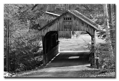
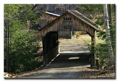
Creamery Covered Bridge is located on a private driveway, visible from Creamery Rd, Ashfield Twp., about 1 mile south east off Rt 112 (Steady Lane to Norton Hill to Creamery Rd.) The property (as of April 2005) is a maple syrup manufacturer. The bridge spans Creamery Brook.
N42 31.092 W72 47.922

PBase Maps, pushpin location is approximate.

[ Yahoo! Maps ]
Creamery Rd, Ashfield MA
CRW_1407 BW
CRW_1407 BW
CRW_1407
CRW_1407