Thailand Dog Handlers |
profile
|
all galleries
>>
635th SPS - U-Tapao
>>
Main Base
>> Maps
tree view
| thumbnails |
slideshow
Maps
Click on these two links below to view Realtime Satellite Views and Zoom around.
This is really cool!
(Kennels)
http://maps.google.com/maps?ll=12.696033,101.017903&spn=0.005157,0.007237&t=k&hl=en
The Kennels are in the center of the map. You can see the circle driveway with the new building next to it, and the kennel run behind the new building (the long white rooftops).
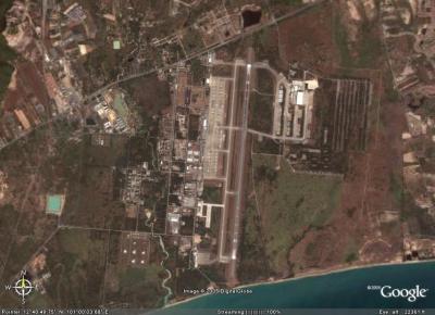
(U-Tapao)
http://maps.google.com/maps?ll=12.691011,101.003022&spn=0.020629,0.028946&t=k&hl=en
This view puts you on the U-Tapao runway.
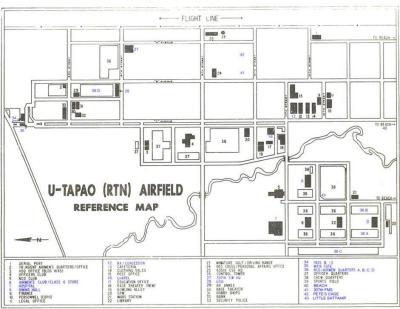
U-Tapao Base Map 2F
U-T Map
U-T Aerial View
U-Tapao Satellite View
click on thumbnails for full image