


|
|
|
|
|
|
| Bernie | profile | all galleries >> December 2012 Images >> Dutchman Trail to Giant Saguaro | tree view | thumbnails | slideshow |
| previous page | pages 1 2 ALL | next page |
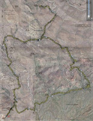 Hike map showing route followed (in counter-clockwise direction) |
 Barkley basin with Miner's Needle in upper left |
 Crooked saguaro |
 Saguaro forest in Barkley Basin |
 Weathered volcanic tuff outcropping |
 An old fenced structure in the southern reaches of the basin |
 Caught in the act of taking pictures and leaving footprints |
 Trail sign |
 The arch through Miner's Needle |
 Bee living it up on one of December's rare blooming plants |
 Hello says Mr. Dead Saguaro |
 Trail heads northwest up the east side of Miner's Needle. This is a view looking back where we came. |
 View to the northeast from the trail alongside Miner's Needle |
 Miner's Needle due south |
 From whence we came |
 Close-up leaves |
 Landscape near the top of Miner's Needle saddle |
 Cardinal on a rock |
 |
 |
 Edge of prickly-pear cactus |
 First view of (the southeast side of) Weaver's Needle from trail |
 Desert grass |
 More close-up leaves |
 |
 Typical sparse vegetation for December |
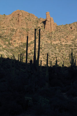
 Cacti pair and a butte |
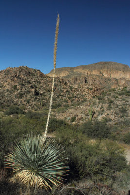 Agave stealing the show |
 First view of giant saguaro from trail (look close) |
 Giant saguaro hoisting 50+ arms |
 A view north from giant saguaro |
 The effect of sunlight on yellow grass |
 Heading back on Tr 104 the way we came. Will take Bluff Springs Trail at intersection. |
 Bird's eye view of agave |
 View to the northwest from Bluff Springs Trail just west of Crystal Springs |
 Weaver's Needle back into view |
 You know it now as Weaver's Needle |
 Prickley Pear and Cholla foreground |
 Late afternoon sillouette |
 Another cool bit of vegetation at trailside |
| previous page | pages 1 2 ALL | next page |
| comment | share |