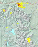
Here is a Forest Service Map showing the fires that were active while we were there.
This image was downloaded from the Forest Service Fire Web Site.
We often want a particular set of conditions while you taking pictures.
Unfortunately, as the song says, You can't always get what you want...
We had to adjust our plans to take into account of the hazy and smokey
conditions we got. In some cases we were able to get some very interesting
shots because of these.