


|
|
|
|
|
|
| SuperMtn Astro | profile | all galleries >> Astronomy - Astronomical objects, images and astronomy related projects >> Superstition Mountain Astronomical League® >> 2013-2014 Event Schedule | tree view | thumbnails | slideshow |
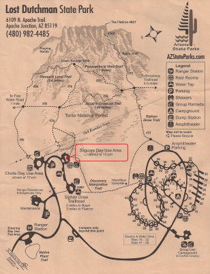 Lost Dutchman State Park - Saguaro Day Use Area Take State Route 88 (Apache Trail) north towards Tortilla Flat. Shortly after passing the Goldfield Ghost Town on your left, look for the park entrance on your right.
|
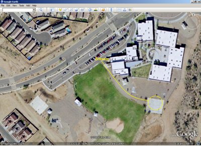
 Central Arizona College - Superstition Mountain Campus SMAL meetings are held in room B126, on the East Campus.
|
 Peralta Trail Elementary School Directions: From Gold Canyon, take US60 east. At milepost 204, approximately a mile and a half past Kings Ranch Road, take Peralta Road, to the left. (This is the same road that leads to the Peralta Trailhead.) Proceed just about a mile to the Peralta Trail Elementary School parking lot, on the right. Walk through the double gates to the observing area on the basketball court to the east of the parking lot.
|
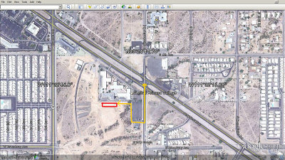 CAC Superstition Mountain Campus - Science Night Location for the 10/25/2013 CAC Science Night. (New campus buildings not shown.)
|
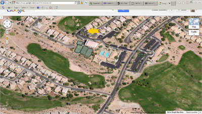 MountainBrook Village Sunset Room From US60, take MountainBrook Drive northeast. Turn left at the second driveway entrance at the community center. Proceed to the back parking lot. See building arrowed.
|