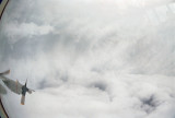
| O.K., one last shot of Super Typhoon Forrest. Actually this particular photo was taken a few hours after the ones you have just seen (if you're viewing these sequentially). We would penetrate the eyewall then find the exact center of the storm. While the Weather Officer was relaying his observations by radio, we had a few minutes to sight-see (and take pictures!). Then we would penetrate the eyewall again on our way out, taking all kinds of observations on the way. We would fly 105 miles away from the center, then turn left and fly to another point 105 miles from the center. The idea was to get data from all four points (north, east, south, and west) of the storm. In the photo above, that eyewall still looks pretty mean. We're looking straight out the left side of the airplane. The center of circulation (where the left wing is pointing) is skewed to one side, and almost looks like it is going to get swallowed up by the eyewall. Actually, it was quite common for the center of circulation to not be in the exact center of the circular eyewall clouds. |