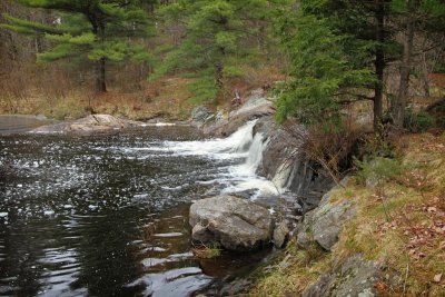
The District Municipality of Muskoka, more generally referred to as the District of Muskoka, or simply Muskoka, is a Regional Municipality located in Central Ontario. Muskoka extends from Georgian Bay in the west, to the northern tip of Lake Couchiching in the south, to the western border of Algonquin Provincial Park in the east. Located approximately two hours north of Toronto, Muskoka spans 6,475 km2 (2,500 sq mi). Muskoka has some 1,600 lakes, making it a popular resort destination.
This region, which, along with Haliburton, Kawartha Lakes, and Peterborough County is referred to as "cottage country", sees over 2.1 million visitors annually. Muskoka is a scenic area sprinkled with picturesque villages and towns, farming communities, and lakeside vacation hotels and resorts near to golf courses, country clubs, and marinas. The regional government seat is Bracebridge. This area encompasses the townships of Lake of Bays, Georgian Bay and Muskoka Lakes, and the towns of Huntsville, Bracebridge and Gravenhurst.
The name of the municipality derives from a First Nations chief of the 1850s. Lake Muskoka was then the hunting grounds of a band led by Chief Yellowhead or Mesqua Ukie.
Algonquin Provincial Park was established in 1893, it is the oldest provincial park in Canada. Additions since its creation have increased the park to its current size of about 7653 square kilometres (2,955.01 sq mi). For comparison purposes, this is about one and a half times the size of Prince Edward Island or the US state of Delaware and about a quarter the size of Belgium. The park is contiguous with a number of smaller, administratively separate provincial parks that protect important rivers in the area, resulting in a total protected area somewhat larger yet.
Its size, combined with its proximity to the major urban centres of Toronto and Ottawa, makes Algonquin one of the most popular provincial parks in the province and the entire country. Highway 60 runs through the south of the park, while the Trans-Canada Highway bypasses it to the north.
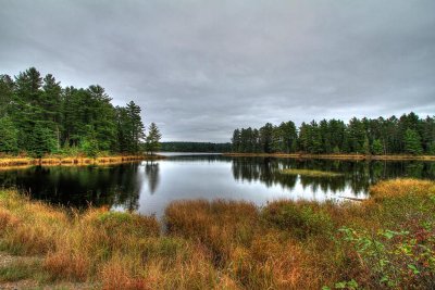
Over 2,400 lakes and 1,200 kilometres of streams and rivers are located within the park. Some notable examples include Canoe Lake and the Petawawa, Nipissing, Amable du Fond, Madawaska, and Tim rivers. These were formed by the retreat of the glaciers during the last ice age.
The park is considered part of the "border" between Northern Ontario and Southern Ontario. The park is in an area of transition between northern coniferous forest and southern deciduous forest. This unique mixture of forest types, and the wide variety of environments in the park, allows the park to support an uncommon diversity of plant and animal species. It is also an important site for wildlife research.