


|
|
|
|
|
|
| Robert Jones | profile | all galleries >> US West - South West >> 2010 >> Antelope Canyon, Page, AZ | tree view | thumbnails | slideshow | map |
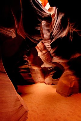
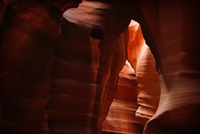
Antelope Canyon is the most-visited and most-photographed slot canyon in the American Southwest. It is located on Navajo land near Page, Arizona. Antelope Canyon includes two separate, photogenic slot canyon sections, referred to individually as Upper Antelope Canyon or The Crack; and Lower Antelope Canyon or The Corkscrew.
The Navajo name for Upper Antelope Canyon is Tse' bighanilini, which means "the place where water runs through rocks." Lower Antelope Canyon is Hasdestwazi, or "spiral rock arches." Both are located within the LeChee Chapter of the Navajo Nation.
Antelope Canyon was formed by erosion of Navajo Sandstone, primarily due to flash flooding and secondarily due to other sub-aerial processes. Rainwater, especially during monsoon season, runs into the extensive basin above the slot canyon sections, picking up speed and sand as it rushes into the narrow passageways. Over time the passageways are eroded away, making the corridors deeper and smoothing hard edges in such a way as to form characteristic 'flowing' shapes in the rock.Flooding in the canyon still occurs. A flood occurred on October 30, 2006 that lasted 36 hours, and caused the Tribal Park Authorities to close Lower Antelope Canyon for five months. Antelope Canyon is visited exclusively through guided tours, in part because rains during monsoon season can quickly flood the canyon. Rain does not have to fall on or near the Antelope Canyon slots for flash floods to whip through, as rain falling dozens of miles away 'upstream' of the canyons can funnel into them with little prior notice. On August 12, 1997, eleven tourists, including seven from France, one from the United Kingdom, one from Sweden and two from the United States, were killed in Lower Antelope Canyon by a flash flood. Very little rain fell at the site that day, but an earlier thunderstorm had dumped a large amount of water into the canyon basin, seven miles upstream. The lone survivor of the flood was tour guide Francisco "Poncho" Quintana, who had prior swift-water training. At the time, the ladder system consisted of amateur-built wood ladders that were swept away by the flash flood. Today, ladder systems have been bolted in place, and deployable cargo nets are installed at the top of the canyon. At the fee booth, a NOAA Weather Radio from the National Weather Service and an alarm horn are stationed.
All photos were taken in Upper Antelope Canyon. Sadly I was not there at the right time to see the shafts of light ... another visit is in order.
The tour company I used was: http://www.antelopecanyon.com/
 Entrance, Antelope Canyon, Page, AZ |
 Antelope Canyon, Page, AZ |
 Antelope Canyon, Page, AZ |
 Antelope Canyon, Page, AZ |
 At The Heart Of The Canyon, Antelope Canyon, Page, AZ |
 Antelope Canyon, Page, AZ |
 Antelope Canyon, Page, AZ |
 Antelope Canyon, Page, AZ |
 Antelope Canyon, Page, AZ |
 The Other End Of Antelope Canyon, Page, AZ |
 Antelope Canyon, Page, AZ |
 Antelope Canyon, Page, AZ |
 Antelope Canyon, Page, AZ |
 Antelope Canyon, Page, AZ |
 Antelope Canyon, Page, AZ |
 Antelope Canyon, Page, AZ |
 Antelope Canyon, Page, AZ |
 Antelope Canyon, Page, AZ |
 Antelope Canyon, Page, AZ |
 Antelope Canyon, Page, AZ |
 Antelope Canyon, Page, AZ |
 Antelope Canyon, Page, AZ |
 Antelope Canyon, Page, AZ |
 Antelope Canyon, Page, AZ |
| comment | share |
| Lawrence Solum | 02-Jul-2010 20:30 | |
| Gary Stanley | 28-Jun-2010 23:17 | |
| Guest | 28-Jun-2010 22:48 | |