


|
|
|
|
|
|
| railvan | profile | all galleries >> Everything Else... >> Railroads >> Railroad Photos >> Bellingham Area Railroad Photos & Info | tree view | thumbnails | slideshow |
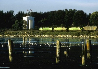 Peace Arch and northbound BN train at USA/Canada border, Blaine, WA. |
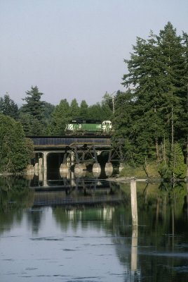 Dakota Creek, just south of Blaine, and northbound train. |
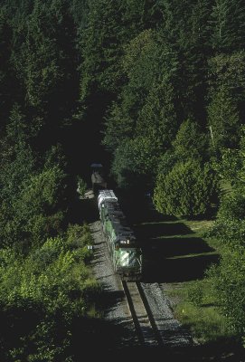
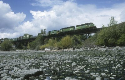 The Intalco Local crosses the Little Squalicum trestle just north of downtown Bellingham. |
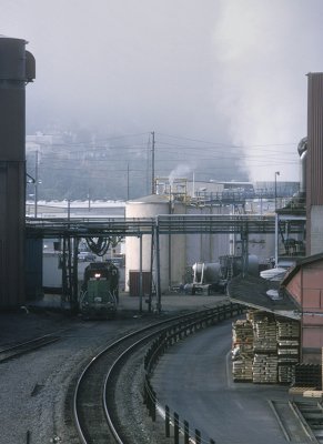
 A BN GP brings a reefer back from the cold storage on the former Milwaukee Road trackage in Squalicum Gulch. |
 Southbound with GP mill in background. |
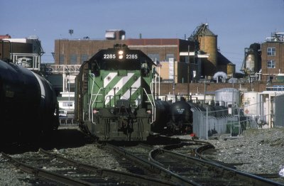
 Switching the GP mill downtown Bellingham. All the buildings in this scene are gone now. |
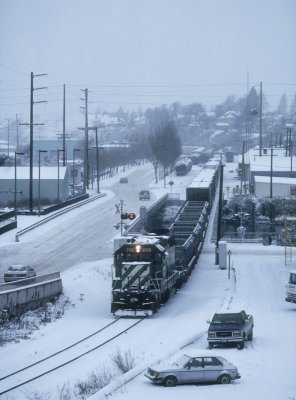 A BN southbound train on the Bellingham waterfront in the snow. |
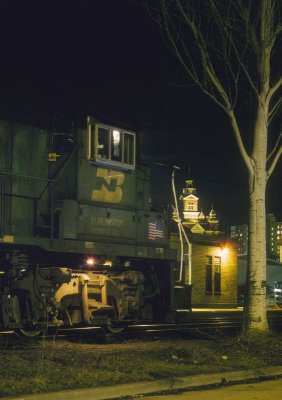 BN GP spotted in front of the old GN depot with museum in the background. |
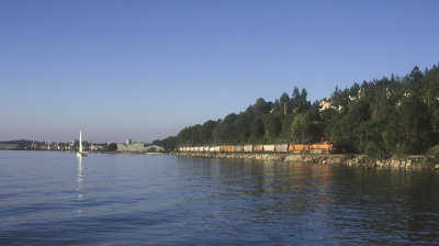 From the north end of Boulevard Park, the former GN route can be seen along the bay. |
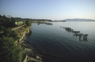 Looking south towards Fairhaven from Boulevard Park. The old NP trestle at right has been replaced with a pedestrian walkway. |
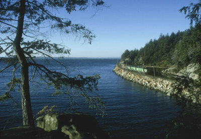 Heading south from Bellingham the old GN route curves along the bay. |
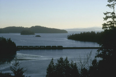 Late afternoon light on the Chuckanut Bay causeway. |
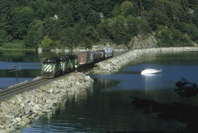 A short northbound passes a boat along the Chuckanut causeway. |
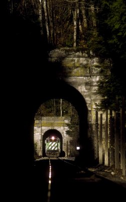 South of Bellingham, WA are two short twin tunnels. |
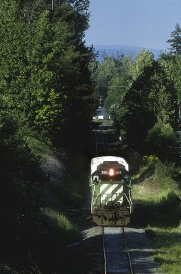
 An afternoon southbound between the twin tunnels along Chuckanut Bay. |
 A southbound BN train at Samish siding. |
 Bellingham print 19x13 |
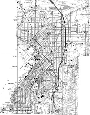 Bham USGS map |
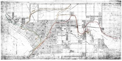
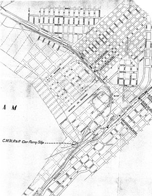 GN Bham map |
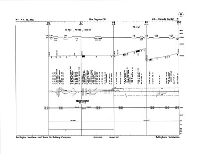 BNSF Bham track chart |
 MILW Bham track chart waterfront line |
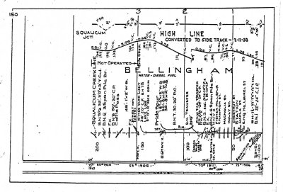 MILW Bham track chart original line |
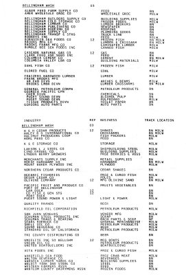 BN Bham 1981 industries |
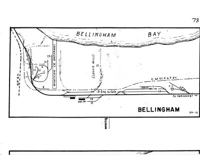 GN Bham track |
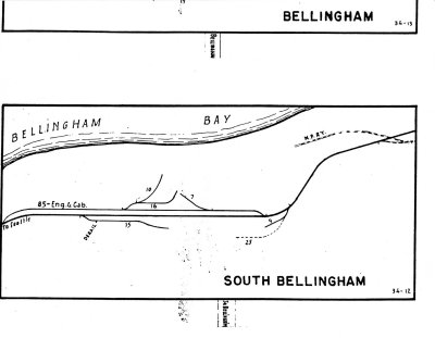 GN South Bham track |
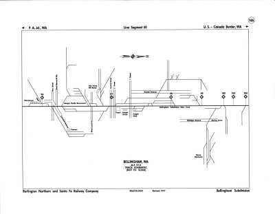 BNSF Bham schematic |
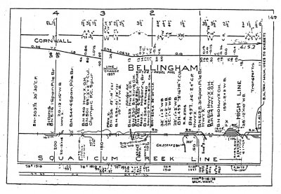
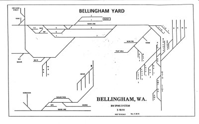 BN Bham SPINS 1991 |
| comment | share |