


|
|
|
|
|
|
| Steve, Katherine, and Norah | profile | all galleries >> Galleries >> Escalante National Monument June 2020: Death Hollow | tree view | thumbnails | slideshow |
 Spiderwort |
 Setting off across the slickrock |
 Stormy skies |
 Keeping an eye on the skies |
 Waiting for the portal to hell to open |
 Just before taking cover |
 Post storm - lots of hail! |
 Blue skies! |
 Some cool slickrock |
 Slickrock hiking |
 Boulder Mail Trail |
 Water flowing now |
 Slickrock hiking |
 Views! |
 Perfect spot for a lunch break |
 Slickrock Saddle Bench panoramic |
 Slickrock traverse |
 Stopping to admire the view again |
 Continuing a slickrock traverse |
 Slickrock traverse |
 Steve and Norah working their way down |
 Kathy on the slickrock |
 Descent into Death Hollow |
 Views the whole way down |
 Death Hollow view |
 Norah on the descent |
 Lots of fun slickrock |
 Death Hollow descent |
 Time to get our feet wet |
 Muddy water - can't see where we are stepping |
 Stream walking |
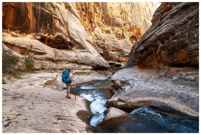
 Death Hollow |
 Steve admiring a neat alcove |
 Steve and Norah |
 Death Hollow |
 Death Hollow |
 Death Hollow |
 Death Hollow |
 Death Hollow |
 Death Hollow |
 Death Hollow |
 Milkweed |
 Death Hollow |
 Death Hollow |
 Campsite about 20 minutes above the cascades |
 Time to get wet again |
 Death Hollow |
 Death Hollow |
 Death Hollow |
 First cascade |
 First cascade |
 First cascade |
 Steve at the first cascade |
 Death Hollow |
 Another small cascade |
 Second small cascade |
 Death Hollow |
 Death Hollow |
 Death Hollow |
 Death Hollow |
 Death Hollow |
 Death Hollow |
 Death Hollow |
 Death Hollow |
 Approaching the narrows |
 Approaching the narrows |
 Approaching the narrows |
 Approaching the narrows |
 Potholes |
 The start of the narrows |
 The narrows |
 The narrows |
 Reaching the crux of the hike |
 The narrows |
 Scoping out the situation |
 Steve is barely visible looking through the narrows |
 Made it! |
 Skirting around a deep pool |
 Leaving the narrows |
 End of the narrows |
 Nice sunny, sandy break spot |
 Death Hollow |
 Look at how tiny we are! |
 Death Hollow |
 Death Hollow |
 Death Hollow |
 Death Hollow |
 Death Hollow |
 Death Hollow |
 Another favorite spot - we all had to get a picture here |
 Death Hollow |
 Death Hollow |
 Tiny waterfall |
 Death Hollow |
 Death Hollow |
 Last shot in Death Hollow |
 Muddy Escalante |
 Hiking out the Escalante |
 A lot more land hiking in this portion |
 Swallowtail |
 Swallowtail |
 Swallowtail |
 Arch |
| comment | share |
| Guest | 26-Oct-2020 04:07 | |
| Long Bach Nguyen | 26-Oct-2020 04:07 | |