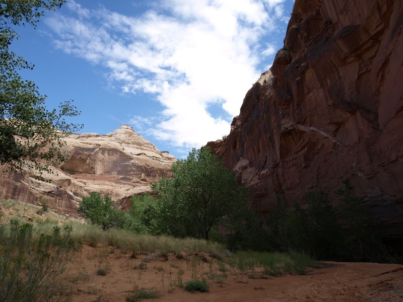
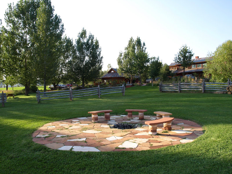
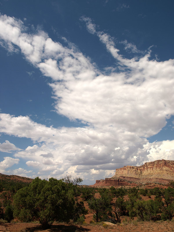
This would be a third Sept trip to Southern Utah for us. We went in �03 and �04, and both of us had traveled throughout the Southwest in years past. So we know the area pretty well and planned this trip around a couple of things we really wanted to see and do. In both the �03 and �04 trips, our plans to hike into the Great Gallery in Canyonland�s Horseshoe Canyon had to be cancelled due to poor weather conditions. This trip we hoped to finally get there. We also wanted to spend a couple of nights at Bryce since we�ve both only done day hikes there in the past. More time in Capitol Reef was also important to us. We decided to skip Moab this trip and concentrate our time looking more closely at a smaller area.
>
>
Click on images for a larger version
>
>
For more images from this trip without commentary go here:
Utah 07 Pictures
From upstate NY, we got a great nonstop flight to Las Vegas getting in just past Noon on Thurs, Aug 30th. Our itinerary looked like this (at the time):
8/30 Arrive LV; head to Zion (cabin)
8/31 Camp at Bryce
9/1 Camp at Bryce
9/2 Camp in Grand Staircase Escalante area
9/3 Austin�s Torrey/Capitol Reef
9/4 Austin�s Torrey/CR
9/5 Grand Gallery; camp at Goblin�s
9/6 Boulder Mtn Lodge
9/7 Zion (cabin)
9/8 Fly out of LV � 4:45pm
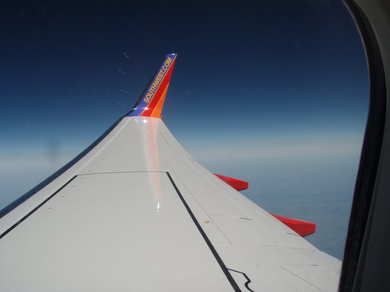
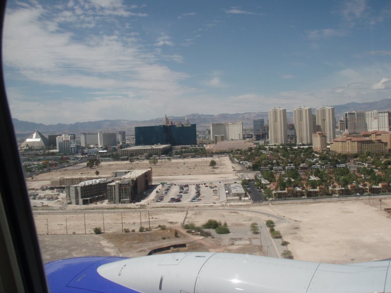
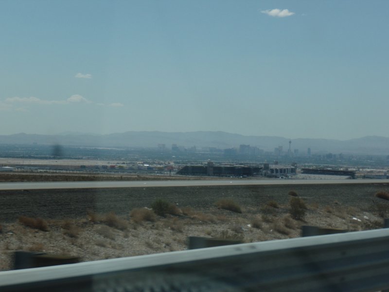
We weren�t planning much in Zion but we hate Las Vegas and love Zion and Springdale so we always head right out. Smooth, non stop flight on Southwest arrived early. We quickly got our pile of luggage (camping gear), SUV from Dollar (great price) and headed north on 15. Before we were out of the city, we stopped for some water, ice, beer and snacks to fill the two soft, folding coolers we brought along. It was so incredibly hot � the car thermometer just kept creeping higher as we drove.
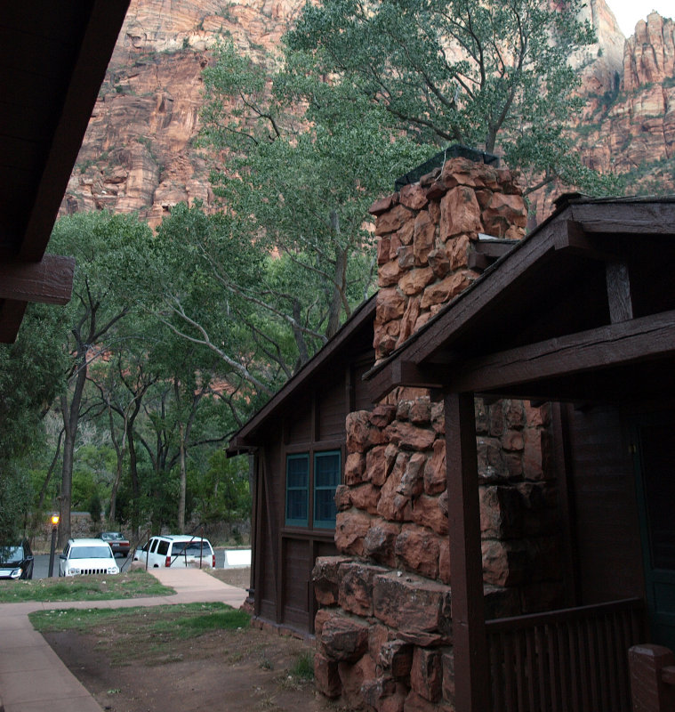
It took just less than three hours to get to Springdale. It was fun seeing this great little town again. We bought our Park Pass at the gate and headed into the Lodge. Our cabin wasn�t quite ready so we hit the Mean Bean in town for some fresh ground coffee for the camp stove. Also grabbed propane cylinders and some other items at Sol Market and headed back to check in.
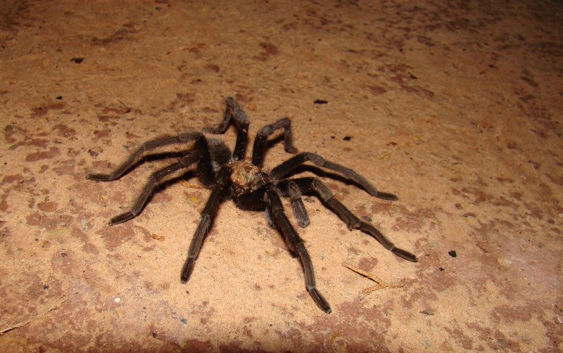
The cabins were great; pricey considering some of the great places to stay in town, but it�s nice being in the park at night and at dawn and having the trails so accessible. Accomodations were quiet, comfy and you�re an easy walk from the lodge and dining. We had dinner at the lodge � roast pork loin for Peter, smoked trout salad w/prickly pear dressing for Sharon. Food was pretty good. Mojitos and margaritas were excellent. Pretty full from dinner, we took a walk on the nearby trail along the Virgin River. It was dark out but there was enough light to see the trail and the HUGE tarantula hanging out. It was a big one! But very cool to see.
We headed back to our cozy cabin and hit the sack � tired, full and so happy to be back in southern Utah.
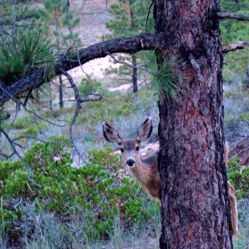
Friday, Aug 31st � we�re always early risers; grab some strong coffee at the Lodge coffee bar that opens super early and walk around taking some pictures and looking up at those incredible canyon walls all around us. Lots of mule deer grazing along the river, horses all saddled up in the corral ready for a day trip. The morning was sunny and warm as we headed to town after packing up and checking out of our cabin.
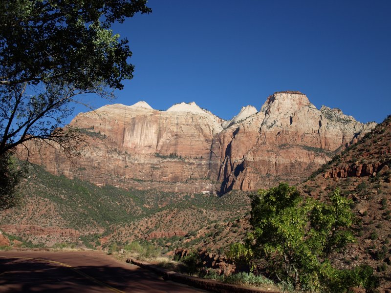
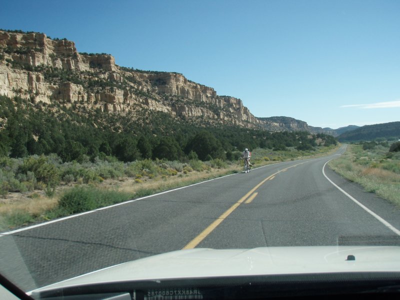
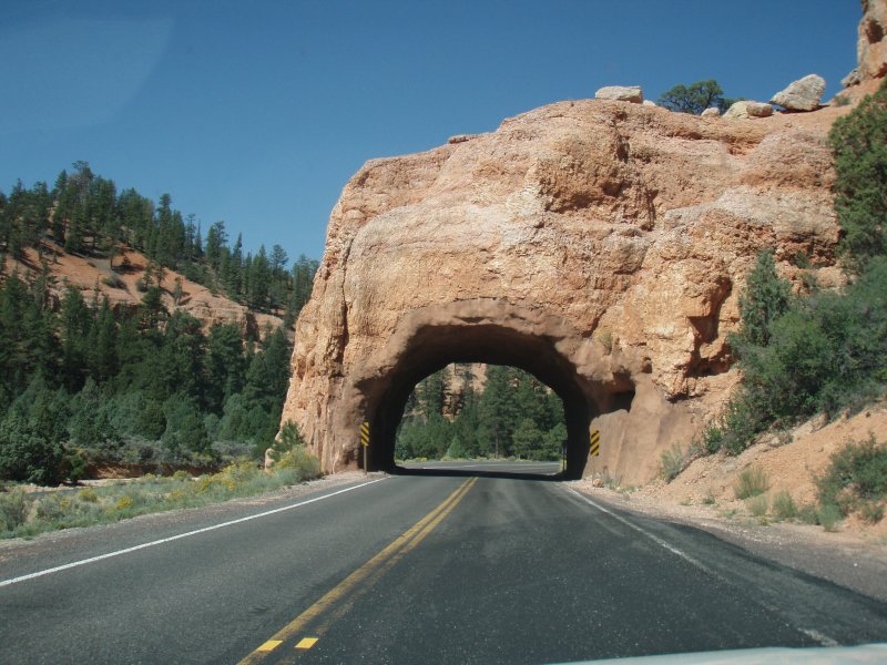
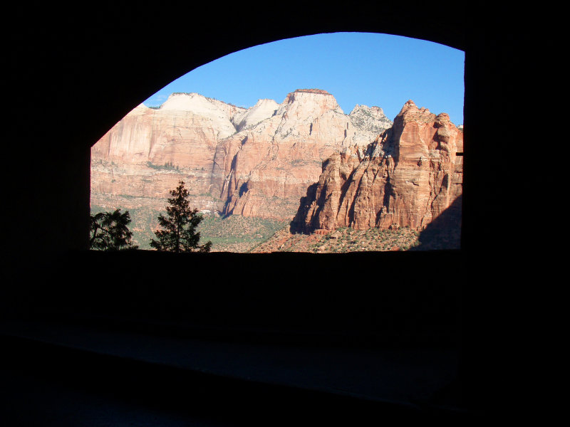
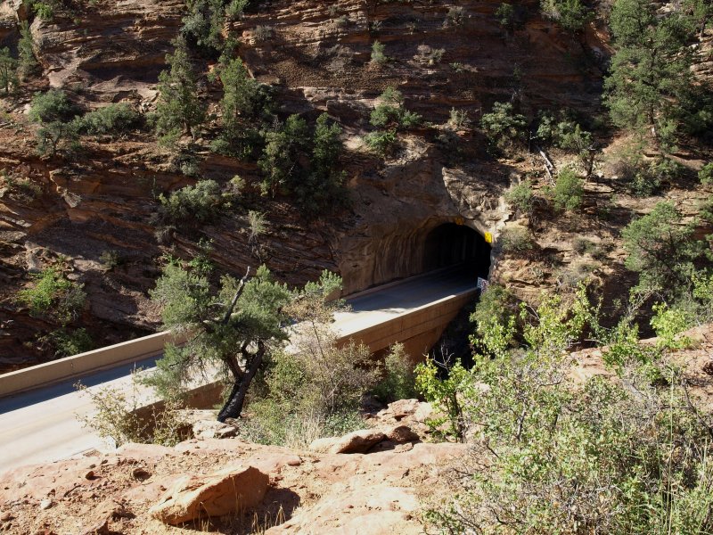
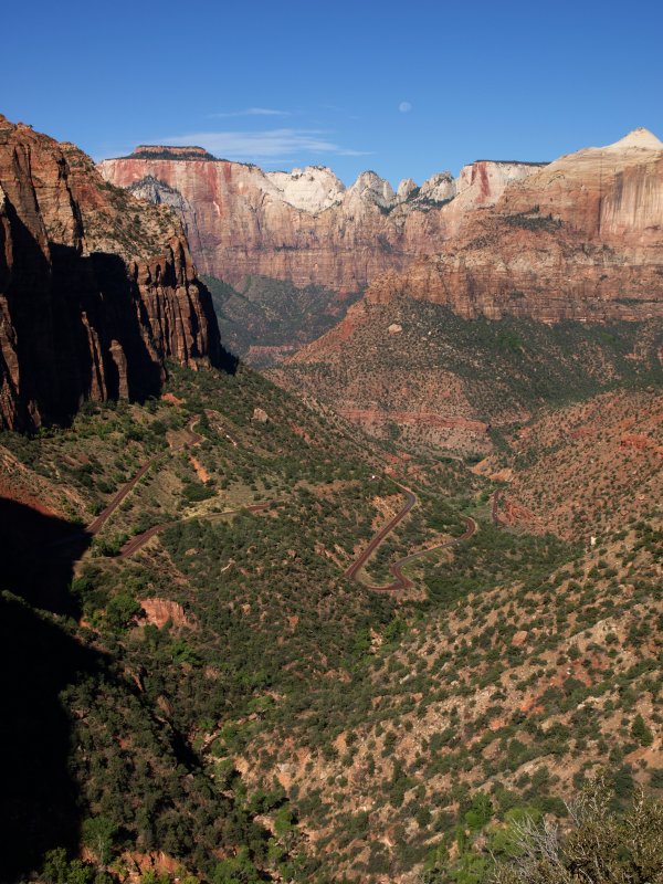
We shared a delicious veggie breakfast wrap at the Sol Caf� and grabbed two turkey guacamole wraps to save for lunch. Another small coffee-to-go from the Mean Bean and we�re headed east out of the park. This drive is always breathtaking, and we stop for plenty of photos as we head toward the tunnel.
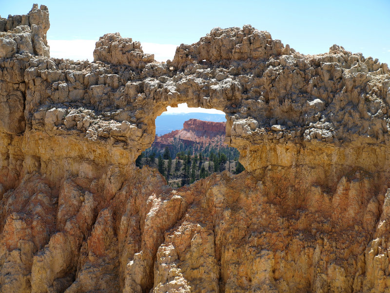
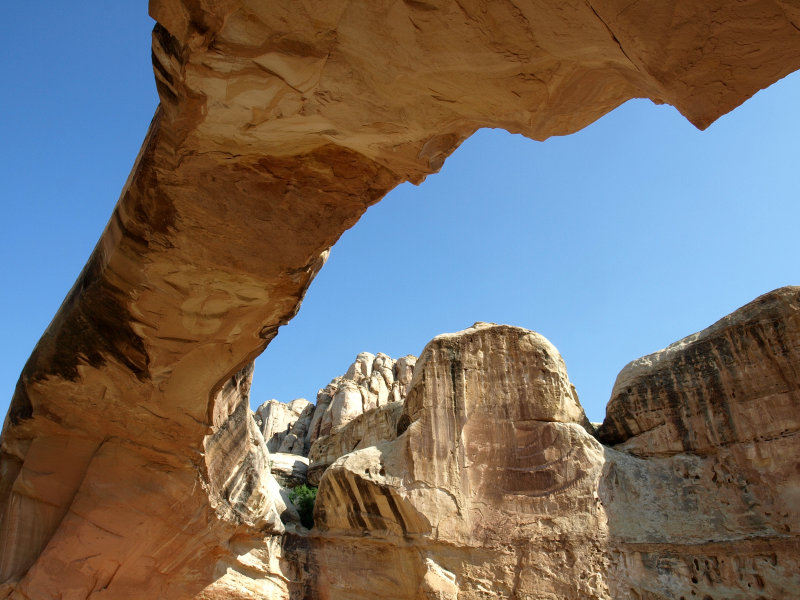
A window cut in the wall of Zion Tunnel
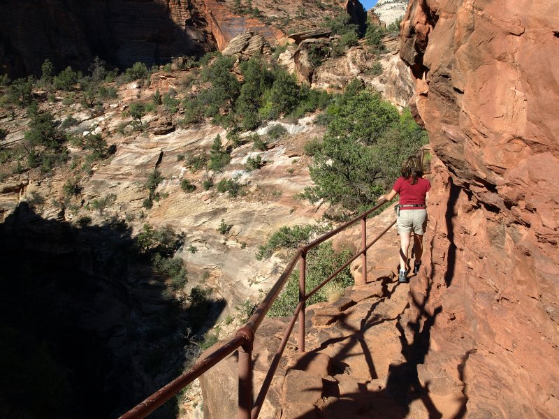
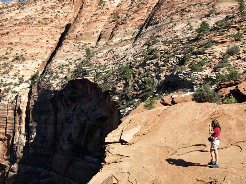
We parked just at the tunnel exit to hike the short Canyon Overlook Trail. It�s a perfect early morning jaunt and already the day was turning pretty warm.
We stopped for a shot of Checkerboard Mesa on the way out of Zion
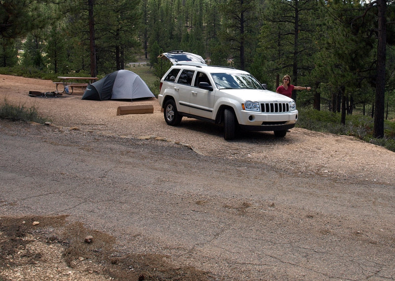
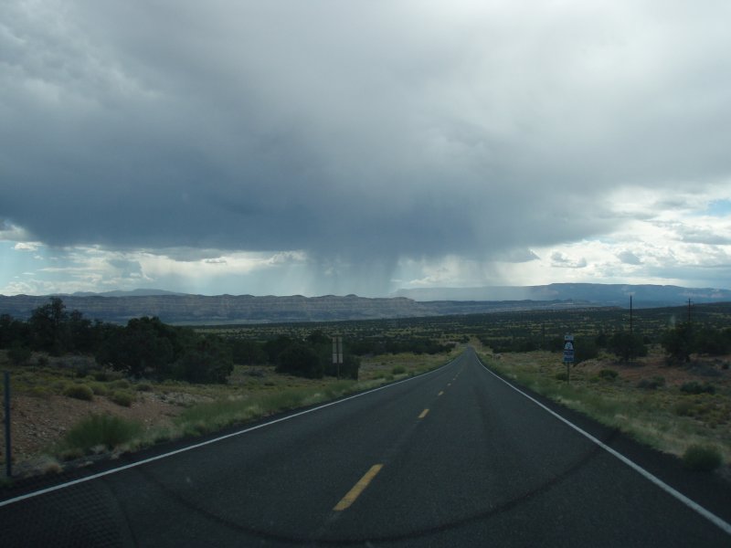
We continued through Mt. Carmel Junction onto 89 passing the Glendale Bench Road that we took back in �04- that was the long, slow route to Bryce. Not this time. We were looking forward to being in Bryce. We arrived around Noon, headed for the North Campground since it was close to the Rim Trail and found a nice tent site at the end of the D loop. We set up our tent, shared one of the wraps with cold beers and noticed the stormy skies approaching.
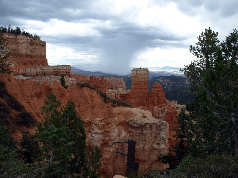
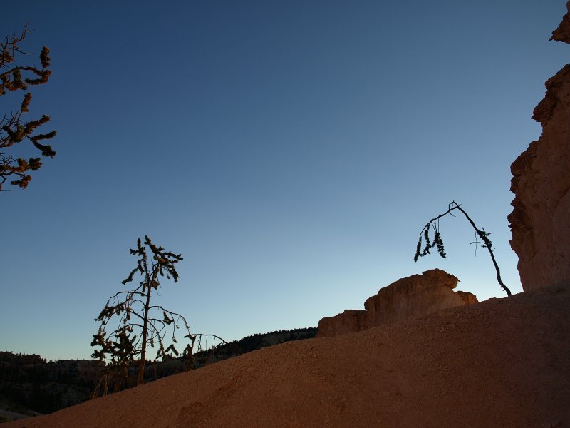
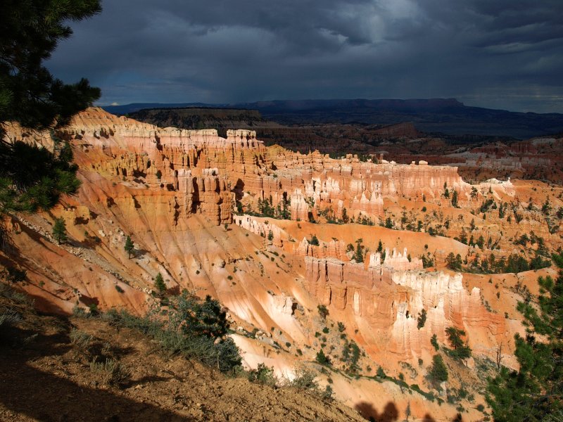
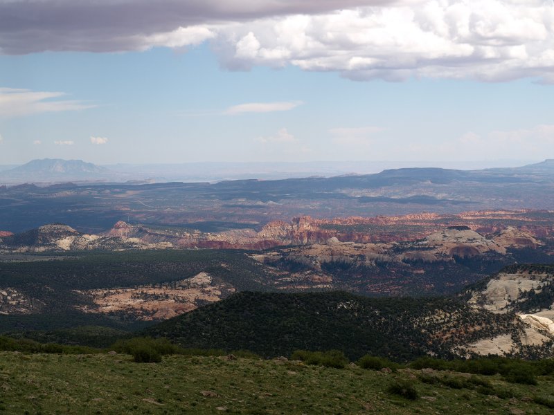
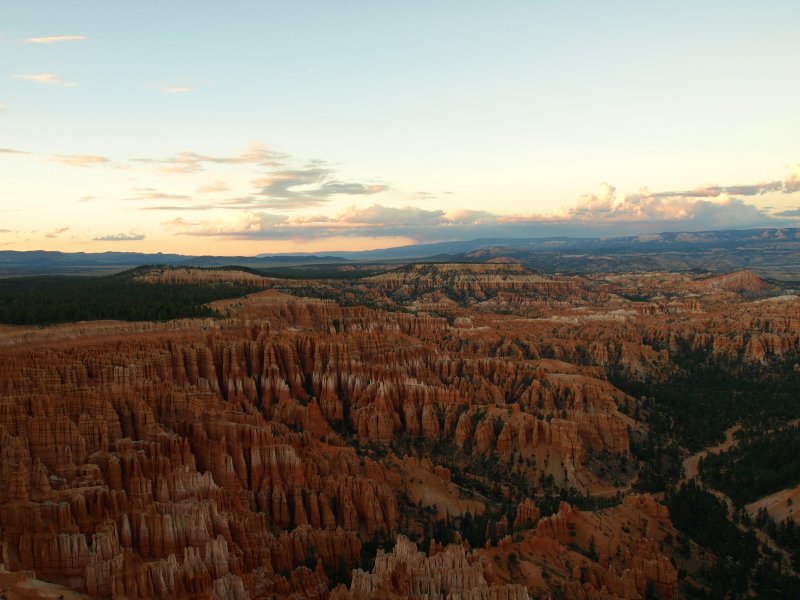
Decided to check out all the scenic overlooks. The sky made for some nice pictures, and we even had some rain with thunder and lightning! Very fun � we love storms, especially out West where the sky is so big.
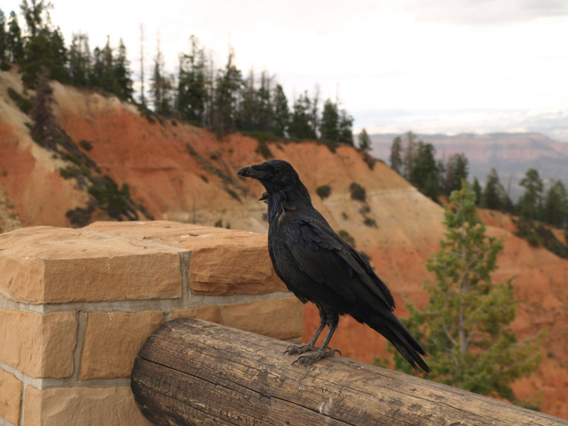
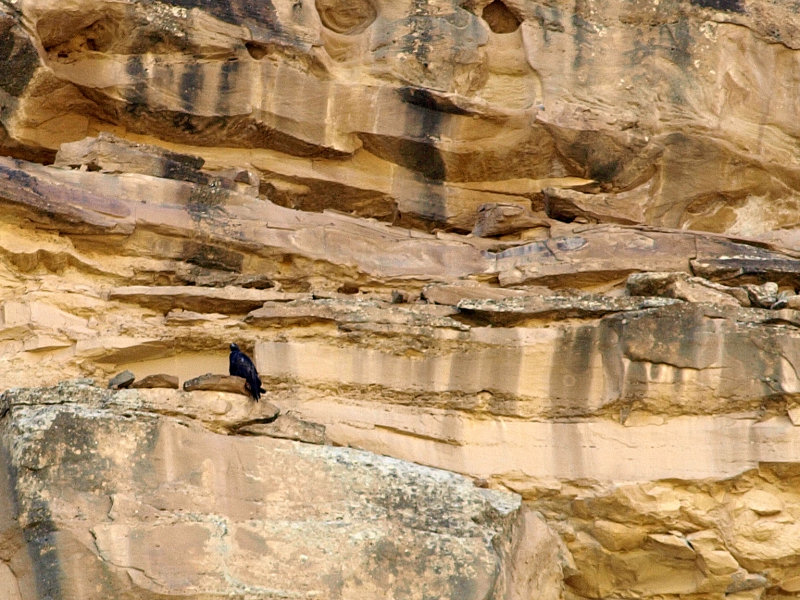
Met some very friendly and inquisitive ravens. Spent the rest of the day taking photos at the overlooks and from the Rim Trail
We were pretty hungry so we called the lodge (our campsite is the only place our cell phones worked) for a dinner reservation � no problem. We decide to keep the remaining wrap for tomorrow�s hike and pig out in the restaurant tonight. A nice bottle of wine, red trout for Sharon, sirloin for Peter, share a yummy tiramisu for dessert. The food was really good, and we had great service from a nice guy from upstate NY. We split a bottle of wine with dinner and the altitude really gave it some extra kick.
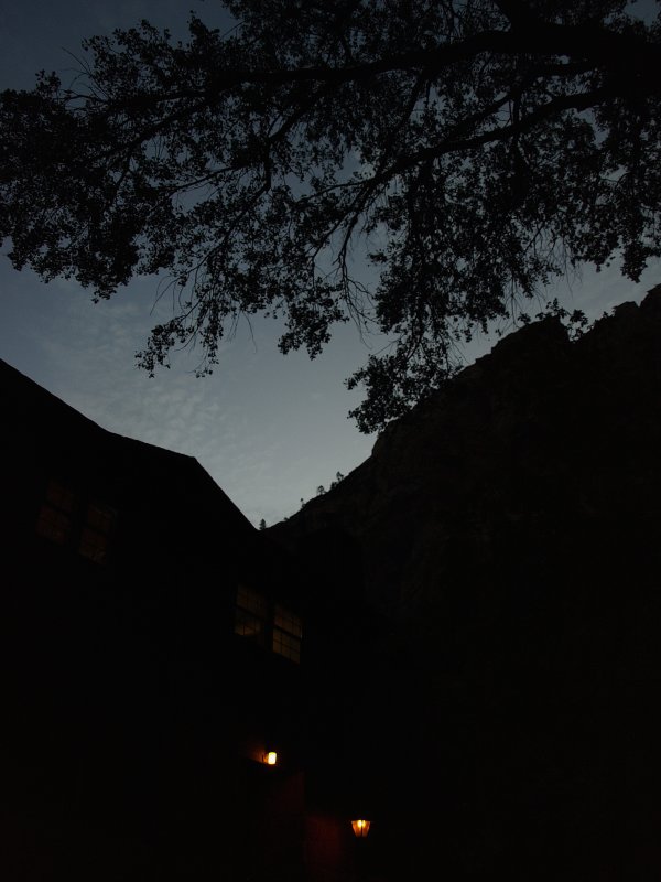
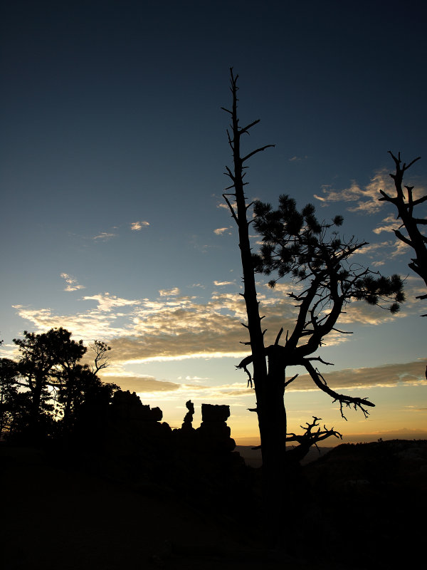
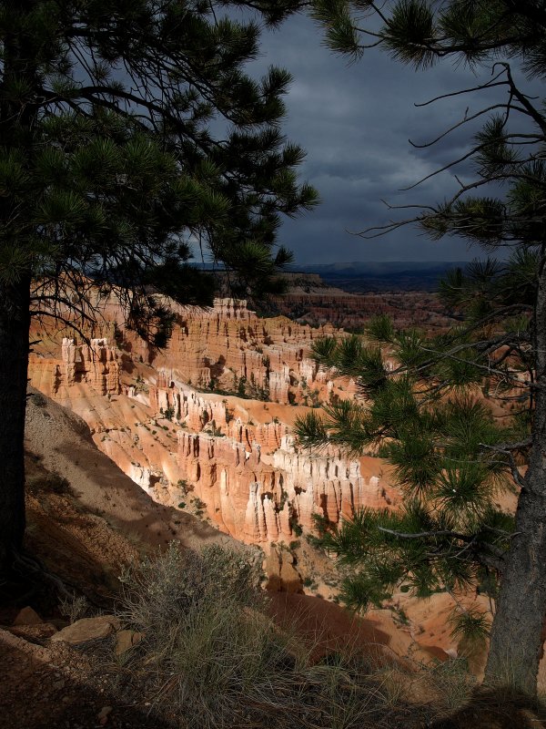
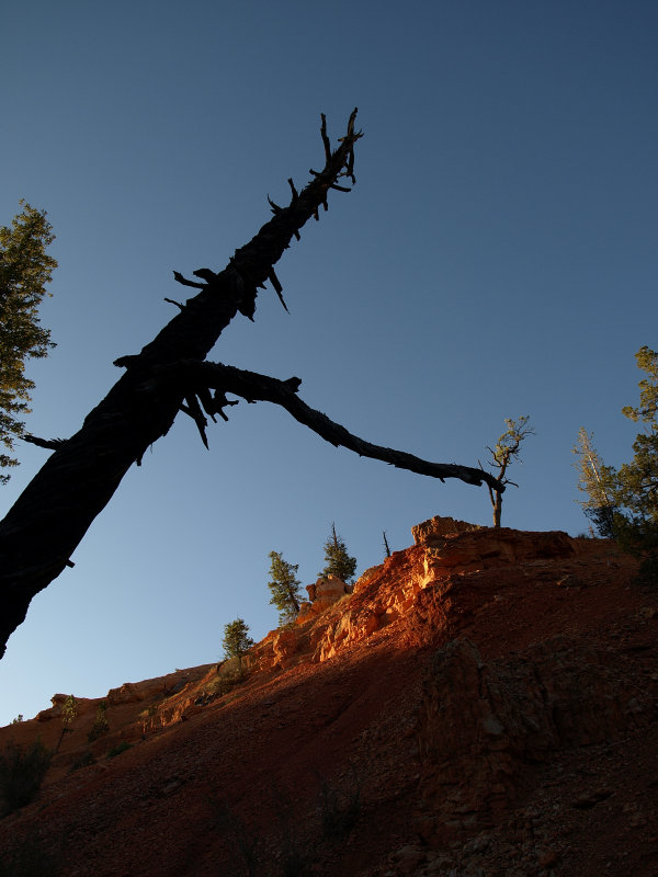
We headed to Upper Inspiration Point after dinner for some sunset photos. Chatted with some folks about hikes and good photo ops and trip plans. Head to our campsite and an early bedtime. A pretty warm night (60�s) considering we were expecting 40�s-50�s nighttime temps at that elevation (8-9,000 ft). It rained a little overnight, nothing much.
Twilight from Upper Inspiration Point
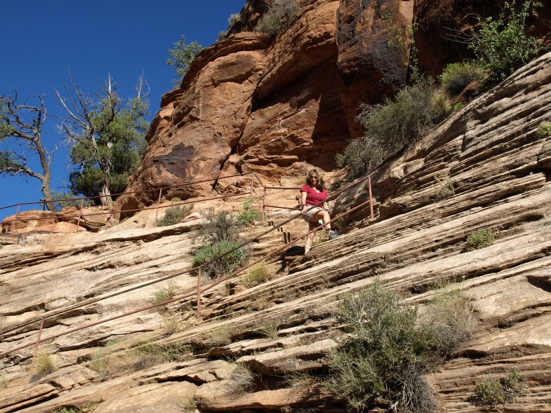
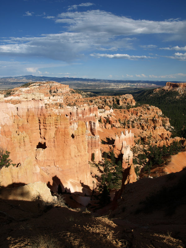
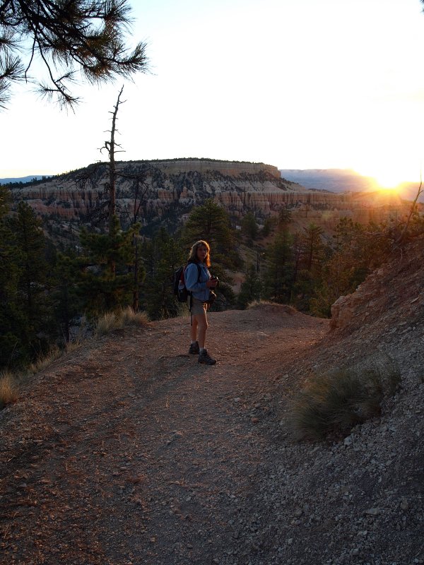
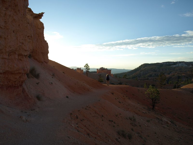
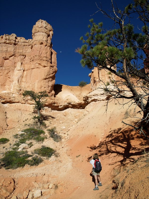
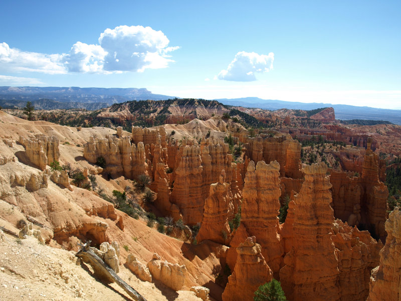
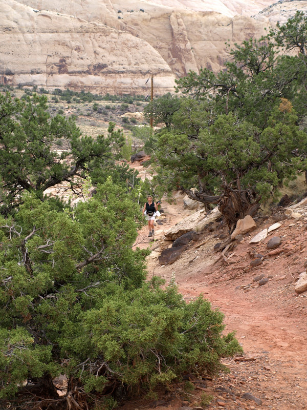
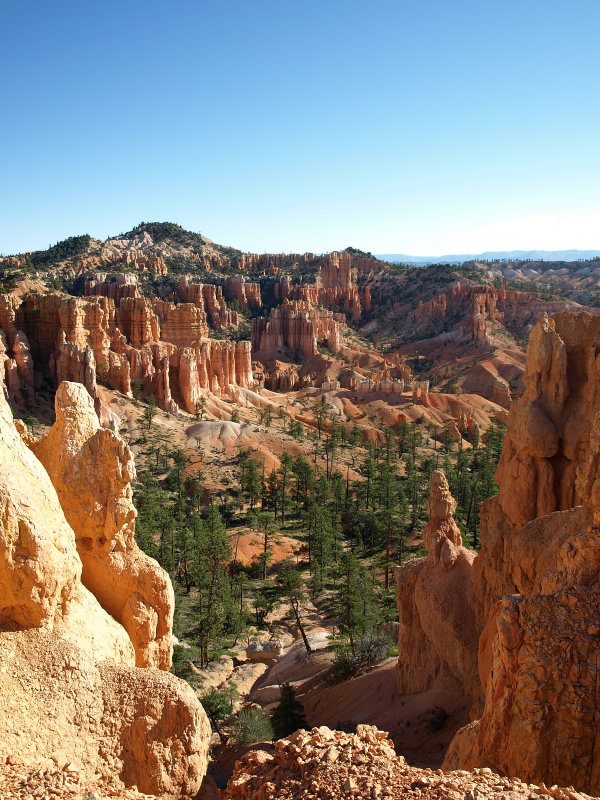
Sat, Sept 1st � Awake before dawn, made a nice pot of coffee. We wash up in the restrooms and walk to the Rim Trail toward Sunrise Pt where it soon meets the Fairyland Loop. We begin the descent into Bryce Canyon. On past visits, we loved hiking the Peekaboo/Navajo Loop. Getting down among the hoodoos is so amazing.
The morning is perfect and we start the Fairyland Loop just after sunrise. We want to get an early start to beat the heat and the afternoon thunderstorms. The Fairyland Loop will take us 8 miles around to our starting point at the campground.
We�ll also be dropping about 1000� before we reach the lowest point and then up and out. We have lots of water and the wraps for lunch. We can take as long as we want for the hike and take as many pictures as we wish. Life is good and this is a moment to relish and remember.
-
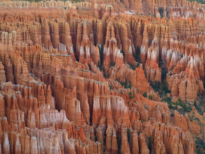
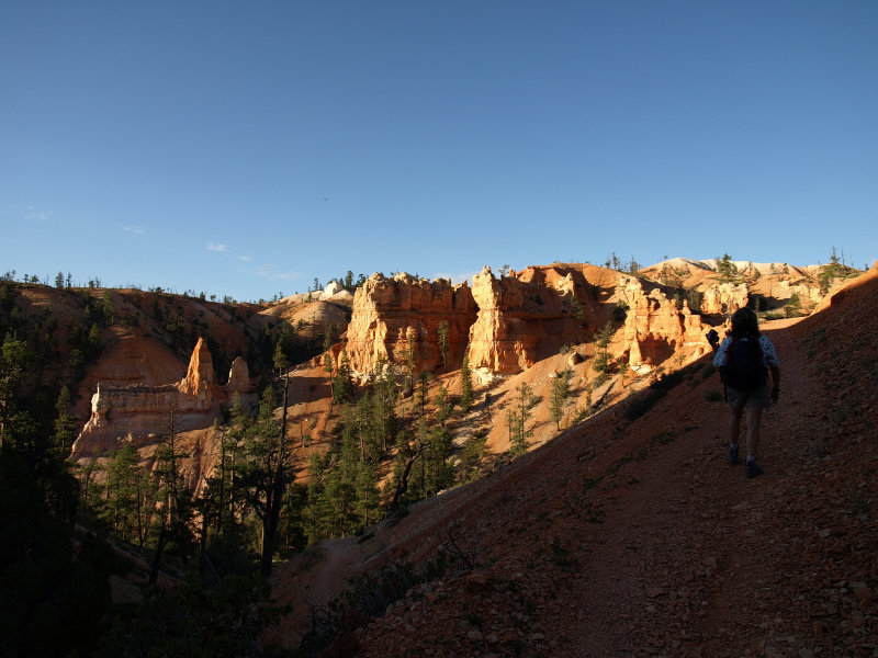
We easily make our way down the smooth gravel trail. The moon is still up but headed toward the western horizon as we are treated to strange views as we wind through ancient Bristlecone Pines.
The hoodoos on the east side of the trail are glowing with the morning sun reflecting off the ones on the west. There is a quality to the light that is unfamiliar and magical. There�s no doubt that the effort to be here now was worth it. Still the trail winds down and down.
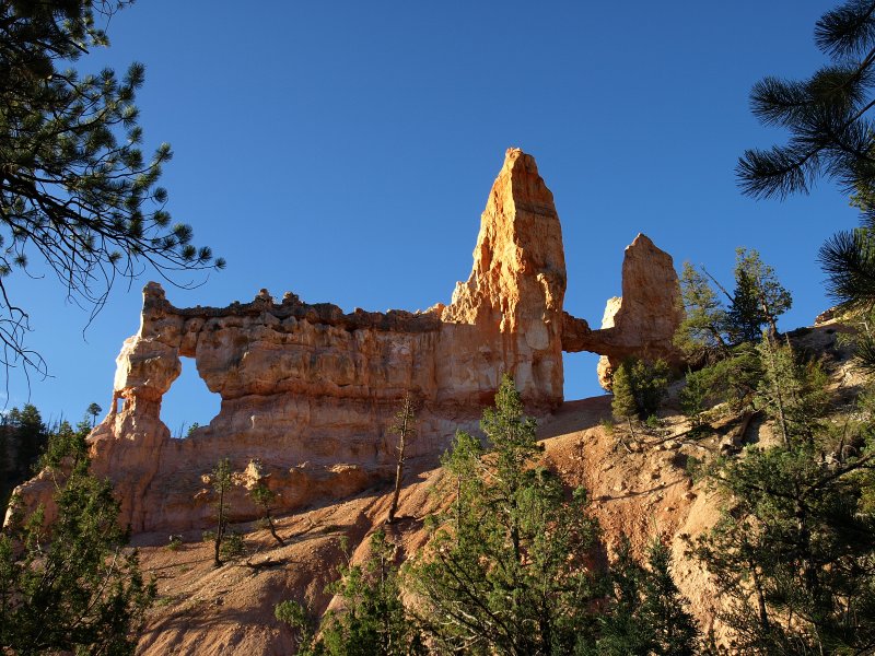
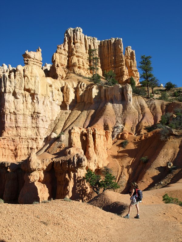
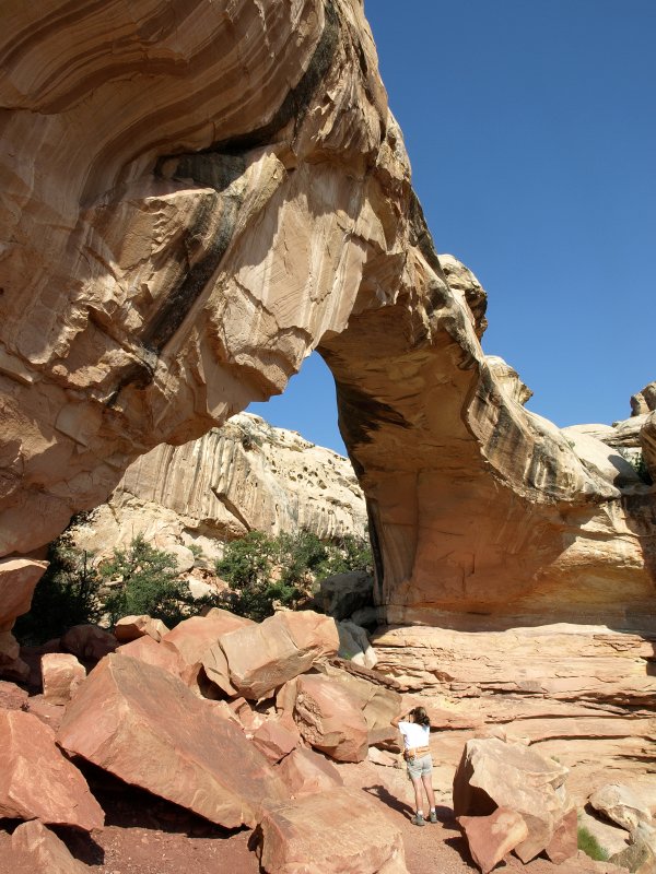
Soon we reach the Tower Arch and take the little side trail to the viewing location. True to it�s name, the massive rock formation resembles the Tower Bridge. It also looks a bit like a medieval cathedral. Either way it is formidable and well worth the few steps off the main trail.
After the Tower Arch, the trail headed up for awhile and then wandered up and down with a general upward trend.
After we were on the trail for a couple of hours, we stopped and made an early lunch of our wrap from the day before. We hadn�t seen another soul since we�d left the campground. There wasn�t a sound except for the occasional flitting and chirping of the few birds that were about. Our little snack really hit the spot and we continued up the trail.
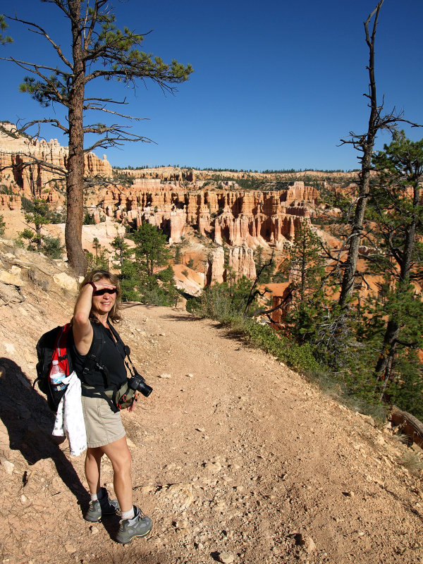
As the trail headed uphill again, we encountered our first hiker coming from the other direction. Since we were about half way, this made sense. We also noticed a pair of hikers catching up with us from behind. Our solitude was gone but the scenery was spectacular and we enjoyed new vistas as we reached the outermost point of the Fairyland Loop.
We took a break where the trail headed downward once again, and the couple hiking behind us passed by while we took in the vista. They seemed to be setting a pretty good pace and were soon out of sight down the trail. The trail meandered down through more fantastic hoodoos.
We were alone again with the canyon and the moon that still lingered in the western sky and the puffy waves of clouds that we were beginning to suspect could become afternoon thunderstorms.
As we knew it would, the trail finally took a turn and started to wind at a gentle but unrelenting grade upward toward the rim. We�d been hiking for a little over three hours. It was starting to get pretty warm and we made sure to drink lots of water from the generous supply in our backpacks. We began to encounter hikers coming in from Fairyland Point. I didn�t envy them the hike they faced in the heat of the day. We were glad to be headed out.
-
In the shade at the end of a set of switchbacks, we caught up with the couple that had passed us earlier. We paused for a water break and a chat. They seemed pretty winded and the wife looked whipped. They were looking forward to the shuttle at Fairyland Overlook. We felt bad but had to tell them that there was no NPS shuttle that stopped there. It was going to be a long last couple of miles for the couple from Ohio. Hope they got home safe and sound.
-
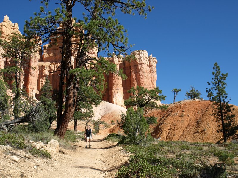
As we trudged on upward, we started to encounter folks who were just hiking out from the overlook with no intentions of doing the whole loop. When we came upon a couple of stylish young ladies in designer sandals, we figured we were close to the parking lot at Fairyland Overlook.
The trail was pretty easy as we left the overlook area. We had views along the way into the canyon and the beginning of Fairyland Loop where we�d hiked a few hours before.
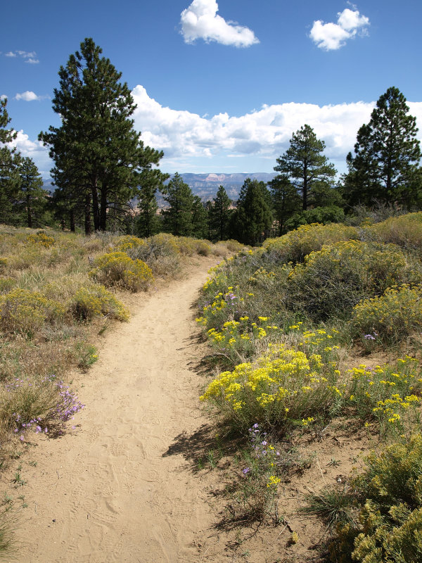
We headed up along the rim over one final hill before getting to the campground. The sand covered trail only added to the strain on our tired legs. We stopped a couple of times to drink more water watch the grasshoppers buzzing loudly among the grasses. The purple and yellow flowers lining the trail were a nice compliment to the dark trees and deep blue sky.
At last we make the final descent along the Rim Trail to the campground. It was about 12:30 PM. The hike had taken us about 5 � hours. After a brief stop at the campsite, we drove over to the camp store to shower. We�d already checked out the store and knew there weren�t many food options there for us so we headed out refreshed and relaxed to see what the out-of-park late lunch/early dinner options were on Hwy 12.
-
We were both quite hungry since we hadn�t eaten since our morning lunch on the trail hours before. We stopped at the restaurant at the Bryce Canyon Pines and succumbed to a couple of local beef patty melts and fries. It was a heavy late lunch but we knew we�d be skipping dinner at the lodge tonight and hitting the hay early as is our habit when camping. We did get a couple slices of their famous pie to go though. No reason to miss that just because you�re full
Since our legs were worn out, we fiddled away the rest of the afternoon visiting Sunset Point and a couple of others we�d missed the day before. This involved a great deal of people watching as well since it was Labor Day Saturday after all. The highlight was a father trying to get his stubborn young son to come to the overlook. The father told him it was the best one yet but the son said it was just �more rocks sticking up out of the ground�. He ended up in the car after taking a kick at his father�s ankles. We relaxed on benches and listened to the many different languages of people from around the world who were sharing this breezy afternoon with us at Bryce Canyon.
As the sun set, we headed back to the campground for a couple of beers and our homemade pie (not necessarily with the beer) as we watched the mule deer browsing nearby. We crawled into the tent as darkness fell but not before Sharon saw a very bright shooting star. It was a little cooler tonight so a restful sleep soon embraced us both.
Sunday 9/2
Up early the next morning and had a strong pot of coffee. Washed up in the nice restrooms (flush toilets and warm water). We met our camp neighbors from Minnesota who were on a 12 day trip but had no plan. They asked us where we were headed which led to a flurry of maps and notepads. I think we convinced them to do the Grand Circle. We�ll have to drop them an email for the rest of the story.
Finally broke up the gabfest to pack up and hit the road. Out of the park and onto Hwy 12. Off through Tropic and Cannonville, then out through the canyons toward Escalante. We set the cruise control to 45 mph and enjoyed the morning. We only needed to get to Escalante. We were in no hurry�we were already where we wanted to be.
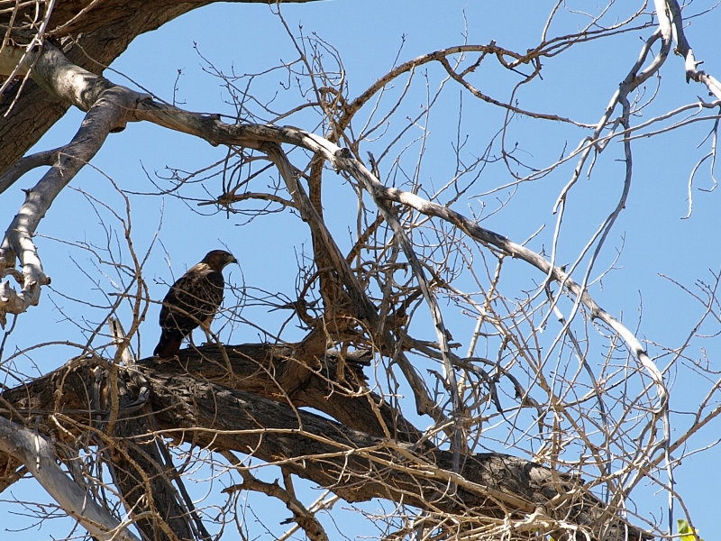
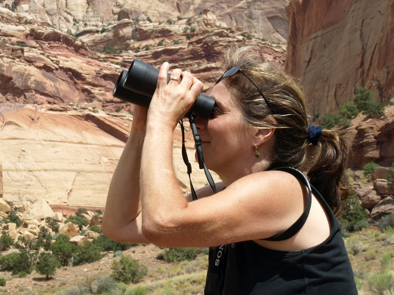
Somewhere along the way, Sharon spotted a large bird on the cliff near the road. We pulled over and watched through the binoculars but it was too far for a decent picture. We decided it was an immature Golden Eagle.
-
Even dawdling along and pulling out for traffic to pass, we soon arrived at the new joint BLM/NPS Visitor�s Center. On our last trip it was under construction and the trailer that was the temporary VC was closed for the night. We pulled in to check it out and who should be there but our Minnesota friends from the campground. They were just leaving the VC and had even watched the movie in the theater. I guess we were taking our time.
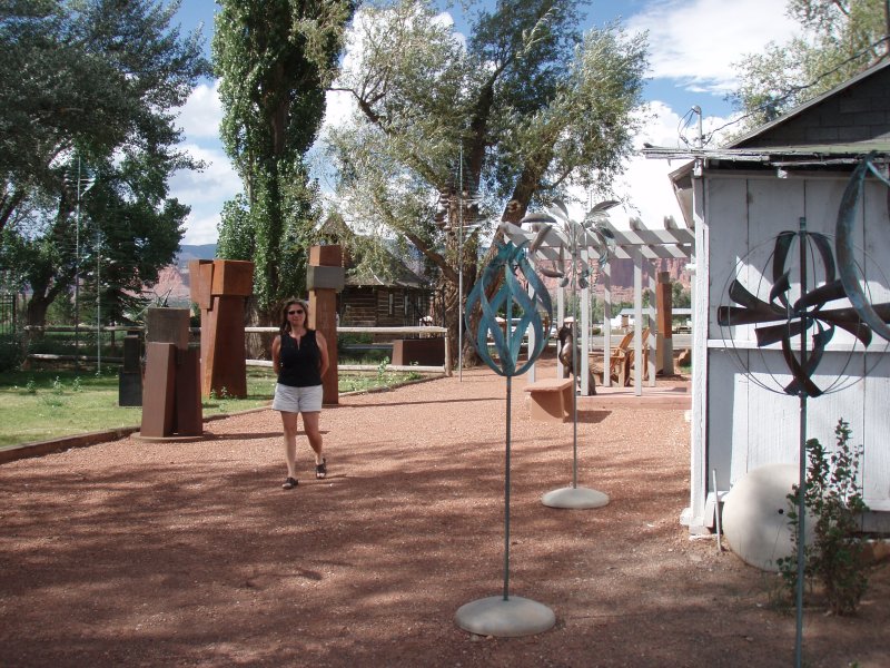
The visitor�s center is very nice. The grounds are landscaped with native plants and some great sculpture of desert critters. We watched a bit of the movie and checked out the displays. It isn�t a large VC but there are people to talk to for advice on activities in the area. They have an extensive selection of topo maps which are a vital bit of gear if you�re headed away from the roads.
-
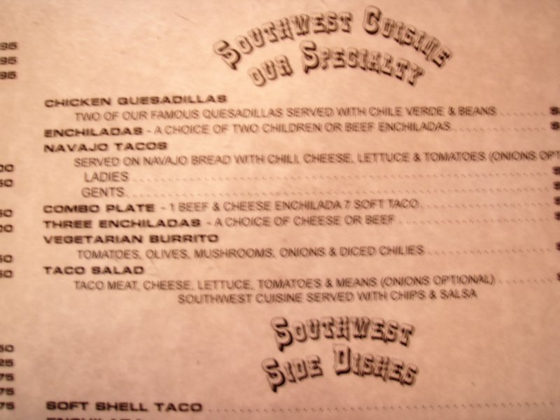
We left the VC and headed into Escalante. After touring the main drag, we were hungry and ended up at one of the only places open, the restaurant at the Prospector Inn. Ordered a couple of Mexican food items � taco, enchilada, veggie burrito. Pretty basic food but fine. We were amused that they served children�children enchiladas! Quite a menu misprint! When we asked for some salsa we were brought what appeared to be a bowl of canned stewed tomatoes but, hey, we were hungry.
After our mediocre mid day meal, we decided to take a backroad cruise on the Hell�s Backbone Road. Before heading out of town, I stopped at the minimart at the north end of town to check the tire pressure. I was suspicious of the left front tire, it looked a little low and the Jeep was pulling to the left a bit. Sure enough, it was about 10 psi low. I checked the other tires as well, and they were all different� not uncommon for a rental. I should�ve checked them sooner in the trip as I usually do.
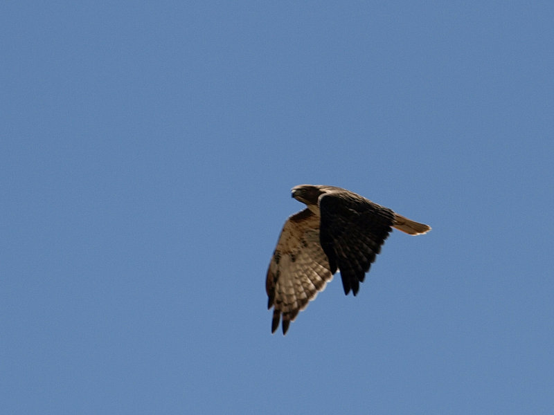
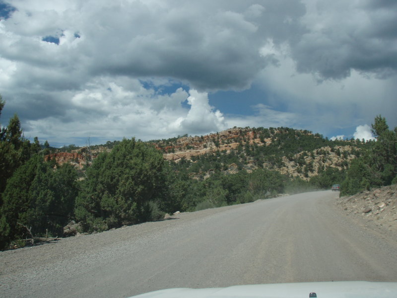
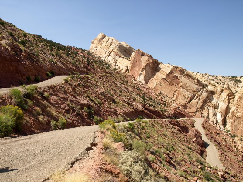
The Hell�s Backbone Rd. is a 38 mile drive that dumps you out on Rt. 12 about three miles south of Boulder. We found the road easily since it is well marked at the north end of Escalante. It starts out as a back street but then turns to gravel as you head out of town. It was wide and dusty. Just as we left town, Sharon spotted a small hawk on one side of the road and I spotted another in a tree on the other side. We stopped and watched them as they eyed us warily.
As we continued along, the road began to climb and red ridges dotted with sage and juniper rose along the left. The road was still loose gravel and had become washboard.
Since it was wide and fairly straight, I was able to keep up some reasonable speed to smooth out the rippled road.
-
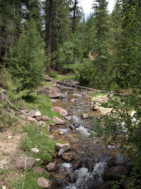
Eventually we climbed higher and the junipers gave way to the alpine forest of spruce and pines. The road got smaller and twistier as we climbed. It was still washboard and caution replaced speed. A car bouncing on washboard in a turn doesn�t respond well and with steep drop-offs alongside the road, I needed a sure response.
It always amazes me to drive just a few miles and find myself in an entirely different environment. A few minutes earlier, we�d been in a dry, scrubby juniper-filled land and here, we were passing babbling mountain streams where the scent of firs and pines filled the air.
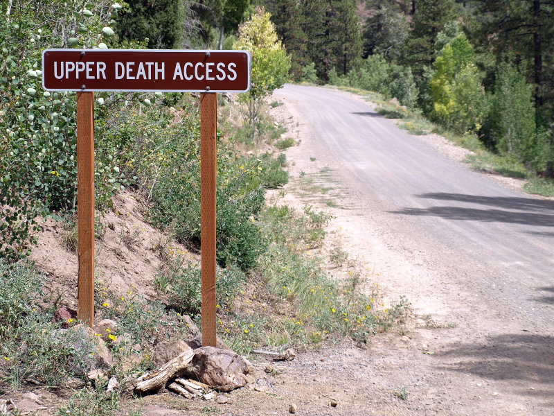
As we passed the highest point on Hell�s Backbone Rd. (9,000� or so) we began to get glimpses of The Box Death Hollow Wilderness on the right. This is a little-used yet spectacular area. I hear there is great hiking in there and I can believe it. Some of the signs in the area are amusing too.
Eventually the road headed down to Hell�s Backbone Bridge which provides great views and photo ops of the area. We stopped to try our luck with the cameras and stretch our legs.
We reentered the juniper forest. The bright yellow flowers of the rabbitbrush added a lovely contrast to the dark green trees. We could hear thunder in the distance, and we were glad to be off the mountain where the sky had turned dark as the storms gained strength in the heat of the afternoon.
As we continued along enjoying the scenery we passed a young woman filling a pickup truck with firewood she�d harvested with a chainsaw from the National Forest we were passing through. The logo on the truck was from a Bed and Breakfast in the area. Gathering firewood is allowed in the public lands as long as you have a permit.
-
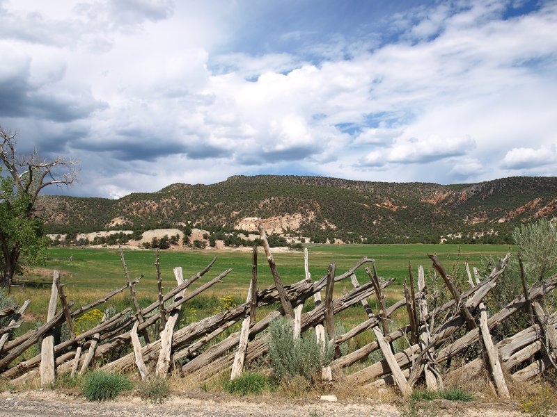
Finally the road leveled out and we came upon the green pastures of Mormon ranchlands. The monsoon rains had been kind to them this year. I stopped to take a picture of the interesting fences they build from the twisted juniper trunks. A dour faced local came along the road toward us as I was shooting and, from his expression, I gathered that they didn�t cotton to strangers thereabouts. I smiled and waved and moved along.
The landscape turned dusty and dry and the juniper smaller and sparser as we drove the final few miles to the intersection with Hwy 12. We took a right back towards Calf Creek and Escalante. This is the section of road, just south of Boulder, that is known as �The Hogsback�.
-
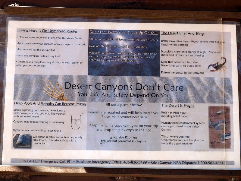
Before we got to the narrow section, we noticed a pullout that led to a parking area with a few cars. Like a good tourist, I pulled in to see whatsup. It turned out to be the parking area for the Upper Calf Creek Falls Trail. It was quite warm out as I wandered over to where the trail drops onto the slickrock. There was the box where you sign in and out of the trail and a tablet that reminded �Desert Canyons Don�t Care�, words that I would ponder later on.
The view was stunning with the thunderstorms looming over the mountain we�d just abandoned. In the foreground I could see the first couple of cairns that marked the trail down the slickrock to the bottom. I took a few pictures and headed back to the car in time to see Sharon get enveloped in a dust devil. She was less than pleased with all the sand in her eyes and nose so I stifled my amusement.
We got back on the road south and soon came to the very narrow stretch of The Hogsback where the canyon plunges steeply away from the road for several hundreds of feet on both sides. Both hands on the wheel please! We�d never gone this direction over The Hogsback and it seemed a little scarier this way. But fun!
-
We enjoyed another scenic pullout overlooking Lower Calf Creek Canyon and then continued down Highway 12 past the state campground. We decided to pull into the Escalante River Trail access by the bridge. It was hot out, and Sharon went for a cooling wade before we returned to the car.
After a few more miles, we came upon the Kiva Koffeehouse and pulled in to see what was new.
We learned that they are now serving dinner a few nights a week and had two accommodations available. Neither was inexpensive but, considering the location and the unique structure, it didn�t seem too far off the chart. We looked at the menu and then headed out thinking we might come back for dinner.
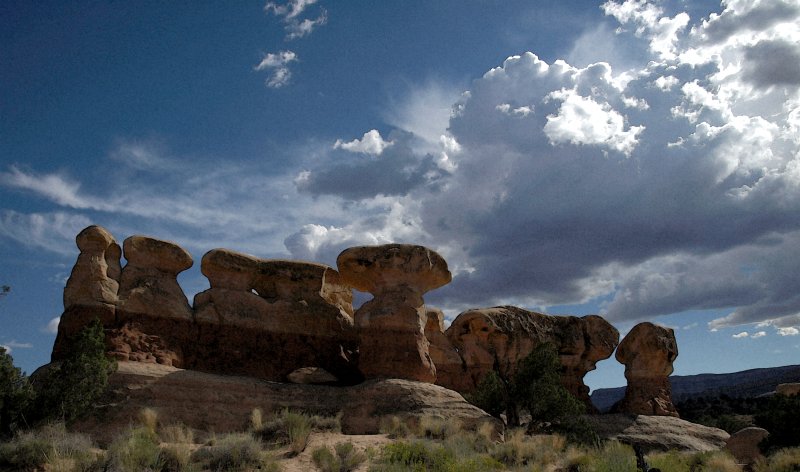
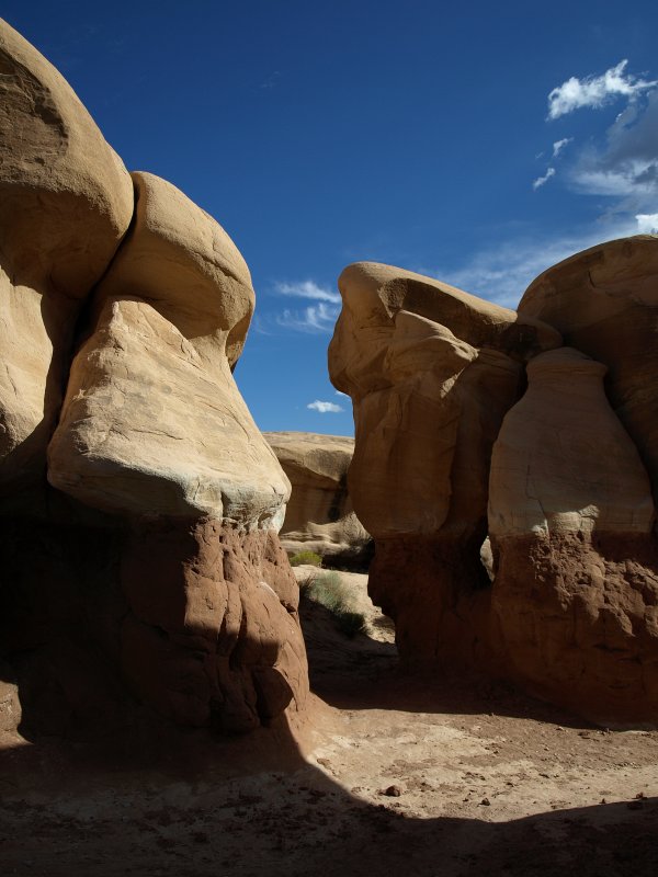
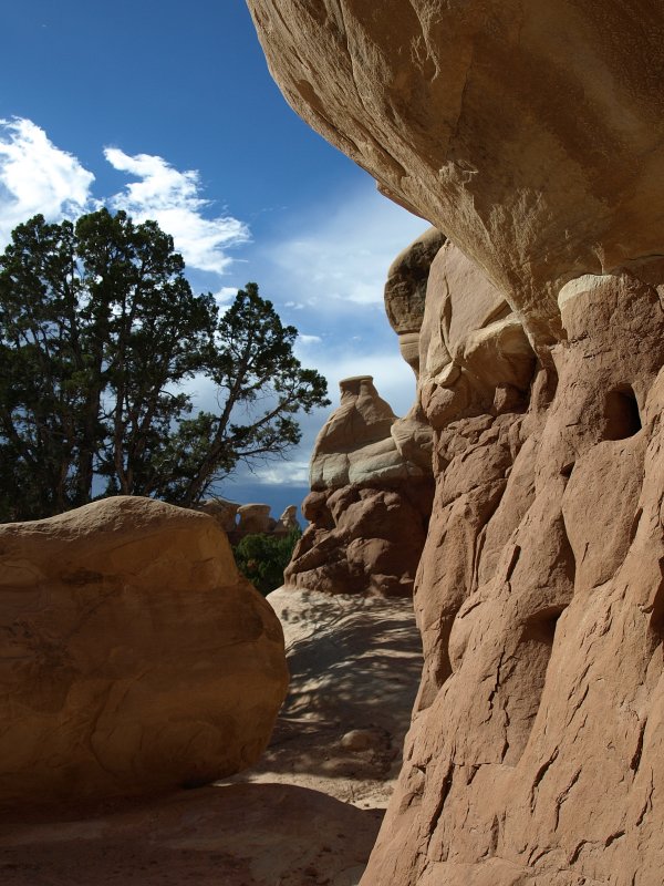
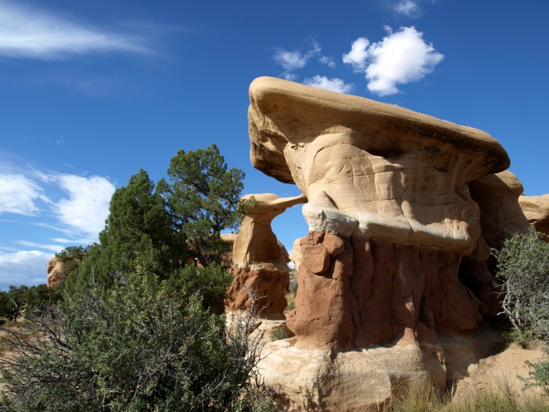
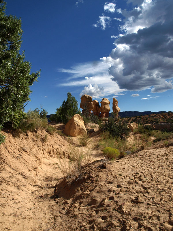
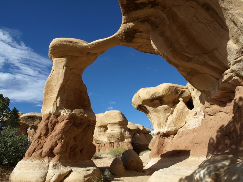
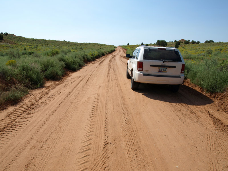
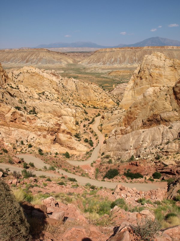
Since it was still early enough, we decided to take the drive down the Hole-in-the-Rock Road to the Devil�s Garden. We figured the light would be about perfect for some pictures by the time we drove the 16 miles or so of dirt road off Highway 12. The Hole-in-the-Rock Road is wide and mostly straight and level but washboarded. We made good time as I was able to keep the speed up to smooth out the ripples. We reached the parking area next to the garden of hoodoos.
No hiking required here, just meandering. The hoodoos, like most hoodoos we�ve seen, were quite amusing. Most are between twenty to thirty feet tall and some are in groups, while others stand alone.
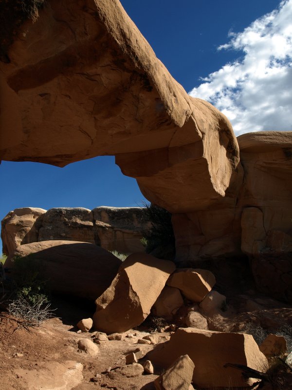
The iconic highlight of the Devil�s Garden is a hoodoo attached by a thin bridge to a larger rock formation. I took way too many pictures of it from every possible angle. The afternoon light and the clouds against the deep blue Utah sky made it easy to get carried away. Besides, pictures are free and I can always delete the duds later.
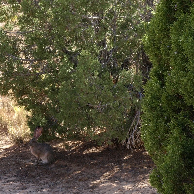
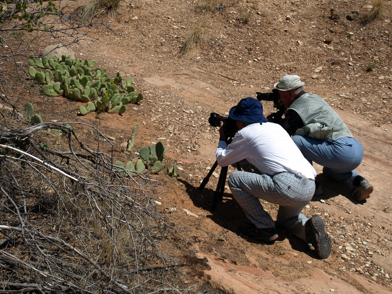
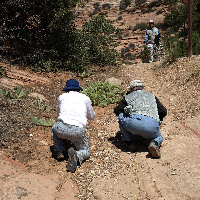
Sharon and I had wandered away from each other so I took a break from shooting to see what she�d gotten into. I found her sneaking up on a jackrabbit, something we don�t have at home. She does tend to gravitate towards the wildlife, and she ended up with way too many pictures of rabbits (as I did hoodoos).

It was about this time that a couple of families arrived and began scrambling over the hoodoos. Watching them, I was reminded of my time growing up in Arizona. Like we had been, these kids had no fear of heights and were taking turns posing in the middle of the thin bridge of rock that I�d been shooting earlier. I was impressed by both the careless bravery of youth and the strength of the bridge of stone. As we headed back to the car we saw photographers beginning to arrive with their tripods to capture the arch and hoodoos during the golden hour before sunset. We needed to head back to town since our plan was to camp at Escalante State Park.
-
As we left the parking area, a light on the dashboard indicated a tire pressure issue. We stopped and checked the tires, sure that the offender would be the left front. I banged on the tires and they seemed fine. I jumped in and decided to proceed with all due haste toward Escalante. I turned onto Hole-in-the-Rock Road and drove as rapidly as seemed prudent. Probably 50 to 60 mph. We had 16 miles of dirt and probably another 10 on Rt. 12 before we made town. I was setting a pretty good pace so you can imagine my surprise when a white Dodge pickup appeared out of our dust trail and passed us! There was a dirt bike strapped in the bed of the truck as it was flying by. Musta been a Hemi.
We pulled over again to check the tires, and it seemed like the left rear was a little softer than the rest. Looks like we had a slow leak. We were wishing we�d bought a can of Fix-a-Flat (like we�d talked about during our trip planning. Guess we should�ve followed our own good advice.) The tire wasn�t so soft that we couldn�t drive on it so we continued, although at a lower rate of speed now that we knew we had a real issue with the tire.
-
We reached the pavement and drove into Escalante. We�d already decided that camping was out and that we�d need to be in town to resolve the tire situation. We stopped again to use the minimart air pump. All the tires were fine except the left rear. It was down 20psi from the 40 it had been before we�d headed up the Hell�s Backbone Road. Just lovely. There was an empty spot on the shelf at the minimart where the Fix-a-Flat should�ve been. Must be a popular item hereabouts. I inquired at the register and was told that the grocery store would have it but they were closed until morning. I figured that the Fix-a-Flat was my best early option since it was the Sunday evening before Labor Day. The chances of getting a tire fixed on Labor Day in this tiny town seemed nil.
I topped off the tire and figured that we�d grab a room and see what the morning brought.
After a drive through town to check out our options, we booked a night at the Prospector Inn ($62/night). Our room was modern, clean and good sized, and right in the center of town. After unloading our luggage, we drove back north on the strip in search of what food might be found in this peaceful little town of Escalante. Considering that it was a Sunday evening, we didn�t expect much but were willing to try any other option than returning to The Prospector.
-
Escalante Outfitters seemed to have a deck with something going on so we pulled in. Sure enough, next to the store they have a little bistro serving light fare including pizza. They also had a nice selection of cold beer and that sounded great after a stressful hour or so. We sat outside on the deck which had seven or eight hummingbird feeders hanging each with several hummingbirds zipping around it. Our beers soon arrived and we ordered a couple of little pizzas and a salad. After a few sips of cold beer and a few minutes of watching the hummers tussle over access to the feeders, we began to chill out. There was quite a variety of hummingbirds and we asked the waitress about it. She said that they have five or six kinds and they were usually gone by now. They�d be leaving any day. Lucky us! The pizzas arrived and, although we don�t recall what kinds we had, but they were quite good and really hit the spot. We told our waitress of our tire issue and she gave us the number of a local guy somewhere just outside of town. I wondered if he�d be open on Labor Day and she laughed and said, �It's his house so I�d guess he�s open if he�s home.� Better than nothing I guess.
-
Before heading back to the motel, we drove back to the tire pump at the minimart. The tire had lost 15psi in about an hour and a half. I topped it off but, at the rate it was leaking, it seemed as though it would be flat by morning. Oh well, at least it will be easier to change on the concrete motel parking lot than by the side of the road. The Jeep had a full sized spare so that was reassuring. We watched the tube until 11 or so and then turned in. I wasn�t sleeping well and went out a couple of times to check the tire. It seemed to be holding up pretty well, and I finally dozed off completely at about 3am.
Monday 9/3
Woke up not knowing what to expect. The tire was low but it looked like we�d be able to drive it to the grocery store to get the Fix-a-Flat. While brewing our pot of coffee, I exchanged pleasantries with the couple next door as they loaded up their matched pair of BMW motorcycles. They were getting an early start headed up Highway 12. They were pretty excited and I reassured them that they had every reason to be.
We enjoyed our coffee and showers and such and then headed off to get our Fix-a-Flat and stock up on ice and gallon jugs of water at the grocery store. Sure enough, they had the tire stuff, three cans. We bought two and left one for the next unfortunate soul who might need it. We reloaded the coolers and headed for the minimart air pump yet again. I wanted to let lots of air out of the tire before putting the Fix-a-Flat in and then top it off with the air pump right before we leave town for Boulder and Torrey.
-
As we drove down the strip toward the north end of town, we noticed that Thomason�s Garage was open and it looked like they specialized in tires. We�d noticed them yesterday but they�d been closed and we figured they�d be closed on Labor Day. The heck with the Fix-a-Flat, we turned around and pulled in. I asked if they might have a look and somebody went out back to see if maybe they could. Turns out that their tire guy was there loading a truck. It seems that the whole business was getting moved to another location and this was their first moving day. I explained the situation and he agreed to take on the job. Hallelujah!
I pulled the car up and he pulled the tire off lickitysplit. He sprayed water on it and misted it with a soapy solution. Nothing. No bubbles. I mentioned the slowness of the leak again and he filled a tub with water and a little soap. We both looked but nothing showed. �Sometimes these slow ones take awhile� mused the rangy, wrinkled tire guy. After patiently turning and misting the tire for a few more minutes �there it is� he says. I looked where he was pointing and finally I could pick out the tiniest little bubble forming. Good eyes. He marked the location of the leak and the tire weights and started removing the tire from the rim.
I went outside to fill Sharon in on the discovery of the leak. She was basking in the warm sun in front of the garage�s minimart. It seemed like a popular place and lots of people were filling their tanks. Every single person who passed by us on their way in smiled and greeted us. Now, I�m not saying that folks back home are unfriendly but they would�ve likely walked past with little or no acknowledgment. Perhaps it was the beautiful day or knowing that the tire would soon be fixed even on Labor Day but the locals seemed to be some of the friendliest folks I�ve encountered. But this is often the case in Utah from our experiences.
I checked back with the tire guy and he was lightly grinding the inside of the tire where the leak had been. I wondered what had made the hole and he replied, �I think it was probably this� as he held up a thin sliver of steel. �Looks like part of a key or something.� As he handed it to me, I slipped it into my wallet as a souvenir. Soon the tire was repaired and mounted back on the Jeep. I asked the tire guy how much I owed him. �You gotta pay inside� he said. I gave him five bucks, shook his hand and thanked him. Inside they charged me eighteen dollars for the repair. Pretty darned good deal. We pulled out onto Highway 12 repaired and raring to go.
Our only plan today was to visit the Anasazi State Park in Boulder and then drive over Boulder Mountain to Torrey so we were in no particular hurry. We drove at a leisurely pace enjoying the scenery until we approached the Kiva Koffeehouse. We figured since the leaky tire had cheated us out of dinner here, we might as well stop for breakfast.
We shared a veggie frittata and an order of southwest potatoes. Both were excellent but, for seventeen dollars, they sure should�ve been. Of course the ambience and the view are worth something as well. The huge Ponderosa Pine logs used to build the place are amazing. I guess that�s why they�re called Ponderosa.
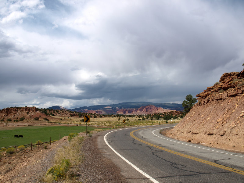
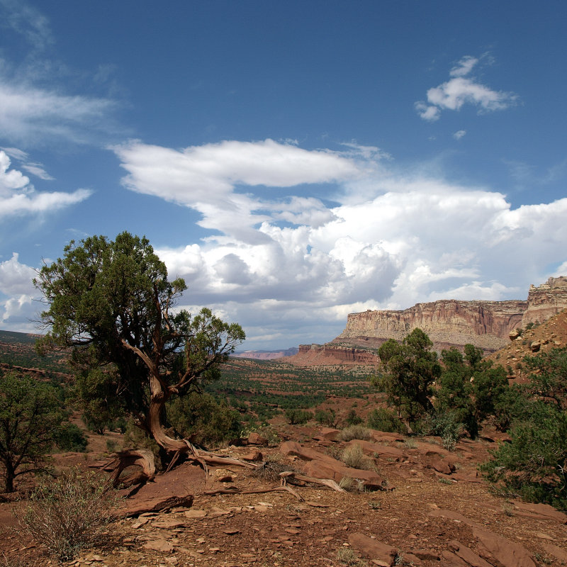
We moseyed on along Highway 12 past the Calf Creek Campground and up over the Hogsback again, this time headed north. It was another stunning day with puffy white clouds that we now knew would grow into thunderstorms as the day progressed. Finally we were overlooking the outskirts of Boulder, one of our favorite places in Utah. I�m not sure why we like it so much. Maybe because it�s such a scenic oasis in contrast to the barrenness to the south. There are farms and pastures, and it seems so green and full of promise.
-
We stopped for some juice and beer at the store just before town. They have an interesting assortment of rocks and rugs for sale in addition to the usual stuff. Lots of organic and natural foods. Even a produce section. Pretty good considering how far in the hinterlands we were. Sharon thought the tanned, long haired hippy guy minding the store was a hottie. He seemed like a nice guy.
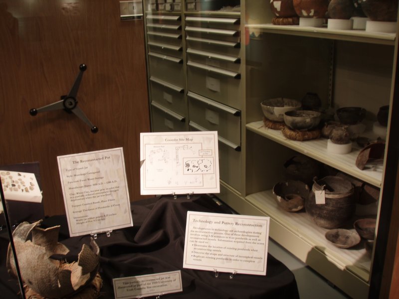
We only had time for a sip of V8 before we arrived at the Anasazi site. We paid the modest admission and browsed the museum display which, though small, was quite informative and well done. Through thick glass at the back of the display area, you could see the racks of pottery and other artifacts that aren�t on display but are available to visiting researchers.
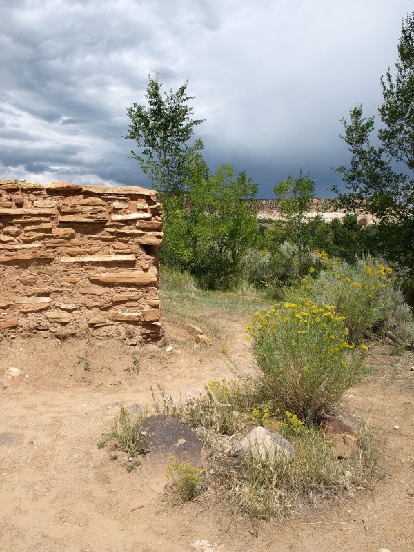
After that, we went out back to look at the ruins. It had been a small community and some of it isn�t excavated. Evidence indicates that it was burned when it was abandoned after 75 years of use. Not very many generations. This was the outer northwestern range of the Anasazi. One can only wonder what happened. These places always make us feel a little melancholy as we try to see the place as they did.
-
We looked out away from the ruins at Boulder Mountain where there would have been game to feed these people. There was water here for crops too when the monsoon season came. And trout in Calf Creek and the Escalante River. The promise that we feel when we arrive in this place is the same promise the Anasazi felt and the Mormon pioneers later on.
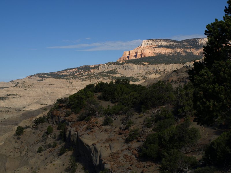
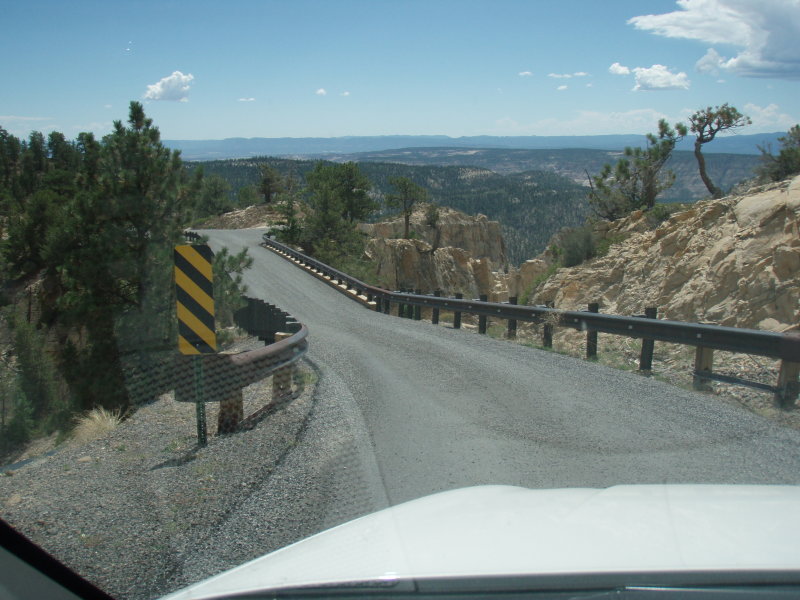
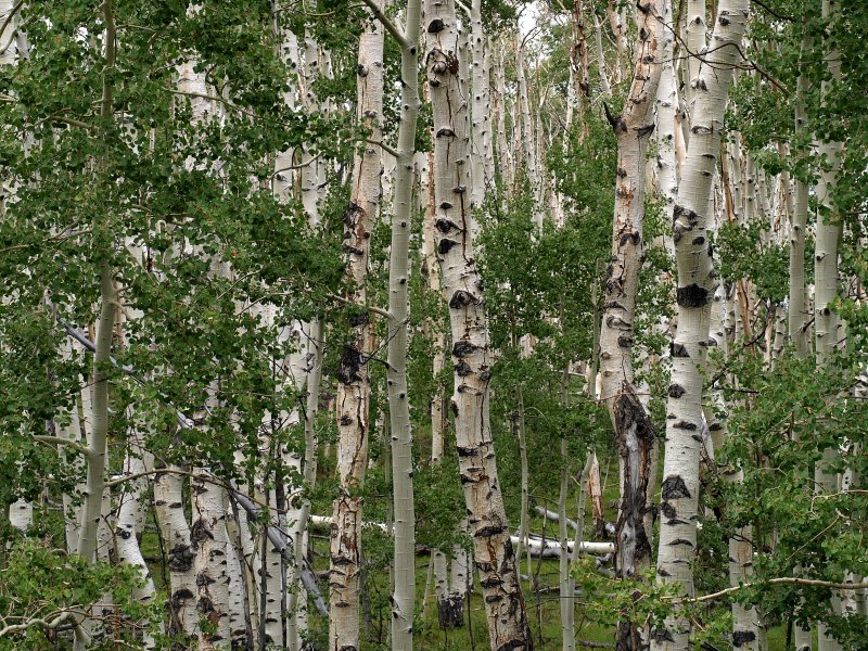
We left the museum and Boulder and began our slow meander up Boulder Mountain. It was looking pretty dark with storm clouds scraping over the 11,000 ft. summit. Up and up we went climbing out of the juniper and scrub into the aspen and pines. Higher we went until the trees thinned and shrank on the higher reaches of the mountain. It rained off and on but never heavily. The air took on a chilly feel as the temperature fell to 59 degrees.
We pulled into a scenic overlook that gives a panoramic view back toward Boulder and canyon country to the south and east. We took a few pictures and continued along. As the road started its gradual descent, it began to rain again and we drove through a muted, misty landscape of tall evergreens and aspens. We'd see an occasional stream rushing down the mountainside and under the road toward the valley below. There are quite a few campgrounds along this stretch of road and they weren�t crowded, but there were plenty of folks out enjoying the wilderness on this Labor Day.
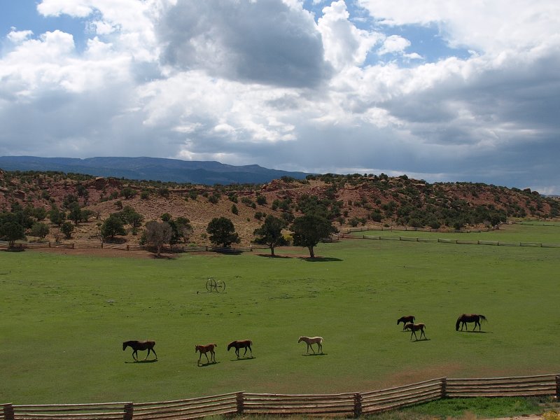
Farther down the mountain, we began to get glimpses of red rock in the distance. Torrey was just up ahead. Soon the road leveled out and we encountered the ranchlands outside Teasdale. The sun had broken out of the clouds. We stopped to watch some young horses frollicking in a lush green pasture.
There was a good bit of construction going on in the outskirts of Torrey. It looks like the word has gotten out about another gem of the west.
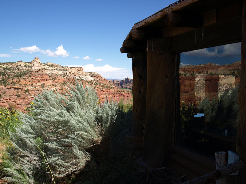
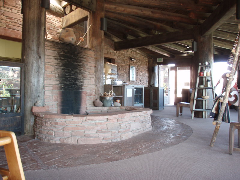
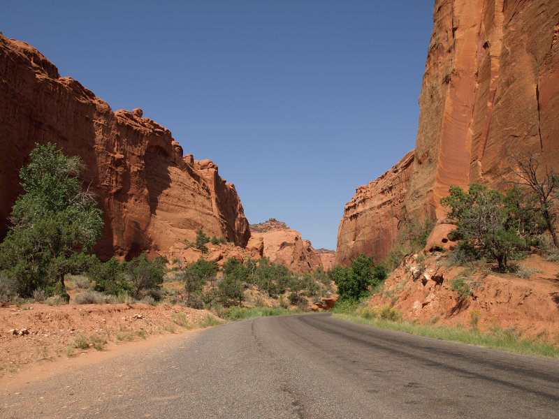
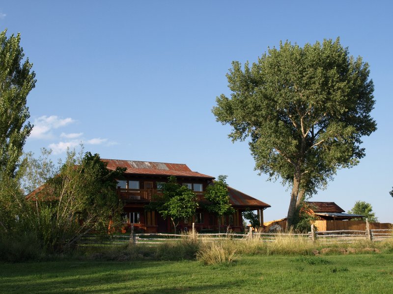
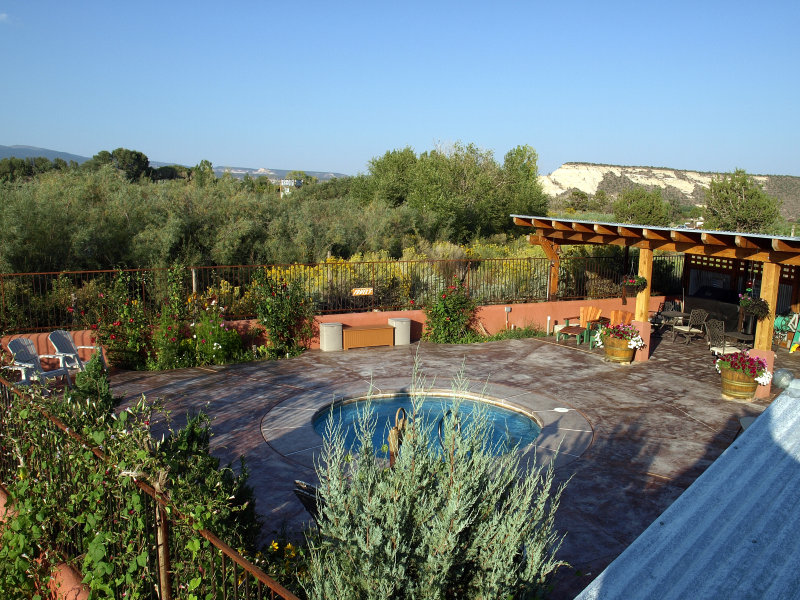
We drove into Torrey, took a left at The Intersection of Highway 12 and 24 and checked into Austin�s. The property is really pretty with nice large trees, a beautiful fenced pool/hot tub/patio area, scattered picnic tables, a few cabins and several outbuildings including the large store. We took advantage of the Laundromat and soaked in the hot tub while we waited. The pool made a nice bracing counterpoint when you began to get overheated. We switched the clothes from the washer to dryer and returned to the tub for a few more minutes. It was nice to have such pleasurable access to a laundromat mid-trip. It cut down on the luggage a bit. When the clothes were done, we went back to the room for a quick shower before dinner.
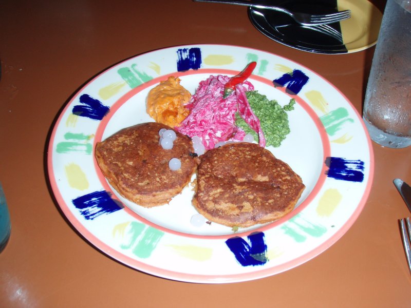
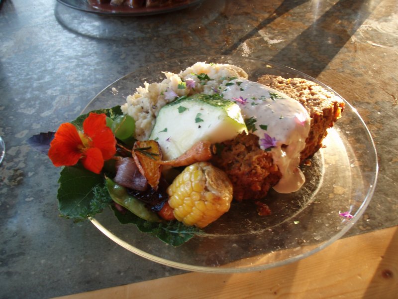
We were returning to Caf� Diablo � our last dinner there was in 2004. We arrived early so there was plenty of seating available. We chose to dine indoors and enjoyed seeing all the wacky coyote artwork again. We ordered a couple of Margaritas and some rattlesnake cakes. They arrived as a pair on a plate with two sauces; cilantro pesto and a chipotle sauce along with some savory slaw. The sauces and slaw were excellent but the snakecakes were kind of plain, and we couldn�t find any distinctive flavor we could have called �snake� - not that we�d have any idea anyway. I guess now we can say we�ve eaten rattlesnake�
Naturally I ordered the chipotle glazed ribs and Sharon was willing to give the turkey tenderloin with veggie masa a try. We ordered another round of margaritas and munched on the complimentary platter of grilled veggies after a warning to be careful of the jalapenos. We ignored the warning and polished it off - jalapenos and all. Just in time too since the entrees were coming right up. The ribs were good as expected although a little fattier than I remembered. Still, it is a large portion and there were plenty of wonderful morsels to be found.
Sharon enjoyed the turkey and vegetables�it was a choice cut that we�d not seen before. We thought we were finished but they don�t really ask you what you want for dessert at Caf� Diablo. They just bring a platter of samples to your table to torture you. They are all made in house so it is irresistible. We ended up ordering a pear tart made from Fruita pears and homemade vanilla bean ice cream and a slice of carrot cake to go. Yup� we�re pigs.
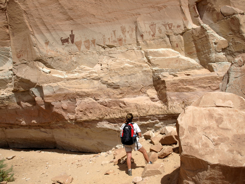
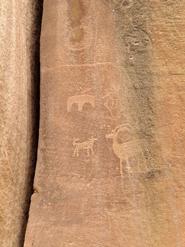
It was still light out when we left so we drove into the park and took a stroll along the boardwalk to see the petroglyphs. The sun was breaking out from behind a cloudbank as it was getting low in the sky and was reflecting warmly off the sandstone cliff across the road. There was even a faint rainbow.
It was a little too dim for pictures of the petroglyphs but we took some anyway. Mostly we enjoyed the cooling air and the play of light on the canyon as we stretched our legs after a wonderful meal. Once it got dark, we drove back to Austin�s and watched the tube for awhile. There was talk of a low pressure system headed into the northwest but no real idea about how it would impact our weather. The forecast was for a warm day tomorrow with afternoon thunderstorms flaring up. Same as every other day of the week so far. We went to sleep planning on spending the day hiking in Capitol Reef.
Tuesday 9/4
When we woke up on the Tuesday after Labor Day in Torrey, our plan was to spend the day hiking in Capitol Reef six miles down the road. We were in no hurry so I started making a nice strong pot of coffee to start the day. Sharon had picked up some freshly ground beans in Springdale at The Mean Bean, and this had become our morning routine. When it finished perking, I brought two steaming mugs back up to the room. We shared the carrot cake from Caf� Diablo with our coffee and watched the Weather Channel. We learned that there was a storm front moving in on Wednesday, and if it came far enough south, it could make travel on the 30+ miles of backroad to the Horseshoe Canyon trailhead impossible.
-
We reluctantly decided to change plans and attempt the Great Gallery hike today. From Torrey, it would take about two hours to the trailhead followed by about four hours to hike in and out of Horseshoe Canyon.
-
We showered and left as quickly as possible. Had we been following the original plan, we�d have made a much earlier start since we wouldn�t have been returning to Torrey but camping at Goblins State Park. Oh well. The Great Gallery hike was to be, for me, the highlight of our trip. We�d tried to go on our last trip, but a storm front had denied us the chance. I was determined to make it this time. We stopped at the Capitol Reef Visitor's Center long enough to learn that the rangers concurred with our opinion...go today...tomorrow may be a bad idea. It was almost 9am.
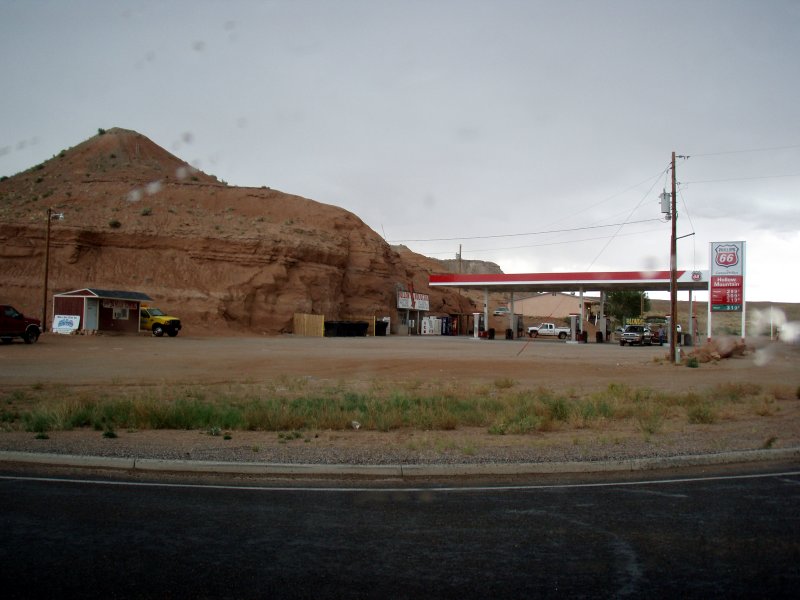
We hopped back into the Jeep and beat feet. We made good time since there was little traffic and the roads are mostly straight and flat. I had an eye on the sky as we rocketed north and east through Hanksville past the unique Hollow Mountain minimarket that is carved into the sandstone.
-
We passed a pickup hauling a large cabin cruiser and saw several others along the way. All these boats in the middle of the desert seems incongruous until you remember that you are on the main road between SLC and Bullfrog on Lake Powell. While the weather seemed fine now, if the pattern repeated today, thunderstorms would probably start bubbling up in the afternoon.
-
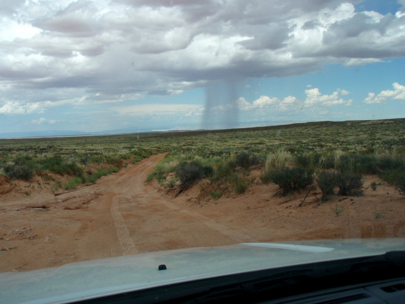
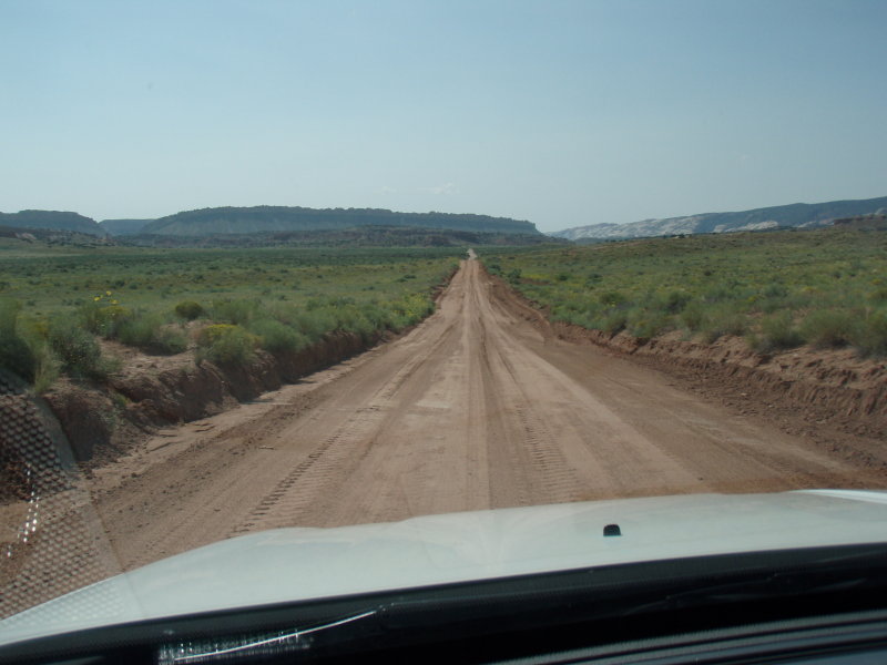
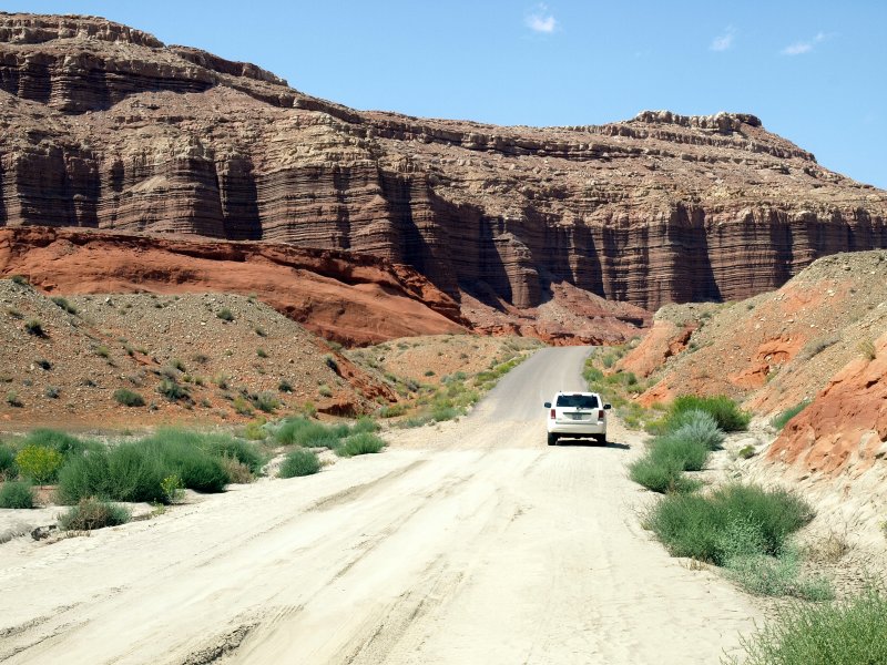
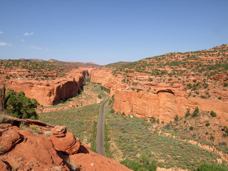
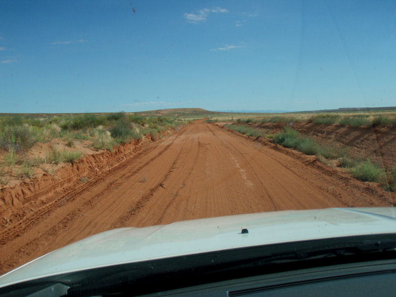
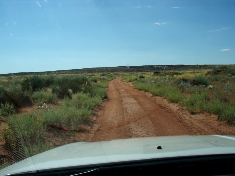
We made it to the turnoff to begin the 30 miles of dirt that would take us to the trailhead. We passed the sign warning that �the road will become impassable in a storm� and proceeded as quickly as the road allowed. The 30 miles of dirt road was in pretty good shape since it had been recently graded to repair flood damaged areas that looked a week or so old. Good news/bad news.
-
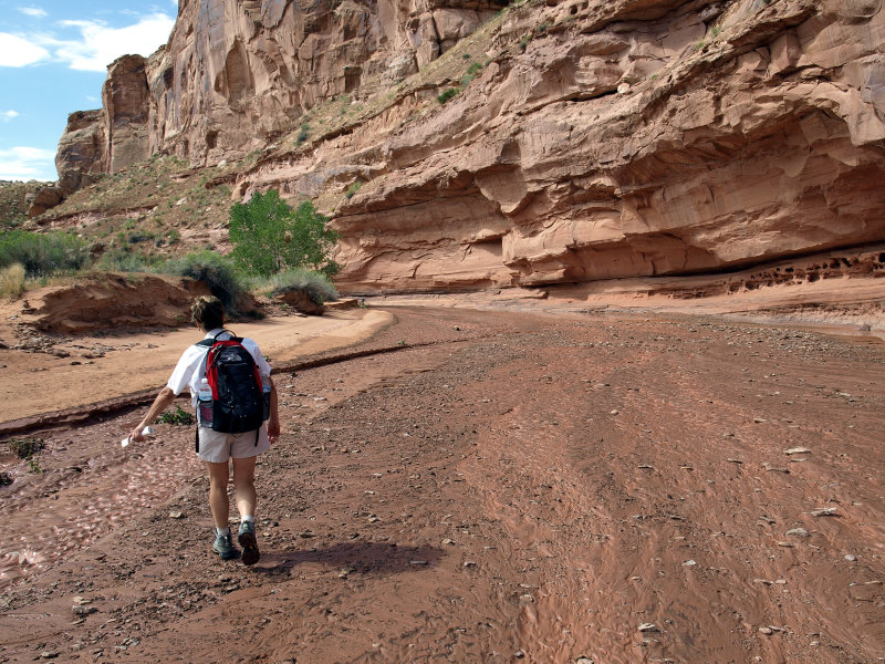
After an hour on this dirt road, through scrub and across sand, we made it to the trailhead. As expected, there was no one else there and the logbook showed that only one couple had hiked in and out the day before. We loaded our packs with a couple of gallons of water, some trail mix, binocs and raincoats. Of course the camera gear was charged and ready in our hip packs as well.
We actually started the hike at about 11 AM, at least 2 hours later than we would have had we stuck to our original plan. While it was a lovely temperature at the moment, I knew that we�d be coming out during the hottest part of the day. They were predicting temps in the low 90s F.
-
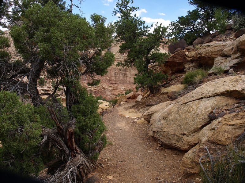
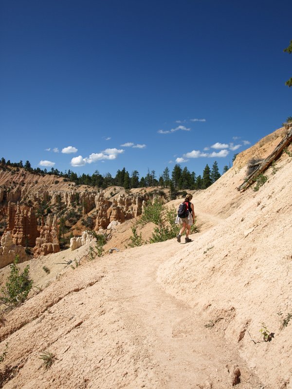
The Great Gallery hike is 7.5 miles or so round trip. The trail starts by dropping 1.5 miles down to the canyon floor with an elevation drop of 900' or so. This part of the hike is like walking down uneven stairs until you get to the last half mile or so which is deep sand.
-
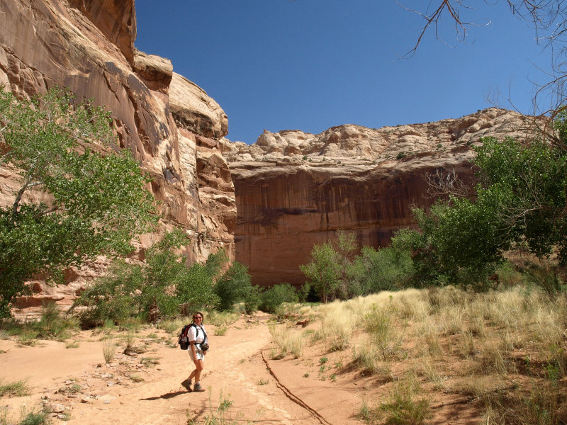
While this hike is a bit shorter than The Fairyland Loop we did at Bryce, it is so remote and you are so alone that you have a greater feeling of vulnerability. I reminded Sharon to be careful, since a twisted ankle would become a huge problem. I was really reminding myself though since I'm the one with the "trick" knee and a foot that was crushed in a tractor accident 25 years ago. I have to make sure I lead down with my right foot to avoid hyper extending the bad knee. About two-thirds of the way down, we went through a cattle baffle designed to keep stock out of the canyon which is a remote section of Canyonlands NP.
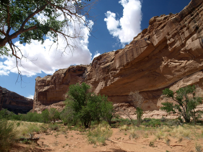
The final sandy stretch gives you a good view of the canyon below. It was a lovely green oasis with trees and grasses growing along the banks of the wash. From this vantage, the wash looked dark red as if damp.
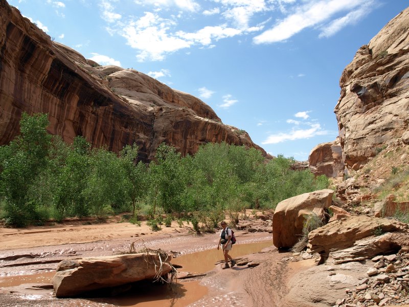
We walked down the sandy trail to the wash, crossed the muddy stream bed and began to follow the trail by watching for the cairns that mark the way.
Soon we came upon the first (smaller) rock art gallery high on the eastern wall of Horseshoe Canyon.
We took a few pictures and wondered how they had been able to paint so high on the wall. This group was 25� or 30� above us as I recall.
To continue up the canyon we crossed the wash a couple more times. It was becoming apparent that the trail was washed out in some sections. We knew that there had been a pair of hikers in and out the day before and we could see their tracks. Theirs were the freshest tracks, and we followed them in many places where the rock cairns weren't obvious. The tracks always ended at the edge of the wash. The footprints were also dappled from a light rain that had fallen since they were laid down.
-
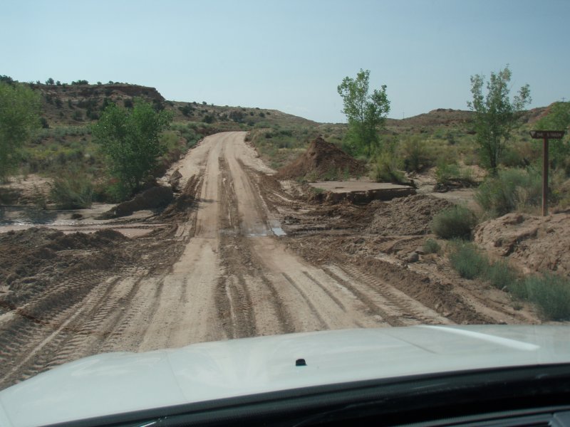
That light rain isn't what was responsible for the flood damage to the trail. This canyon had flash flooded yesterday afternoon sometime after the last hikers exited.
It was also obvious that the rain that produced this flash flood hadn't fallen here but somewhere upstream and then flushed down through the canyon washing out the trail and cairns that marked it as it crossed the wash. This would have been a potentially deadly flood had someone been in the canyon.
-
In this picture, you can see how high the water had gotten and the debris washed up onto the rock is testament to the force of the rushing water that had passed this way not long before. This was all food for thought as we still had a mile and a half to go before we reached The Great Gallery. This isn�t a slot canyon and there are higher areas in most of the canyon that you could get to as long as you saw the water coming. I began to keep an eye upstream when we started crossing the wash again. We had a topo so the loss of the trail and marker cairns wasn't a safety issue. We knew right where we were and where we were going at all times. NEVER attempt a hike like this without a topographic map. After all �Desert Canyons Don�t Care�.
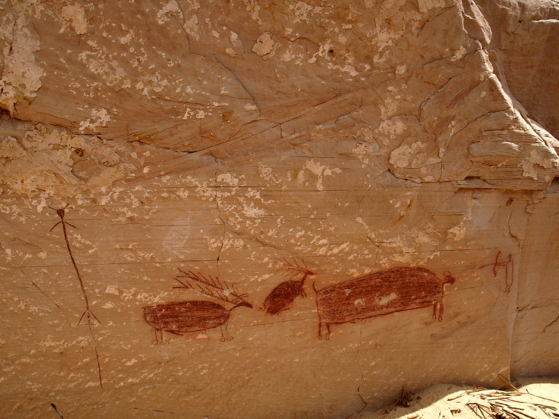
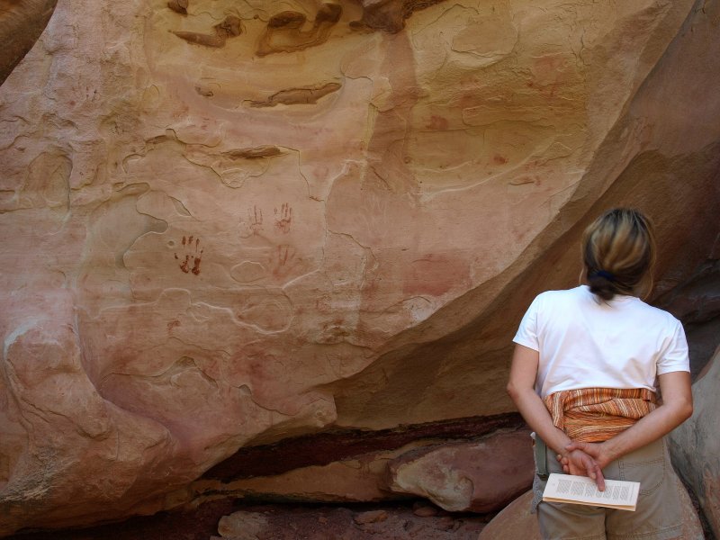
We came to the second grouping of pictographs on the west side of the canyon.
03-SEP-2007
There were a few much much closer to the ground and smaller and likely more recent than others in the canyon as evidenced by the depiction of a bow and arrow.
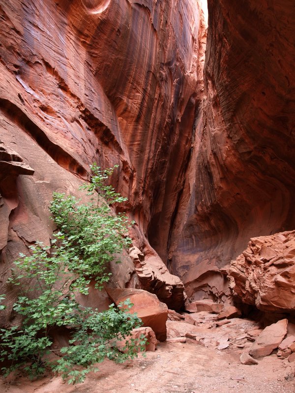
We continued picking our way along the trail trying to avoid snakey looking places and staying close to the stream. We came to the Alcove Gallery but decided we�d check it out on the way out and plough onward up the canyon.
-
Somewhere along this stretch Sharon noticed some movement and saw the hind end of an antelope disappearing over a rise to our right. Sure enough, we came upon the fresh tracks near the water.
Not a bad place to hang out for an antelope. Plenty of water and forage and more plants would be springing to life now that the canyon had been irrigated. The only thing the antelope had to worry about would be a mountain lion. Hmmm.
As the day got hotter, we were ready to be at The Great Gallery. It was just past midday and it was hot! The appearance of clouds, as benign as they seemed, only increased the bit of anxiety that we were both quietly feeling. These clouds are the precursors of thunderstorms and were lining up nicely on our little section of wilderness. We made sure that we knew where the highest nearby ground was along each stretch of trail just in case.
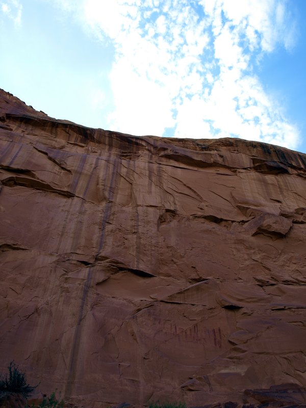
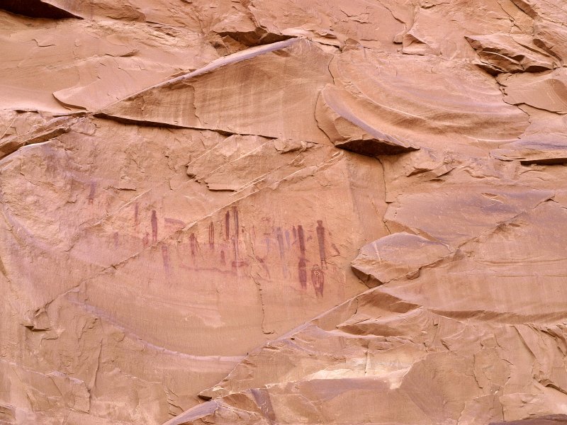
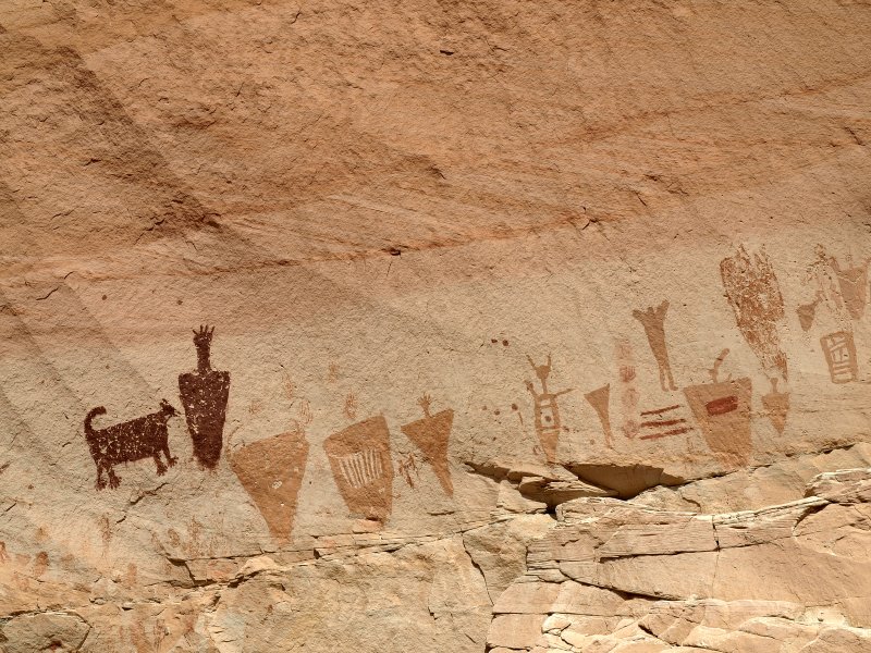
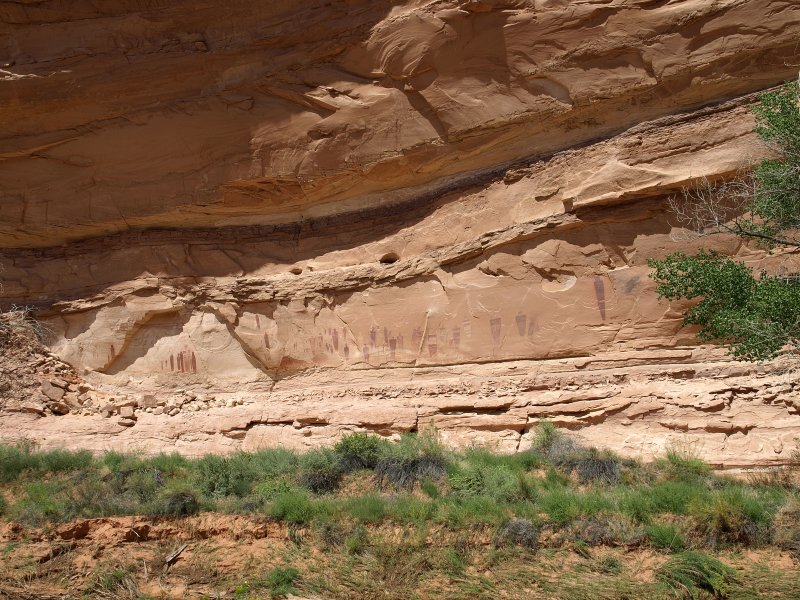
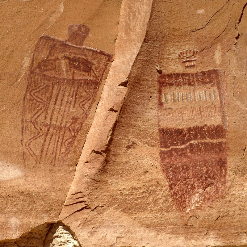
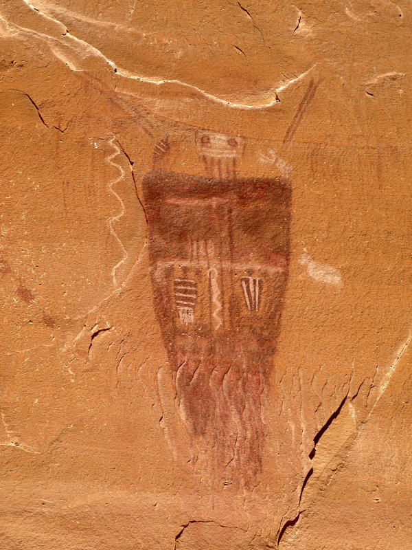
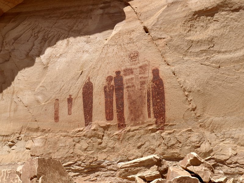
We came around one final bend in Horseshoe Canyon and there it was. The Great Gallery. This group of pictographs is the largest grouping known in North America. They are thought to be 2,000 to 8,000 years old and no one knows what they were for or what they mean. From a distance, it appeared that they were created at ground level and then the canyon floor eroded away. Yes, these images are VERY old.
-
For those of us intrested in ancient americans and their art, this is our "Sistine Chapel". I'd waited long to make it here and am grateful to have a companion who would make the journey with me. Sharon had wished on the falling star she's seen at Bryce that we'd make it in here this time. We both got her wish. Thanks Honey ;^)
I wasn�t expecting to see such a variety of pigments used. One can only imagine what they looked like fresh and new thousands of years ago. Some of the pigment was applied by hand and other sections were blown from the artist's mouth, or perhaps a reed, resulting in a spatter pattern. You can also see that, in addition to being painted, some figures also have sections that are incised into the rock. Sadly, there are also numerous bullet holes from the days before such artifacts were appreciated.
I made sure to look away from the images and out at the canyon too. The canyon is wide and slopes up gradually away from the wall where the images are. I got the feeling that this was a place where stories were told and passed along through the generations. The canyon has great acoustics and would be wonderful for chanting, flutes and drumming.
It would seem that there was one individual (ancestor? spirit? god?) who somehow fell from grace with the people and who's image was eradicated at some point. Perhaps I'm wrong and the image was created that way.
Finally my thoughts returned to the clouds and we felt it best to head out. I had plenty of images to enjoy later but still, I wished we could've spent a long afternoon here. Another time perhaps.
The hike back through the canyon was quick since we knew the way and had our own footprints to follow.
The clouds continued to build but we figured it was still early enough that we'd be out of the canyon before the storms got wound up. A least we hoped so. Of greater concern was the long, hot climb out and the 30 miles of dirt road.
-
It occurred to me as we beat our hasty retreat how opposite my feelings about this place were from those ancient americans whose place this had been. To me, this was the middle of nowhere. For them, this had been the middle of everywhere. I needed to get out of here to feel safe and secure. They needed to be in this place to survive. There was water here and game and shelter even. This canyon was their sanctuary.
-
I got the idea somehow that some of the figures in the Great Gallery might represent this and other canyons. Their shapes resemble the flat-bottomed V of these canyons and the stripes and other features might be descriptive of the attributes of different canyons or sections of this canyon system. Some of the pictographs have animal figures in them. Perhaps some canyons were known for good hunting. One can only wonder.
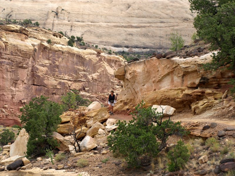
It didn't take long to make the hike down the canyon. I checked over my shoulder upsteam once in a while just in case but no flood came. We made our last crossing to the base of the sandy trail that starts the climb out. We found some shade to rest in and drank some water before the pull up out of the canyon. While the elevation gain would be the same as The Fairyland Loop in Byrce, there would be no gentle switchbacks. This would be a workout. We got to our feet and started up the steep, sandy first section of trail. We'd been walking non-stop since 11:00 except for the 20 minutes or so we'd spent at The Great Gallery. Our legs were tired. I came to hate the deep sand and had to stop frequently to let the burn in my legs die down. We were glad to make it to the cattle baffle since we knew that we were done with the sand and the rest of the hike would be on rock.
-
Still, it was a tough climb. It was about 94� F and the clouds had abandoned us. The trail is open to the south and the sun just added to the heat. We stopped more and more frequently for water breaks but never for too long. There was an underlying urgency to the hike since we could see clouds still moving in our direction. Neither of us spoke as our concentration was focused on the most productive placement of our next step up the stoney stairway out of the canyon. I made a game of making sure that each step took me up. No stepping down allowed. It became mesmerizing after awhile. I'd hiked many miles in desert heat as a youth. My mind knew how to ignore the heat and complaining feet and legs. Sharon's request for water snapped me from my merciful reverie and I noticed that she looked a little pale and woozy. It was time for longer break in spite of the rumbling we were starting to hear in the distance. There was no place to get out of the sun so we just sat on a rock.
-
I figured we were probably two thirds of the way out by now so I encouraged Sharon to drink water as much as she wished since we still had a couple of quarts. I used the 'misty mate' she'd brought along to spray her head and neck to cool her off. Hurrying was not a wise option. Slow and steady would get us out of here. As we resumed our uphill march, I began to mentally inventory what supplies we had in the truck in case the road washed out and we became stranded. There was still 4 gallons of water in the Jeep as well as ice melt water, maybe another 2 gallons, in the beverage cooler. We had probably 7 or 8 beers, a couple of leftover pizza slices from Escalante, some trail mix and a couple of other snacks. The camping gear was also there so I figured that, if worse came to worst, we could manage for 3 or 4 days at least. Good to know.
-
As we reached the rim, the rumbling of thunder was much closer and we could see the storm moving in our direction from the southwest. 3 PM�...showtime and we're outta here. We paused long enough to take off our boots and get some ice cold water from the cooler. The first bit of road was rough and first gear was as fast as we could go.
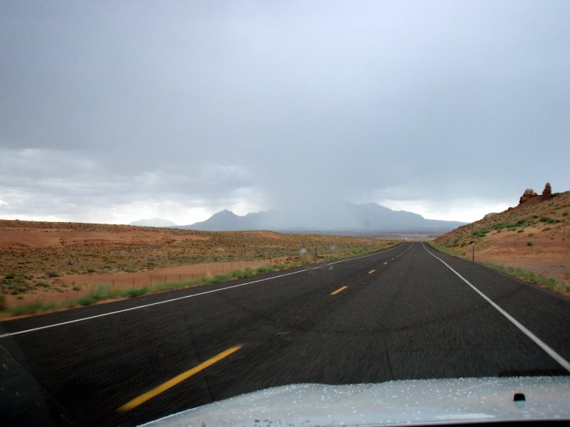
When the road smoothed out, I hit the accelerator. The only tracks on the road were ours from our drive in earlier. With storms erupting around us we blasted out of there at speeds up to 70mph. We were hit with a couple of rounds of heavy rain but never enough to cause problems with the road.
-
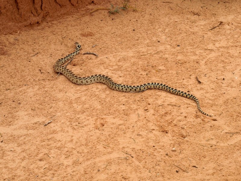
As we came around one sweeping curve at about 50 mph, a stick that was lying in the road suddenly sprang to live and leapt about 3' in the air and 5' off the road to the right. The stick was actually a snake trying to get out of the way of our speeding Jeep. I never knew they could jump so high or far! It wasn't a rattler but I have no idea what type it was. Ain't never seen nothin' like that afore!
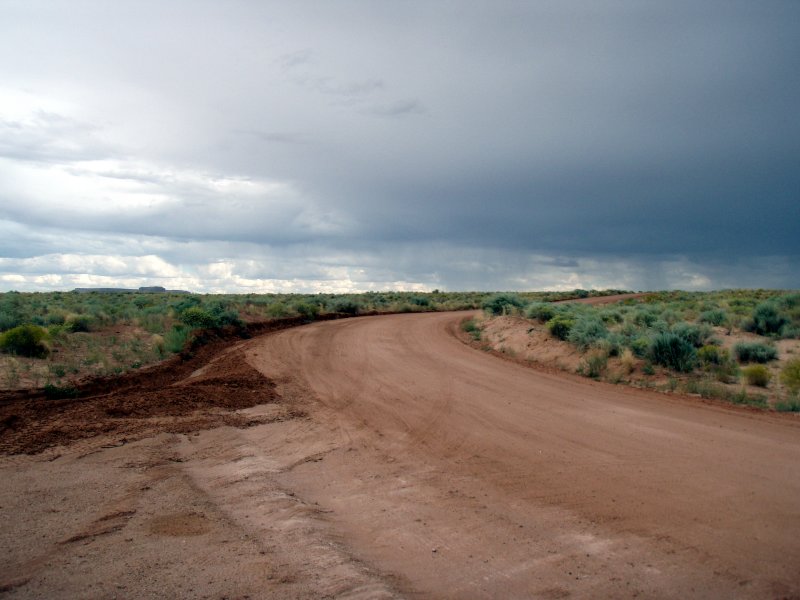
Lightning near and far. Heavy crosswinds. Quite exciting actually. The road veered to the west finally and away from Horseshoe Canyon and the storms so we slackened the pace a bit. We�d beat it. It seemed a little anticlimactic and we'll never know if the canyon flooded or the road washed out but, we decided we could live with that little mystery.
We finally made it to the paved road...I'd shaved 20 minutes off the drive. We stopped there, shared a cold one and enjoyed some cold pizza before we drove back to Torrey. We drove in and out of storms and showers most of the way. We talked about our original plan which would have us checking out of Austin�s in the morning and leaving for a night of camping at Goblins State Park. The idea of potentially camping in the rain as the storm front moved through wasn�t appealing. Our idea of hiking into Little Wild Horse Canyon had also lost it�s luster. After our experience earlier, we were ready for a break from canyons that might flood.
-
Here's some accounts of flash floods so you'll know why we are so cautious:
-
http://www.climb-utah.com/SRS/flashflood.htm
-
http://www.climb-utah.com/Powell/flash_antelope.htm
-
and here's some video of flash flooding in Utah
-
http://www.youtube.com/watch?v=kV4aF4AZtY0
-
http://www.youtube.com/watch?v=VuR23OvMrCs
On the way back through Hanksville we passed the unique minimart in a mountain.
We stopped by the VC where we saw this bright young lady. We went inside to tell the rangers about the trail being washed out. We learned that Capitol Reef had experienced some flash floods as well and the scenic drive was closed until they could clear the debris. Finally, it was back to Austin's for a couple more beers and some relaxation after a very exciting and tiring adventure. We checked as soon as we arrived, but Austin�s was booked solid for tomorrow night. We called around and finally settled on the Best Western since it was closest to the park and had a pool and hot tub. They had a room for us and we took it ($89/night).
Since it was our last night at Austin�s, we figured we'd relax and enjoy it. The hot tub sure did wonders for our tired muscles and aching feet. We decided to hang out and try Austin�s Mexican take out for dinner. Take-out, in this case, would be to a table out on the large front porch. There were picnic tables on the lawn but we figured we�d enjoy people watching on Torrey�s main drag.
-
We pigged out and ordered a chicken tamale, shredded beef enchilada, pork carnitas quesadilla and enchilada. Black beans and veggies on the side and lots of fresh salsa and guacamole. We took our time and enjoyed the meal. It was far better than we�d expected (and especially delicious with the cold beers we grabbed from our cooler) and the portions were so large that we regretted ordering so much. Locals and tourists would park in front of the store and go in to shop. One even commented that our food smelled pretty darn good. We let him know that it tasted good too! �Good to know�, he said as he hopped into his pickup and drove off with his dog.
-
The traffic in on Rt. 24 was pretty constant but not so much or so fast that it was annoying to eat there. A group of about nine motorcycles pulled into Austin�s and idled to the office as we finished dinner. They later pulled over to the three cabins at Austin�s. We saw quite a few biker folks around in general. It was beautiful riding weather, and the scenery and winding Highway 12 are well known in the motorcycling world. We returned to our room and watched TV before falling asleep early. We�d rather be up early than up late, especially while on vacation.
Wednesday, Sept. 5
As was the routine, I went outside to perk the coffee while Sharon roused herself. Again we were in no hurry.
As I enjoyed the sunrise at one of the picnic tables, I noticed that the sky to the north was looking pretty stormy and felt better about our change of plans.
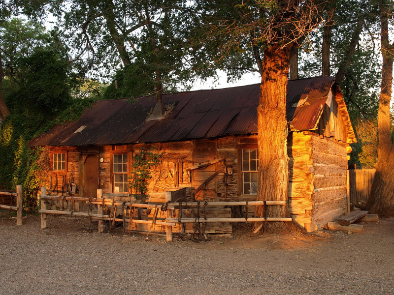
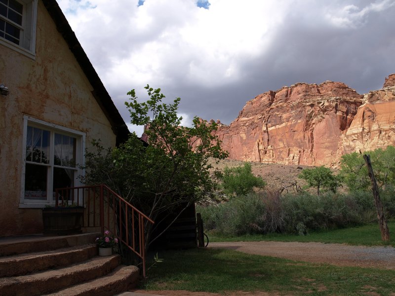
There�s an old log cabin at Austin�s with an assortment of rusting tools and wagon parts garnishing its� walls and the fence around it. I�d asked earlier about it and found out that it was �an original settlers cabin�. The clerk in the store also volunteered that it was where Zane Gray stayed when he came to Torrey to explore and gain inspiration. While a tall tale, it seemed possible. Besides, nothing like a couple of weeks in a log cabin to inspire western noveltry. I took a few photos of the cabin while the coffee perked.
When I returned to the room, Sharon said that the storm front had wreaked havoc on the Salt Lake City area. We hoped Dayle from Fodor�s and a distant cousin from that area were OK. It looked pretty nasty. Lots of folks were without power. Some even reported seeing a funnel cloud. After coffee and showers we hit the store for sandwiches and another six pack of some tasty IPA. We drove to the park and stopped at the VC to check on the road. The scenic drive would remain closed until noon when the silt from the flash flood would be cleared away.
-
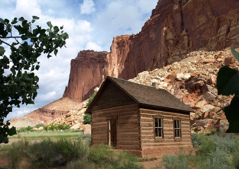
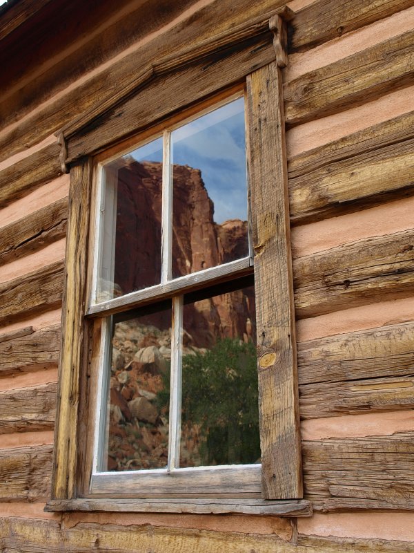
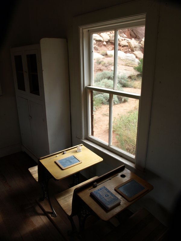
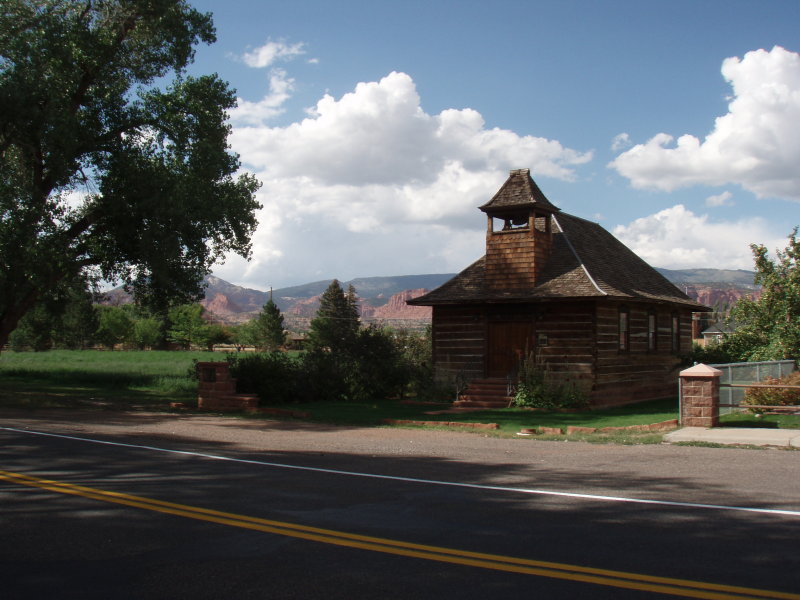
We drove over to the little cabin that was the Fruita School. I like the way the sky and cliffs reflect in the windows. I find the old log cabins very enticing. They aren�t the type of structure that would survive long in the climate where we live. This cabin would�ve rotted into the ground long ago back home in upstate New York. Just when we were getting ready to leave, a ranger pulled in.
Her name was Cyndi and she�d come to open the school for visitors as they do every day for a few hours. It was great to get a look inside. The school was all restored and gave you a good feel for those times. We asked Cyndi what hikes she might suggest since the road was closed. She asked if we�d been to Hickman Bridge. We told her that we were planning to. She also thought the hike up Cohab Canyon to the trail overlooking Fruita was nice. You park in the lot on Rt. 24 for both. We thanked her and headed out.
We found the parking lot and decided to try the Cohab Canyon Trail. We put on our hiking boots, loaded our packs with the water, strapped on the cameras and headed out. To get to the trailhead we crossed the bridge over the river and then crossed Rt. 24. The trail climbs right up away from the road but not too steeply. The ranger was right. Cohab is a beautiful little trail up the canyon through intricately carved colorful rocks and the vistas got better the higher you went.
We passed by the branch of the trail that led to the Fruita Overlook deciding to continue on toward the Frying Pan. We weren�t planning on going all the way but were enjoying the trail so much we figured we�d keep going. We knew it was downhill all the way to the car so it would be faster going out. This was a feature we looked forward to today after the grueling pull out of Horseshoe Canyon the day before. The grade in front of us blocked our view of the incoming sky so we were a bit surprised when dark clouds came into view. This convinced us to turn around and head back.
By the time we made it to the junction of the overlook trail, the sky had improved so we decided to go to the Fruita Overlook to add to our hike a little. The trail dipped to the bottom of a small arroyo then headed up til it leveled out.
Along the way, there were many of what I call �sunburned� rocks - some rocks that are naturally white but turn black after lying out exposed to the sun for a few hundred or thousand years. If you flip one over, the bottom is still white. Leave it that way and, many years from now after we�re all long gone, both sides will match.
It wasn�t long before we were nearing the overlook. Naturally the sky was looking real stormy again. A testy looking thunderhead appeared from the southwest accompanied by low rumbling in the distance. We took a quick couple of shots at the overlook but felt too exposed on the edge to feel comfortable with lightning headed in our direction.
-
Again we found ourselves on the run from incoming storms. We weren�t too surprised since we have yet to get through a Utah vacation without weather affecting our plans. That's the price you may pay if you visit in "monsoon season".
We did some speed hiking back the way we�d come. As we dipped through the arroyo again large cold raindrops began to spatter the rocks. There were numerous overhangs that could�ve sheltered us had the rain increased. By the time we made it back down to Rt. 24, the thunderstorm had slid off to the east leaving us dry. It seemed like it would be a good time to head down the scenic drive since it was just after noon.
We dropped into the VC to make sure the road was open. It was open as far as Capitol Gorge but the dirt section beyond was closed since the potential for flash floods still existed. We bought a couple of CDs while there - Mary Youngblood�s �Beneath the Raven Moon� and American Spirit II. They made a wonderful soundtrack for the rest of our trip.
We headed down the scenic drive with the cruise control set at 35 so we could take our time. The sky was a mixed bag with storms in the distance. The earlier showers had saturated the landscape and this really brought out the rainbow of colors in the rock. We�ve never seen Capitol Reef look finer. We took our time and lots of pictures as we meandered down to the parking area at the closed gate into Capitol Gorge. We stopped for a few minutes, and Sharon scanned for Desert Bighorn while I snapped photos.
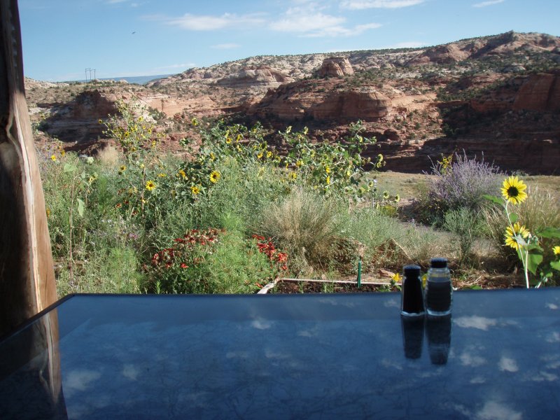
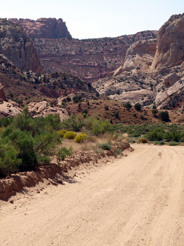
As you leave the parking lot, there�s a little dirt road that goes off to the left called Pleasant Creek Road. We were hungry and decided to drive down the dirt road to find a quiet spot to have our lunch. Pleasant Creek Road was indeed pleasant as it dipped up and down through washes for a couple of miles. We found a spot that had a nice view looking north back the way we�d come. We broke out the sandwiches from Austin�s and cracked open a couple of cold IPA�s. As we enjoyed our lunch in the warm sun, we heard a babbling noise. We walked across the road and looked down to see what we assumed to be Pleasant Creek gurgling along.
We finished lunch, took a few pictures and pondered whether to continue on Pleasant Creek Road but, after consulting the gazetteer, decided against it since it turned into a long 4WD road and our rental SUV didn�t have low range. We piled back into the Jeep and headed back the way we came.
-
At the first dip where the road crossed the wash, lo and behold, there was 4-5� of water flowing across the bottom! We�d been through here not a half hour ago and it�d been dry. The babbling creek we�d heard must�ve been this same drainage and this was a little bitty flash flood. The storms of a couple of hours ago must have rained upstream from here and the water was just now getting here. We drove through it easily but I didn�t dally. The sudden appearance of flowing water is always cause for concern and we were again reminded that �Desert Canyons Don�t Care�. A few minutes from now, Pleasant Creek might very well be quite unpleasant, and I wanted to be well away. The rest of the crossings were dry and shortly, across one last dip, we arrived at the paved road by the parking area. We headed on back toward the entrance of the park never knowing whether the little flood ever grew or just soaked away into the soil unnoticed.
At Fruita, we stopped at the old Mormon homestead museum. It was a wonderful collection that makes it easy to imagine the trials of trying to thrive in such a remote area. But what a setting! The area still benefits from the orchards they had the foresight to plant. There was a small gift area and they were selling ice cream made by Caf� Diablo. While we bought some, another couple asked the young woman minding the shop about Caf� Diablo and she highly recommended it. We chimed in and asked her where else was good since we were open for suggestions, especially from a local. The Rim Rock Restaurant across from the Best Western she thought was almost as good as Caf� Diablo. Good to know.
We went outside into the yard and enjoyed our ice cream and the spectacular setting.
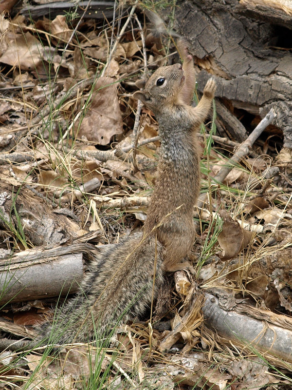
Leaving there, we passed the VC again and decided the light would be good on the petroglyphs by the boardwalk. We pulled in and were just starting down the trail when a NPS truck pulled in and it was Ranger Cyndi again. She was about to do a talk on the petroglyphs. Good timing! Sitting on the bench with several other folks, we enjoyed an informative twenty minutes.
We went and took our pictures and had a nice visit with a local squirrel that came scampering down the cliff. I expected him to beg for a handout but he was quite wary as he gathered seeds by the boardwalk.
It seemed like a good time to go check into the Best Western so we headed back toward Torrey. We pulled into the BW and there was an entire busload of people checking in. Perhaps we�ll come back later. We drove into Torrey and checked out some of the side streets and residences.
It is an odd blend of old and very old buildings in various states of repair. Some are quite lovely and there�s newer construction on the outskirts.
Returning to Rt. 24, we dropped into the gift shop across from Austin�s. The tiny Post Office is on the property and they also rent cabins for $29 a night. As we browsed, we chatted with the proprietor. He seemed well traveled and had interesting stories to tell about the Native Americans who still sometimes show up out of the blue with craftwork to sell. He liked that stuff the best of all. I picked up a business card and noticed that his name was Rob Torrey. I asked if he was related to the town. Indeed, a great, great uncle who had been one of Teddy Roosevelt�s Rough Riders had lived there and somehow the town ended up getting named for him. We bought a small, flat red stone with a petroglyph etched into the surface as a memento and bid Rob farewell as some other tourists came in.
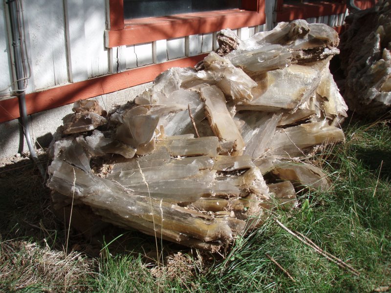
Next, we stopped at the Capitol Reef Inn and bought another petroglyph-style etched stone. We had stayed here our first trip to Torrey � our old, but clean room was only $48/night, although the hot tub was dysfunctional and the rooms and plumbing were very outdated. Looking around the place we decided that, if we ever won the lottery, it would be fun to buy this place and fix it up. It has a lot of character but has seen better days. We were awed by the interesting stonework and this giant clump of crystals near the entrance.
Back to the Best Western, we had a lower room in back facing the cliffs.
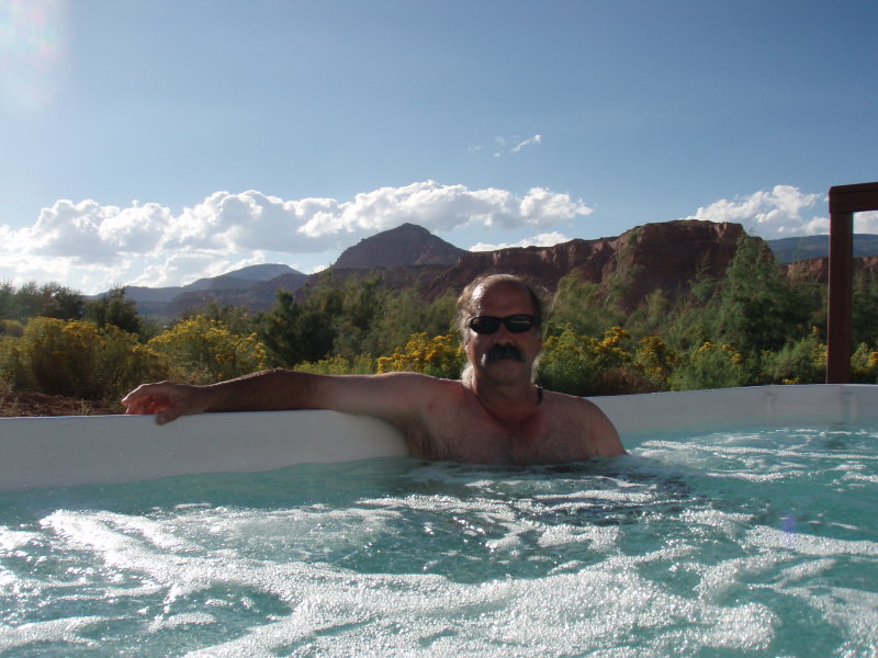
We suited up and headed over to soak in the hot tub. We were alone and the tub was huge. You could practically swim laps! We soaked up the warmth and the beautiful scenery until we were overheated, then it was off to the pool for a cooling swim before heading back to the room for showers. The room was modern and clean and the shower and beds top notch. We very rarely stay in chain motels when we travel, but the BW in Torrey was great.
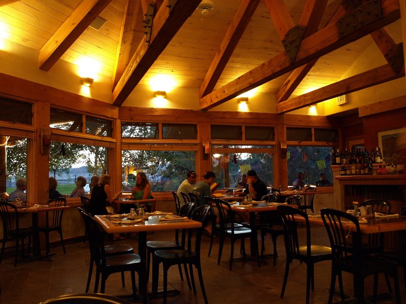
After a leisurely clean up, we wandered across the road to the Rim Rock Restaurant. There were several parties seated, but we still managed a table by the large windows looking east.
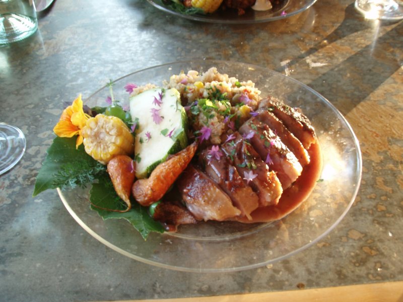
We ordered some margaritas and enjoyed the ripening glow of the sunset as it lit the thunderheads to the east. To get a taste of local treats, I ordered the mixed grill; left to right trout, a quail and duck filet, each prepared with its own sauce.
Sharon was tempted by the chicken with homemade mole that, we were told, has more than 50 ingredients. Both dishes were excellent with samples getting passed back and forth between us. We had to agree that it was equal to Caf� Diablo. For a vegetarian, either place would present very limited options. For us though, it was an excellent dinner. Once again, it was early to bed although Sharon was up for some comedy and watched an hour of the republican presidential debate.
Thurs. Sept. 6
Up early perking strong coffee out on the patio. This is a nice feature, having the little burner for the percolator. We packed the car and headed back to Torrey to fill the tank and wash the windows for our drive down the Notom Rd. to Bullfrog on Lake Powell. After a last stop at Austin�s for ice, sandwiches, and beverages, we finally departed Torrey for the last time and headed back through Capitol Reef. We stopped at the VC to confirm that the Notom Road and Burr Trail were open since they�d been flooded the day before. Yup, open all the way. Good to know.
Since we never had a chance the day before, we decided we�d hike up to Hickman Bridge before leaving. It was a beautiful morning and thunderstorms were not forecast for the next few days. The hike is easy and the bridge is worth seeing.
Another interesting feature is all the graffiti etched into the stone below the bridge. It�s from the 1930�s or earlier, before it was parkland.
On the hike out, we took our time and met an excited �young� couple in their 70�s who were visiting the area again after 40 years. They�d remembered the hike to the bridge and wanted to see it again. They were, dare I say, precious. We assured them they were almost there and pointed up to Hickman Bridge which was still in view. Off they went.
Returning to the car, we bid farewell to Capitol Reef and headed east on 24 and then south on the Notom Rd. It was about 11am and we had dinner reservations at the Hell�s Backbone Grill at 6:30pm. Plenty of time. We enjoyed our drive north on Notom Rd. on our last trip, and this time we�d see it and the Burr Trail from the opposite direction.
Every now and again, we�d slow down for a low area where the graders had repaired the washed out road to allow passage.
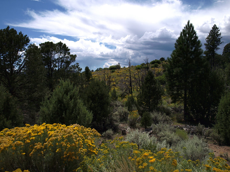
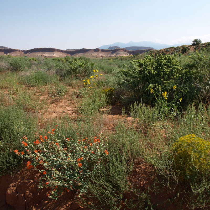
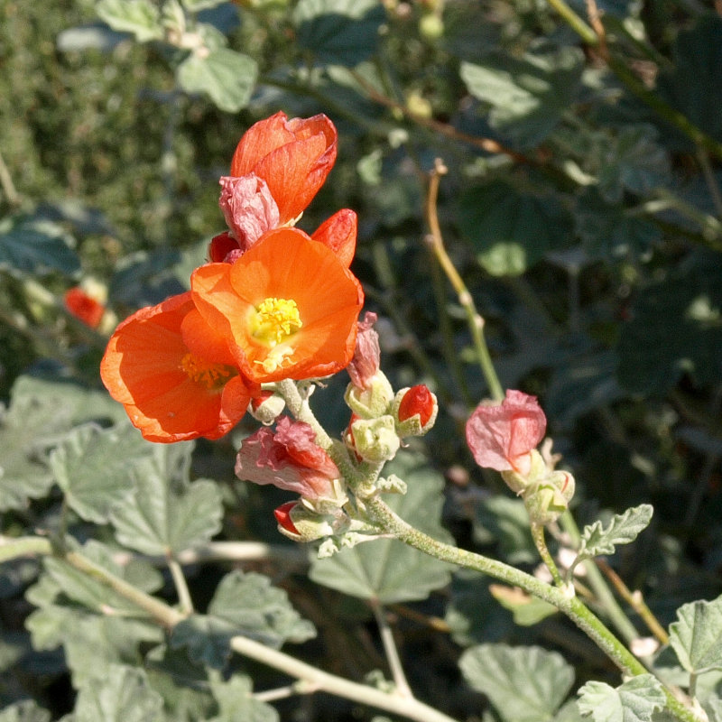
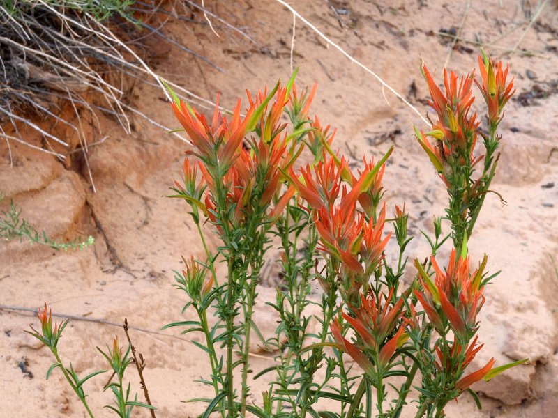
The recent storms had watered the ranchlands on both sides of the road and irrigation sprinklers were taking advantage of the flow. We noticed a couple of Bed and Breakfast signs. Interesting option. Farther down the road, the ranches disappeared and wildflowers, including the brilliant salmon-orange desert mallows, lined the roadside adding a festive touch.
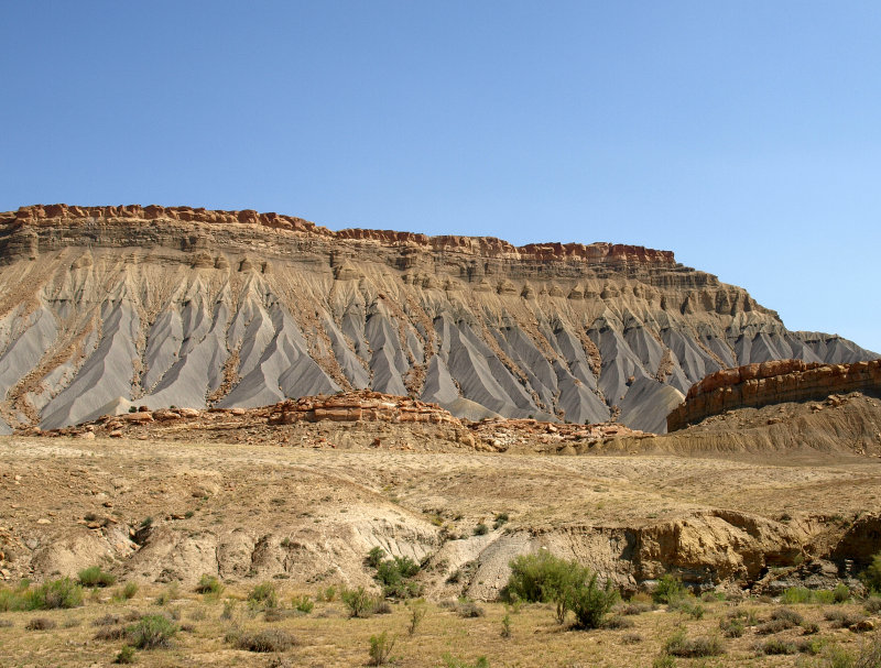
The jagged Waterpocket Fold paralleled our path and the landscape changed to juniper and sagebrush. As we neared the intersection with the Burr Trail, striped purple mounds of bentonite appeared alongside the road with steely blue-gray and red mesas to the east.
This is a unique bit of landscape that defies description. We passed the Burr Trail turnoff and continued toward Bullfrog, still about 30 miles to our south.
The landscape became pretty barren, and we were forced to negotiate some washes that hadn�t been repaired after flooding. The deep ruts though muddy bottoms gave a clue that others had made it so we forged ahead. With a minimum of mud and rock scraping the bottom of the Jeep we were able to continue. We hoped there wasn�t worse ahead but decided to take it as it came. Turning around is always an option.
-
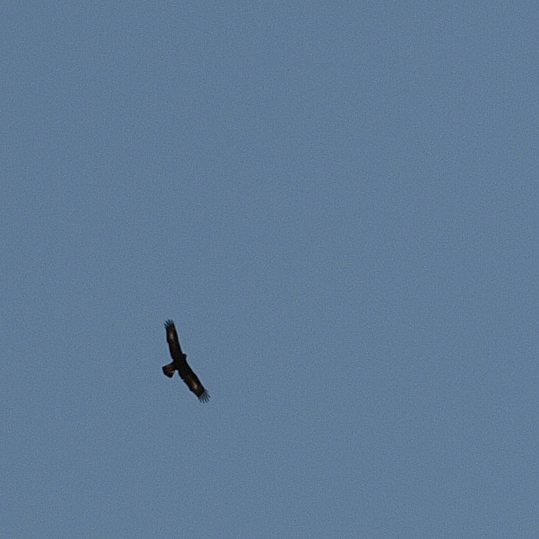
Sharon spotted a couple of huge birds soaring above so we stopped for a look through the binoculars. They were very large birds with a wingspan of 4� or more. There were 3 of them but they didn�t look like vultures. We id�ed them as Golden Eagles. They finally soared out of sight, and we pressed onward toward Lake Powell. Soon we were driving along the edge of the mesa looking into deep red canyons. Perfect eagle country.
The road dropped down from the rim as we approached the lake. We came upon one deep and steep sided wash but managed to get across just fine. There were blockades at the roads into the North Campgrounds with signs warning of roads out. It looks like they'd had storms here too.
-
We rejoined the paved world at Rt. 276 just north of Bullfrog. If you take a left here, you�ll eventually get to Hanksville. We turned right toward the lake. To our surprise, there was a gatehouse. It is a federal recreation area so we tried our park pass and it worked. We found the picnic area overlooking the lake and had the sandwiches from Austin�s.
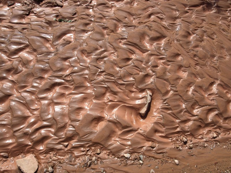
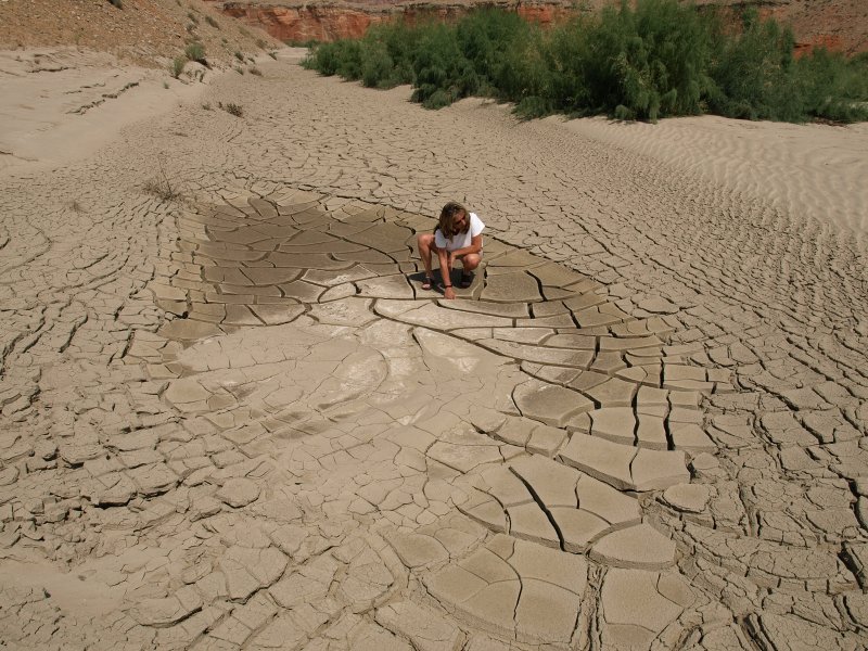
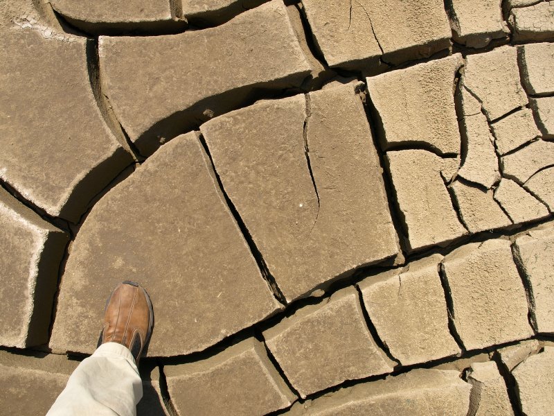
We headed out and back up the Notom Rd. Off to the side of one wash, we noticed a patch of mud drying from the flash floods.
It had formed giant cakes separated by giant cracks about 5� deep. Very odd.
We eventually reached switchbacks where the Burr Trail climbs to the top of the Waterpocket Fold.
-
The folks at the Hell's Backbone Grill told us later that a man had been trapped here at the base of the switchbacks by flash flooded roads. It took four days before the road crews got to where he was. He'd only gotten out the day before we came through. Desert Canyons Don't Care after all.
The switchbacks are always fun and we enjoyed going up instead of down this time.
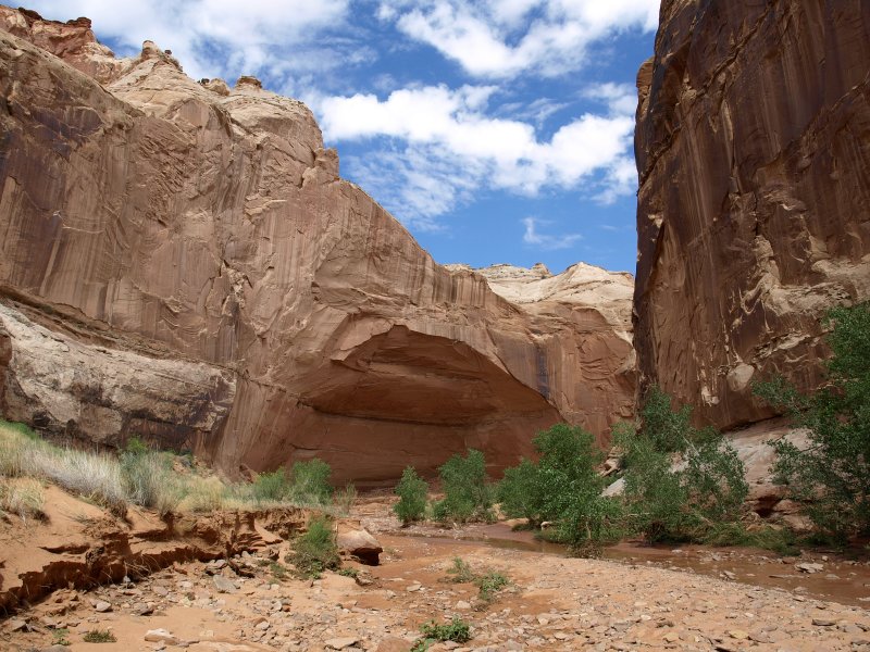
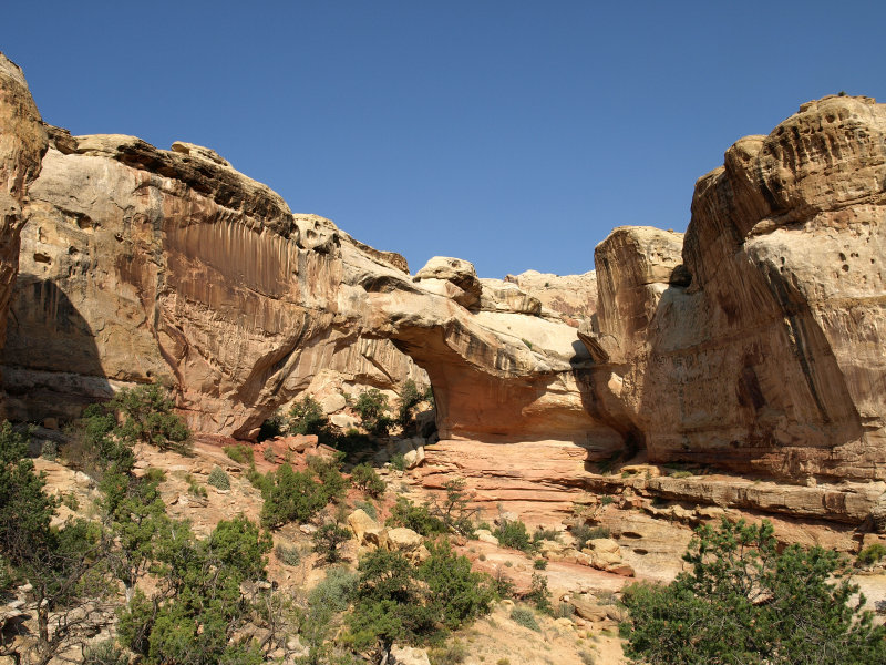
The Burr Trail is an easy drive and soon we entered Long Canyon where we stopped to stretch our legs at the little slot canyon right alongside the road. It is a tranquil and lovely spot.
The ladies at the Hell�s Backbone Grill had told us that they brought visiting Buddhist monks here to chant in the canyon.
We tried a few �oms� and thought that it was probably best to leave the chanting to the monks. Sounded cool though.
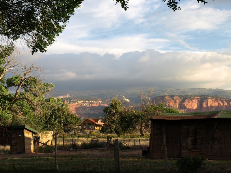
We left Long Canyon and knew we were close to Boulder and the lovely Boulder Mountain Lodge.
Boulder Mountain Lodge at last.
The corrugated metal roofs on the buildings are distressed for a mottled rusty look.
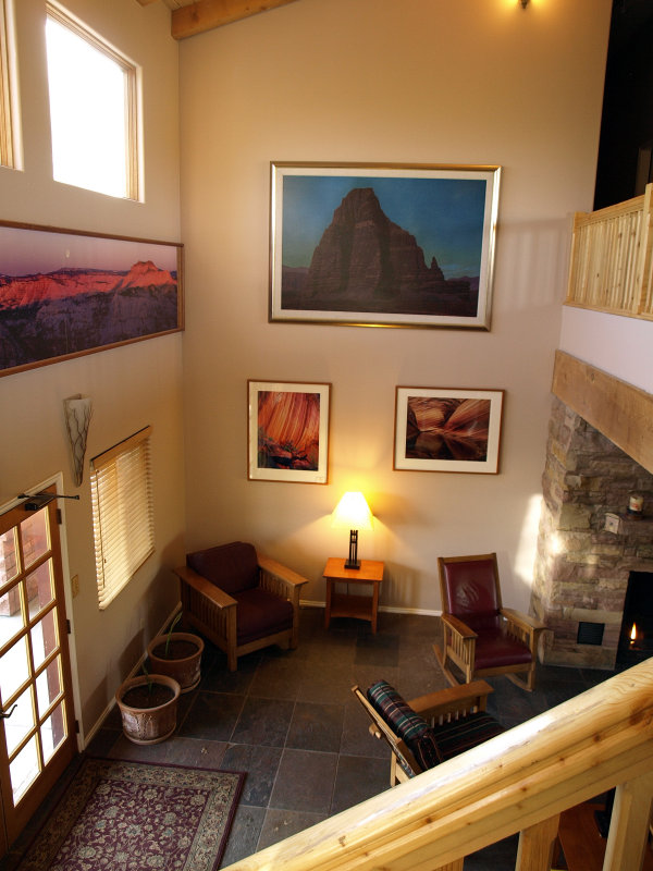
They display excellent artwork throughout the inn including the rooms. All very warm and western.
It is a lovely place with plantings, gardens and a large pond. At night you are serenaded by peepers, and the occasional quack of a duck or lowing of cattle. An uniquely Boulder experience.
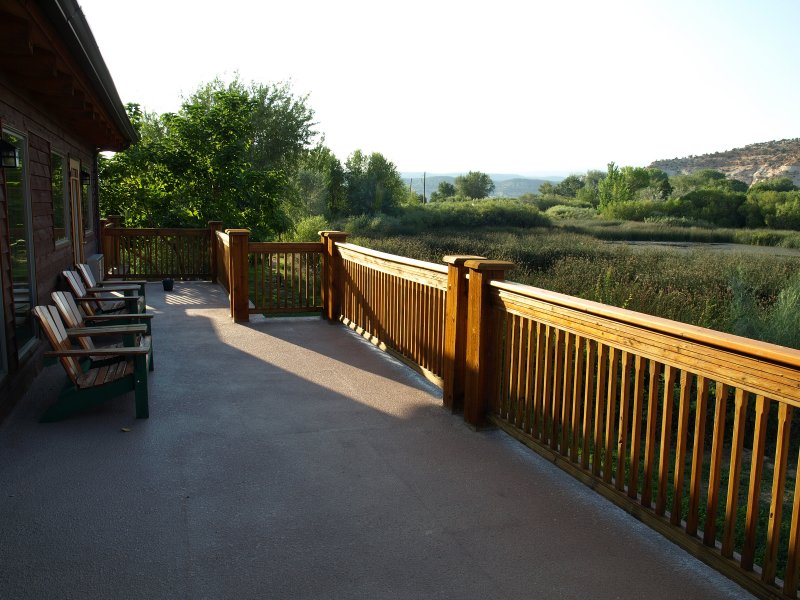
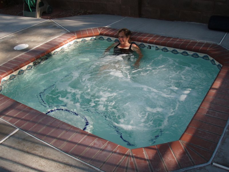
Our room was close to the hot tub as promised. The tub is large and surrounded by a beautifully landscaped patio with a portion under cover of a roofed ramada. There are two showers tucked away among the morning glories for rinsing. Fresh soft towels are in a large bin nearby. Since we had an hour and a half until dinner, we decided to enjoy the spa. We prolonged our hot soaking with cooling blasts from the outdoor showers. Finally, with our skin tingling and puckered, we returned to the room to relax and shower for dinner
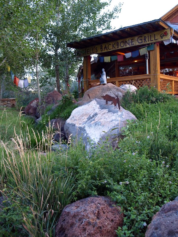
We hit Hell�s Backbone Grill promptly at 6:30 and were seated right away. There was plenty of room. To our surprise, the hostess was the waitress who�d served us pizza in Escalante a few days before. It seems she works at both places but lives here in Boulder. Small world. She said she could make it from Boulder to Escalante in 45 minutes. Pretty impressive considering the road. Lavinia, the sister of one of the owners, waited on us once again and was delightful. We started with a nice Groth Savignon Blanc, homemade chips and salsa and a 3 beet salad (w/local goat cheese) from their own fresh beets. They have a large garden which adds so much flavor to the food and makes interesting ingredients available in a remote location.
As expected, Sharon ordered the chipotle meatloaf.
This left me no option than to order the rosehip and sage duck breast with quinoa. We weren�t disappointed; both dishes were outstanding. We were too full for dessert so instead we each ordered a glass of really, really good red wine from their excellent wine list; a Sangiovese for Sharon and a Pinot Noir for me. What a perfect meal. We ordered a couple of bag lunches for tomorrow that we�d pick up at breakfast.
We headed back to the room and then the hot tub for awhile before tumbling into that large and comfy bed.
Friday Sept. 7th
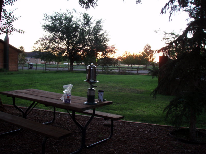
We lazed about in the morning in no rush. This was the start of our last full day of vacation and we wanted to take full advantage. I skipped making coffee since they make it right at the HBG so I wandered over and brought a couple of cups back to the room. Eventually we were ready for breakfast and headed back to HBG. We both opted for eggs with sage potato pancakes. Sharon chose smoked bacon while I went for the spicy buffalo sausage. Wonderful as always. We picked up our bagged lunches that we�d ordered and bid adieu to the Hell�s Backbone Grill.
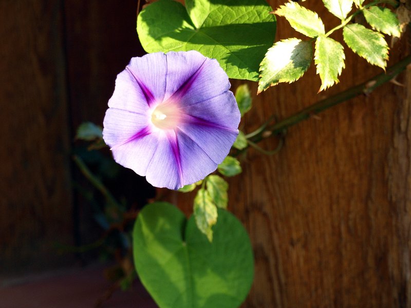
Since the only plan for the day was to drive back to Zion, we felt we had plenty of time for a morning soak in the spa before we left the inn. It was another stunning morning and the flowers at the lodge were in their glory�morning glory that is. It was a relaxing half hour before we returned to the room to shower and finally make our departure from the Boulder Mountain Inn and south down Highway 12. We didn�t get far though as Sharon though it would be a good idea to stop for the day�s beverages at the little minimart/grocery where the �long haired cute guy� works. Sure, why not. They have a good selection there and I found the lemon/ginger juice that I enjoyed earlier in the trip.
We took our time cruising over The Hogsback and down past Calf Creek taking in the now-familiar views one last time. Over the Escalante River and past the Kiva Koffeehouse until we hit the long, straight stretch that leads to Escalante. As our speed increased, we noticed that the Jeep had developed a pronounced vibration. Playing with the accelerator, I decided it was coming from a wheel which seemed out of balance. I suspected maybe we�d thrown a wheel weight so I stopped once again at the minimart with the air pump as we entered Escalante. This was getting to be an annoying routine. The tire pressures were all fine and there was no evidence that a wheel weight was missing. On closer inspection I saw that there was a blob of mud on the inside of the left rear rim. We must have picked it up back on the Notom Rd. going through the low muddy sections. The mud had dried there and had gone unnoticed since, until now, we�d been going slowly on bumpy roads.
Reassured that it was a minor problem that could be fixed by visiting a car wash, we left Escalante for the rewind to Zion. We made good time to Bryce since we had to go either slower than 50mph or faster than 62mph or endure the annoying vibration. We figured we�d stop for gas and use the carwash at Ruby�s. After tanking up, I went in to pay and get change for the do-it-yourself car wash and learned that it was out of order. So much for that idea.
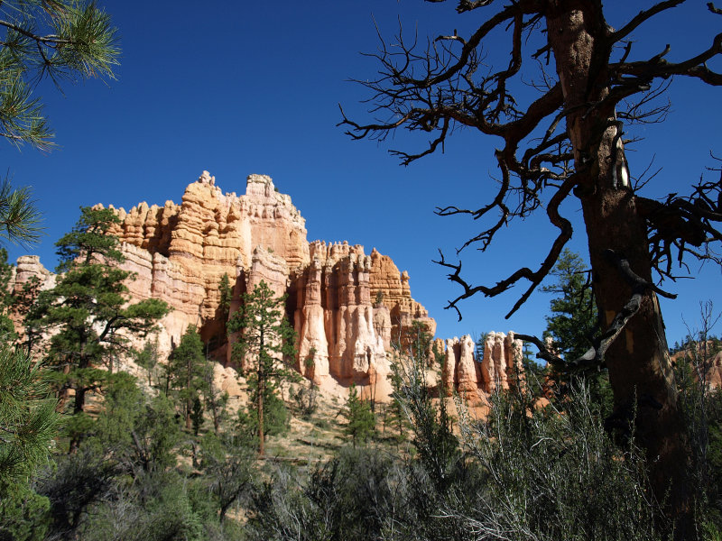
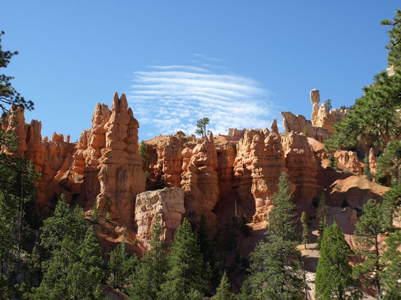
We left and continued on down 12 through Red Canyon and rejoined Rt. 89. This stretch of 89 goes quickly and we enjoyed the scenery but not all the signs of development. We passed a sign for a planned gated community along the way. We wondered on that a bit since we were in such a rural location. What was the community gated against? The animals? Surely there was little crime out here. People are funny sometimes.
As we neared Mt. Carmel Jct. we were careful to obey the speed limit since there seems to be a perpetual speed trap in the area. This time it was between Orderville and Mt Carmel; just north of Mt Carmel Jct. We took our right there onto Rt. 9 to head the final few miles into Zion. This was the first time we�d entered Zion from this direction and it was spectacular. We stopped frequently since we knew the cameras had plenty of memory left and our time was running shorter.
At one of these stops, we encountered a group of Japanese who, according to the logo on their van, were on a photo tour of the west. They were quite enthusiastic shooters and agog with the amazing scenery. I couldn�t resist clicking off a couple of shots myself. A couple of them even scooped up a film container of red sand as a memento. We departed the turn out just behind them and chuckled at the slow progress they made weaving along trying to figure out how and where to stop next. Finally they found another stop to their liking and we, and the line of cars behind us, passed them by as they tumbled out of the van in a jumble of arms, legs and tripods.
We made it through the tunnel and down the switchbacks and drove into the Zion Lodge. It was too early to check into our cabin but we got our new �red tag� to display on our windshield. Only lodge guests get them and no other cars are allowed into the park and lodge guests can go no further than the lodge. Beyond that, shuttle busses only.
We went into town to see if there was somewhere to print SW boarding passes but it seemed that all the internet access points had malfunctioning printers. We went to the Visitor�s Center and learned that they could do it right at the lodge DOH! We returned to the lodge and checked in. We dragged all the luggage inside so we could begin the final pack for our flight home the next day. Never a happy chore. We walked down to the lodge at 5 to see about the boarding passes. It went smoothly although we ended up in group B. Oh well.
We left the lodge again and went down and parked near the bridge where Rt. 9 crosses the Virgin River. Wandering down the trail with our cameras, we marveled at the scenery and admired the giant white flowers of the datura.
There were also interesting reflections of the canyon in the puddles of streams below the footbridges.
Sacred Datura aka Jimson Weed
As the light began to fade, we retraced our steps to the bridge for the view of The Watchman as the sun set.
This is a well known scene especially among photographers. It presents the challenge of a dim foreground and sunlit rock formation. We staked out a prime spot and lingered as the light faded. Soon others began to arrive. A van pulled into the parking area at one point and another group of Japanese photographers piled out. They ran onto the bridge and began to hastily set up. They were determined to be ready when the light was right. Again, I was impressed with their enthusiasm. At one point I realized that we were the only Americans among the 25 or so people on the bridge. I could hear French, Spanish, Japanese, Italian, Englandish, German and a Slavic language I couldn�t place. It was quite an international gathering! We got way more shots than necessary and gave our spot to the Japanese photographers to head into town for some dinner.
Oscar�s seemed crowded but we found a parking spot and were seated right away on the patio. It was bustling and that�s good to see. We ordered some Hop Valley IPAs and guacamole with chips. There was a couple seated next to us with a baby who was very well behaved and, anytime a fuss seemed to be looming, one of the parents would leave with the child until he calmed down. It took awhile for them to eat this way but we appreciated it.
-
Sharon ordered a mahi taco and I a shredded pork burrito. Everything was great and we headed back to the cabin around 9ish. We sat for awhile on the porch of our cabin and watched a little bat swoop in and out of one of the parking lot lights. It was a beautiful evening. We read in bed for awhile to reacquaint ourselves with the plots we�d gotten involved with on the flight in. Finally we dropped off to sleep on our last night in Utah.
Sat. Sept. 8th
Started the day with more coffee from the coffee window at the lodge which we enjoyed on a bench in front of the place. Then back to the room for the final clean up. Loaded the car at a leisurely pace and went into Springdale. We returned to the Gallery/Caf� and enjoyed another of their breakfast burritos and their blueberry tea smoothie�really yummy. After that we drove down to see the Michael Fitaldi gallery near the theater and Sol Market. I recommend the Fitaldi Gallery for photography. Wonderful large format film images beautifully displayed. Michael was minding the gallery and it was nice meeting him.
After that we parked downtown and Sharon finally got her chance to visit a rock shop. We try to limit ourselves to �local� rocks. We found some bargains on rough split geodes and a few other interesting specimens.
We headed out of town down the road to Rockville and drove out toward Grafton for a few last moments in the quiet landscape of southern Utah.
Reluctantly, we pointed the car south toward Las Vegas stopping just once in Hurricane at a car wash to wash the mud off the rim to smooth out our long drive. Ten hours later we arrived home to our joyous dog and thoroughly miffed pair of cats. Our adventure was over.