All images and text are protected under United States and International copyright laws.
The photographs on this website may NOT be downloaded, reproduced, copied, stored or
manipulated in any manner or form whatsoever without the prior written permission of MARICHU PEREIRA.
Your use of this site indicates your acceptance of the following terms and conditions:
The use of any image as the basis for another photographic concept or artistic illustration is also a violation of copyright law.
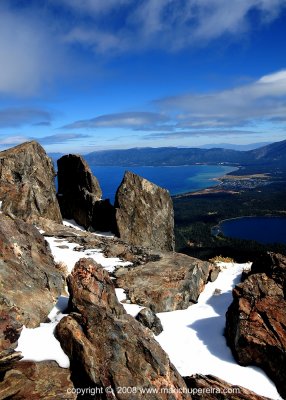
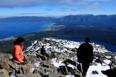
Desolation Wilderness is far from being desolate. It's covered with wonderful vistas, subalpine and alpine forest, granitic peaks, and glacially-formed valleys and contains many small streams, about l50 lakes. Elevations within the wilderness range from 6,500 to over 10,000 feet. It is located west of Lake Tahoe and north of Highway 50 in El Dorado County.
Mount Tallac is a mere child, standing at 9735 feet above sea level. With its distinctive "cross" of snow rising directly above the southwest corner of Lake Tahoe, Mount Tallac commands attention. The summit affords without question the best panorama in the Tahoe Sierra.
"Walk away quietly in any direction
and taste the freedom of the mountaineer.
Camp out among the grass
and the gentians of glacier meadows,
in craggy garden nooks." - John Muir