18-OCT-2013
The old and the new
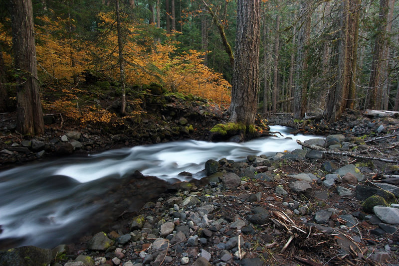
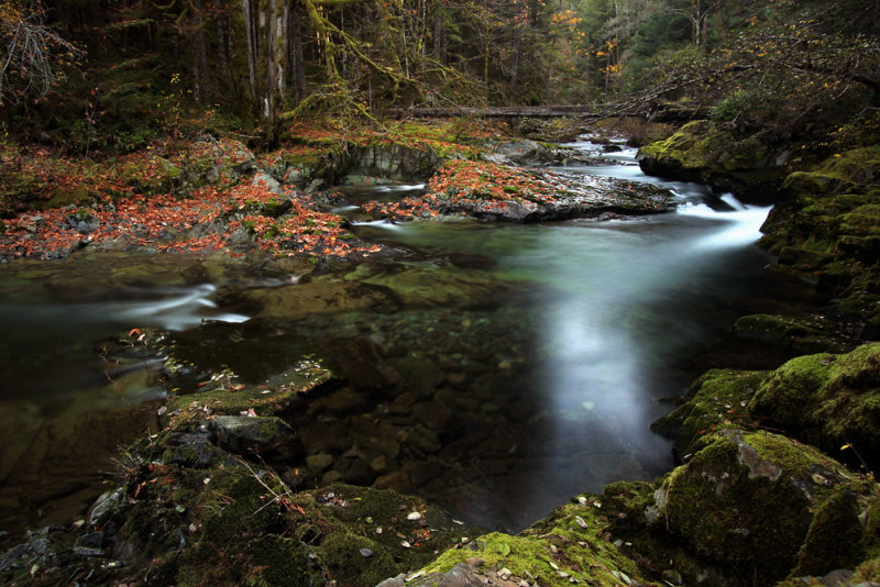
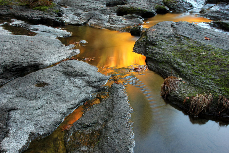
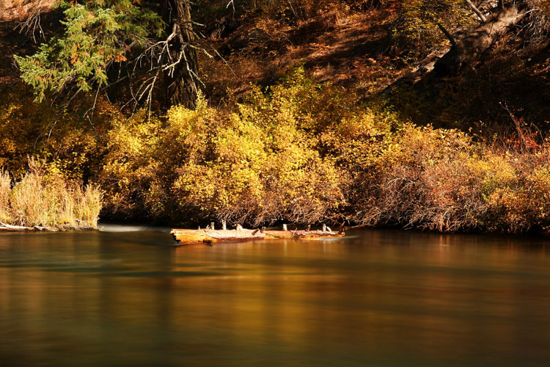
This is Pamelia Creek showing the difference between the untouched forest and where the mudflow swept through. The left side represents my trip to the Pacific Northwest, while the right represents going home. As for the creek in the middle, well I guess I’ll let you figure that one out
31-OCT-2013
I don’t know why I bother going anywhere else
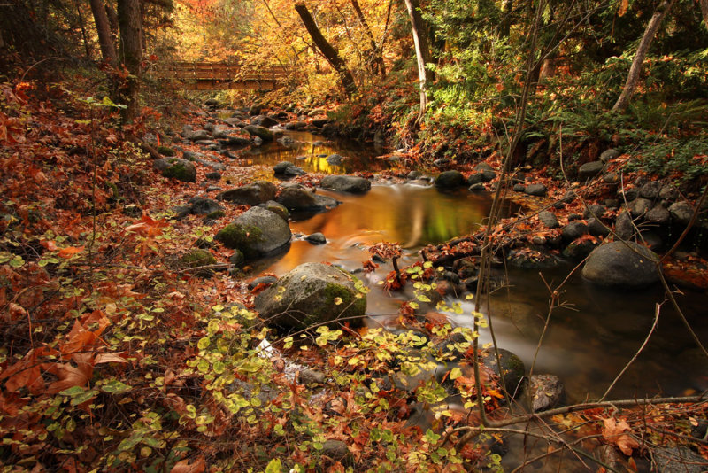
I really don’t know why. I’ve been stopping at Lithia Park in Ashland on the way home on the past few trips. It’s a wonderful place to stroll. Not to mention that if the light is favorable you can get some darn nice pictures of little Ashland Creek.
I wasn’t sure how it was going to be today considering that there hasn’t been much in the way of fall color. Actually Lithia Park had better color than the other places I’ve visited this month. Well, with the exception of the trees in the cities.
Today was, as usual, a sunny day. So I was hoping to get some nice colorful reflections in the creek. Apparently timing is extremely critical. As it so happened, I hit the perfect time last year. This year I was lamenting the lack of reflected color. As I walked a bit further I started to see some. You see, I arrived just a tiny bit earlier this year. My observation, which is based on a sample of just two days, is that the right time starts around 10:35. I ended up looping back to my original spot by 11:40 and that was too late.
Oh I made sure to visit the tiny Japanese Garden. Last year I was just a bit late, but there was still some color and the fallen red leaves were pretty. This year I was definitely too late.
After dinner tonight I was looking for a trash can. I found one in the exercise room. As long as I was in there I figured why not try the machines. I had never used an elliptical before. I didn’t like it. I had to bend my knees too much. The recumbent bike was okay. I wouldn’t mind working with it a little more to get a better feel for it. But I tried that after I got a work out on the treadmill. That was okay. I prefer actually walking on the ground, but I think I wouldn’t mind having one at home. It felt a little strange, but I think I might be able to get used to it. Gee, that would save me the trouble of driving so far so that I can go walking in the woods.
30-OCT-2013
The same old thing
I hardly took any pictures today. I hiked a small portion of the Tioga segment of the North Umpqua Trail to Fern Falls. I had seen a picture and wasn’t expecting a whole lot. But I went anyway since I never had the time to check it out in the past. There wasn’t a lot of water in the creek, so it wasn’t anything special. Perhaps it looks better with more water. Anyway, that wasn’t the point. I just wanted to stroll along the trail. It was quite easy and pleasant provided that a person doesn’t mind some traffic noise from state route 138 across the river. There wasn’t a lot of river access on the portion that I hiked.
This felt like a very casual day. I didn’t have any particular things I needed to see. I didn’t even make plans for the day when I was preparing for the trip. Today was just supposed to be a day to hang out some place along the river. I checked out the new hiker bridge just west of Susan Creek. I saw it when I was up here last year. It was built in 2012 on top of the old pilings of a bridge that washed out in 1964. The new bridge is a beautiful, huge, wood arch suspension bridge. As substantial as it is, when I jumped up and down I could feel it moving, which sort of surprised me.
I finished the day strolling by the river at the Susan Creek day use area. I sat on a wood bench and gazed out at the river. I had my arms on the back of the bench, but something just wasn’t right. Someone was missing.
Had I known what I would choose for today’s picture I would have uploaded something else yesterday. Of course that’s hindsight. I didn’t really have anything else to choose today. I shot a few snapshots along the trail and a couple of quick reference pictures so I would remember what Fern Falls looks like. I only shot three scenic shots of the river, and they were all of the same rocks with slightly different compositions.
29-OCT-2013
Why don’t you people just get high?
Since I had already completed all of the major locations in my plan, I was reduced to looking for some fill in items from my options list. I can assure you that it’s a horrible situation to be in. I’m feeling so sorry for myself that I’m close to tears. Or maybe I’ll be honest and say that I simply enjoyed an easy and quite enjoyable final day in the Portland area.
I went to Wahclella Falls in the morning. I haven’t geocached in several years, but I would have had to be blind to miss the cache sitting right out on a rock near the falls. I wrote a short note in the log, but I don’t intend to go to the web site and record my visit. I guess that sometimes people just find caches and write in the log even if they’re not involved in geocaching. For instance, someone at work found a cache and read the log. There was an entry from a decidedly non-geocacher. It read, “Why don’t you people just get high?”
I went about halfway up the talus slope and shot a couple of quick frames. I was going to continue to the huge boulder but decided that there wasn’t much point. Since East Fork Falls was barely flowing and the ephermal waterfall on the cliff wall near the talus slope was living up to its description, I didn’t expect that I was going to get any particularly good shots from up there. The only reason I would have gone is to see if the shrine has been replaced. It was gone during a previous visit or two, so I don’t have any reason to expect that it’s back.
My next stop was Beacon Rock State Park. Since I didn’t have any time pressure I hiked slow and stopped often to just enjoy my last day in the Gorge. I was on the Hamilton Mountain Trail, but I had no intention of going up to the top. I’m not one of those sort of people who needs to get high. While I can enjoy grand, scenic views, I seem to gravitate to much closer, more intimate settings.
Rodney Falls was mostly in the shade, but there were spots of sunlight. Although those certainly didn’t enhance my pictures, I managed to get a couple of photos that weren’t too bad. It’s a pretty waterfall, but the coolest part is something which isn’t easy to photograph. There is a spur to the Pool of the Winds, which is a small alcove that the top tier of the waterfall flows into. The view is fenced since it’s on the rocks right next to the outlet. I can only imagine how much wind and spray shoots out of there when the creek is flowing high. A somewhat drier view can be had from the bridge below. There was no spray at the bridge today. It probably does get wet in high water, although it would be nothing like standing next to the entrance of Pool of the Winds. The entire cascade goes on for a while, but there aren’t really good viewpoints.
Looking at the park map, I saw a short trail to a pond size lake. I figured why not check it out since I was already finished with what I wanted to do today. It was nice hiking without my backpack and tripod. There may have been a pond there at one time, but now it’s a marshy meadow surrounded by berry thickets.
28-OCT-2013
No rest for the Devil
Today I hiked the Multnomah – Wahkeena loop. I’ve hiked part of both sides before, but this was the first time that I’ve done the complete loop. At one point the trail was muddy. I looked to the side and saw the bank. Oh, that was the spot I heard about a couple of weeks ago. The person reporting said that the landslide was still moving at the time. Well they had it cleaned up with a level trail going through. That was one of the reasons why I decided to hike the loop in a clockwise direction. I certainly didn’t want to hike most of the way only to find that the trail was closed and have to turn around and go all of the way back. The other reason is that I felt that since Multnomah Falls is so heavily visited maybe my car would be safer. The Gorge has a very bad reputation for car prowls. Speaking of crowds, Multnomah was a madhouse by the time I returned.
Wahkeena Springs emerges about three feet below the trail. I was wondering how stable the ground above it is. I guess the water must not be eroding anything or the trail would have been long gone.
When I was near Lemmon’s Point a man asked where I had hiked. I later realized he must have been asking me because I must have looked like a more serious hiker, what with all of the gear I had. I remember back when we used to hike these trails with a whole lot less stuff. That gentleman told me he was headed to Devil’s Rest today. That would have added about another 1,200’ of elevation gain to the hike I did. No thanks. I already climbed 1,600’.
But I suppose that 1,600’ wasn’t enough since I headed right over to Horsetail Falls. I wanted to climb up to Ponytail Falls. I don’t even recall how much gain that is. The trail isn’t long, but there are switchbacks. I spoke with a photographer while I was there. I told him that I didn’t even bother to take any pictures of Horsetail Falls since I already had pictures with much better fall color. He commented that I was spoiled. I replied that he was spoiled since Mount Rainier is in his back yard. It was all good fun, and I’m pretty sure that we were both right.
My next stop was at Bridal Veil. I didn’t go there to shoot the falls, although I walked up to take a look since I was already there. My reason for stopping there was to shoot the creek below the falls.
At Shepperd’s Dell I was surprised to see a woman photographer with a tripod. It’s not as though there aren’t plenty of women photographers. It’s just that it’s so unusual for me to see one with a tripod. I don’t mean that as social commentary. It’s just a personal observation. Maybe y’all see women with tripods all of the time.
I finished my day at Latourell Falls, which is my favorite waterfall in the Gorge. I set up my tripod and took a shot. The results looked like my camera was crooked since the wind had blown the water sideways. I spent a lot of time watching the wind play with the water.
After stowing my camera, I made two view stops at Crown Point and Chanticleer Point. That’s about as much of a view as I need. I won’t be hiking to either Angel’s rest or Devil’s Rest. Oh and that hiker I had spoken to earlier – well he told me that he had hiked up to Sherrard Point last week. Oh man! That’s practically a four thousand foot gain. I’m so lazy that when we visited we got there in a car and I wasn’t even the driver!
27-OCT-2013
Passing through Boring
Boring, Oregon that is. I wonder who came up with that name. I suppose it was probably someone with the surname of Boring. Hopefully it wasn’t intended as a descriptive name. But perhaps someone just thought that the simple life is the way to go.
I’m sure that much of the younger generation of electronic multi-taskers would have been horrendously bored with what I did today. What did I do? Well I walked in the rain. You heard me right; it finally rained. The forecast was for showers starting in the late morning. I was trying to figure out if I was going to take my backpack, but since it was already sprinkling on my way to the trail it turned out to be quite an easy decision.
I took a few pictures near the beginning of the Lower Salmon River trail. Most of the rest of that section I spent just walking and observing. Although I didn’t see anything that caught my eye in terms of photography, I still enjoyed my solitary hike. I was the only one out there on this rainy morning. Instead of hiking out and back the entire distance, I walked back to my car and then drove to the Central Salmon River trail head.
There was one car here. I figured that it belonged to the hardy souls who had a tent set up in the campground. Speaking of camping, I saw signs reading that the forest service was considering closing camping outside of developed fee campgrounds in this area. The portable toilet and trash cans were intended for hikers and were not intended to serve as fee free campground facilities. Of course instead of closing the area to free camping they just removed the toilet and trash cans. I do have to say that I don’t blame the campers for using the toilet. I would have done the same in their position. However, they could have certainly packed out their garbage.
It was raining pretty well while I hiked the Central Salmon River trail. I could have skipped it. I even thought about turning around. My thought was that I didn’t want to get my camera gear soaked. I set a time when I would turn around if the rain didn’t let up. When that time came I decided to continue, because I was enjoying myself. After all, what better way is there to spend a rainy day than walking on a trail? I reasoned that my gear has survived getting wet before. I just had to make sure that it didn’t get too wet.
I ended up seeing maybe ten people on this trail section, which surprised me. I figured that maybe the locals had gotten spoiled by all of the recent sunny weather. I, perhaps, may have been spoiled by the rain. The remainder of my time in Portland is expected to be sunny. How boring.
26-OCT-2013
Glutton for punishment
No, actually I’m not. Today was a rest day. Had it been a week day I would have gone on a hike, but instead I opted for less crowded locales.
When I drove back to Portland yesterday I was surprised to finally see some overcast. It was dark when I left the hotel this morning, but when it got light I still had overcast skies. Yay!
My first stop was at the Cedar Creek Grist Mill. I figured that this might be a bit late for color, and I was right. I only took a few shots. I spoke for a bit with another photographer. Since he was headed to the Columbia River Gorge I gave him some tips and a color report. The folks in the grist mill were making cider. The sign on the side of the building indicated that visiting hours start at 1 o’clock, so I just watched at the door for a little bit. I’m pretty sure that they were open to receiving visitors. They were already putting out signs to make the narrow road one-way. I enjoyed the smell of sawdust and listening to the sound of the belts and pulleys. It was a comfortable feeling for me.
Going to Big Tree Creek Falls was a really low priority for me. But I ended up driving there since I was already going to be in the area. The gate was open. I saw a sign indicating that the gate opens one hour before hunting hours and is closed and locked one hour after. I have no idea what the hunting hours are. I’m sure that I would have been alright since it’s just a short walk on the road and then the view is from close to a bridge. Three trucks came out from that road during the few minutes that I was reading the sign. I decided to skip Big Tree Creek Falls and move on to Sunset Falls.
We saw Sunset Falls one June. I was pretty sure that it would look a whole lot better with a much lower river level. Well what do you know; I was right. Seeing Sunset Falls with low flow was the entire reason that I decided to come up this way today. I was very pleased not only with the waterfall, but also that I was enjoying overcast. I spent a lot of time here.
I have been to Yacolt Falls a couple of times. I was already more than happy with the photo results from a previous excursion, so I wasn’t expecting to top that. But I still was looking forward to seeing it again. It’s a good thing that I already got some good pictures since there is now a small fallen tree right at the best part of the waterfall. I still spent time taking many shots. Afterward I crossed the road and walked to a view of the arch bridge. Then I continued the very short distance to Moulton Falls. The sun had come out by the time I looped back to Yacolt Falls. Seeing it that way, I was happy that I got some shots in the right conditions beforehand.
I stopped at Lucia Falls, but there was too much sun on half of it to get any good shots. This is another location where I already was pleased with my photos, so it didn’t bother me too much that I wasn’t going to take pictures today. I took my time walking around and I watched some fish jumping up the falls.
I was planning to finish the afternoon at one or two other locations, but instead I made it a short day since I didn’t think that either place would be good in the sunlight.
25-OCT-2013
Forgetful Guy
My previous visit to Eagle Creek didn’t make a strong impression. The temperature was 102 degrees. When I exited the air conditioned car my stomach lurched, and I thought I was going to be sick. We got back in the car and left in search of easier destinations.
Today I actually got around to hiking Eagle Creek. Since it was a longer hike I needed to be mindful of the time. That meant that I did not take as many pictures as I would have liked. I think that overall this would not have been as photo rich (for me) as some of the other creeks I have visited during this trip. But a lot of the time I had to just keep hiking instead of stopping to take pictures. Of course that was easier during the times when I had the sun shining on the creek.
I had expected that Tunnel Falls would be sort of a novelty. I have to say that when I was able to experience it in person I really liked it a lot. It was actually pretty darn cool. There are many spots along Eagle Creek where the builders blasted the trail out of the cliffs. This spot was one of those locations, except that there happened to be a waterfall flowing down the cliff. What do to? How about blasting a tunnel behind the fall? So you’re walking on an exposed cliff. You enter a short tunnel maybe fifteen feet long. When you emerge there is mist from the waterfall flowing at the portal. Right after that you’re walking through rain, which is water falling from the cliff. Oh and you’re still on a narrow ledge. Hike a short distance farther and you’re looking at the waterfall you just bypassed. Well I don’t know. Maybe that doesn’t sound like much to you. But I really enjoyed the experience.
Twister Falls was spectacular, but I was looking directly into the sun, so I didn’t even shoot any frames.
On my way back, I kept feeling like I was forgetting something. I checked to see that I had my tripod, camera, and other assorted paraphernalia. I did have everything, but I couldn’t shake the feeling that I was forgetting something. I finally figured that it was my subconscious mind telling me that I was forgetting to take pictures. As I previously mentioned I knew that I was going to have to choose between actually completing the entire planned hike or taking a long time shooting as much as I normally do. I rationalized that the majority of the creek scenes were not drastically different than other creeks I’ve visited. In addition, much of the trail runs high above the creek. I did pass up a few opportunities to get down to creek level. One in particular was a spot with green mossy rocks sprinkled with fallen leaves in the middle of cascades. I couldn’t tell if I was actually going to get a good vantage if I headed down there. I was saving my time for something else.
The light was less than desirable at Punchbowl Falls on the way in. My plan was to return on my way back. My thought was at that time I should have better light. Perhaps more enticing was that I thought I might actually enjoy numbing my feet in the chilly water in the afternoon. I’m not sure why since I had about thirteen miles of trail rocks providing a relaxing Shiatsu massage to my feet. I was disappointed to find that the light was not much better when I returned. I’ve seen some stunningly beautiful photographs of Punchbowl Falls, but it appears that I won’t be adding to that particular bounty.
Eagle Creek has a very bad reputation for car prowls. I considered changing my hike to Saturday since I thought that more activity might mean less privacy for crooks. Instead I opted for a week day for a less crowded hike. I think that turned out to be a wise decision since even on a Friday I saw around sixty people on the trail.
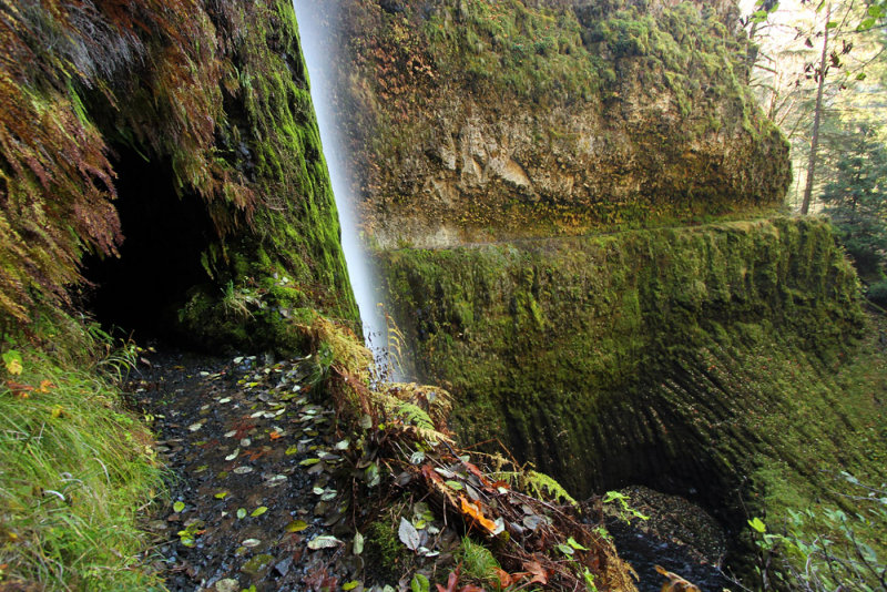
To wrap up, photographically my day was mostly spent just taking quick snapshots along the trail. I didn’t end up with much worth sharing. In fact, I had a hard time finding anything at all I felt like uploading. The picture I finally chose was just a quick hand-held snapshot before I entered the tunnel behind the waterfall. What I like about it is that it gives you a feel for the trail cut into the cliffs. There is about a sixty foot drop in this location. Oh, and you can see a little bit of columnar basalt. Just before reaching this location, I passed through another blasted ledge. The rock looked a bit strange. It took a minute to hit me that I was walking on columnar basalt. The interesting thing is that the tops of the columns were mostly slightly convex or concave.
24-OCT-2013
PCT Hiker
I hiked a short section of the PCT to Dry Creek Falls. I had the option of hiking to PCT Falls, but I don’t seem to remember being impressed by pictures of that one. I suppose it would have been a nice hike though just for the scenery.
I had a stroll up a bit of Gorton Creek. I wasn’t exactly thrilled at the sign board indicating that this is bear country. There was quite a bit of information, so I suppose that they weren’t kidding.
My next stop was at Starvation Creek. This time I didn’t hike to Cabin Creek, Warren Creek, and Lancaster Creek. I was just there to photograph Starvation Creek below the falls.
My final stop of the day was at Yeon State Park to see Elowah Falls. That was a bit of a miscalculation on my part. Today was supposed to be a rest day, since I have a more difficult hike tomorrow. I had been thinking that I had only four more days left in Portland. Once I started hiking to Elowah I realized that I actually have five. I had already started by that point so it seemed pointless to turn around.
23-OCT-2013
I’ve finally figured it out
It’s a good thing that I had Siouxon Creek on my itinerary this year. I’m not so sure that it will remain reachable by passenger car much longer. That is without a doubt the worst (mostly) paved road I’ve ever driven.
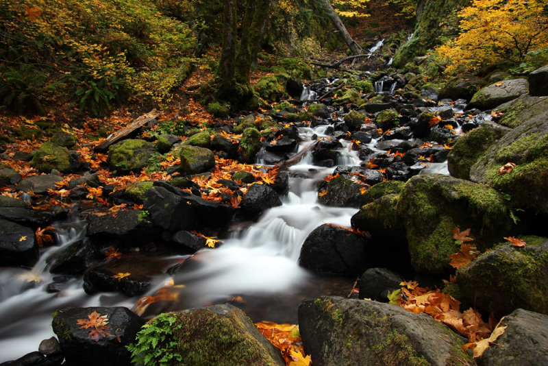
Even with the days being sunny, there are places where the direct sunlight doesn’t reach for most of the day due to the lower angle of the sun at this time of year and the surrounding terrain. Since I planned this trip for this normally overcast time of year that has been a real godsend. Imagine a fall trip without rain and without much fall color. And speaking of color, I would love to share a picture of the beautiful color of the water in places in Siouxon Creek with you. The problem is that while I was able to see it through the trees, when I went down the bank to the creek level the light was different and I wasn’t able to capture what I could see from above. Speaking of above, the trail is mostly above creek level. That’s not exactly unusual. I am very pleased to report that the trail stays very close to the creek for the most part. It’s kind of disappointing when I hike a trail named for a creek or river and have very few views of those features.
The trail continues past the cutoff for the Chinook Creek Trail. I would have loved to continue, but instead, as per plan, I took the short spur to Chinook Falls. Chinook Falls is very nice, although I did not even take a picture. It was almost all in the shade, while the cliff on the left side was in full sun. I stood and watched it for a while. I wanted to stay longer, but it had already taken me five hours to get to my turn around point. It only took me two hours to hike back to the trail head. I figured out why it takes me so long to hike. (That is besides my various ailments.) I keep stopping to take pictures! Five hours in and two hours out. I’m sure you can do the math. Imagine what I could do if I just left my camera behind.
22-OCT-2013
Lewis River
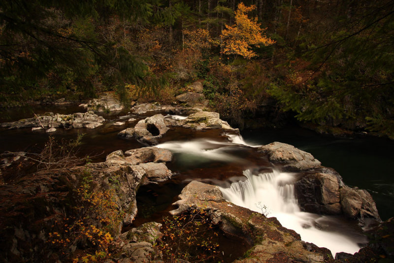
This portion of the Lewis River trail has three main waterfalls. There's a fourth pretty big one, but the viewpoint leaves something to be desired. Probably the most famous of them is Lower Lewis River Falls - with good reason. It's a beauty. It's also right next to a campground, so I imagine that during summer it's quite a busy area. There are signs informing people that someone died there so be careful in the river upstream. Actually I would be surprised if only one person died there. The crazy thing is that there is a wooden staircase and the stairs cut into the rock right above the waterfall. Slip there and you would be right in the main channel headed over the brink.
In my experience, Middle and Upper Lewis River Falls don't photograph all that well. Or the photos certainly aren't representative of actually being there. All three of the main falls have one main channel powerfully funneling the lion's share of the river. The rest of the water flows along shallowly sloped rock and flows over the much wider ledges. I suppose that it's ironic for me to speak of photographs not being representative of the scenes since I appear to be a big fan of long exposures. But then I suppose one could delve into the discussion of dynamic range limits or other such issues which make photographs not look like seeing a scene in person.
One of the things I liked about this particular spot is the bedrock in the foreground. It sort of reminds me of argillite. I would be interested to find out if anyone knows what it actually is.
21-OCT-2013
I forgot how beautiful it is
Yesterday I had a very nice time at dinner with Greg and Cheryl.
This morning I went to Panther Creek Falls. This time I also went down to the bottom. I won’t be doing that again. It was rough going. Bless the kind soul who left a sort of rope tied to a tree. Too bad it wasn’t long enough. But anything helps. I’m glad that I was able to get down there to see what it looks like from that perspective.
I completely forgot how beautiful the cleverly named Falls Creek is. I suppose that sort of oversight is prone to happen when there is a magnificent, exhilarating waterfall upstream. Pictures don’t do Falls Creek Falls Justice. Especially mine. But most of them won’t show how impressive this waterfall is.
I was planning to finish the day with a hike to Rodney Falls and Hardy Falls. I haven’t yet been to them, but since they’re south facing I figured that it was likely that I wouldn’t be getting any shots due to the sunlight, so I decided to make this a short day.
20-OCT-2013
Sunday Driver
I decided to take a drive to the coast, which was foggy. Go figure. Every morning has been staring off with fog before the sun burns it off. Today at the coast it was foggy pretty much the entire time I was there. It was just a matter of degree. When I was at Cape Foulweather I was in full sun with a solid layer of fog below me. It looked like I was on an airplane flying over the clouds.
I just stopped at any wayside that caught my fancy. The only two I didn’t go to were the two that I was actually planning to see. The parking lot for Fogarty Creek is isolated and there was not a car there. Signs warn that it’s not safe to leave your valuables in your car. Since today was a travel day for me, all of my stuff was in the car. There was a guy who looked a bit sketchy hanging around, so I left.
The other place I planned to visit was Cape Kiwanda, but it was absolutely packed.
The rest of my day was spent driving to Portland. I took the scenic route. Oh and I finally found excellent fall color – along Salem city streets. Maybe I should hike in the cities and take fall foliage pictures. Speaking of which, I only shot three frames today.
Which of the following did I not see today?
A) Quail
B) The Oscar Meyer Wienermobile
C) Bald Eagles
D) Bigfoot
E) Rifle toting men walking along the side of a state highway
19-OCT-2013
Cascadia
We’ve driven by Cascadia State Park numerous times. Actually we’ve been there since it’s a good rest stop along that highway. I remember thinking it was a nice place and wishing that we had more time. There’s even a trail to a waterfall. Lower Soda Falls doesn’t have the form that I prefer, but you know how much my travels tend to revolve around waterfalls. So this was an opportunity to actually explore the park.
The Lower Soda Falls Trail reminds me a bit of being at Silver Falls State Park. It’s not as wide, and on a fall weekend it sure didn’t have as many visitors. But the narrow canyon, the vegetation, and the creek are quite similar. Well maybe the creek isn’t. What I’m trying to convey is that the area felt much the same to me. After enjoying that short hike I spent time down by the Santiam River. There were a few spots that provided me with some good photographic opportunities.
I went to Yukwah campground, which is closed for the season. I wanted to check out the accessible nature trail to see what sort of river views it has. As I’ve mentioned before, I really like accessible trails and viewpoints. Not everyone is able bodied. I imagine those that aren’t must find it such a treat to be able to get out and experience nature. At Yukwah (and at a couple of pullouts to the west) there are even platforms over the river with low railings so that the disabled can fish.
I planned to hike at House Rock. I parked near the gate and walked downhill on the access road. When I reached the campground area, I read a sign which stated that a trail bridge is out. There are a couple of other places I could access the Santiam Wagon Road, but I decided to make it a short day and leave that trail for another trip.
18-OCT-2013
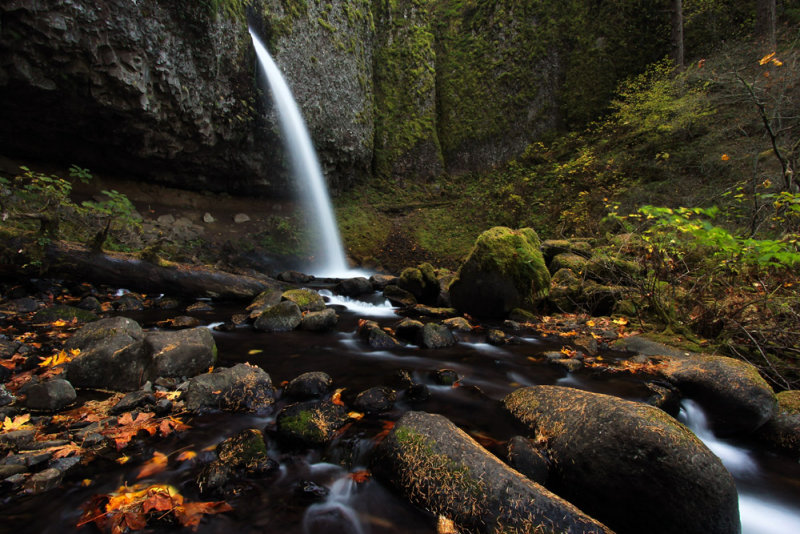
Limited entry
Some years ago I saw and downloaded a picture of Pamelia Lake. The picture was not especially noteworthy. It wasn’t a great composition or a great scene. It was just a point and shoot snapshot. But what I loved is that it is a picture of an Oregon forest, and that’s enough for me. I look at it often.
I didn’t even know why Pamelia Lake is an impacted area. I didn’t know what sets it apart from other lakes which aren’t as heavily visited. My whole reason for wanting to visit is because of that picture. I could look at it and imagine being in a generic Pacific Northwest forest with no particular destination.
Since the federal shutdown is finally over I was able to go online and buy a permit when I got back to my hotel yesterday afternoon.
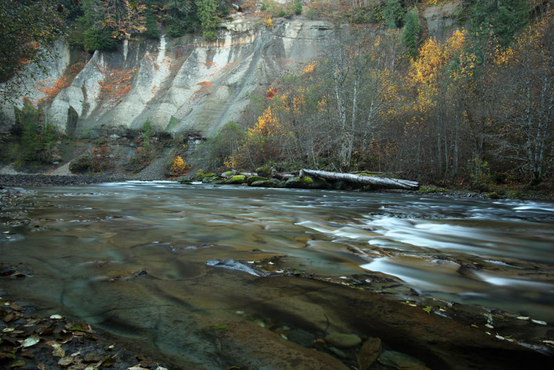
I’m sorry to say that I the picture I’ve been talking about was not representative of what I experienced today. I thought the trail was exceptional. I suspect that for most people the trail is just where you have to travel to get to the lake. For me the lake was just an afterthought. For one thing I finally saw some decent fall vine maple near the beginning. But it was what came later that I loved. I was hiking and thinking that the trail reminded me of the Ramona Falls hike. Then I realized why. The normal forest understory I’m used to is full of ferns, Oregon grape, salal, etc. What I was seeing here was lots of moss and rhododendrons, which is what I love about Ramona Falls. However, during this hike the creek is much more energetic. The creek is off to the side of the trail and accessible with short bushwhacks. Even the damage from the 2006 mudflow was less than I expected.
The forest changes a little upon reaching the lake, and again after passing the inlet. That area was extremely wet. I couldn’t walk a minute without encountering several creeklets crossing the trail. The floor below the trail is pretty flat and the water braids all through the area. I hadn’t planned to continue the hike to Hunts Cove, but I was sorely tempted to continue past my turn around point. I made a miscalculation based on how long it took me to drive to the trailhead and how long I had been hiking. I spent a lot of time taking pictures and a lot of time soaking in the surroundings on the hike in. I figured that the hike out would be quicker, but I ended up returning a whole lot faster than I anticipated. So, as it turned out, I could have hiked farther. But it’s still a good idea to err on the side of caution.
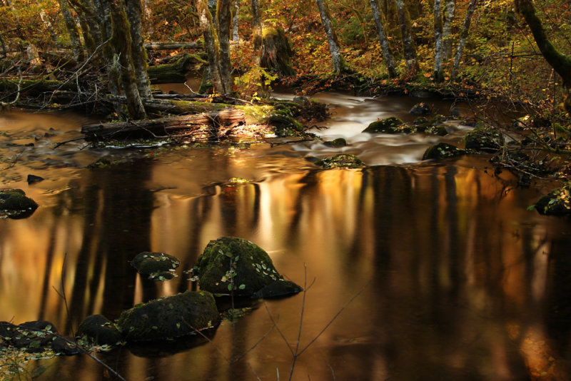
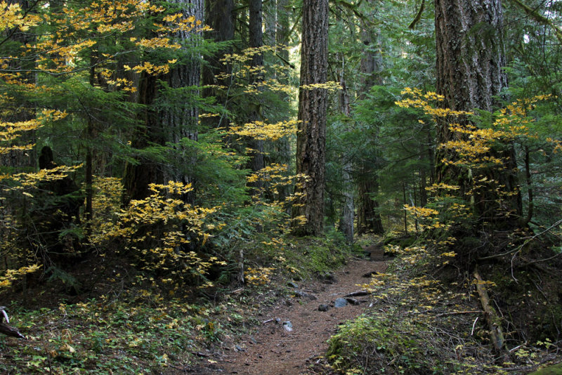
So after all that talking about the things I loved the most about the trail, I decided that instead of uploading any of my better pictures I was just going to upload a picture of a generic forest. This was shot at the beginning of the trail before the vegetation changes to what I was talking about earlier. This is my version of a simple, quick snapshot while hiking. Who knows, maybe someone will download this and decide to take a hike.
17-OCT-2013
A Little North
I started off the day with a few minor locations before I went to Three Pools. I’m sure I’ve previously mentioned how surreal it is to be on an unpaved forest road and start to see no parking signs. Then the day use area is a large paved parking lot with speed bumps and striped spaces. But I completely understand why that is. I imagine that on summer days the place must just be a madhouse. Today, however, I was the only person partaking in the magnificent beauty of the area. That differs from our previous visit when there were a few people leaving just as we arrived. Either I have great luck in finding solitude or I just visit during at the right time of the year. Unlike my previous visit, today wasn’t raining, so other people just have no excuse.
I then finished the part of the North Fork Santiam Trail that I missed yesterday. I thought I was only going to be able to hike a short portion, but the signs indicating that the bridge over Cedar Creek is out are outdated. There’s a nice, new bridge there. So I was very happy that I was able to complete the hike. This section is pretty easy. There are lots of views of the turquoise water through the trees. Mostly you have to be content with obstructed views because there aren’t many places where it’s possible to bushwhack down to the river on social paths. But even gazing at the marvelous river through the trees is an outstanding way to spend a day.
I spent the rest of the afternoon driving down Forest Road 2207 and stopping at each pullout. I remember seeing lots of pullouts when we visited Sullivan Creek Falls. So today I had plenty of time to walk down go down to splendidly scenic Cedar Creek.
16-OCT-2013
The sunrise filled me with joy
I only hiked part of the Little North Santiam trail. There were a few social trails down to the water in the first stretch. Then I started climbing and climbing. It was steep too. I’m happy to say that I managed to get up to the top and back down. Then when I was on a flat section I felt some pain in one of my knees. I thought about it and decided that it would be a good decision to turn around. I felt that if the pain fully set in it would probably take me until midnight to climb back up and down that hill and get back to my car.
So now I had the luxury of time. I was able to take it slow(er), and I stopped plenty of times to just take in the scenery. I spent my time taking in everything you can imagine seeing in the forest. I even stopped and enjoyed the sunlight streaking through the canopy. I had plenty of time to think about a wide range of subjects. One was a poem by Terry Hertzler. The Night of the day that Davy Maxwell Died. “The sunrise filed me with joy. How strange. The sun.”
Oh and that picture taking thing that I seem to like to do – well let’s just say that unlike yesterday I had an embarrassment of riches. I only got shots in a few places during the first portion of the hike, but I had a near impossible time trying to decide which to upload today. I usually flip through them and note the files that I might wish to choose. Tonight I pretty much just used the dart board approach. Okay so maybe there weren’t really that many good shots. But after yesterday’s strikeout it seemed like quite a bounty.
15-OCT-2013
Over the Rivers and Through the Woods
When I first started planning this trip one of the first items on my list was the Metolius River. I later moved that entry into my options list. It’s just too far away. Although it’s pretty, I really prefer the lush, western forests. I’ll probably be too late for the fall color. I had excuses galore. Well after yesterday, I really needed an easy hike. So I got in the car and drove three hours (enhanced by the two roadwork delays!).
I didn’t remember the distance from the Canyon Creek gate to the trailhead so this time I parked at the Wizard Falls STATE fish hatchery. The good ol’ Oregon state government is not shut down.
I took it very slow and careful and was able to complete the hike. Of course had my body been in tip top shape, and perhaps the drive been a bit shorter, there are other trails on both sides of the river that could have been added. But this is about getting to spend time outdoors instead of recuperating in the hotel room. I’ll even skip my complaints about all of this dreadful sunshine. But stay tuned tomorrow when I’ll be back to my usual whining.
After my hike I strolled around the hatchery and fed some fish in the settling pond.
My return trip was slightly shorter. Well it was the same route; it just took me a little less time to get back. Of course I already did know that it’s not exactly the fastest, easiest state highway. I’ve been on it before. I’ve never spent any time exploring any places along the route though, so I have a few places that I plan to visit later this week. I have no idea what they’ll actually be like. Not to mention that they’re actually closed due to the federal shutdown as well as at least one being closed for the season. I just wanted to be able to actually get out of the car to take a look around since the area is pretty (when you can spare a second to glance away from the road, which isn’t often). So I guess I just spent more time writing about what I haven’t yet done than I did writing about what I did today. Maybe that’s because it was more of a day just spent outdoors than a day getting any good pictures. Or maybe it’s because sometimes I just don’t have a whole lot to say.
14-OCT-2013
Good News Bad News
Or is that good news good news? The good news is that from what I can tell the federal shutdown won’t be having a huge effect on my trip. I know that there’s at least one place I definitely won’t be able to visit. Whether other places will be open to hikers remains to be seen, but I have high hopes. So the good news is that I didn’t cancel my trip. The bad news is that the ten day forecast is almost entirely sunny! I imagine that the majority of people up there consider that good news. If you know me, that’s just about the worst news I can imagine. At this time of year I was expecting just a few sunny days with the majority of my hikes under overcast skies. This doesn’t bode well for my kind of photos I was planning on shooting. I may end up spending much more time just hiking and enjoying the sights than actually shooting them. I can’t really imagine anyone feeling very sorry for me. Okay, so I guess I better start feeling sorry for myself. I did have one problem today. I was doing just fine until the last mile when my knee started hurting. I must have looked very strange walking like a pirate with a peg leg. It hurt so bad to lift my left leg that I was pivoting to the right in order to reduce the amount my left knee had to bend. So naturally my right hip is now killing me as well. I guess I just wasn’t cut out to be a pirate.