


|
|
|
|
|
|
| James Lyall | profile | all galleries >> Iceland, 2010 >> Puffins, Iceland, 2010. | tree view | thumbnails | slideshow | map |
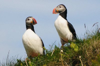
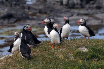
These puffins were photographed on the Latrabjarg cliffs in July 2010.
Latrabjarg is a 14 km long, sheer cliff with an east-west direction on the northern coastline of Iceland’s second largest bay, Breidafjordur. The part of it called Bjargtangar is the westernmost part of Iceland, and its highest elevation is 444 metres. The Azore Islands are, however, the westernmost part of Europe. It is highly interesting to walk carefully along its brink to watch the myriad of birds, the seals on the skerries down below, and the occasional whales swimming by. For centuries, brave men were roped down the cliffs during the breeding season of the avifauna to collect eggs, which were a regular part of the diet along with the birds themselves. Sometimes as much as 40.000 eggs and 36.000 birds were taken. Just before Christmas 1947 the miraculous rescue of the crew of the British trawler Dhoon, which ran aground at the bottom of the cliffs was carried out successfully, and will be remembered as the most difficult rescue operation carried out up to this date. The distance from the capital is about 347 km via Stykkisholmur and across the Breidafiord Bay with the car ferry Baldur to Brjanslaekur.
(The above details are with acknowledgement to the Iceland Touring Association).
 |
 |
 |
 |
 |
 |
 |
 |
 |
 |
 |
 |
 |
 |
 |
 |
 |
 |
 |
 |
 |
 |
 |
 |