


|
|
|
|
|
|
| |
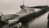
Credit to The Royal Engineers Museum
It was once known as "Barbed Wire Island": a flat, marshy area in the Thames Estuary that was heavily fortified and bristled with guns in anticipation of a German invasion that never came.
But when archaeologists began excavating the island of Sheppey off the north Kent coast, what they found took them by surprise.
They expected to uncover structures from World War Two, but instead discovered "fantastic" trenches dating back to World War One that they believe to be of national importance.
The network of trenches was just one aspect of a huge security operation centred on the island during war. Residents were issued with "Sheppey passports" and plans were drawn up that would have seen the entire north Kent community facing evacuation and the loss of their livelihoods.
A devastating "scorched earth" policy aimed at hindering and frustrating the invaders would have seen livestock slaughtered and even beer destroyed.
During World War One, the Germans were expected to invade across the North Sea to Kent and the Thames Estuary, with the military ports of Sheerness and Chatham considered prime targets.
More here: http://www.bbc.co.uk/news/uk-england-kent-29572952
Please don't nick my pictures without asking first. My pictures © Trevor Edwards