No. I didn't drive through this quagmire of water and clay-mud. I by-passed this mess by using another road just east of here. Seeing this water worried me, not because I couldn't get past it, but because of what it meant for the condition of the mud flat I was planning to hike on with a handcart. My worry was well-founded, because the mud flat was too wet.
This looks southwest at Donner-Reed Pass, the low point separating the Silver Island Mountains (background) from Crater Island (behind me). The fabled Donner party passed through this pass on its way to disaster in the Sierra Nevada. During my visit I did not have to abandon any wagons, furniture, or livestock, nor was I delirious from lack of water. Figuring out how to get around this water was the extent of my suffering.
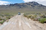
Behind my car, this road joins the Silver Island Mountains Backcountry Byway, the unpaved road I drove on for 30 miles to reach this point.
|