


|
|
|
|
|
|
| Khanh | profile | all galleries >> Hong Kong >> Hiking >> Sharp Peak | tree view | thumbnails | slideshow |
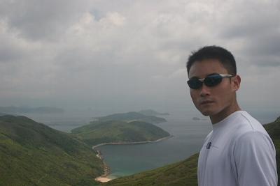
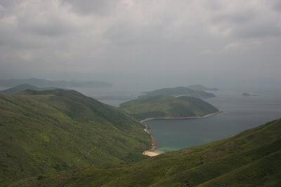
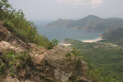
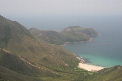
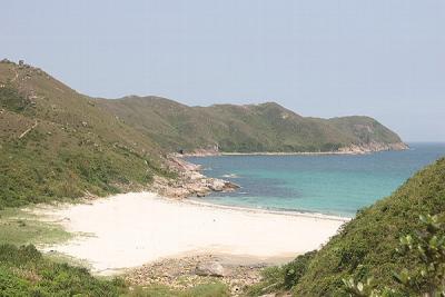
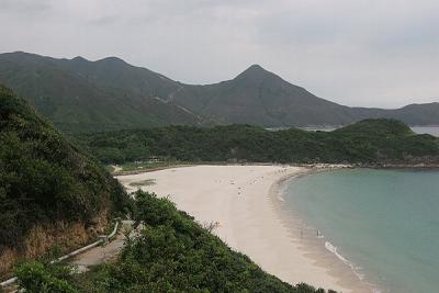
18th May 2005Five false starts later (too hot, too cold, too far away, too lazy, too bloody difficult) I find myself finally sitting on 94 bus on the last 30 minute leg of a 90 minute journey from Tin Hau to Pak Tam Au, and ultimately to summit Sharp Peak - Hong Kong most sharpest looking peak1.Sharp Peak (南蛇尖), which measures at 468 metres, is located in the north eastern part of Hong Kong, specifically part of the Sai Kung East Country Park. Though not the highest point in Hong Kong (still working on it) it is surrounded by gorgeous beaches and magnificent peaks, all miles away from the road.Anyway, our trip starts near Wong Shek pier, through Chek Keng Hau and on to Tai Long Au where we find various warning signs not to proceed on to Sharp Peak. Being rebels that we are, we headed on up anyway.Various steep rocky and slippery inclines later we find ourselves rewarded at the top of Sharp Peak looking down at some of Hong Kong best veiws2. Looking north we can just make out the flat Tung Ping Chau (another album for you to check out). However, to the south, Tai Long Wan, (not to be confused with the one in Shek O) is our exit route.About four hours after we first started (two of that just going up) we finally made it to the fabulous first sandy white beach (and possibily of all of Hong Kong) that we saw from the peak (and only another 30 minutes to lunch). Apparently this stretch of beach is quite popular for locals to go camping as there is a couple of restaurants and some shower facilities. Though I suggest Tai Wan and Ham Tin Wan as Sai Wan suffers from human infestations (ie lots of rubbish on the beach).Eight hours later (of which six and half of it was hiking) we were on a mini bus and on our way back to Sai Kung town (for Honeymoon Desserts) and of course back home. Another mission completed.Footnotes:
- This was very unscientifically determined by measuring volume of the grunt from the people that were asked to come along.
- This involved another very unscientific survey of three at the summit (ie Tony, Jane, and me).
How to get there (and back):
- You'll need to catch the 94 bus from Sai Kung bus terminus and get off before Wong Shek Pier at Pak Tam Au (about a 30 minute ride). If you end up in Wong Shek Pier, don't worry, your walk will only be slightly longer than mine.
- If you don't know how to get to Sai Kung, you can either catch the 96 bus from Diamond Hill MTR station; the 101M green minibus from Hang Hau MTR station; or the 1A green minibus from Choi Hung MTR station.
- There is a 16:45 minibus that leaves Sai Wan Ting and heads back to Sai Kung town. Good idea to try to catch it.
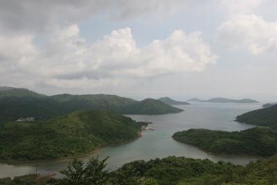 Ko Tong Hau |
 Sharp Peak (Our First View) |
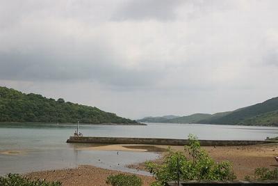 Pier at Chek Keng Hau |
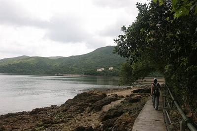 Along Chek Keng Hau |
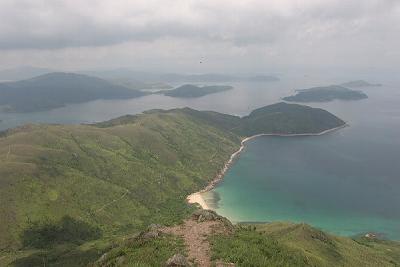
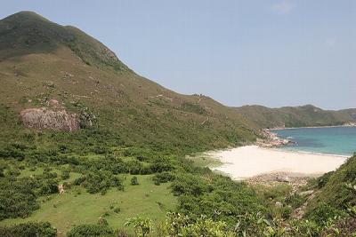
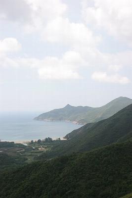 View of Tai Wan |
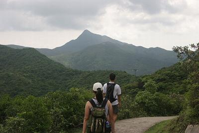
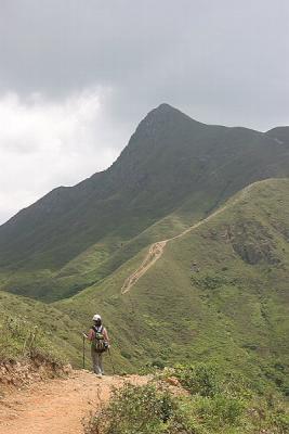
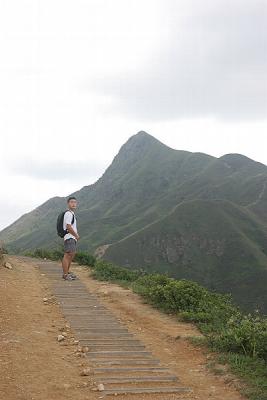 Tony on the Path to Sharp Peak |
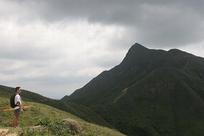
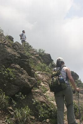
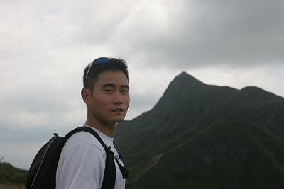 Tony with Sharp Peak |
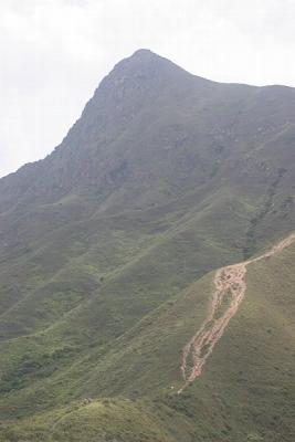
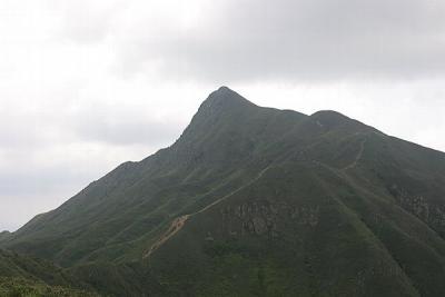 Sharp Peak (468m) |
 Tony Looking at Sharp Peak |
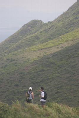
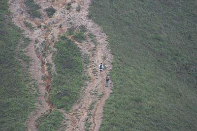
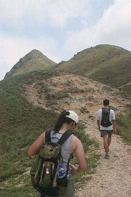
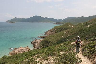
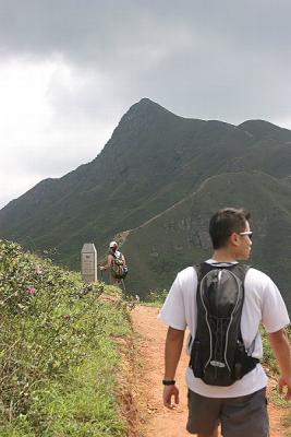 Tony and Jane on the Path to Sharp Peak |
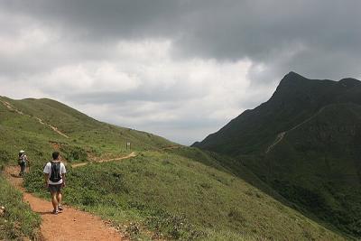 Tony and Jane on the Path to Sharp Peak 2 |
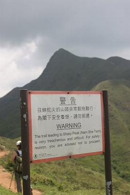 Warning Sign at Sharp Peak |
 Jane on the Path to Sharp Peak |
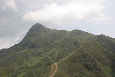 Sharp Peak |
 Jane and Tony at Nam She Au |
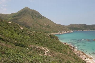
 Sharp Peak from Nam She Au |
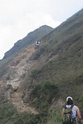
 Slope of Sharp Peak |
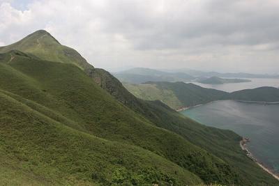
 Tony and Tung Wan Shan |
 Tung Wan Shan (298m) |
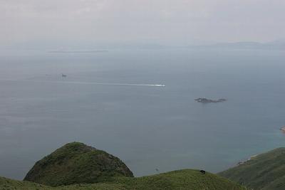
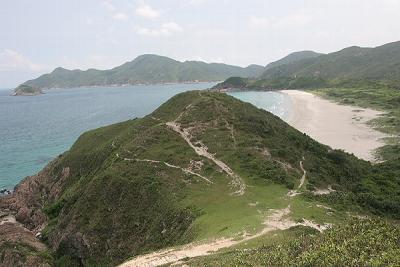
 Tai Long Wan |
 Slope of Sharp Peak 2 |
 Tung Wan Shan and Tung Wan |
 Tung Wan |
 Slope of Sharp Peak (Almost There) |
 Slope of Sharp Peak (Virtually There) |
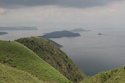
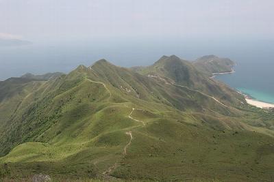 East View from Sharp Peak |
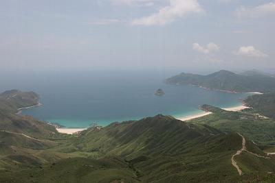 Tai Long Wan 2 |
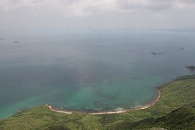 Nam She Wan |
 North View of Sharp Peak |
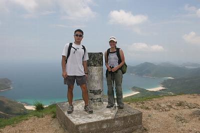 Tony and Jane at the Geodetic Marker on Sharp Peak |
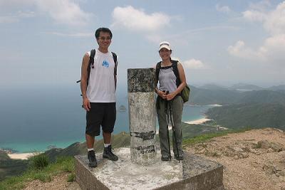 Khanh and Jane at the Geodetic Marker on Sharp Peak |
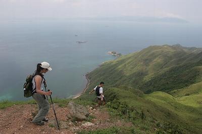 Jane and Tony Decending Sharp Peak |
 Tung Ping Chau |
 North Tip of Nam She Wan |
 Looking West onto Sharp Peak |
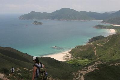 Jane and Tai Long Wan |
 Tung Wan |
 Tung Wan 2 |
 Jane and Tung Wan |
 Jane and Tai Long Wan |
 Tung Wan Shan and Tai Wan |
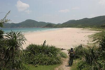
 Tai Wan |
 Jane on Tai Wan |
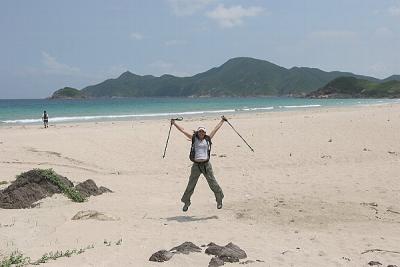 Jane Star Jump Tai Wan |
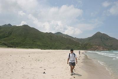 Tony on Tai Wan |
 Tony and Jane on Tai Wan |
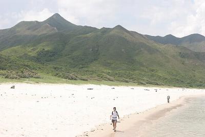
 Tai Wan and Sharp Peak |
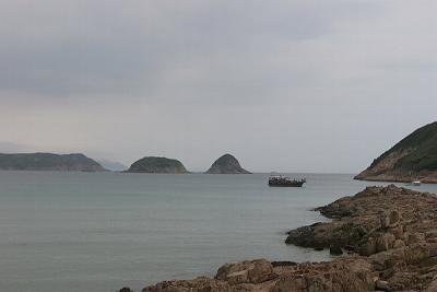 Lan Tau Pai, Ti Chau and Tsim Chau |
| comment | share |
| michelle | 22-Jun-2005 16:45 | |