


|
|
|
|
|
|
| Jurisam | profile | all galleries >> Neighbourhoods Of Haifa, Israel >> New Haifa (1761 CE - 1918 CE) | tree view | thumbnails | slideshow |
| previous page | pages 1 2 3 4 5 6 ALL | next page |
 Bachtary St., Where The Southern Wall Of "New Haifa" Turned Back To The North, Towards The Coast..JPG |
 Leaving Bachtary St, We Reach The Entrance To Pal-Yam St.,Where The Courts & Rabin's Center Are Located.JPG |
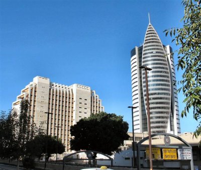 Another View From East On Gov. Center ,Known By The Name: Kiryat Rabin.JPG |
 An Arched Path, Coming From Pal-Yam St.To Rabins Gov. Buildings A & B.JPG |
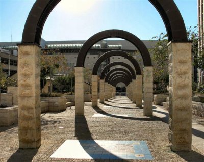 The Arches As Viewed From The Entrance To The Sail Building.JPG |
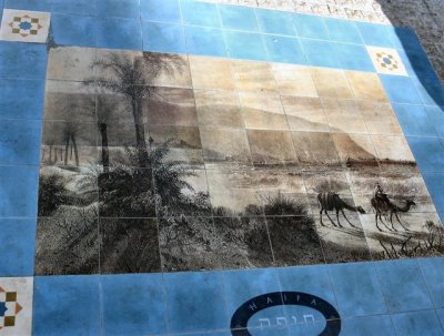 Beneath Each Arch There Is A Painting, On Ceramic Paving, Of Scenes Regarding Haifa & It's Neighborhood.JPG |
 Front Of New Courts Building At Pal-Yam St.JPG |
 Reflection Of The Sail Building In Courts Windows.JPG |
 Gov.Buildings At Kiryat Rabin And Old Zim Building, View From Pal-Yam St..JPG |
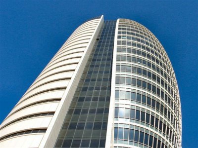 View Up To The Sail Building.JPG |
 View To The East From Pal-Yam St. At Background - El Isticklal Mosque.JPG |
 House Of Grace,ex Greek Catolic Church, Pal-Yam St. Founded 1882, Restored 1982.JPG |
| previous page | pages 1 2 3 4 5 6 ALL | next page |
| comment | share |
| Ashley Hockenberry | 27-Apr-2007 20:51 | |