


|
|
|
|
|
|
| |
| 01-MAY-2011 | |
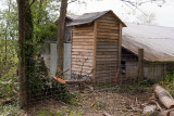
The surveyed offset pin is at the base of the construction stake behind the fence that was constructed this past week.
The yellow tipped pin can clearly be seen here http://www.pbase.com/jtsmall/image/128885512
The offset from this pin is 6.23 feet, which puts the boundary of the cemetery behind the out house. The survey stake
placed at the offset by the surveyor is seen here http://www.pbase.com/jtsmall/image/128779782
The City of Sharpsburg commissioned Alan Justice Engineering and Surveying Inc. to re-survey the property that
was originally conveyed to the city by deed 1849. The survey was completed September 20, 2010, establishing
the boundaries and a calculated area of 8/10 acre.
© 2005-2022 by John Small