


|
|
|
|
|
|
| Jim Larkey | profile | all galleries >> Galleries >> Weminuche Wilderness, CO 2002 | tree view | thumbnails | slideshow |
In 1975, Congress combined the San Juan and Upper Rio Grande primitive areas into the Wilderness area. With an average elevation of 10,000 ft., it is the highest wilderness area in the nation. More than 80 miles of the Continental Divide passes through the Weminuche Wilderness.
Three of Colorado's 54 Fourteeners are located in the Wilderness: Mt. Eolis (14,083 ft), Sunlight Peak (14,059 ft), and Windom Peak (14,082 ft). In addition, there are 81 high mountain lakes.
| previous page | pages 1 2 3 4 5 6 7 ALL | next page |
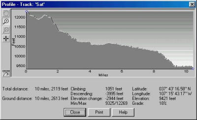 Sat profile stats |
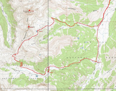
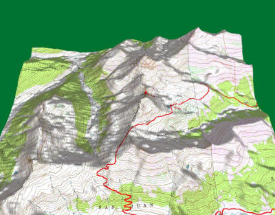
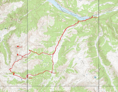 Overall Trip Route, 1:24000 |
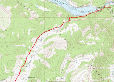 Weminuche Trail #523, Thirty Mile CG Trailhead |
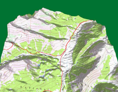
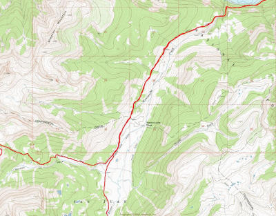 Continental Divide Trail (West), Weminuche Pass |
 "The Window" Loop, La Vaca Trail (CDT) North, La Osa Trail South |
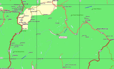
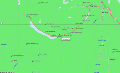
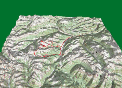 The Big Picture, Weminuche Wilderness, 1:100000 scale |
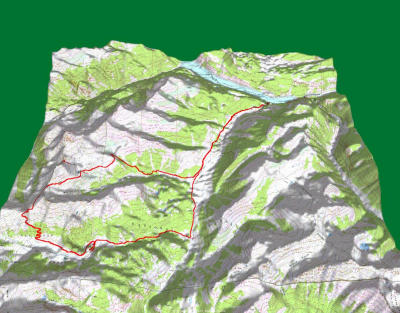 Trip View, 1:24000 scale |
 Weminuche Pass |
 "The Window" and, Rio Grande Pyramid (Elev 13,821) |
 Trailhead, Thirtymile CG |
 Zoom |
 Zoom...Zoom |
 Zoom...Zoom...Zoom |
| previous page | pages 1 2 3 4 5 6 7 ALL | next page |
| comment | share |
| Jim Larkey | 21-Oct-2012 23:56 | |
| Roland Rangel | 18-Oct-2012 04:27 | |
| Guest | 28-Aug-2009 17:02 | |
| Dean Bell | 15-Dec-2007 06:31 | |
| Robert C Richmond | 20-Feb-2003 19:25 | |
| Jim Larkey | 28-Oct-2002 01:52 | |
| Guest | 26-Sep-2002 02:34 | |
| Jim Larkey | 07-Sep-2002 12:38 | |
| Al Ferry | 22-Aug-2002 16:12 | |
| Cory Somes | 10-Aug-2002 03:34 | |