


|
|
|
|
|
|
| Jim Larkey | profile | all galleries >> Cloud Peak Wilderness, Big Horns, WY, July, 2007 >> Maps & Resources, Cloud Peak Wilderness | tree view | thumbnails | slideshow |
| previous page | pages 1 2 ALL | next page |
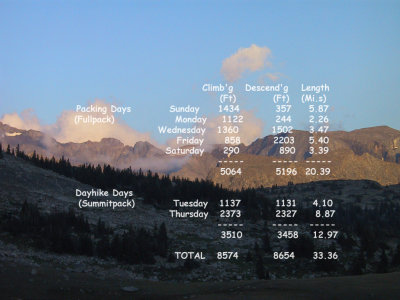 Climbing/Descending Stats |
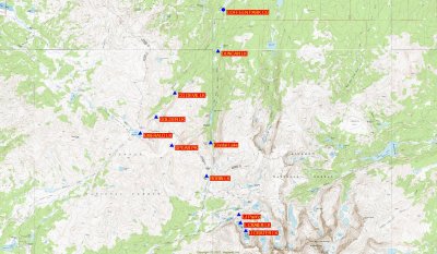
 Cloud Peak Road Map Location |
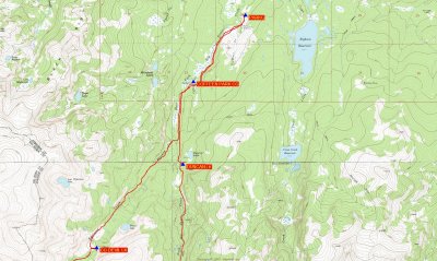
 Overview, 1:100,000 USGS |
 Overiew, 1:4,00 USGS |
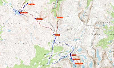
 Northern 1/2 of Hiking, 1:24:000 USGS |
 Southern 1/2 of Hiking, 1:24:000 USGS |
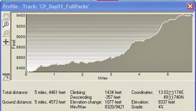 Day 1 Stats, Sunday 07/15/07 |
 Day 2 Stats, Monday 07/16/07 |
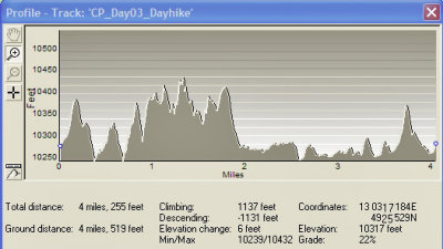 Day 3 Stats, Tuesday 07/17/07 |
 Day 4 Stats, Wednesday 07/18/07 |
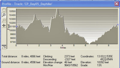 Day 5 Stats, Thursday 07/19/07 |
 Day 6 Stats, Friday 07/20/07 |
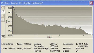 Day 7 Stats, Saturday 07/21/07 |
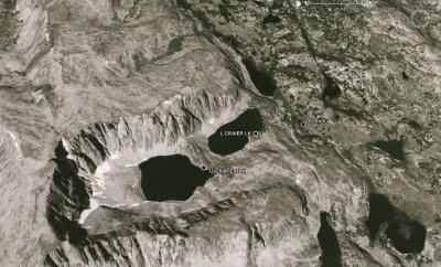 Sat Photo of Crater Lakes (Upper & Lower) |
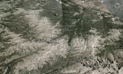 Sat Photo, Overview of Hiking Area |
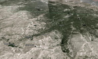 North Section of Hike (Waypoints shown) |
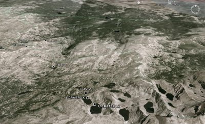 South Section of Hike (Waypoints shown) |
| previous page | pages 1 2 ALL | next page |
| comment | share |