photo sharing and upload picture albums photo forums search pictures popular photos photography help login
Jim Larkey | profile | all galleries >> Colorado 14'er Peak Bagging, Jul '10 Climb >> Capitol Peak (14,130'), Standard Route, NE Ridge tree view | thumbnails | slideshow | map

Capitol Peak (14,130'), Standard Route, NE Ridge

Capitol Peak will sharpen your focus and concentration skills. The fun begins after the most-noted "Knife Edge" ridge, a 100' length of good solid rock, with 2,000' of exposure on both sides, that must be traversed to reach the summit. Maybe a stopper for the inexperienced Fourteener climber, but it's what follows the ridge that will put you in a zen-like zone of focus. You can checkout my team member's impressions of this climb on this link.

One of Colorado's toughest Fourteeners to climb, it's massive trapezoidal shape can be seen from the Capitol Creek trailhead. Said to resemble the US Capitol building, it was named by the Hayden Survey, but never climbed. Capitol's loose rock above the "Knife Edge", is typical for other peaks in the Elk Range, such as the Maroon Bells, and Pyramid.

Before you reach the "Knife Edge", you'll will have to decide whether to climb K2's (13,664') summit, or contour around the N'ly slope. Should you plan to summit K2, a Class-4 move or two will be required. The climb is short, and it is worth the effort. You'll get some great views of Capitol, as well as the "Knife Edge".

You'll reach the Knife Edge shortly after descending from K2. Your choice of traverse is up to you. I've seen some scoot on their butts, others hang on the edge, and friction climb with their feet. And I've seen others walk across the edge. Your skill and confidence will determine what's best for you.

Once across the "Knife Edge" the fun begins. Route finding is important. Look for the cairns, and stay high when crossing the gully on the east side below Capitol's summit. I've seen climbers knock rocks loose, and watch them ricochet down the gully like a pin-ball. I can't emphasize enough to stay high on the good rock when crossing the gully.

Once across the gully, the summit is a short climb to the top. We chose to do the ridge (good rock), but you can choose other routes as well. There are many options to the summit.

But once on the summit, you'll enjoy views of Pyramid, the Maroon Bells, and other peaks in the Elks Range. Keep an eye on the weather, and enjoy the rewards of standing on one of the toughest fourteeners in Colorado!

Tips: Keep an eye on the weather...."off the summit by noon" means back at the saddle by noon!
Stay high on the gully crossing, on the E'ly side of Capitols summit.
You can view an excellent detailed route description with photos here.
previous pagepages 1 2 3 4 ALL next page
The West Snowmass Appoach, Moon Lake (right of center)
Mt Daly's (13,300') Talus Slope, and Darkening Clouds
Moon Lake (11,740'), (lower center) and W Snowmass Creek Approach
Deteriorating Weather
Capitol Lake, Viewed From the K2-Daly Saddle
Not a Time to  Be on the Summit of Capitol (left, in the clouds)
Not a Time to Be on the Summit of Capitol (left, in the clouds)
Brian and Russ Descending Saddle, Sprinkles of Rain
Cool Rock Formation, Fallen Column
Crappy Rock
Crappy Rock
Looking W'ly Across Capitol Lake...Basecamp Soon
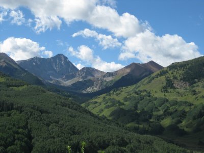
Early Morning Light on Neighboring Peaks Near Basecamp, Strong Winds Through the Night
Not a Good Day to Climb Capitol's Cloud Shrouded Peak...Strong Winds
Good-Bye to Capitol
Good-Bye to Capitol
Russ, John, and Marietta at Cattle Gate
Capitol Creek Crossing
John, Marietta, and Russ
g1/06/5106/3/128178546.UkCdxbAq.jpg Russ Hiking Along Ditch Trail
Russ Hiking Along "Ditch Trail"
View of Capitol Peak (14,130'), and the Capitol Creek Drainage That Was Our Approach Route
previous pagepages 1 2 3 4 ALL next page