


|
|
|
|
|
|
| Jerry Pillarelli | profile | all galleries >> Travel and Nature; Sites by State >> US Travel; by Trip, by State >> Montana >> Upper Missouri River Breaks National Monument – Montana | tree view | thumbnails | slideshow |
 Early morning approaching the Stafford Ferry area in Upper Missouri River Breaks NM |
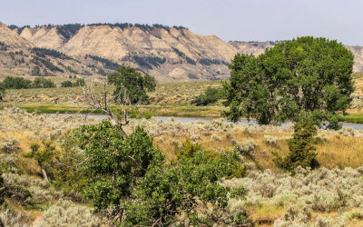
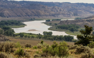
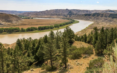
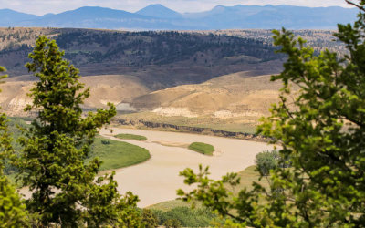
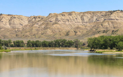
 View across the Missouri River valley in the Stafford Ferry area in Upper Missouri River Breaks NM |
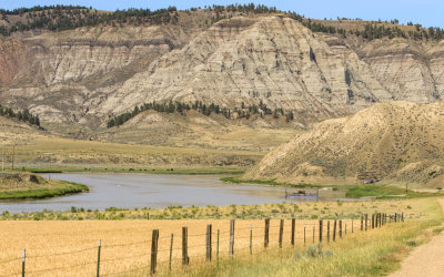
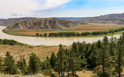
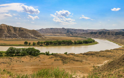
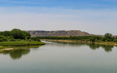
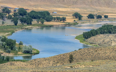
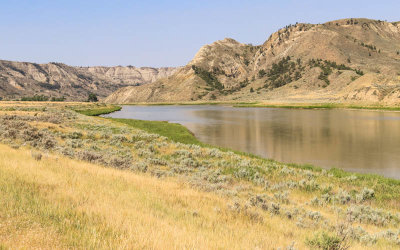 The Missouri River flows through the Stafford Ferry area in Upper Missouri River Breaks NM |
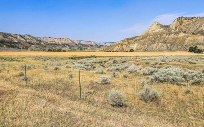
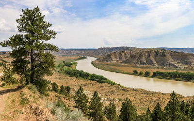
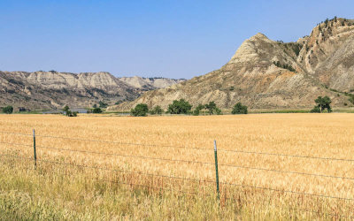 View of the Missouri River across a field in the Stafford Ferry area in Upper Missouri River Breaks NM |
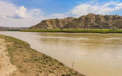
 Cliffs and the Missouri River in the Stafford Ferry area in Upper Missouri River Breaks NM |
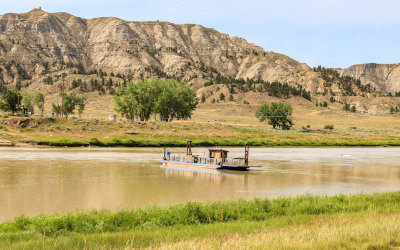
 The McClelland Stafford Ferry crosses the Missouri River in Upper Missouri River Breaks NM |
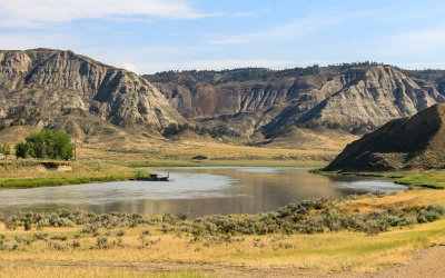 View of the Missouri River and the McClelland Stafford Ferry in Upper Missouri River Breaks NM |
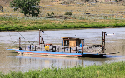 The McClelland Stafford Ferry crossing the Missouri River in Upper Missouri River Breaks NM |
 McClelland Stafford Ferry in the Missouri River in Upper Missouri River Breaks NM |
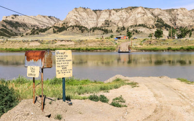 Southern side terminus of the McClelland Stafford Ferry in Upper Missouri River Breaks NM |
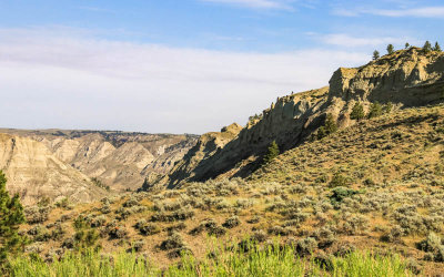
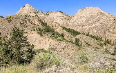
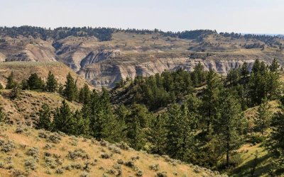
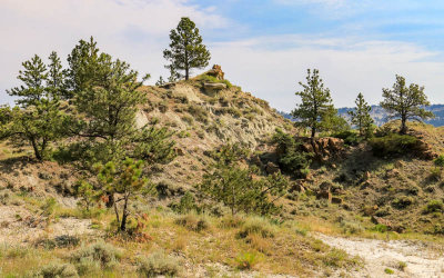
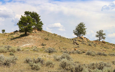
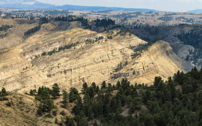
 Mountainous ridge in the Stafford Ferry area in Upper Missouri River Breaks NM |
 Stafford Ferry area ridge in Upper Missouri River Breaks NM |
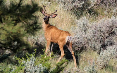 Deer in the Stafford Ferry area in Upper Missouri River Breaks NM |
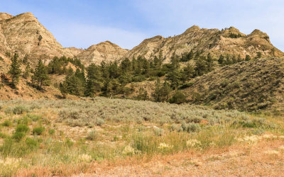
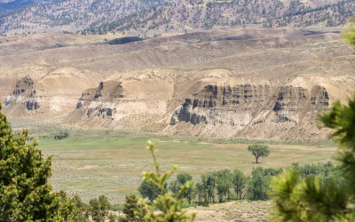
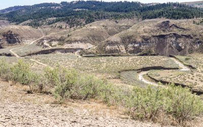
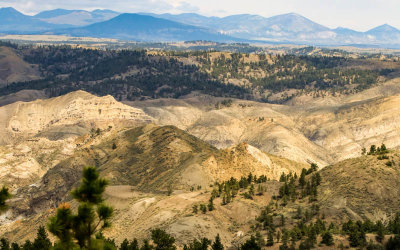
 Rugged landscape in the Stafford Ferry area in Upper Missouri River Breaks NM |
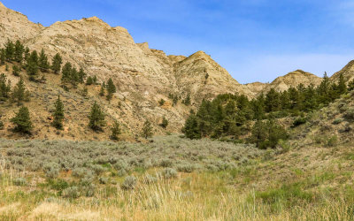
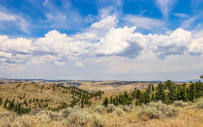
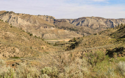 View into the Stafford Ferry area in Upper Missouri River Breaks NM |
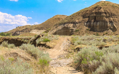
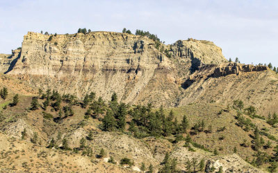 Rocky ridge above the Stafford Ferry area in Upper Missouri River Breaks NM |
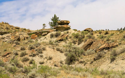
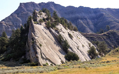 Granite formation in the Stafford Ferry area in Upper Missouri River Breaks NM |
 Looking toward the McClelland Stafford Ferry and the Missouri River in Upper Missouri River Breaks NM |
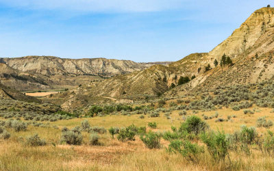 View into the Stafford Ferry area in Upper Missouri River Breaks NM |
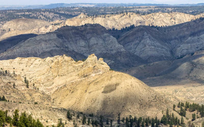
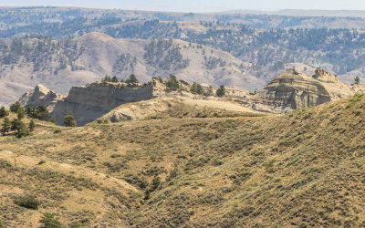
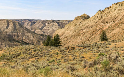 Rugged ridges around the Stafford Ferry area in Upper Missouri River Breaks NM |
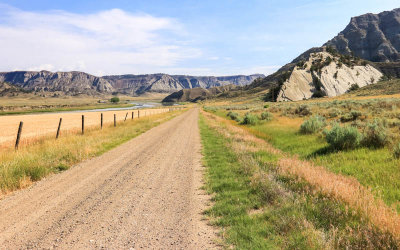
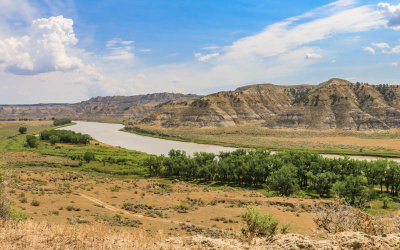
 View from Lower Two Calf Road into the river valley in Upper Missouri River Breaks NM |
 The Missouri River as viewed from Lower Two Calf Road in Upper Missouri River Breaks NM |
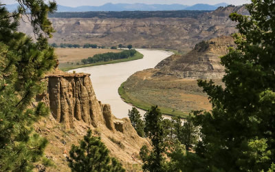
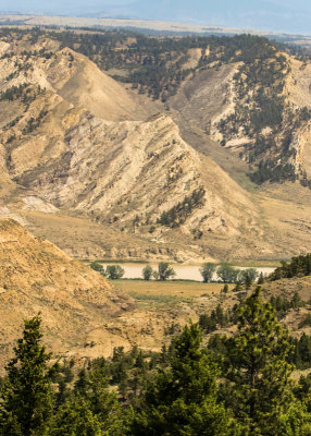
 Wide view of the Woodhawk area and the Missouri River bend in Upper Missouri River Breaks NM |
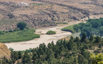
 The Missouri River bend in the Woodhawk area in Upper Missouri River Breaks NM |
 View of the Missouri River from above the Woodhawk area in Upper Missouri River Breaks NM |
 Trees growing from a rock formation in the Woodhawk area in Upper Missouri River Breaks NM |
 On the banks of the Missouri River in the Lower Woodhawk area in Upper Missouri River Breaks NM |
 Wide view of the Missouri River bend from above the Woodhawk area in Upper Missouri River Breaks NM |
 The Missouri River curving its way through the Woodhawk area in Upper Missouri River Breaks NM |
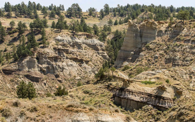
 Weathered rock formation in the Woodhawk area in Upper Missouri River Breaks NM |
 Rock formation along the Lower Two Calf Road in Upper Missouri River Breaks NM |
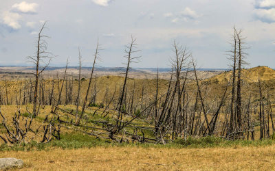 Burnt trees along the Lower Two Calf Road in Upper Missouri River Breaks NM |
 The Missouri River snakes its way past a rock formation as viewed from the Lower Two Calf Road in Upper Missouri River Breaks NM |
 Cloud cover accentuates the landscape as seen from Lower Two Calf Road in Upper Missouri River Breaks NM |
 Small island in the Missouri River as seen from Lower Two Calf Road in Upper Missouri River Breaks NM |
 Rugged ridge as seen from Lower Two Calf Road in Upper Missouri River Breaks NM |
 Cliffs in the river valley as seen from Lower Two Calf Road in Upper Missouri River Breaks NM |
 Big sky above the Missouri River as seen from Lower Two Calf Road in Upper Missouri River Breaks NM |
 Small river as seen from Lower Two Calf Road in CM Russell National Wildlife Refuge in Upper Missouri River Breaks NM |
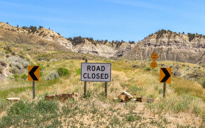
 Blocked by mud at a river crossing along Lower Two Calf Road in CM Russell National Wildlife Refuge in Upper Missouri River Brea |
 The Missouri River as viewed from Lower Two Calf Road in Upper Missouri River Breaks NM |
 Trees on a rocky ridge next to Lower Two Calf Road in Upper Missouri River Breaks NM |
 The Missouri River as seen from Lower Two Calf Road in Upper Missouri River Breaks NM |
 Sunlight paints hills as seen from Lower Two Calf Road in Upper Missouri River Breaks NM |
 Rocky cliffs as seen from Lower Two Calf Road in Upper Missouri River Breaks NM |
 The Missouri River looking east from on the Judith Landing bridge in Upper Missouri River Breaks NM |
 Looking west at the Missouri River from on the Judith Landing bridge in Upper Missouri River Breaks NM |
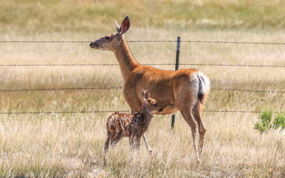 Deer and fawn in Upper Missouri River Breaks NM |
 The Missouri River as seen from the Claggett Hill area in Upper Missouri River Breaks NM |
 Dead end of the Old PN Bridge Road at Claggett Hill in Upper Missouri River Breaks NM |
| comment | share |
| Guest | 20-Jul-2021 18:12 | |
| Thomas Walker | 20-Jul-2021 12:49 | |
| Greg Temple | 20-Jul-2021 03:13 | |