photo sharing and upload picture albums photo forums search pictures popular photos photography help login
Jerry Pillarelli | profile | all galleries >> Travel and Nature; Sites by State >> US Travel; by Trip, by State >> California >> San Gabriel Mountains National Monument – California tree view | thumbnails | slideshow

San Gabriel Mountains National Monument – California

Images of San Gabriel Mountains National Monument – Southern California, taken in May 2019.

Maintained by the US Forest Service, San Gabriel Mountains National Monument was created in 2014 to protect the wilderness area directly to the northeast of the sprawling Los Angeles basin. The park represents two very distinct areas; the rugged dry desert mountains to the west and the snowcapped and pine covered mountains in the east.

On my first trip through the park I drove the Angels Forest Highway from north to south which snakes its way through the dry mountainous region ending up near Mount Wilson where I took a side trip to the peak to look out over the cloud covered Los Angeles basin and to visit the Mount Wilson Observatory. But the most interesting thing I saw on this day was the Chaparral Yucca blooms; towering 15 foot stalks, 6 to 8 inches in diameter, dotting some of the hillsides created an impressive show. These plants live for approximately five years, bloom spectacularly and then die.

Taking on a trip through the eastern mountains was a little more difficult as a “landslip” had closed some of the Angel Crest Highway. Because of this I had to drive almost 80 miles around the northern boundary of the park to see whatever I could get to. Unfortunately the road was closed at the Islip Saddle, much further to the east than I had anticipated. As disappointing as this was I was still able to see some impressive views of Mount Burnham (9,001 ft) and Mount Baden-Powell (9,407 ft).
Rugged mountains along the Angels Forest Highway in San Gabriel Mountains NM
Open-spanned arch bridge built in 1941 along the Angels Forest Highway in San Gabriel Mountains NM
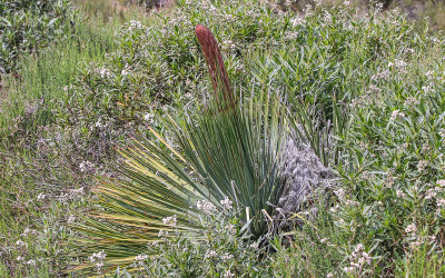
Chaparral Yucca plants blooming in San Gabriel Mountains NM
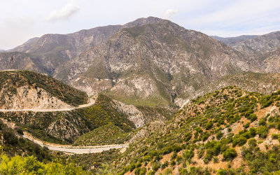
Mountainous area along the Angels Forest Highway in San Gabriel Mountains NM
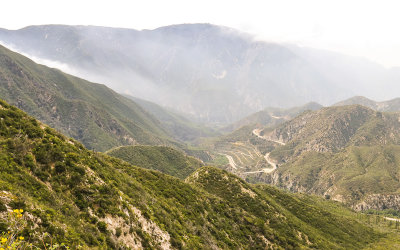
Mount Wilson in the fog from along the Angels Forest Highway in San Gabriel Mountains NM
California Thistle bloom in San Gabriel Mountains NM
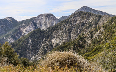
Nearby peaks as seen from Mount Wilson in San Gabriel Mountains NM
Chaparral Yucca bloom in San Gabriel Mountains NM
View of cloud cover over the Los Angeles Basin from the Eaton Canyon Saddle in San Gabriel Mountains NM
Flower blooming in San Gabriel Mountains NM
Early stage of Chaparral Yucca stalk growth in San Gabriel Mountains NM
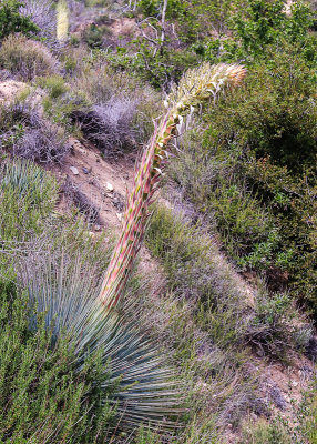
Chaparral Yucca stalk growing from the plant in San Gabriel Mountains NM
Blooming hillside near San Gabriel Peak in San Gabriel Mountains NM
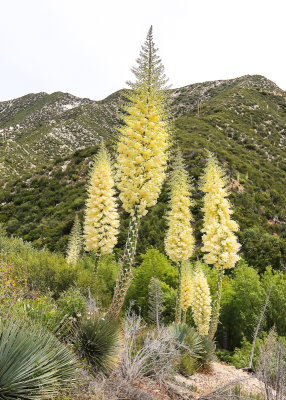
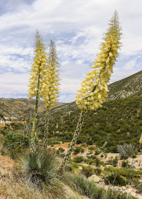
Chaparral Yuccas 15 foot stalks bloom in San Gabriel Mountains NM
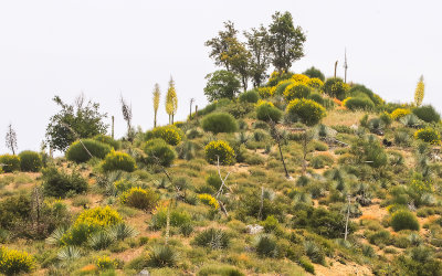
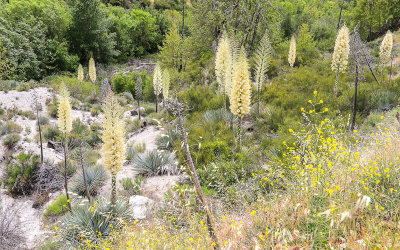
Ravine filled with blooming Chaparral Yucca in San Gabriel Mountains NM
Chaparral Yucca barren stalk as the plant dies in San Gabriel Mountains NM
View of snow covered Mount Baden-Powell (9,407 ft) in the distance in San Gabriel Mountains NM
Domes of the Mount Wilson Observatory with Mount Baden-Powell in the distance in San Gabriel Mountains NM
Mount Wilson Observatory 100-inch Telescope dome in San Gabriel Mountains NM
Mount Wilson transmission tower area in San Gabriel Mountains NM
View of the cloud-covered Los Angeles Basin from Mount Wilson in San Gabriel Mountains NM
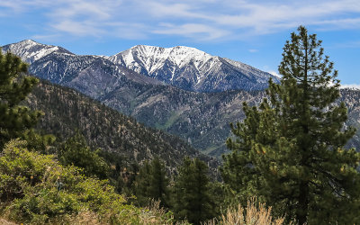
Pine Mountain #1 and Mount San Antonio (Mount Baldy) in San Gabriel Mountains NM
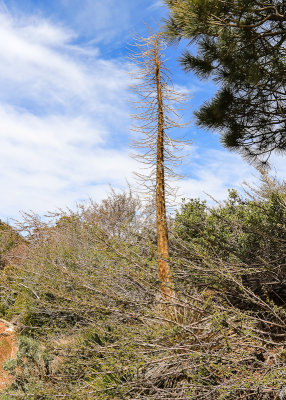
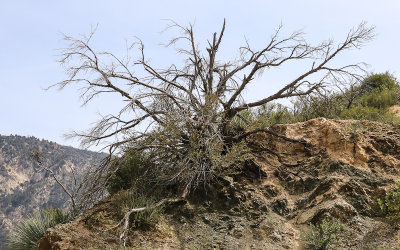
Dead tree in San Gabriel Mountains NM
Landslip road closure along the Angel Crest Highway in San Gabriel Mountains NM
Wind-swept trees along the Angel Crest Highway in San Gabriel Mountains NM
Pine Mountain #1 and Mount San Antonio (Mount Baldy) from Inspiration Point
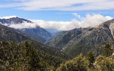
Clouds over the valley as seen from the Islip Saddle along the Angel Crest Highway in San Gabriel Mountains NM
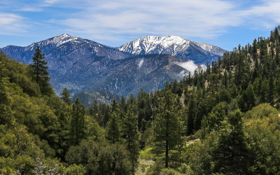
Pine Mountain #1 and Mount San Antonio (Mount Baldy) from the Islip Saddle in San Gabriel Mountains NM
Mountainous area as seen from Inspiration Point in San Gabriel Mountains NM
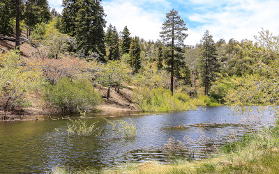
Jackson Lake along the Big Pines Highway in San Gabriel Mountains NM