photo sharing and upload picture albums photo forums search pictures popular photos photography help login
GMChrysler | all galleries >> Adventures of the Unofficial Hike Club >> Weavers Needle Hike > Weavers Needle Hike Map.jpg
previous | next

Weavers Needle Hike Map.jpg

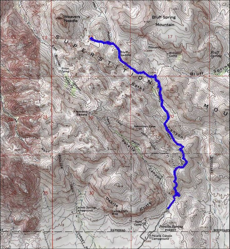
The hike path: started and ended at the Peralta trailhead (the loop at the end of the dirt road). The northern most point is where we stopped for lunch in Needle Canyon.


other sizes: small medium large original auto
share
Type your message and click Add Comment
It is best to login or register first but you may post as a guest.
Enter an optional name and contact email address. Name
Name Email
help private comment