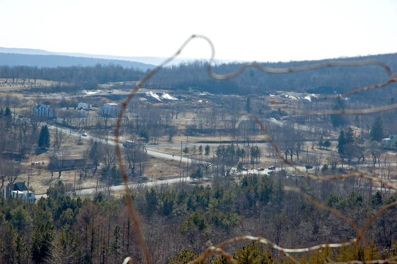
View of the former (the U.S. Post Office revoked the town's Zip Code in 2003) town of Centralia
from above, on Rt. 42, between Centralia and Conyngham.
The mine fire that destroyed the town started in 1962.
It still is burning, about 70 feet laterally per year.
Most of the houses were demolished in the 1980s,
when the underground fire eventually encroached upon the town,
and poisonous gases from combustion of coal entered the homes.
Over a hundred homes would have been visible from this perspective in 1980.
South Street (where other photographs were made) is at the upper left.
There were originally many houses where there now are steam plumes - all the way to the right in the image.